
California Trail Passport
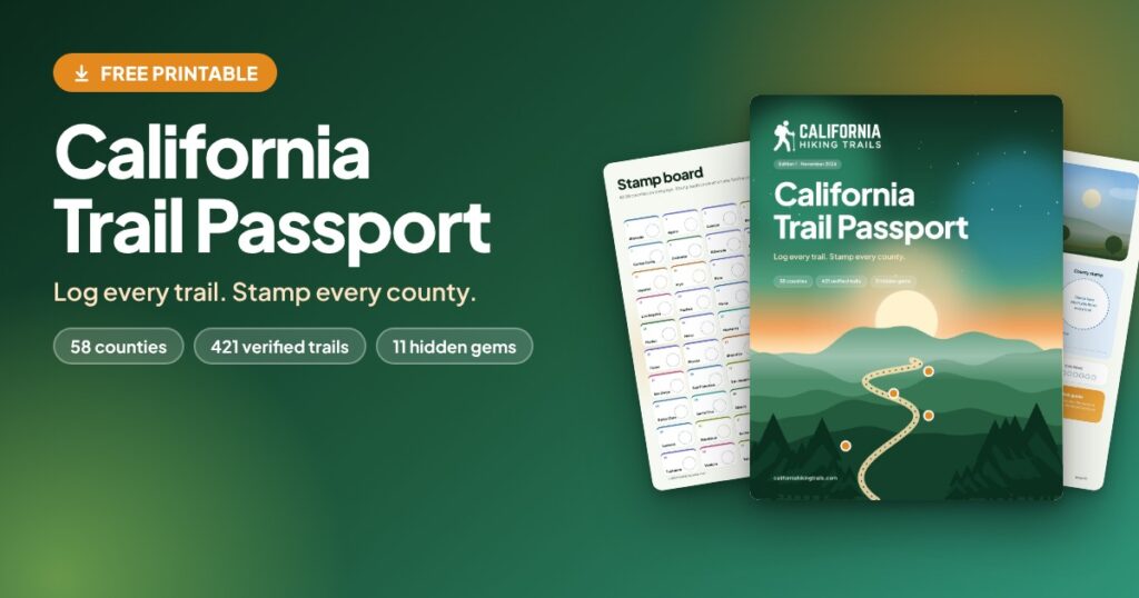
A free printable hiking logbook for all 58 California counties. It comes pre-filled with 421 verified trails, 435 blank log cards for your own hikes, 11 hidden gems and a stamp page for every county. Download the PDF to print, or use the interactive version on screen.
WHAT IT IS
The California Trail Passport is a logbook that already knows where you are going. Each of California’s 58 counties gets its own chapter: an illustrated county page with a checklist of verified trails and a big circle for your county stamp, followed by log cards for every hike.
It comes as a 287-page print-ready PDF (US Letter) and as an interactive HTML file you can use in your browser.
WHAT’S INSIDE
– 421 guide trails with names and locations, grouped by county
– 58 illustrated county pages, each with a trail checklist, a stamp circle and a progress tracker
– 435 blank log cards for the trails you find yourself
– Log cards with date, weather, who came along, a 1 to 5 rating and notes
– 11 hidden gems, marked where an independent source calls the trail little-known or underrated
– A clickable contents page and a 58-tile stamp board that jump straight to each county
– Four ways to play: finish your home county, collect all 58 stamps, complete a colour zone or hunt the hidden gems
– A research and method page, safety and Leave No Trace pages, and a hiker’s glossary of common trail words and slang
– Links to our county hub guides, and to our own trail guides where they cover the exact trail
WHO IT IS FOR
– Californians who want to see beyond the same handful of famous trails
– Visitors and road trippers planning hikes in more than one county
– Beginners who want a clear list of places to start, and experienced hikers who like a goal
– Families, friends and couples who want a shared challenge
– Anyone who enjoys ticking things off, collecting stamps or filling a book
WHY YOU NEED IT
Most trail lists send everyone to the same few places. This passport spreads your attention across the whole state, including small counties that few guides cover well. It gives you a ready list to choose from, a reason to go, and a record to look back on.
A finished stamp page is also simply motivating. When a county has four trails and a circle waiting for a stamp, the next hike is easy to pick.
HOW TO USE IT
1. Download the PDF (and the interactive file if you like).
2. Fill in the details page, then open the Contents and pick a county. Tap a county name to jump straight to it.
3. Choose a trail from the county checklist and hike it.
4. Tick the trail, then fill in its log card: date, weather, who came, a rating and a few notes.
5. Press a stamp, add a sticker or draw in the dashed circle on the card.
6. When every trail in a county is ticked, stamp the big county circle and the matching tile on the Stamp Board.
7. Use the blank log cards for any extra trail you hike in that county.
Using the interactive version: open the HTML file in a current browser such as Chrome, Edge, Firefox or Safari. Tick trails and add notes on screen. Your entries are saved in that browser on that device, so use the Back up button now and then. Clearing your browser data can erase them.
HOW TO PRINT IT
– Print on US Letter paper. Choose “Actual size” or 100%. On A4 paper choose “Fit to page” (about 97%).
– The full book is 287 pages. You do not need to print it all. Print the front pages and then only the counties you plan to visit. – The Contents page lists each county’s page number.
– Colour is best, because each landscape zone has its own colour. Black and white works too.
– Bind it in a three-ring binder, or take it to a print shop for spiral or comb binding. Test-punch one page first, because punched holes can touch the printed border on some pages.
WHO IT IS NOT FOR
– Anyone looking for navigation. It has no maps, GPS tracks or turn-by-turn directions. Use an official map or navigation app for that.
– Anyone who wants a full trail guide. It lists trails and your logs, and it does not cover parking, permits or current conditions for every trail.
– Hikers outside California. See our free Adventure Journal for a logbook that works anywhere.
– People who want an app that syncs between devices. The interactive version stores data in one browser on one device.
– Anyone who needs up-to-the-minute closures, fire or weather information. Always check with the land manager before you go.
HOW WE RESEARCHED IT
Each trail was checked against published sources before it earned a place in a county. Of the 421 trails, 344 (about 82%) are backed by two or more sources, and 77 rest on a single source, so those are worth double-checking. Distance, climbing and difficulty are printed only where our own guide covers that exact trail (101 trails). Everywhere else those fields are left blank for you to fill in.
Three counties have fewer trails than the rest (Calaveras, Kings and Sutter). We chose not to pad them with trails we could not verify.
GOOD TO KNOW
Trails change. Fires, floods, closures and new permit rules can alter a hike quickly. This passport is a planning and logging tool, not a safety guide. Check conditions and rules with the park or land manager, tell someone your plan and carry the essentials.
Free for personal use. Please do not sell or re-upload the files. If you want to share it, share the link to this page.