The 5 Best Hiking Trails in Death Valley, Inyo County
The hiking trails in Death Valley share a county with Mount Whitney, the highest point in the contiguous United States. This is a genuinely strange geographic pairing, since this park also contains Badwater Basin, the lowest point in North America. For the county’s high country, my Mount Whitney trails guide covers the opposite extreme. Start at the Inyo County trail guide for the complete picture. To lay out your logistics across these vast distances, you can consult our Death Valley National Park map and itinerary.
Disclosure: Please note that some of the links below are affiliate links and at no additional cost to you, I may earn a commission. Know that I only recommend hiking gear I personally stand behind; when you use my affiliate links, it helps me run this blog and keep all of this content free of charge for readers (like you).
Death Valley’s summer heat is a genuine, documented safety hazard, not just discomfort. Every trail in this guide should be hiked October through April; mid-summer temperatures regularly exceed 120°F, and this is one of the few places in this entire site’s coverage where the wrong season can be genuinely dangerous, not just unpleasant.
Key takeaways:
- The classic introduction: Golden Canyon to Red Cathedral, featuring golden badlands leading to a striking red rock amphitheater.
- The film-famous overlook: Zabriskie Point, featuring wrinkled badlands that have appeared in countless movies and photographs.
- The extreme-elevation superlative: Badwater Basin, a vast salt flat 282 feet below sea level (the lowest point in North America).
- The short desert arch: Natural Bridge, a genuine rock span over a narrow canyon reached via a bumpy access road.
- Currently closed, likely for another year: Darwin Falls, a real spring-fed waterfall that is inaccessible since its access road washed out in 2023 flooding.
- This is the most safety-critical guide in this entire site’s coverage. Read the timing guidance in every section, not just the first one.
Golden Canyon to Red Cathedral Trail
Trailhead access: free NPS lot on Badwater Road
Park at the free, well-marked trailhead on Badwater Road, just south of Furnace Creek, which serves as the starting point for one of the most popular introductory hikes in the entire park.
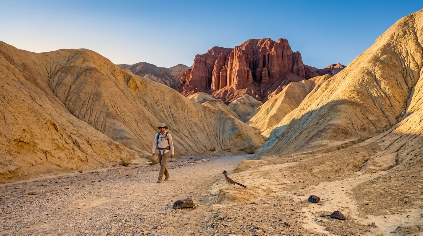
What you’ll see: golden badlands leading to a red rock amphitheater
The trail climbs through eroded, golden-hued badlands before reaching Red Cathedral, a striking red rock formation that anchors much of Death Valley’s classic postcard imagery. Many hikers extend the trip into a loop through Gower Gulch, passing Manly Beacon along the way.
Best time to hike Golden Canyon: winter only; Death Valley is genuinely dangerous in summer
This isn’t seasonal preference the way it is at most trails on this site; summer heat here is a real, documented safety hazard, and this trail’s exposed badlands offer essentially no shade at any time of day.
Zabriskie Point Trail
Trailhead access: a paved overlook lot directly off Highway 190
This is the single most accessible trailhead in this entire guide: a paved parking area right off Highway 190, with no walking required to reach the main overlook itself.
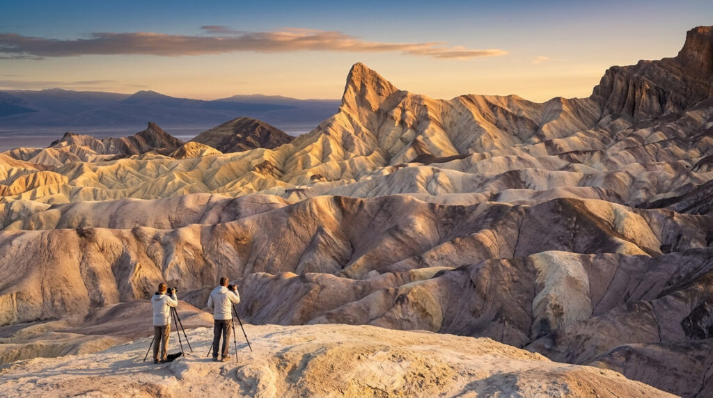
What you’ll see: wrinkled badlands made famous by countless films and photographs
The sweeping view of eroded, wrinkled badlands here is among the most reproduced desert landscape images in America, having appeared in numerous films over the decades, making it genuinely one of the most photographed viewpoints in the entire National Park System.
Best time to hike Zabriskie Point: sunrise for the most dramatic badlands light
Low-angle sunrise light models the badlands’ texture and color more dramatically than any other time of day; this is the classic photography window here, and one worth setting an early alarm for.
Badwater Basin Trail
Trailhead access: a paved lot directly off Badwater Road
Park at the paved lot right at Badwater Basin, the access point for the lowest elevation in North America.
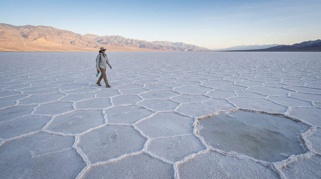
What you’ll see: a vast salt flat 282 feet below sea level
An enormous, hexagonally-cracked salt flat stretches to the horizon here, 282 feet below sea level, making it the single most extreme elevation superlative anywhere in this site’s coverage. Walking out onto the flat requires no real elevation gain, just distance across genuinely flat, reflective terrain.
Best time to hike Badwater Basin: early morning, even in winter, to avoid midday glare and heat
The fully exposed, reflective salt surface makes even winter midday hours notably harsher than an early start, which is a real terrain hazard consideration distinct from the shade-based logic that applies at most other trails on this site.
Natural Bridge Trail
Trailhead access: Badwater Road, then a bumpy unpaved access road
From Badwater Road, turn onto the unpaved Natural Bridge access road, which is generally passable for most vehicles but rough enough that higher-clearance vehicles have an easier time than the fully paved trailheads elsewhere in this guide.
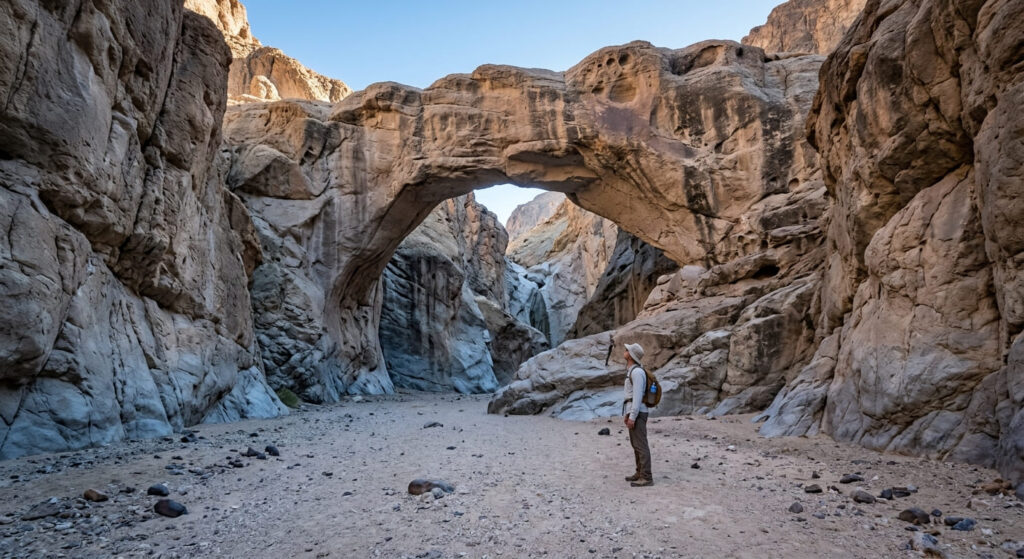
What you’ll see: a massive natural rock arch spanning a desert canyon
It’s roughly 1 to 1.4 miles round trip with 250 to 450 feet of gain, depending on how far up the canyon you continue. The arch itself stands about 35 feet above the canyon floor and is genuinely massive up close, distinct from the smaller limestone natural bridge covered elsewhere on this site in Calaveras County. Hikers who continue past the arch reach a dry waterfall chute where most people turn around.
Best time to hike Natural Bridge: cooler winter mornings for the exposed canyon walk
The canyon walls provide some shade in spots, but this is still a genuinely exposed walk; winter mornings remain the only consistently comfortable window, consistent with every other trail in this guide.
Darwin Falls Trail
Trailhead access: currently closed; the access road washed out in 2023 flooding
I want to be direct about this rather than describe a hike you can’t currently do. The unpaved access road near Panamint Springs, on the park’s western edge, has been completely washed out by repeated flooding since August 2023.
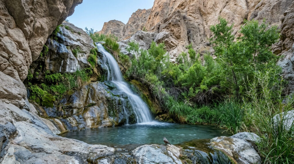
The most current source I found, dated May 2026, describes it as closed with no confirmed reopening before summer 2027 at the earliest.
What you’ll see when it reopens: a genuine year-round waterfall in the middle of the desert
Darwin Falls is a spring-fed waterfall and small riparian oasis that normally flows year-round in one of the driest places on Earth, creating a genuinely startling contrast that is unlike anything else in this guide. Reaching it historically involved a couple of creek crossings through a narrow canyon, exactly the kind of water hazard worth understanding before the trail reopens, before the falls came into view.
Best time to hike Darwin Falls: not applicable until the access road reopens
Unlike the rest of this guide, timing here was never really about the water; the spring-fed flow stayed fairly consistent year-round. Right now, the only timing question that matters is when the road itself reopens; I’ll update this section the moment that changes.
Which of these five to actually hike right now
Given Darwin Falls’ closure, build your Death Valley day around the other four: Zabriskie Point at sunrise, Golden Canyon to Red Cathedral as your main hike, Badwater Basin for the lowest-point novelty, and Natural Bridge as a short add-on if you have a higher-clearance vehicle. All four deliver genuinely different Death Valley experiences, and all four are confirmed open as of this writing.
Frequently asked questions
Is Death Valley dangerous in summer?
Yes, genuinely. Mid-summer temperatures regularly exceed 120°F, and heat-related deaths have occurred in the park. Every trail in this guide should be hiked October through April.
Has Zabriskie Point been in movies?
Yes, its distinctive wrinkled badlands have appeared in numerous films over the decades and remain one of the most photographed landscapes in the National Park System.
How far below sea level is Badwater Basin?
282 feet, which is the lowest point in North America.
Is Natural Bridge Trail easy to reach?
Mostly. It’s a short hike once you’re there, but the unpaved access road off Badwater Road is bumpy enough that a higher-clearance vehicle makes the drive easier.
Is there really a waterfall in Death Valley?
Yes, Darwin Falls is a genuine spring-fed, year-round waterfall, though as of this writing, its access road is washed out and closed, likely until at least summer 2027.
What is the best season to visit Death Valley?
October through April, without much competition; summer heat here is a real safety hazard, not just a comfort issue, across every trail in this guide.