The 5 Best Hiking Trails in the Mojave National Preserve, San Bernardino
This is the final guide in my San Bernardino County series, and it covers the Best Hiking Trails in Mojave National Preserve, the biggest single piece of protected land in the whole batch, 1.6 million acres, the third-largest National Park Service unit outside Alaska. If you’ve already read my desert trails guide, this is a genuinely different scale of desert: singing sand dunes, a real limestone cave system, and a Joshua tree forest still visibly recovering from fire. For the rest of this county, Big Bear, Lake Arrowhead, and the true high country of the San Bernardino Mountains, those three guides round out everything else this county has to offer. The full picture starts at San Bernardino County’s trail hub.
Disclosure: Please note that some of the links below are affiliate links and at no additional cost to you, I may earn a commission. Know that I only recommend hiking gear I personally stand behind; when you use my affiliate links, it helps me run this blog and keep all of this content free of charge for readers (like you).
One honest note before the list: the 2020 Dome Fire changed this preserve’s most famous landscape in a real way, and I’ll walk through exactly what that means for the trail most affected.
Key takeaways
- The acoustic oddity: Kelso Dunes, California’s tallest dune field, famous for a rare “singing sand” phenomenon.
- The fire-recovery story: Teutonia Peak, once one of the densest Joshua tree forests on Earth, now a genuinely striking mix of fire-killed and surviving trees.
- The scramble: Hole-in-the-Wall’s Rings Loop Trail, the only trail in this entire county batch that requires using fixed metal rings to descend a slot canyon.
- The underground one: Mitchell Caverns, the only true cave tour in this site’s California coverage so far, and the only trail here you can’t do without a reservation.
- The solitude pick: Caruthers Canyon, a genuinely unusual high-elevation pinyon-juniper woodland most visitors to this preserve never see.
- This is the most logistically involved guide in the whole batch. Remote trailheads, limited facilities, and one trail requiring an advance-booked tour make planning matter more here than anywhere else in this county series.
Quick-glance comparison
| Trail | Distance (RT) | Elevation gain | Fee / permit |
|---|---|---|---|
| Kelso Dunes | ~3 mi | ~650 ft | Free |
| Teutonia Peak | 3.2–4 mi | ~700–750 ft | Free |
| Hole-in-the-Wall Rings Loop | 1.4–1.5 mi | ~150–700 ft | Free |
| Mitchell Caverns | ~1.5 mi total | ~250 ft | Reservation required, tour fee |
| Caruthers Canyon | 2–6 mi (route-dependent) | ~500 ft | Free |
Kelso Dunes: California’s tallest dune field, and the sand really does sing
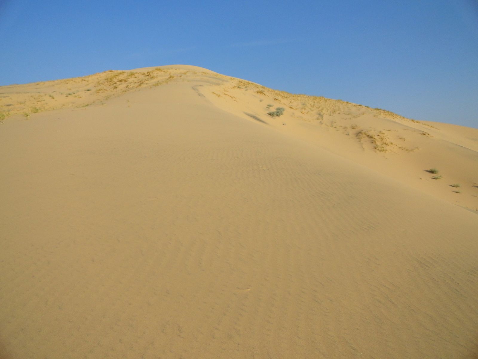
This is the trail every Mojave National Preserve visitor puts at the top of their list, and it earns that reputation, climbing a genuine mountain of sand is a stranger experience than photos suggest.
Trailhead access: free, undeveloped, no facilities
The Kelso Dunes trailhead has no water, no restrooms, and no development beyond a dirt parking area, come fully self-sufficient. No fee, no permit.
Difficulty, distance, and elevation gain up the dunes
It’s about 3 miles round trip with roughly 650 feet of gain, but sand hiking is deceptively strenuous, every step gives back a little, so this feels considerably harder than the mileage alone suggests.
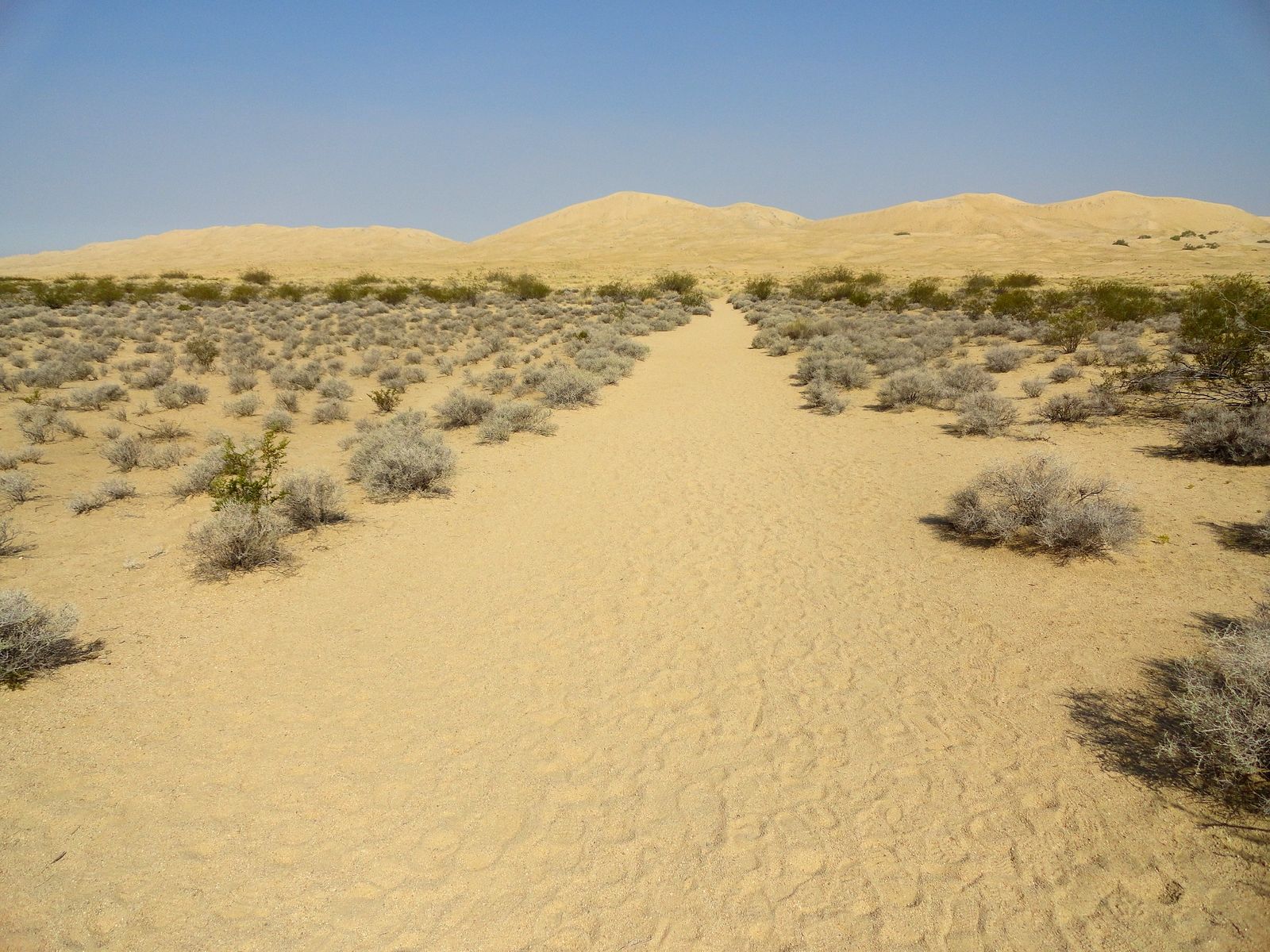
What you’ll see: the second-tallest dune field in the U.S., and “singing sand”
Kelso Dunes rises more than 600 feet, and under the right dry conditions, sliding sand on the steepest faces produces a genuine low booming or humming sound, a rare acoustic phenomenon found in only a handful of places worldwide.
Best time to hike Kelso Dunes: cool season, early morning for firmer sand
Morning sand holds together better than afternoon sand, which softens and shifts more in the heat, worth timing both for comfort and heat safety, especially since there’s zero shade anywhere on this trail.
Teutonia Peak: a Joshua tree forest still recovering from a major fire
I want to be upfront about this one before you go, because the trail you’ll hike today tells a different story than the one older write-ups describe.
Trailhead access: free roadside pullout on Cima Road
The trailhead sits on Cima Road, about 12 miles south of I-15 (or 5 miles north of the town of Cima), with a small pullout lot and no fee.
Difficulty, distance, and elevation gain to the summit
It’s 3.2–4 miles round trip with 700–750 feet of gain, starting flat and sandy before switchbacking steeply up rocky terrain to a boulder-strewn summit.
What you’ll see: fire-scarred and surviving Joshua trees side by side, and an old silver mine
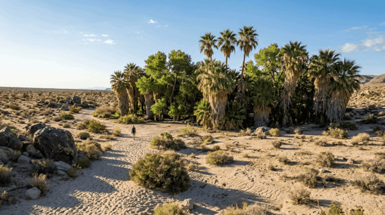
This area was, before August 2020, part of the densest concentration of Joshua trees in the world. The Dome Fire that month burned roughly a third of the Preserve’s Joshua trees, and this trail crosses directly through the burn scar, the National Park Service now specifically recommends this hike as the place to see fire-killed Joshua tree skeletons standing alongside healthy survivors and new regrowth.
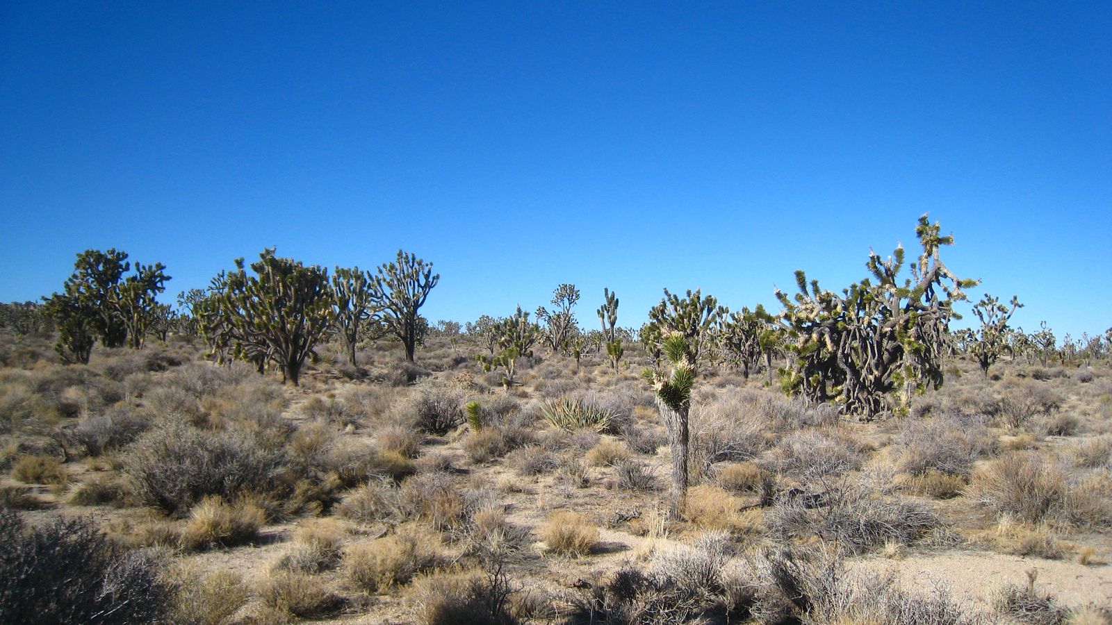
About a mile in, a short spur leads to the remains of the Teutonia Mine, a silver mine that briefly supported a small town, houses, a general store, a blacksmith, from 1906 to 1909 before it flooded and was abandoned. From the summit, you’ll get postcard views of Cima Dome, a nearly symmetrical 1,500-foot geological dome considered one of the most geometrically perfect of its kind in the country.
Best time to hike Teutonia Peak: any season, though spring softens the burn scar with new growth
Unlike most of this desert-heavy county series, this trail is genuinely worth visiting for the contrast itself, not despite it, spring adds a layer of visible recovery to the fire story.
Hole-in-the-Wall’s Rings Loop Trail: the only ring-assisted scramble in this county series
This is the most physically distinctive trail in the entire San Bernardino County batch, genuinely nothing else covered across all five guides requires this specific climbing technique.
Trailhead access: a staffed seasonal information center, the most developed trailhead in this guide
Park at the Hole-in-the-Wall Information Center, which has restrooms and a picnic area, a rare amenity in this remote preserve. No fee.
Difficulty, distance, and elevation gain through Banshee Canyon
It’s a 1.4–1.5-mile loop, with sources reporting real variation in elevation change (150 to 700 feet depending on the exact measurement), through a slot-like ravine called Banshee Canyon.
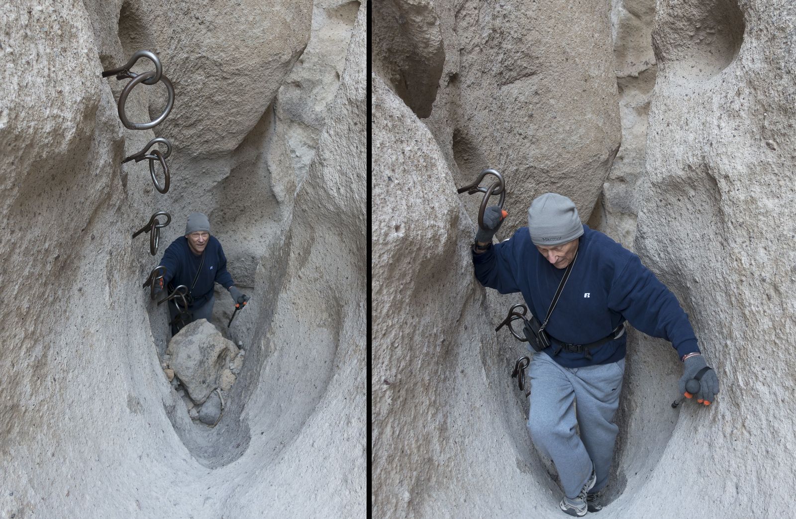
What you’ll see: rhyolite walls riddled with erosion holes, navigated by fixed metal rings
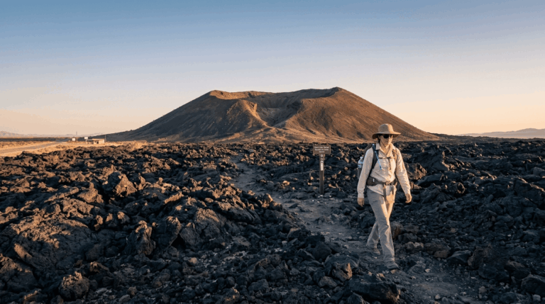
The volcanic rock here is pocked with holes from ancient gas bubbles, giving the area its name, genuinely striking, Swiss-cheese-like walls. Two steep sections require using ringbolts fastened into the smooth rock to climb or descend safely, an easy obstacle for most hikers but worth knowing about in advance if you’re not comfortable with any hands-on scrambling.
Best time to hike the Rings Loop: cool months, fully exposed terrain
Like the rest of this preserve, there’s minimal shade here, and this trail is open and hikeable year-round with the usual cool-season caveat for summer heat.
Mitchell Caverns: the only true cave tour on this entire site
Every other trail in this guide, and in this county’s whole batch, is a self-directed hike. This one isn’t, and that changes how you need to plan it.
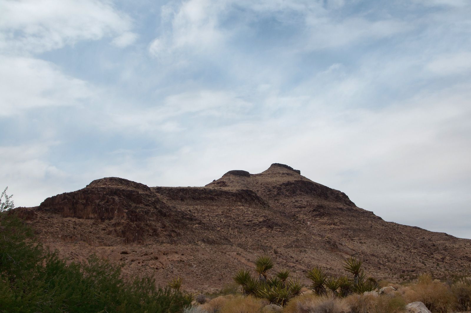
Trailhead access: Providence Mountains State Recreation Area, reservation required, and closed in summer
Book your tour in advance online through ReserveCalifornia.com, this is a California State Parks enclave inside the federally-managed preserve, with its own separate reservation and fee system. Worth knowing: the park is entirely closed during July and August, and operates Friday through Sunday (plus holiday Mondays) the rest of the year.
Difficulty, distance, and elevation gain to the cave entrance
The full guided experience involves about 1.5 miles of walking round trip, including the approach hike to the cave entrance and the tour itself, with roughly 250 feet of elevation change. This isn’t fully accessible for mobility-limited visitors, given uneven, sloped terrain on the approach.
What you’ll see: limestone cave formations tens of thousands of years old
A California State Park ranger leads small guided groups through two connected limestone caves, El Pakiva and Tecopa, past stalactites, stalagmites, and rarer formations like helictites and cave “popcorn.” A third cave, Winding Stair, is considered too dangerous for public tours and stays closed except for rescue-team training.
Best time to visit Mitchell Caverns: book ahead, and never in July or August
This is the one trail in this entire county series where the calendar itself, not the weather, is the main planning constraint, reserve your tour slot well ahead of a visit.
Caruthers Canyon: a hidden high-elevation woodland most preserve visitors never see
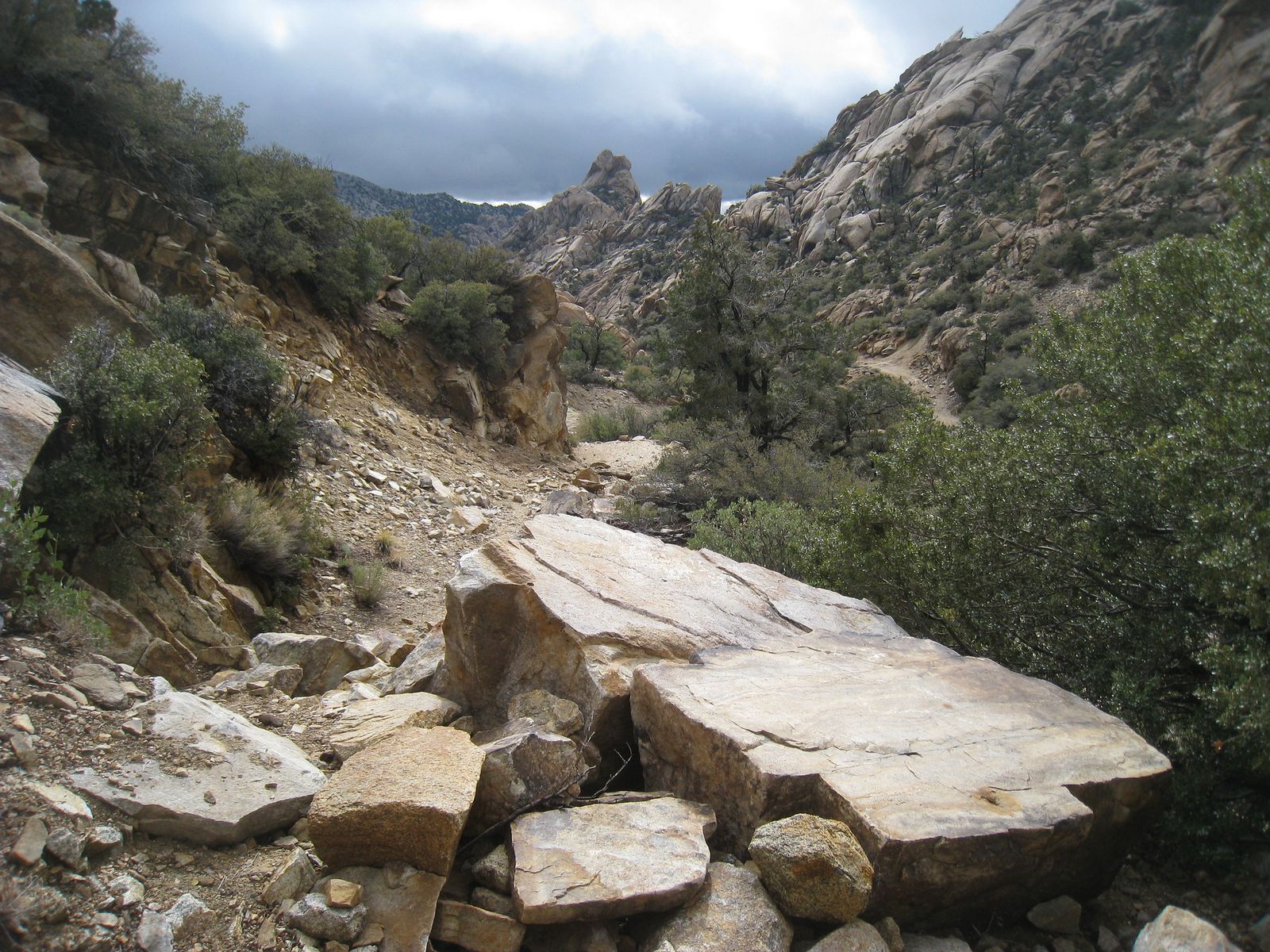
If everything else on this list feels like classic Mojave Desert, this trail is the outlier, genuinely surprising vegetation at 6,000 feet in the New York Mountains.
Trailhead access: a high-clearance dirt road, the most remote trailhead in this guide
Reaching Caruthers Canyon means driving an unpaved, high-clearance-recommended road into the New York Mountains, by far the most remote access point in this entire San Bernardino County batch. No fee once you’re there.
Difficulty, distance, and elevation gain through the canyon
Shorter adjustable turnarounds run 2–4 miles round trip, while the fuller documented route to see all of the canyon’s named rock formations extends to about 6 miles round trip, with roughly 500 feet of gain on an easily followed old mining road.
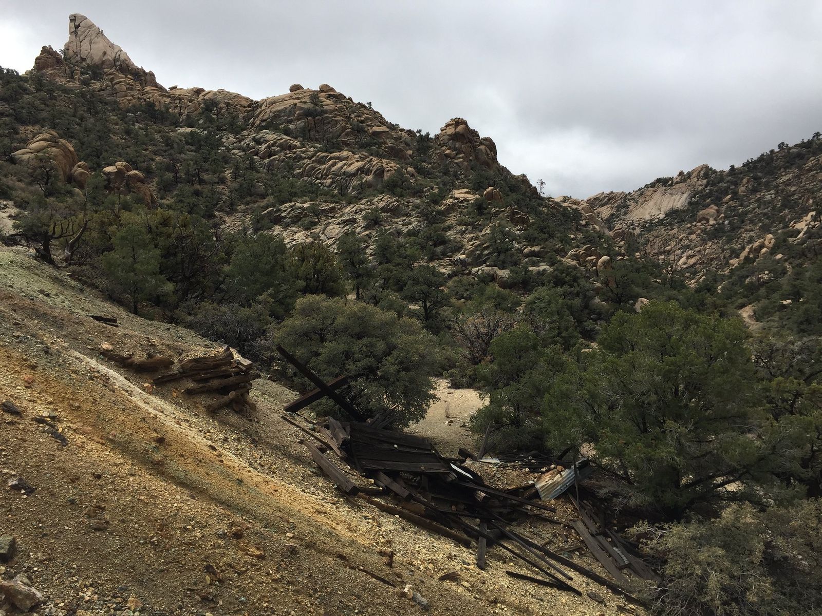
What you’ll see: granite boulder fields and a genuinely unusual woodland
Nearly 300 plant species live in this canyon, including pinyon pine, white fir, oak, and juniper, and oddly, coastal chaparral species that feel more at home in the Santa Monica Mountains than the Mojave Desert. Historic mining relics dot the canyon, evidence of the small operations that once worked this remote high country.
Best time to hike Caruthers Canyon: spring or fall, and it runs cooler than you’d expect
This canyon’s higher elevation genuinely moderates the heat compared to Kelso Dunes or Teutonia Peak, making it a reasonable option slightly later into the warm season than the rest of this guide.
Which of these five to hike first
If you only have time for one stop, Kelso Dunes is the iconic choice and the easiest to plan around. If the Dome Fire’s aftermath interests you as much as it interested me while researching this guide, Teutonia Peak tells a genuinely compelling recovery story. And if you want the one experience in this entire site’s coverage you can’t get anywhere else, book ahead for Mitchell Caverns, just not in July or August.
Frequently asked questions
Is there an entrance fee for Mojave National Preserve?
No, entry to the preserve itself is free. The only fee in this guide is Mitchell Caverns’ guided tour reservation, since that site is managed separately by California State Parks.
Do the Kelso Dunes really make a sound?
Yes, under the right dry conditions, sliding sand on the dunes’ steepest faces produces a genuine low booming or humming sound, a rare phenomenon known as “singing sand.”
Do you need a reservation for Mitchell Caverns tours?
Yes, book online through ReserveCalifornia.com before you go. The park is also closed entirely during July and August, so check the season before planning a visit.
Is Mojave National Preserve safe to hike alone?
It can be, with real preparation; this is one of the most remote, self-sufficiency-dependent areas covered anywhere on this site. Cell service is unreliable throughout; trailheads often lack water or facilities, and trail etiquette practices like telling someone your route matter more here than almost anywhere else in this county series.
How hot does the Mojave National Preserve get in summer?
Regularly well over 100°F at lower elevations like Kelso Dunes, which is part of why Mitchell Caverns closes entirely in July and August. Higher-elevation stops like Caruthers Canyon run somewhat cooler.
What is the best season to visit Mojave National Preserve?
Fall through spring, broadly, cooler temperatures make every trail in this guide considerably more comfortable, and spring adds wildflowers and, at Teutonia Peak, visible new growth in the fire-recovery areas.