The 5 Best Hiking Trails Near Joshua Tree’s Southern Entrance, From a Desert Oasis to a Slot Canyon
If you’re entering Joshua Tree from I-10 rather than the town of Joshua Tree itself, here’s the short version: start with Cottonwood Spring for the fastest oasis payoff, add Mastodon Peak if you want a summit and some mining history, and save Painted Canyon for a separate day trip entirely, it’s not even inside the park.
Disclosure: Please note that some of the links below are affiliate links and at no additional cost to you, I may earn a commission. Know that I only recommend hiking gear I personally stand behind; when you use my affiliate links, it helps me run this blog and keep all of this content free of charge for readers (like you).
This guide covers the quieter, lower Riverside County side of Joshua Tree National Park, entered off I-10 near Cottonwood Visitor Center, with some of the best hiking trails near Joshua Tree. The terrain is genuinely different from the Joshua-tree-covered Mojave Desert side most people picture, since you’re in Colorado Desert country down here and won’t see a single Joshua tree.
Five trails, one quiet corner of a very famous park: Cottonwood Spring Oasis, Mastodon Peak, Lost Palms Oasis, the Bajada Nature Trail, and Painted Canyon (Ladder Canyon), the last one technically outside the park entirely, in BLM-managed Mecca Hills.
If you want the full park experience with Hidden Valley, Joshua trees, and the rest of the Mojave-side terrain, my guide to Joshua Tree National Park’s best trails covers that side. This guide is specifically the Riverside County gateway, and if you’re working through the rest of the county, my complete Riverside County guide ties this into the Palm Springs and Idyllwild guide too.
Key takeaways
- Fastest oasis payoff: Cottonwood Spring, a spring-fed fan palm and cottonwood grove, viewable in a 0.1-mile stroll from the parking lot.
- Best combo of summit and history: Mastodon Peak, a granite scramble past an abandoned 1930–1971 gold mine, with Salton Sea views from the top.
- Biggest reward for the longest walk: Lost Palms Oasis, the largest native fan palm oasis in the entire park, but a real 7-plus-mile day.
- Quickest roadside stop: Bajada Nature Trail, a flat, quarter-mile loop through Colorado Desert plant life, no real effort required.
- The one that isn’t even in the park: Painted Canyon (Ladder Canyon), a BLM-managed slot canyon with fixed ladders, inside Mecca Hills Wilderness.
- None of these require a wilderness permit the way several Idyllwild trails do, just the standard park entrance fee for the first four, and free access for Painted Canyon.
Quick-glance comparison
| Trail | Distance (RT) | Elevation Gain | Fee | Best For |
|---|---|---|---|---|
| Cottonwood Spring Oasis Trail | 0.1–1.5 mi | Under 100 ft | Park entrance fee | Fastest oasis payoff |
| Mastodon Peak Trail | ~3 mi loop | 375–440 ft | Park entrance fee | Summit + mining history |
| Lost Palms Oasis Trail | 7.2–7.5 mi | ~600 ft | Park entrance fee | The park’s largest palm oasis |
| Bajada Nature Trail | ~0.25–0.3 mi loop | Negligible | Park entrance fee | Quick roadside stop |
| Painted Canyon (Ladder Canyon) | ~4.3–5 mi loop | 750–950 ft | Free (BLM land) | Slot canyon, fixed ladders |
Cottonwood Spring Oasis Trail: the fastest oasis in the park
This is the trail I send anyone entering from I-10, full stop, it asks almost nothing of you and delivers a genuine desert oasis in minutes.
Trailhead access and parking at the Cottonwood Spring Oasis Trailhead (park entrance fee)
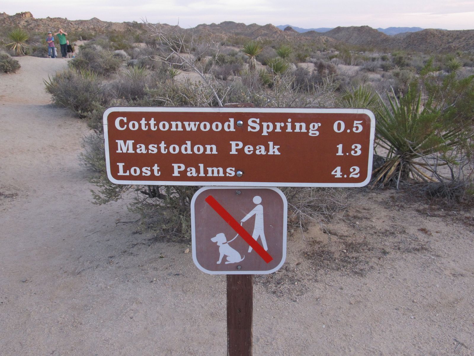
The trailhead sits one mile southeast of the Cottonwood Visitor Center, at the dead end of the access road, with a large paved parking lot and a backcountry registration board. You’ll need the standard Joshua Tree entrance fee, $30 per vehicle for 7 days, $15 per person on foot or bike, same fee that covers Mastodon Peak, Lost Palms Oasis, and the Bajada Nature Trail.
Difficulty, distance, and elevation gain to the Cottonwood Spring oasis
NPS’s own trail page describes the direct walk to the spring as a short 0.1-mile stroll from the parking lot, with negligible elevation change. Most visitors extend that into a fuller 1 to 1.5-mile loop around the wash for a proper tour, either way, this is a walk, not a workout.
What you’ll see: a fan palm desert oasis fed by a natural spring
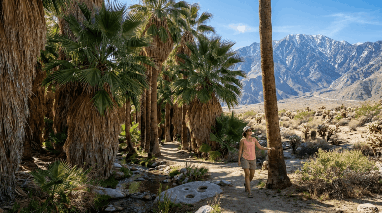
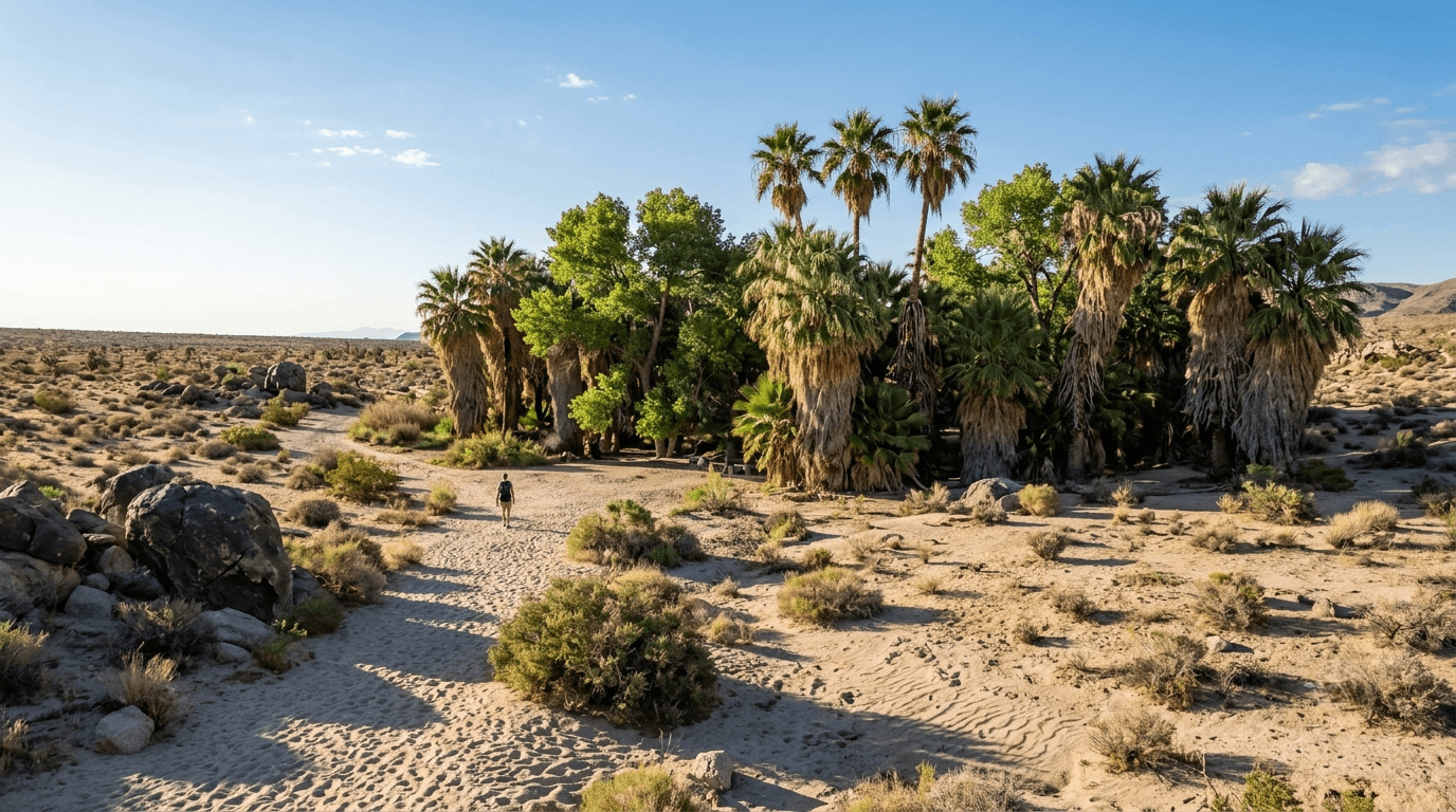
This spring, the result of ancient earthquake activity, pushes over 500 gallons of water a day to the surface, supporting one of only five spots in the park where native California fan palms grow naturally. Cottonwood trees (unique to this particular oasis among the park’s five) grow alongside them. Bedrock mortars near the trail mark where Cahuilla people once processed food here, and prospectors used the spring as a water stop as early as 1875.
Best time to hike Cottonwood Spring: cool months, early morning in summer
The wash sits fully exposed with minimal shade. October through April is genuinely pleasant; a summer visit still works if you’re there at opening and gone before mid-morning.
Mastodon Peak Trail: a granite scramble past an abandoned gold mine
If Cottonwood Spring is the easy stop, Mastodon Peak is the next natural step, same trailhead, real elevation, and a genuinely interesting piece of mining history along the way.
Trailhead access and parking at the Cottonwood Spring Trailhead
Same parking lot and entrance fee as Cottonwood Spring. The loop branches off the Lost Palms Oasis Trail about 0.7 miles in, so you’ll pass through the oasis itself before climbing.
Difficulty, distance, and elevation gain to the Mastodon Peak summit
Officially about 3 miles round trip with 375 to 440 ft of gain, plus an optional 0.1-mile scramble to the actual summit block, short but genuinely rocky at the top, not technical, but real hand-and-foot climbing for the last stretch.
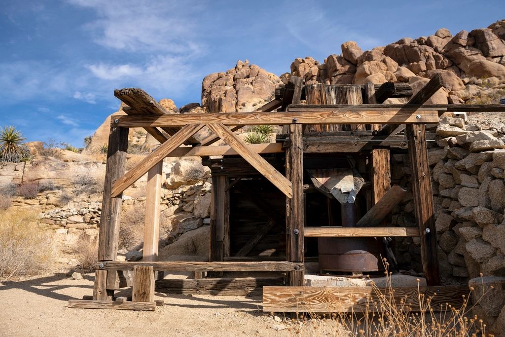
What you’ll see: a historic gold mine and 360° Colorado Desert views
The trail passes the Mastodon Mine, which operated intermittently from 1930 to 1971 before its main shaft, 45 ft deep on an incline, was caged over. From the summit, clear days deliver 360° views that reach the Salton Sea to the southeast.
Best time to hike Mastodon Peak: combine with Cottonwood Spring at sunrise
Since both trails share a trailhead, an early-morning combo of the two is a genuinely common way locals do this. Winter mornings deliver the clearest air; summer works if you’re moving before 9 a.m.
Lost Palms Oasis Trail: the largest fan palm oasis in the park
This is the trail I’d only recommend to someone who actually has the morning to spare, everything about it is a bigger commitment than the other four trails in this guide.
Trailhead access and parking at the Cottonwood Spring Trailhead
Third trail launching from the same hub, heading the opposite direction from Mastodon Peak once you’re past the initial junction.
Difficulty, distance, and elevation gain to Lost Palms Oasis
Sources land between 7.2 and 7.5 miles round trip with about 600 ft of gain, over rolling, fully exposed desert terrain, genuinely the longest trail in this guide, and one where getting down into the oasis itself at the end requires a short, unmarked scramble off the main route.
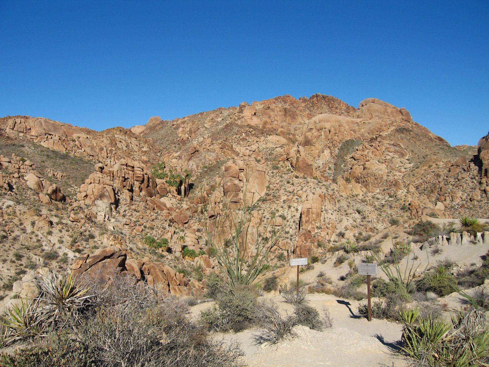
What you’ll see: the largest fan palm oasis in Joshua Tree National Park
This is the superlative payoff of the whole guide, the single largest concentration of native California fan palms found anywhere in the park, a genuine reward for the distance. It’s also a strong dark-sky location if you’re ever tempted to extend the trip into evening.
Best time to hike Lost Palms Oasis: a full morning outing, not a quick stop
NPS guidance is direct here: this trail isn’t recommended between May and October because of extreme heat. Budget a full morning, start early, and carry more water than you think you need, there’s no shade and no cell service anywhere on this route.
Bajada Nature Trail: the quickest stop in this entire guide
This barely counts as a hike, and that’s exactly the point, it’s the trail I recommend for anyone who wants a 10-minute leg-stretch on the way into or out of the park.
Trailhead access and parking at the Bajada Nature Trail, near the park’s southern entrance
The trailhead is its own separate turnout on Cottonwood Springs Road, about 1.5 miles north of the I-10 entrance and roughly 5 miles south of the Cottonwood Visitor Center, not at the visitor center itself. It’s a flat dirt-and-sand loop; the park’s own materials note some areas of deep sand that may not suit every wheelchair, so I wouldn’t bill it as universally accessible.
Difficulty, distance, and elevation gain on the Bajada Nature Trail
About a quarter-mile loop with negligible elevation change, the easiest, lowest-commitment entry in this entire batch of 25 trails.
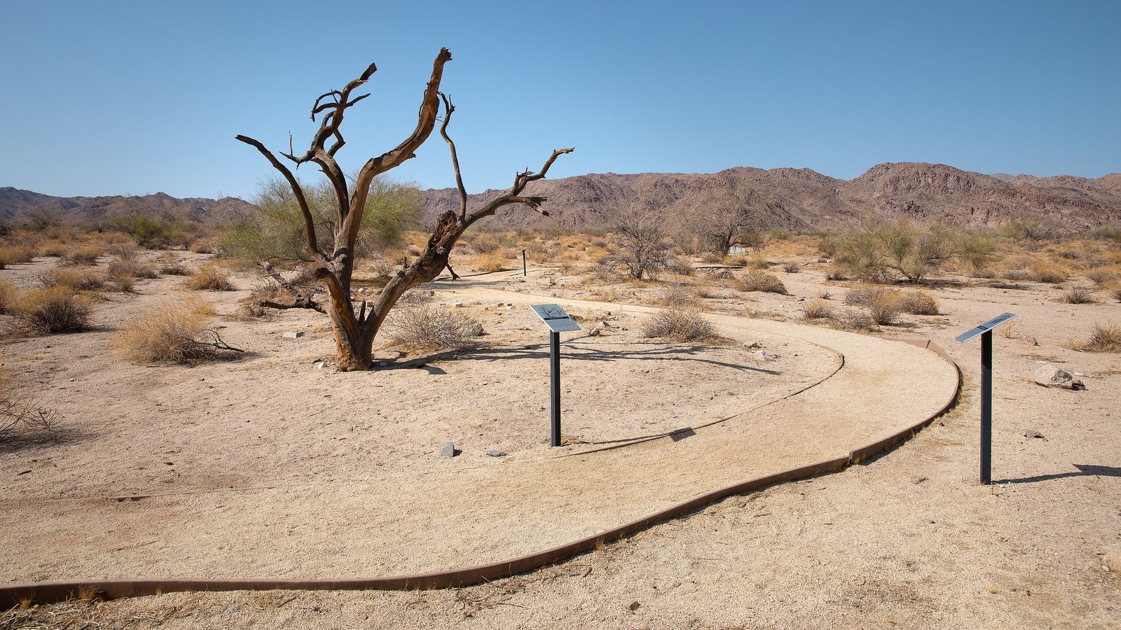
What you’ll see: a self-guided introduction to Colorado Desert plant life
Sixteen numbered interpretive panels cover creosote bush, cholla cactus, and the odd parasitic relationship between desert mistletoe and its host trees. Surrounding mountains, Cottonwood, Eagle, Orocopia, and Santa Rosa, ring the loop in every direction.
Best time to hike the Bajada Nature Trail: any time, a quick roadside stop
No shade, but also no real effort, so this works whenever you’re passing through, it removes the heat-safety caution central to every other trail in this guide.
Painted Canyon (Ladder Canyon) Trail: the one that isn’t even in the park
This is the outlier of the guide, and worth treating as its own separate trip rather than a stop on a Joshua Tree day.
Trailhead access and parking on Painted Canyon Road, Mecca Hills Wilderness
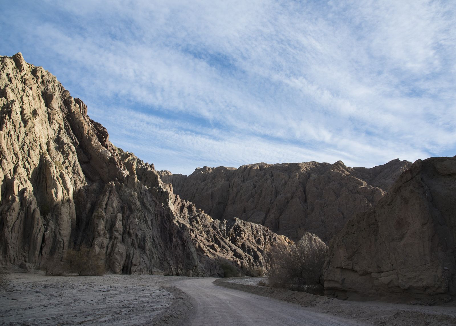
Painted Canyon sits in BLM-managed Mecca Hills Wilderness, now part of Chuckwalla National Monument, geographically outside Joshua Tree’s park boundary entirely, and the only non-NPS trail in this guide. Reach it via unpaved Painted Canyon Road off Box Canyon Road, about 4 to 5 miles of dirt; most passenger cars manage it when dry, though high clearance helps. No entrance fee.
Difficulty, distance, and elevation gain through the Ladder Canyon slot
Budget roughly 4.3 to 5 miles for the full loop, with 750 to 950 ft of gain, including several fixed wooden ladders, 5 to 6 of them, depending on the source and current trail conditions, inside the narrow slot canyon sections.
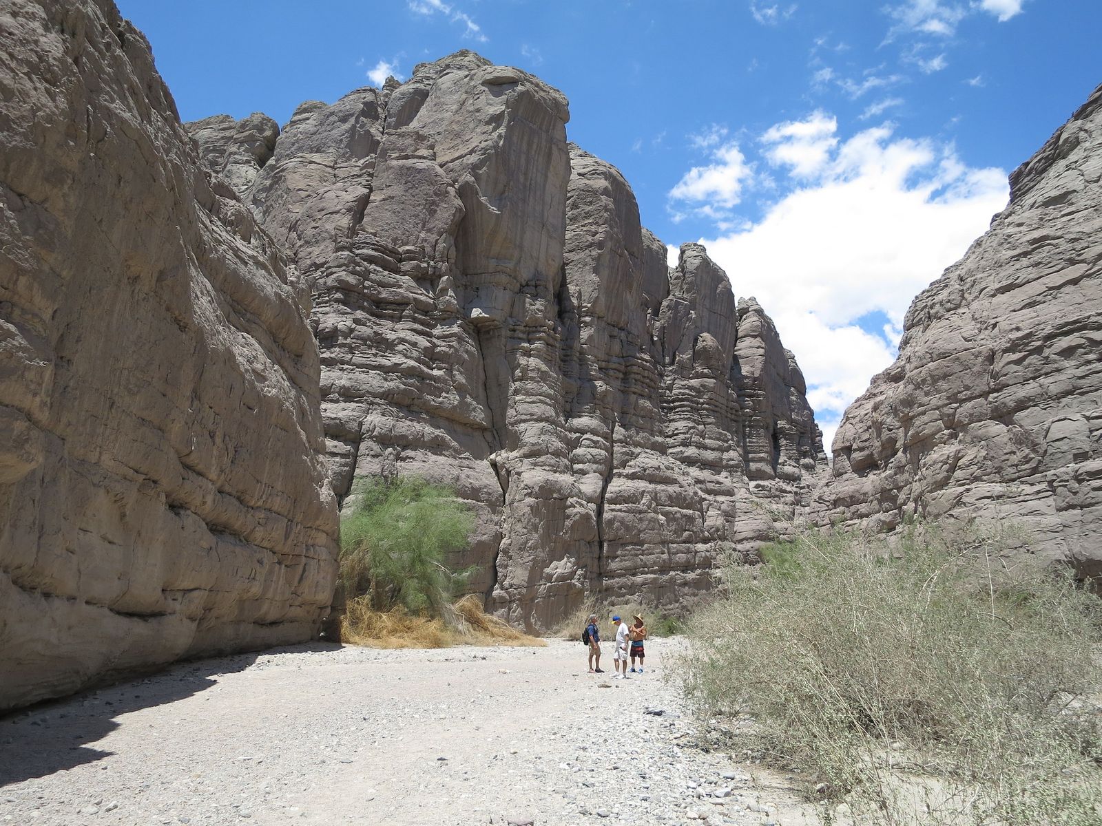
What you’ll see: colorful slot canyons and fixed wooden ladders
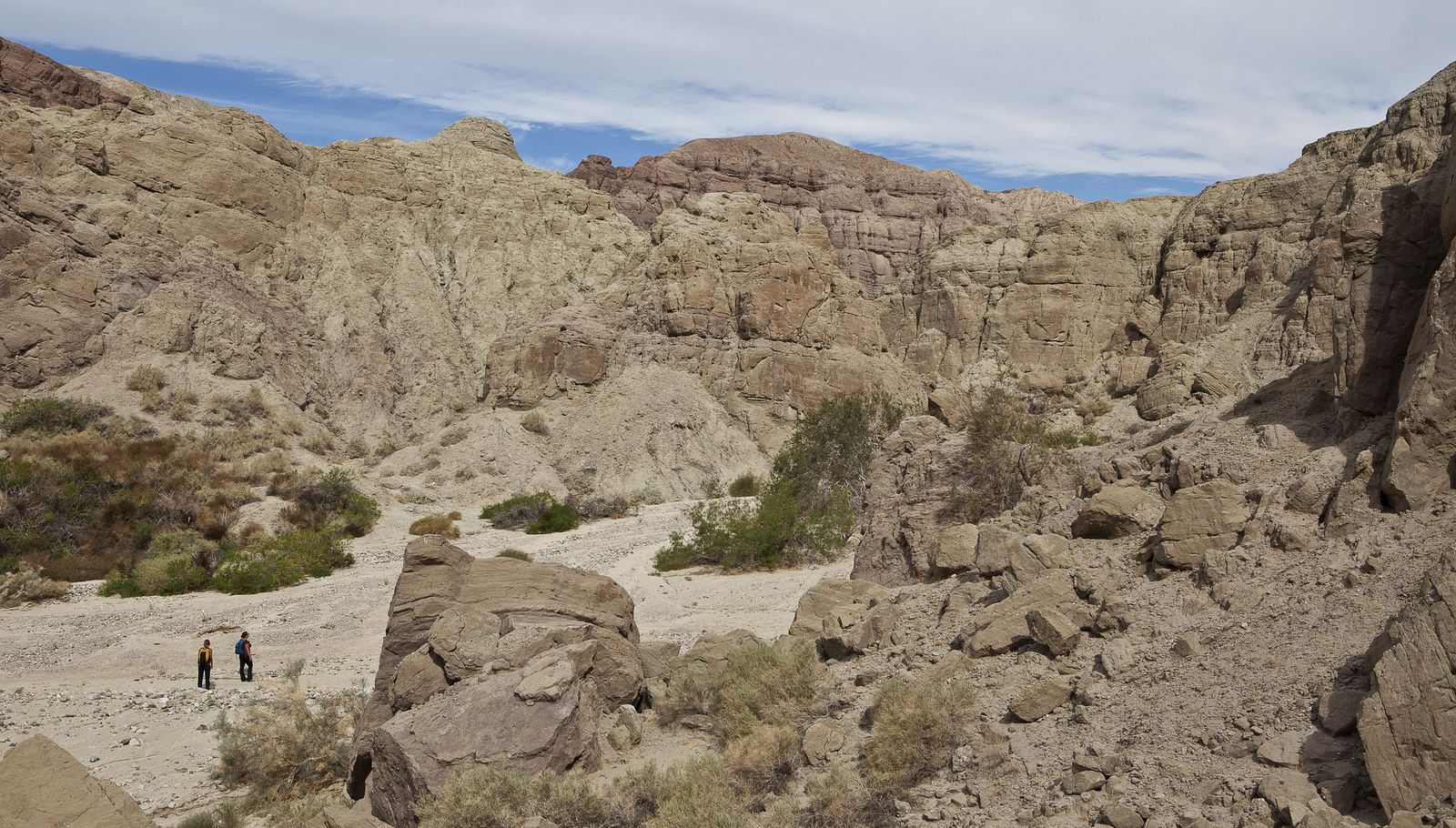
Banded pink, red, and tan badlands rock, a direct result of the San Andreas Fault’s proximity, climbed via ladders volunteers maintain and periodically replace. It’s genuinely unlike anything else in this guide: a true slot-canyon scramble rather than a desert walk.
Best time to hike Painted Canyon: avoid after rain, flash flood risk
This is a real, acute hazard, not a general caution, the canyon floods fast, and the access road itself closes after storms. Check current conditions before driving out, and never enter if rain is forecast anywhere nearby. October through April also dodges the worst of the heat.
The trail I’d actually start with
If you’ve only got one stop on your way into the park from I-10, make it Cottonwood Spring, it’s the fastest way to understand why this quieter, palm-oasis side of Joshua Tree is worth the detour at all. From there, Mastodon Peak is the natural next step, and Lost Palms Oasis is the one to save for a morning you can actually commit to. Painted Canyon deserves its own separate trip, not a rushed add-on.
These desert-floor oases pair naturally with the higher-elevation Coachella Valley trails covered in my guide to the Santa Rosa and San Jacinto Mountains, same county, a genuinely different climate. And since heat and flash floods are the two real hazards across this guide, my breakdowns of hiking safety and weather hazards on California trails are worth reading before you commit to a summer visit here.
Frequently asked questions
Is Cottonwood Spring in Riverside County or San Bernardino County?
Riverside County. Joshua Tree National Park straddles both counties, but Cottonwood Spring, Mastodon Peak, Lost Palms Oasis, and the Bajada Nature Trail all sit in the park’s southern section, within Riverside County.
Do you need a park pass to hike at Cottonwood Spring?
Yes, the standard Joshua Tree entrance fee applies: $30 per vehicle for 7 days, $25 per motorcycle, or $15 per person on foot or bike. An annual Joshua Tree pass ($55) or the America the Beautiful pass ($80) both cover it too.
Is Painted Canyon the same as Joshua Tree National Park?
No. Painted Canyon and Ladder Canyon sit in BLM-managed Mecca Hills Wilderness, now part of Chuckwalla National Monument, a separate piece of public land outside Joshua Tree’s actual boundary, with no park entrance fee required.
How many ladders are on the Ladder Canyon Trail?
Around 5 to 6, though the exact count varies, they’re volunteer-maintained and occasionally washed out or replaced after flash floods, so don’t expect the same number every visit.
Is Lost Palms Oasis worth the hike?
Yes, if you can commit the time. It’s a genuine 7-plus-mile round trip with no shade, but it ends at the largest native fan palm oasis in the entire park, a payoff the shorter trails in this guide can’t match.
Is hiking near Joshua Tree safe in summer?
Only with real precautions. NPS itself advises against Lost Palms Oasis between May and October, and every trail in this guide except the short Bajada loop carries genuine heat risk with little to no shade. Start early, carry more water than feels necessary, and skip Painted Canyon entirely if rain is anywhere in the forecast.