The 5 Best Hiking Trails in Napa County’s State Parks
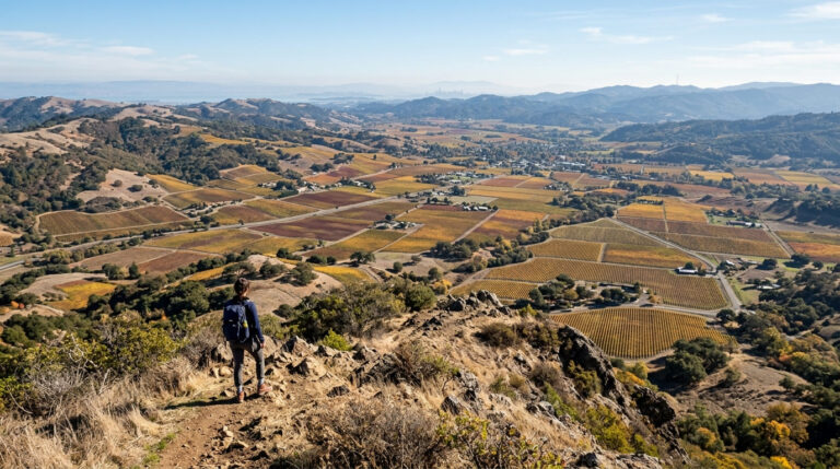
Napa County contains three designated California State Park units: Bothe-Napa Valley State Park, Bale Grist Mill State Historic Park, and Robert Louis Stevenson State Park, this guide covers all in depth, a genuine departure from the city and county parks covered in my Napa Valley flagship guide. Start at the Napa County trail guide for the complete picture across both guides.
Disclosure: Please note that some of the links below are affiliate links and at no additional cost to you, I may earn a commission. Know that I only recommend hiking gear I personally stand behind; when you use my affiliate links, it helps me run this blog and keep all of this content free of charge for readers (like you).
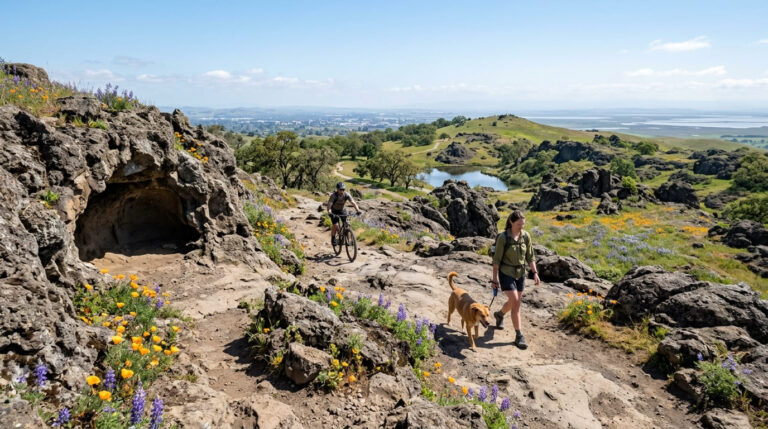
One theme runs through this entire guide, worth knowing before you go: unlike Alston Park’s dog-friendly trails covered elsewhere in this county, none of these five State Park Hiking Trails allow dogs. The range here also spans more than most single guides on this site, from a flat, shaded creek walk to a genuine 10-mile summit push.
Key takeaways
- The shaded classic: the Redwood Trail, Napa Valley’s easternmost reach of coast redwoods, and a genuine summer escape.
- The creek-side companion: Ritchey Canyon Trail, mixed forest and more tree diversity than the pure-redwood trail beside it.
- The living history stop: the History Trail to Bale Grist Mill, a working 1846 water-powered mill, still milling on weekends.
- The county’s highest point: Mount St. Helena, a genuine 10-mile summit push with a real literary history connection.
- The shorter alternative: Table Rock Trail, dramatic volcanic cliffs in about half the distance of the full summit.
- No dogs on any trail in this guide. That’s the single clearest distinction from this county’s other guide.
Redwood Trail (Bothe-Napa Valley State Park)
Trailhead access: a day-use fee lot near Calistoga
Bothe-Napa Valley State Park charges $10 per vehicle ($8 seniors, $4 with an ADA placard) at its entrance on the St. Helena Highway between Calistoga and St. Helena, the anchor trailhead for three of this guide’s five trails.
What you’ll see: coast redwoods at the eastern edge of their range
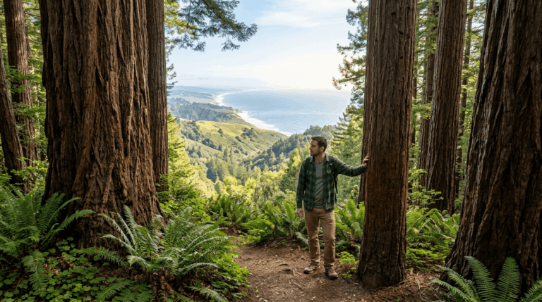
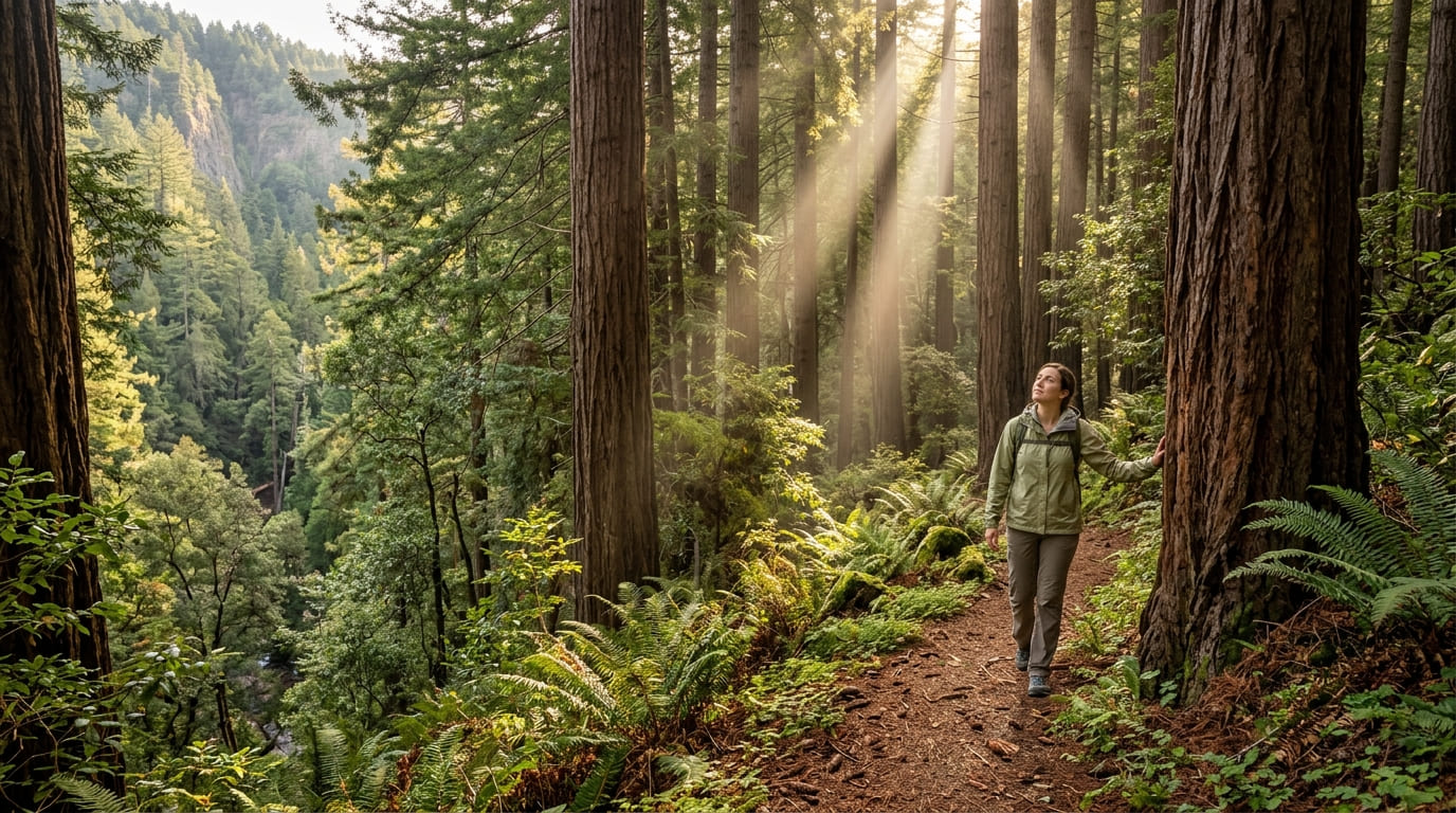
This 1,900-acre park is the furthest inland California state park containing coast redwoods, a genuine range-edge distinction. The Redwood Trail winds along the Ritchey Canyon ridgeline through towering redwoods and Douglas fir, with delicate ferns along the creek below, dogs aren’t allowed on any trail here, restricted instead to the campground and picnic areas.
Near the Visitor Center, a Native American Plant Garden interprets plants historically used by the Wappo people for food, medicine, and basket-weaving. The park also runs a seasonal swimming pool, open weekends from Memorial Day through mid-June and then daily through Labor Day, a nice pairing if you want to cool off after the hike.
Best time to hike the Redwood Trail: a shaded summer escape from valley heat
Consistent canopy shade makes this noticeably cooler than the valley floor on a hot day, since shade changes footing and comfort more than most hikers expect.
Ritchey Canyon Trail (Bothe-Napa Valley State Park)
Trailhead access: the same entrance as the Redwood Trail
This trail shares Bothe-Napa Valley’s entrance and fee with the Redwood Trail above, following a different creek drainage deeper into the park, the two are commonly combined into a single loop of about 3 miles with 400 feet of gain.
What you’ll see: a creekside canyon through genuinely mixed forest
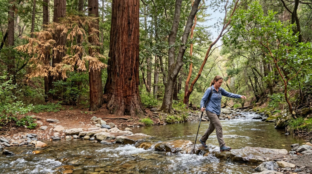
Redwood, Douglas fir, tanoak, and madrone all grow along Ritchey Creek here, offering more species diversity than the pure-redwood focus of the trail above. Expect some creek crossings that can be slippery after rain, a real water hazard worth sturdy footwear for, not just a scenic backdrop.
Best time to hike Ritchey Canyon Trail: spring for creek flow
Spring rainfall directly drives how much water is actually running through the canyon, by late summer, the creek can slow to a trickle in places.
History Trail to Bale Grist Mill State Historic Park
Trailhead access: from Bothe-Napa Valley or Bale Grist Mill’s own lot
Walk this connector from either park entrance, Bothe-Napa Valley’s fee covers the trail itself, while Bale Grist Mill charges its own separate $8 adult admission ($3 for children 6–17) to enter the historic mill grounds.
What you’ll see: a working 1846 water-powered grist mill
Built in 1846 by Edward Turner Bale, this fully restored mill features a 36-foot water wheel, among the largest in the country, and still grinds grain on its original stones.
The roughly 2-mile round-trip trail passes the Pioneer Cemetery, resting place of several early Napa Valley settlers, and the site of White Church, the valley’s first church, founded by Minister Asa White. Dogs are allowed in the mill’s developed day-use areas but not on the trail itself, consistent with every other trail in this guide.
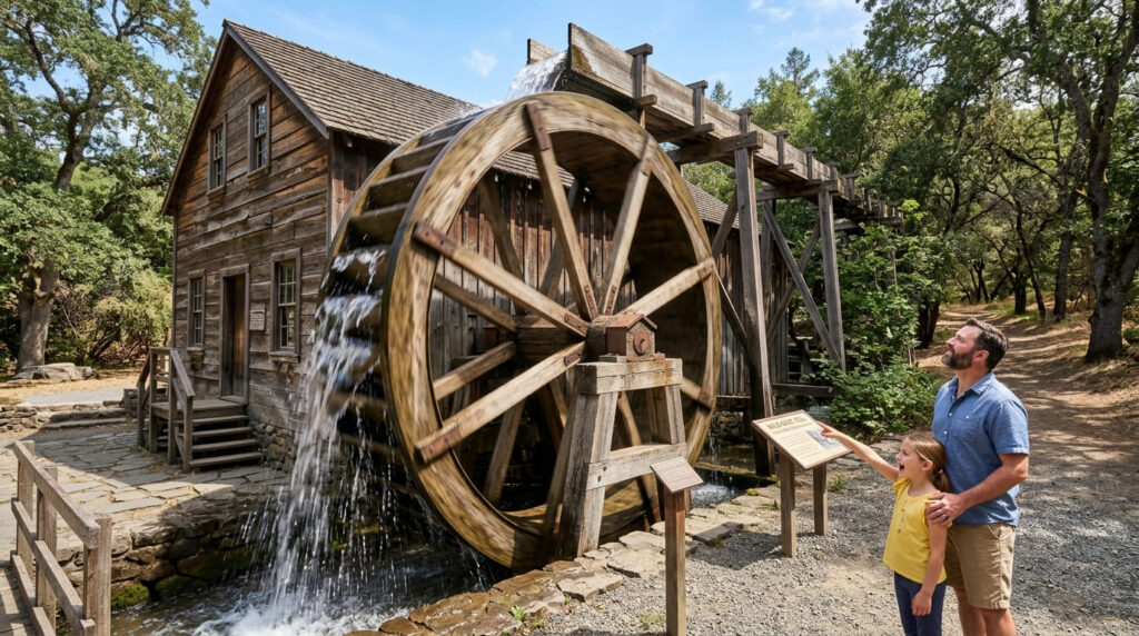
Best time to hike the History Trail: check the mill’s weekend demonstration schedule
Live milling demonstrations run Saturdays and Sundays, 10 a.m. to 4 p.m., the mill itself is closed on weekdays, so time your visit accordingly if seeing the wheel in motion is the goal.
Mount St. Helena Trail (Robert Louis Stevenson State Park)
Trailhead access: a free roadside lot on Highway 29
Park along Highway 29, about seven miles north of Calistoga, marking the boundary where Napa, Sonoma, and Lake Counties meet. No fee, though the lot is small and parking along the busy highway itself takes real caution.
What you’ll see: Napa County’s highest peak, and a literary honeymoon site
At 4,343 feet, Mount St. Helena is the highest point in Napa County, and its broader peak complex extends into neighboring Sonoma and Lake Counties as well. Author Robert Louis Stevenson honeymooned on its slopes in 1880, an experience that inspired his book “The Silverado Squatters”, nothing remains of his cabin today, but the site is marked along the trail.
Dogs are prohibited throughout the entire park to protect wildlife, the strictest policy of any trail in this guide. Winter here occasionally brings genuine snow, one of the few hikes within an hour of the Bay Area where that’s true.
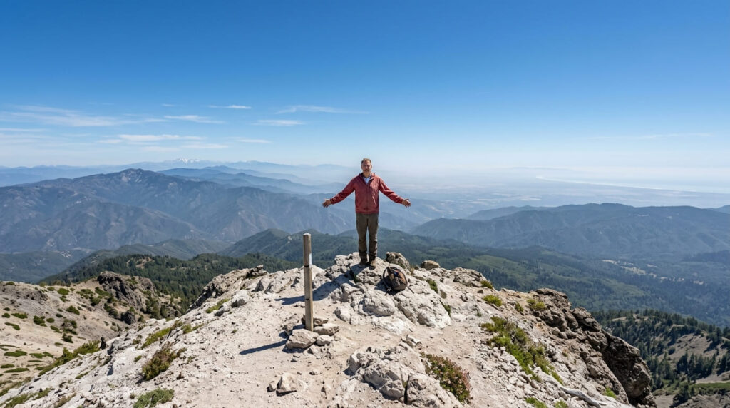
Best time to hike Mount St. Helena: clear days for the farthest views
On the clearest days, the summit view reportedly extends to Mount Shasta, Mount Lassen, the Sierra Nevada, and the Pacific Ocean, genuinely exceptional visibility worth timing a visit around.
Table Rock Trail (Robert Louis Stevenson State Park)
Trailhead access: across Highway 29 from the Mount St. Helena trailhead
Table Rock Trail begins on the opposite side of Highway 29 from the Mount St. Helena approach, within the same state park.
What you’ll see: a dramatic flat-topped rock and volcanic cliffs
It’s roughly 4 miles round trip to Table Rock itself, meaningfully shorter than the full Mount St. Helena summit push. The rock formation drops sharply, about 300 feet, to the hillside below, part of the mile-long volcanic Palisades wall formed by the same Sonoma Volcanics eruptions, 2.6 to 8 million years ago, that shaped Mount St. Helena itself.
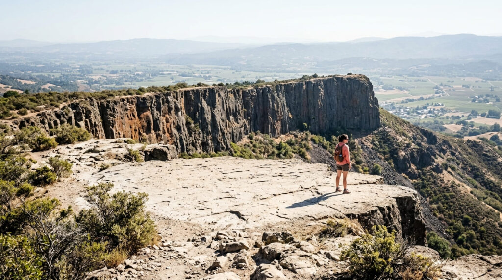
Best time to hike Table Rock: a shorter alternative when you don’t have a full day
This is the trail to choose when Mount St. Helena’s full 10-mile push doesn’t fit your schedule, delivering genuinely dramatic geology in about half the distance.
Which of these five to hike first
If you want the shaded, easy classic, Redwood and Ritchey Canyon combine into a genuinely pleasant loop. If living history interests you, the mill’s weekend demonstrations are worth timing a visit around. And if you’re deciding between the two Robert Louis Stevenson trails, Table Rock is the better choice when you want real payoff without the full day Mount St. Helena demands.
Frequently asked questions
Is there a fee at Bothe-Napa Valley State Park?
Yes, $10 per vehicle ($8 seniors, $4 with an ADA placard).
Is Bale Grist Mill still working?
Yes, it’s a fully restored, functioning water-powered mill, with live milling demonstrations offered on weekends only.
How tall is Mount St. Helena?
4,343 feet, the highest point in Napa County.
Is Robert Louis Stevenson State Park named for the author?
Yes, directly, Stevenson honeymooned on Mount St. Helena’s slopes in 1880, an experience that inspired his book “The Silverado Squatters.”
Is Table Rock Trail easier than Mount St. Helena?
Yes, notably, about 4 miles round trip versus Mount St. Helena’s roughly 10-mile push, while still delivering dramatic volcanic scenery.
Are Napa County’s state parks crowded?
Bothe-Napa Valley and Mount St. Helena both see real weekend traffic, especially in summer, but they’re considerably less crowded than more famous redwood parks elsewhere in Northern California.