5 Best Canyon Hiking Trails in Butte County, From a 410-Foot Waterfall to a Covered Bridge Rebuilt After the Camp Fire
Butte County’s canyon country spans a volcanic tableland, one of California’s tallest waterfalls, a historic covered bridge with a moving rebuilding story, and the dramatic Feather River Canyon. This guide covers the county’s canyons and waterfalls; for Chico’s flagship municipal park, see our Bidwell Park trails guide, part of our full Butte County hiking guide.
Disclosure: Please note that some of the links below are affiliate links and at no additional cost to you, I may earn a commission. Know that I only recommend hiking gear I personally stand behind; when you use my affiliate links, it helps me run this blog and keep all of this content free of charge for readers (like you).
Key takeaways
- Best spring double-feature: Phantom Falls, a seasonal waterfall plunging off a volcanic tableland, peaking in the same narrow window as the reserve’s wildflower bloom.
- Tallest, most significant waterfall in the county: Feather Falls, one of California’s tallest waterfalls, though not quite as tall as its famous (and incorrect) legendary height.
- Most moving rebuilding story: Honey Run Covered Bridge, destroyed in the 2018 Camp Fire and fully reopened to the public in 2025.
- Best reservoir views: Bidwell Canyon, sweeping views over Lake Oroville, California’s second-largest reservoir.
- Most dramatic transportation corridor: Feather River Canyon, a canyon shared by a highway, a historic railroad, and the Feather River itself.
- Two of these five trails (Phantom Falls, Feather Falls) are strictly seasonal or long-commitment hikes, read the specific distance and timing notes before you plan a trip around either one.
How these five Butte County canyon trails compare
| Trail | Distance | Height/Scale | Fee/Permit | Best for |
|---|---|---|---|---|
| Phantom Falls | ~4 mi round trip (no formal trail) | ~130-166 ft | CDFW Lands Pass | Spring wildflowers + waterfall |
| Feather Falls | ~8.6-9 mi round trip | 410 ft | Free | Tallest waterfall in the county |
| Honey Run Covered Bridge | Short walk | 238 ft long bridge | Free | History, rebuilding story |
| Bidwell Canyon | Variable | Lake Oroville views | Vehicle Day-Use Fee | Reservoir scenery |
| Feather River Canyon | Variable | Deep transportation canyon | Free | Highway/railroad/river canyon |
Phantom Falls Trail (North Table Mountain Ecological Reserve)
Trailhead access and parking at North Table Mountain Ecological Reserve, near Oroville
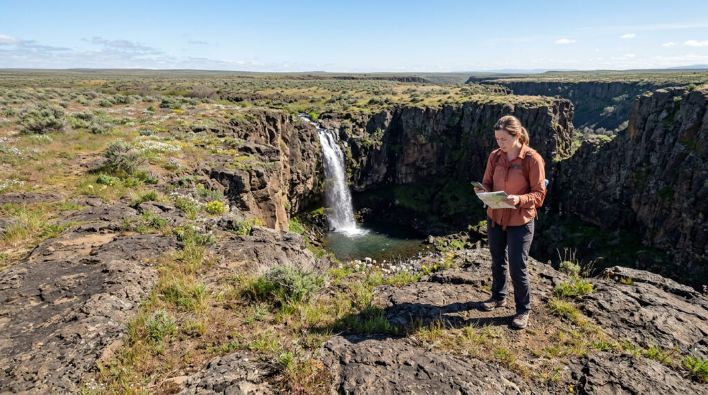
A California Department of Fish and Wildlife reserve trailhead sits off Cherokee Road atop a flat-topped volcanic tableland. Visitors 16 and older must carry a valid CDFW Lands Pass (or a current hunting/fishing license) to access the reserve. One thing worth knowing: there’s no formal, maintained trail to Phantom Falls itself, hikers cross roughly 2 miles of open tableland to reach the rim of Coal Canyon, where the falls are viewed from above rather than approached at the base.
What you’ll see: a seasonal waterfall plunging off a volcanic tableland
Phantom Falls drops roughly 130 to 166 feet (sources vary) off the edge of Coal Canyon into a grotto below, named for how completely it vanishes during the dry season, it runs only in the rainy months, roughly late autumn through early spring. A small pool at the base is home to a subspecies of California newt.
Best time to hike Phantom Falls: spring for both peak waterfall flow and wildflowers
This is a dual-seasonal peak: the reserve’s spring wildflower bloom and Phantom Falls’ strongest flow both land in the same narrow window, roughly February through April, miss it, and you’ll likely find dry tableland and an empty canyon rim instead.
Feather Falls Trail
Trailhead access and parking near Feather Falls Scenic Area, Plumas National Forest
A free Forest Service trailhead off Lumpkin Road, roughly 30 miles from Oroville. Budget for an 8.6-to-9-mile round trip via the recommended upper loop; a shorter, steeper lower-loop route exists but is more exposed to spring flooding.
What you’ll see: one of the tallest waterfalls in California, and a correction on its famous height
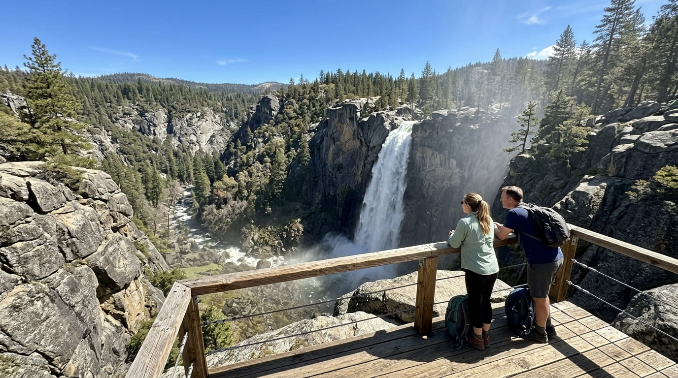
Feather Falls drops 410 feet along the Fall River, one of the tallest waterfalls in California, viewed from a dedicated observation platform. Here’s a correction worth making clearly: the widely repeated figure of 640 feet is incorrect.
Multiple sources, including USGS survey data, confirm the accurate measured height is 410 feet, still remarkable, just not the number that’s been circulating in guidebooks and trail signage for decades. A bonus for winter visitors: the Frey Creek area along the trail is a well-known stopping point for migrating ladybugs, with millions visible some winters.
Best time to hike Feather Falls: spring for peak flow, check trail conditions after storms
Spring snowmelt and rain drive this waterfall’s peak flow, though given the trail’s considerable length, it’s worth checking current conditions after storms, sections can get muddy and slow you down more than the mileage alone suggests.
Honey Run Covered Bridge Trail (Butte Creek Canyon)
Trailhead access and parking near the Honey Run Covered Bridge, Butte Creek Canyon
A free trailhead near the historic bridge site sits in Butte Creek Canyon, east of Chico, one of the more historically significant single stops in this entire county’s trail network.
What you’ll see: a historic covered bridge, destroyed by wildfire and rebuilt by the community
Built in 1887, the Honey Run Covered Bridge was the only three-span Pratt-truss covered bridge in the United States, and a beloved regional gathering spot for well over a century.
On November 8, 2018, the Camp Fire, the deadliest and most destructive wildfire in California history, which killed 85 people and destroyed the nearby town of Paradise, completely destroyed the bridge.
What’s worth knowing, though, is what happened next: the nonprofit Honey Run Covered Bridge Association raised several million dollars from the local community to rebuild it, and the reconstructed bridge officially reopened to the public on June 1, 2025, in the same spot where the original stood for more than a century.
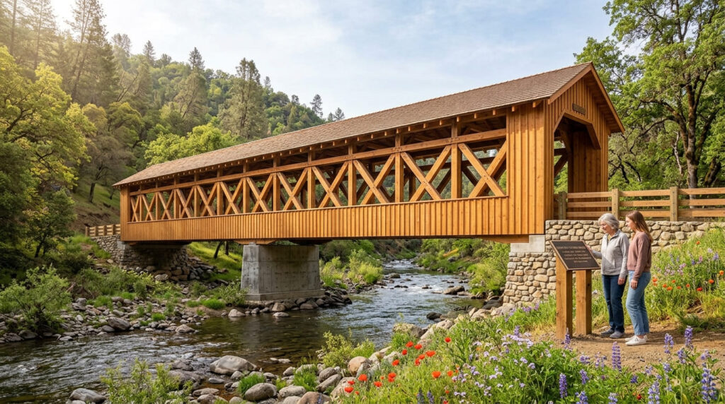
Best time to hike Honey Run Covered Bridge: spring for wildflowers along Butte Creek Canyon
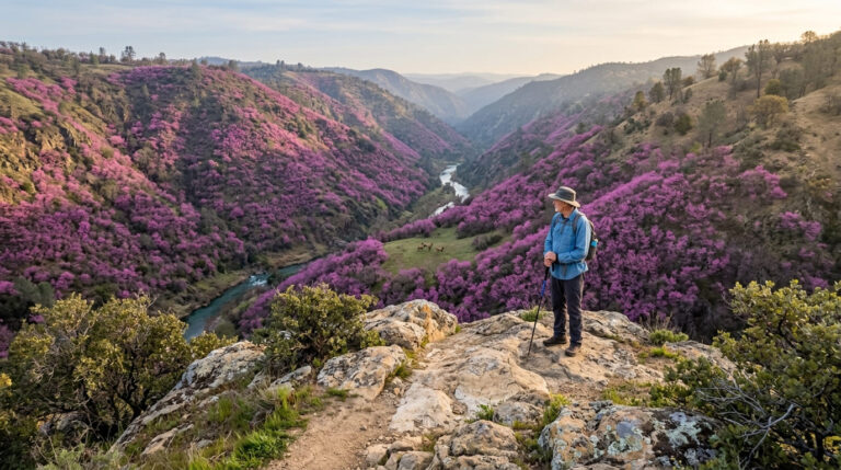
Spring brings wildflower bloom to the canyon’s slopes, adding real color to a visit that’s already worth it for the history alone.
Bidwell Canyon Trail (Lake Oroville)
Trailhead access and parking at Bidwell Canyon, Lake Oroville
A trailhead at Lake Oroville, California’s second-largest reservoir, requires a vehicle day-use fee (typically $8) and offers a different canyon-and-reservoir landscape than the waterfall-focused trails covered earlier in this guide.
What you’ll see: sweeping views over California’s second-largest reservoir
Wide views open up over Lake Oroville’s canyon-carved shoreline here, a dramatic change of scale from the narrow waterfall canyons elsewhere in this county, the sheer size of the reservoir itself is the main draw on this trail.
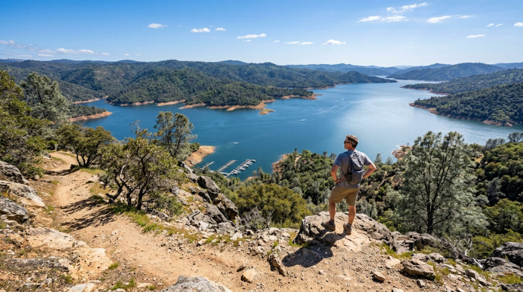
Best time to hike Bidwell Canyon: spring for the fullest reservoir views
Seasonal reservoir-level changes dictate how full and scenic the lake appears from this canyon-rim trail, spring, after winter rain and snowmelt have filled the reservoir, typically delivers the most dramatic views.
Feather River Canyon Trail (Near Storrie)
Trailhead access and parking near Storrie, along Highway 70
A Forest Service trailhead near the small community of Storrie offers the most remote access point in this entire guide, free, with no fee or permit required.
What you’ll see: a dramatic highway and railroad canyon along the Feather River
This deep canyon is shared by the Feather River, Highway 70, and a historic Western Pacific Railroad line, a rare three-way transportation-and-river-canyon combination unique to this trail. It’s also worth noting, with gravity rather than as trivia: the 2018 Camp Fire, which destroyed the Honey Run Covered Bridge covered earlier in this guide and killed 85 people in nearby Paradise, ignited in this same Feather River Canyon.
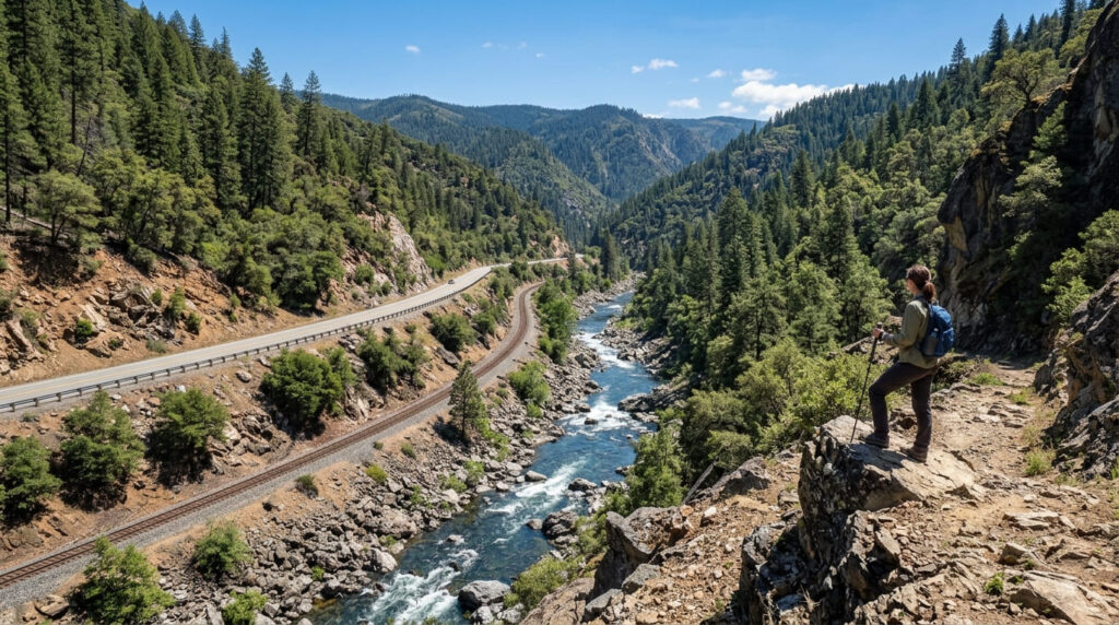
Best time to hike Feather River Canyon Trail: spring and fall for comfortable canyon temperatures
This canyon tends to trap heat in summer, making shoulder-season timing meaningfully more comfortable than a midsummer visit.
Frequently asked questions about canyon hiking trails in Butte County
How tall is Phantom Falls?
Sources cite figures between roughly 130 and 166 feet, a tall seasonal waterfall, though it runs only during the rainy months and disappears completely by summer.
How tall is Feather Falls?
410 feet, not the widely repeated but inaccurate figure of 640 feet, still one of the tallest waterfalls in California by any measure.
Was the Honey Run Covered Bridge destroyed by fire?
Yes, the 2018 Camp Fire completely destroyed the historic bridge. It has since been rebuilt through community fundraising and officially reopened to the public on June 1, 2025.
How big is Lake Oroville?
It’s California’s second-largest reservoir by capacity, behind only Shasta Lake, with a canyon-carved shoreline visible from the Bidwell Canyon Trail.
Does a railroad run through Feather River Canyon?
Yes, a historic Western Pacific Railroad line runs through the same canyon as Highway 70 and the Feather River itself, a rare three-way transportation corridor.
Which Butte County canyon trail has the tallest waterfall?
Feather Falls, at an accurately measured 410 feet, one of the tallest waterfalls in the entire state.