Water Hazards on California Trails: River Crossings & Flash Floods
Water causes more hiking deaths in the U.S. than almost any other trail hazard, and most of them don’t happen in dramatic whitewater, they happen in ordinary-looking streams that turn out to be faster and stronger than they looked from the bank. California adds its own version of this problem: desert washes that flood on a clear day. Understanding Water Hazards on California Trails is essential; Here’s how to read water before it reads you, from spring snowmelt crossings to summer flash floods to what’s actually safe to drink.
Disclosure: Please note that some of the links below are affiliate links and at no additional cost to you, I may earn a commission. Know that I only recommend hiking gear I personally stand behind; when you use my affiliate links, it helps me run this blog and keep all of this content free of charge for readers (like you).
Key takeaways
- Water’s danger is invisible from the bank, a stream two feet deep moving at 5 mph exerts over 200 lb of force, easily enough to knock an adult off their feet.
- Unbuckle your hip belt and sternum strap before any real crossing so you can shed your pack immediately if you fall; a waterlogged pack can hold you under.
- Snowmelt-fed Sierra streams run lowest in early morning and peak in late afternoon, cross early in the day whenever a crossing looks marginal.
- Flash floods don’t require local rain, a storm 25 miles upstream can send a wall of water through a canyon under a clear blue sky.
- No California stream is safe to drink unfiltered, including clear alpine water, Giardia and Cryptosporidium don’t care how the water looks.
- If in doubt, don’t cross, turning back or waiting an hour for water to drop is always the safer option than testing a marginal ford.
Why water is one of the most underestimated hazards on California trails
Water doesn’t look dangerous the way a cliff edge does, which is exactly the problem. Clear, ankle-deep-looking streams routinely turn out to be knee-deep and moving fast enough to sweep a hiker off balance, and California’s terrain adds two distinct versions of this: Sierra snowmelt crossings in spring, and desert flash floods that need no local rain at all.
How California’s snowmelt patterns create dangerous river conditions in spring
Sierra Nevada snowpack melts primarily from May through July, and crossings on trails like the John Muir Trail and routes through Kings Canyon and Yosemite that are a simple rock-hop in August can be genuinely dangerous fords in June. Flow generally runs lowest in the early morning and peaks in late afternoon as the day’s melt works its way downstream, so a crossing that looks unsafe at 4 p.m. is often manageable at 7 a.m. the next day. As of July 2026, most Sierra crossings are past peak snowmelt danger for a typical year, but a heavy snow year can push that window later, check the specific trail’s current conditions before you go rather than assuming the calendar alone tells you enough.
River and stream crossings: how to cross safely on California trails
Crossing technique matters more than raw fitness here, the hikers who get into trouble are usually the ones who didn’t slow down to assess before stepping in.
How to assess whether a river crossing is safe before you attempt it
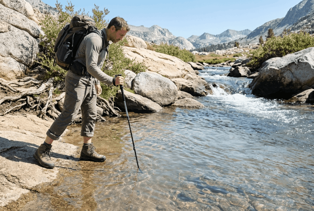
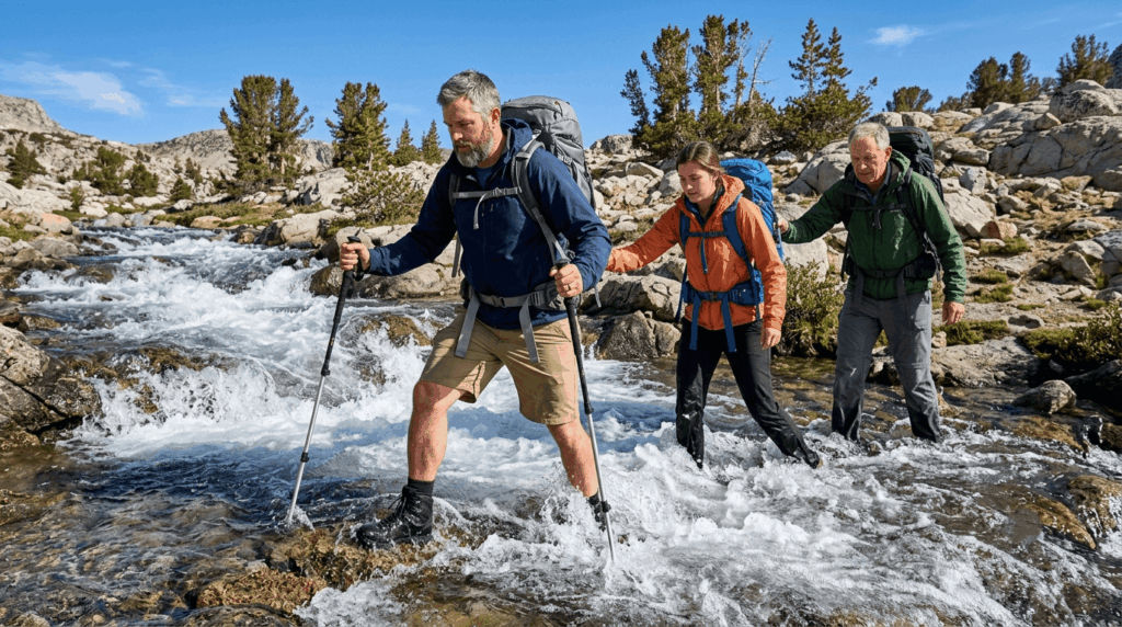
Look for the widest section of river, not the narrowest, wider usually means shallower and slower. Probe with a trekking pole rather than trusting your eyes; murky or fast water hides depth and holes in the streambed. As a rule of thumb, reconsider any crossing where the water is above your knee and moving with real force, and always scout downstream for rapids, log jams, or drop-offs before committing.
Crossing techniques for California’s Sierra Nevada and mountain streams
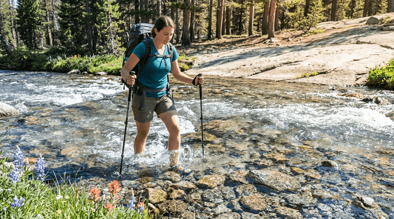
Unbuckle your hip belt and sternum strap before you step in, so you can shed your pack quickly if you fall, a pack that fills with water becomes a heavy, unpredictable weight that can hold you under. Face slightly upstream, keep your trekking poles planted for a stable third and fourth point of contact, and shuffle sideways rather than crossing your feet. In a group, the strongest hiker takes the upstream position to break the current while others link arms or hold onto hip belts, moving together rather than crossing one at a time. For a broader overview of trail challenges, review our difficulty ratings guide.
What to do if you fall into a river while crossing a trail in California
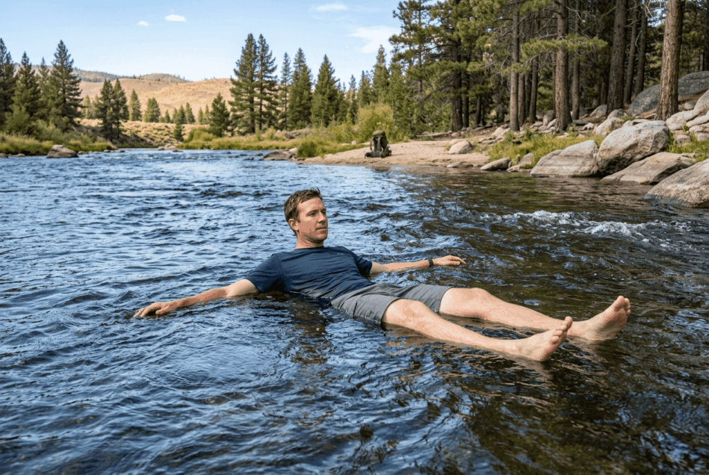
Get out of your pack immediately if it’s dragging you down, gear is replaceable. Point your feet downstream in a defensive swimming position, on your back, and use your arms to angle toward the nearest bank rather than trying to stand up in the current, since a foot caught between rocks in moving water is a real entrapment risk. Never try to stand up in a strong current until you’ve reached water shallow enough to do so safely. If this forces you off your planned route, know when to turn around.
Flash floods on California desert and canyon trails
Flash floods are the water hazard most likely to catch experienced hikers off guard, precisely because the trigger can be completely invisible from the trail.
How flash floods happen on sunny days: the upstream rain problem
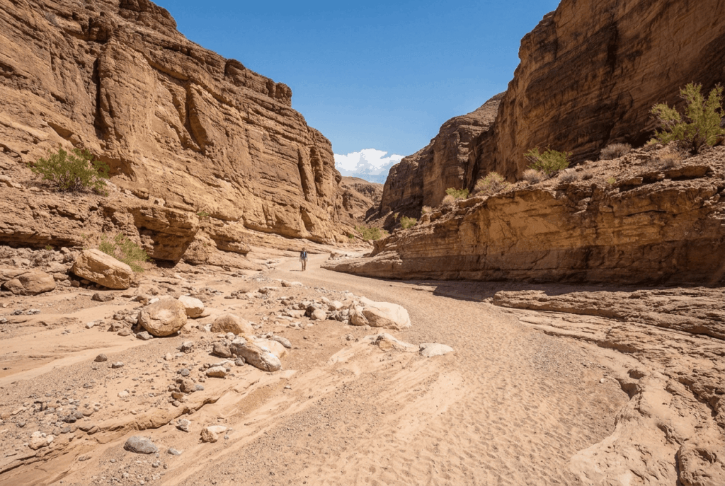
A canyon or dry wash is fed by everything upstream of it, its entire catchment basin, so a thunderstorm 25 miles away can send a wall of water down a canyon that hasn’t seen a drop of local rain. Flash floods can build within 30 minutes of that distant storm, giving hikers in the canyon very little warning beyond a rising water level, a sudden roar, or water turning from clear to muddy. The terrain can also be destabilized by previous fire-scarred slopes, making debris flows more likely. Always check weather forecasts before departing.
Which California trail areas are highest risk for flash floods?
Death Valley’s alluvial fans, San Gabriel Canyon, Antelope Valley washes, and the dry washes throughout Joshua Tree all carry real flash flood risk, especially during the region’s summer monsoon thunderstorm season. Any dry wash or slot canyon in desert terrain should be treated as flood-capable terrain, not just a scenic shortcut.
What to do if you are caught in a flash flood on a California trail
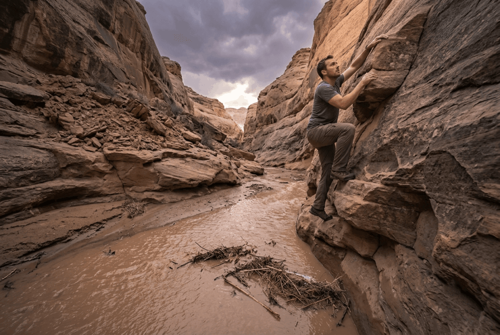
Move to higher ground immediately and perpendicular to the direction water is flowing, up a canyon wall, not further up or down the drainage. Never try to outrun a flash flood down-canyon; the water moves faster than you can. Don’t climb onto an isolated boulder either, since rising water can strand you there longer than waiting on stable high ground would.
Water quality and drinking water safety on California trails
Clear water and safe water are two different things, and California’s backcountry doesn’t reward assuming otherwise.
Is stream water safe to drink on California hiking trails?
No, not even the clearest alpine stream in the Sierra Nevada. Giardia and Cryptosporidium are both present in California backcountry water sources regardless of elevation or clarity, and neither one announces itself until symptoms show up days later. Treat every water source the same way: filter or purify it before drinking.
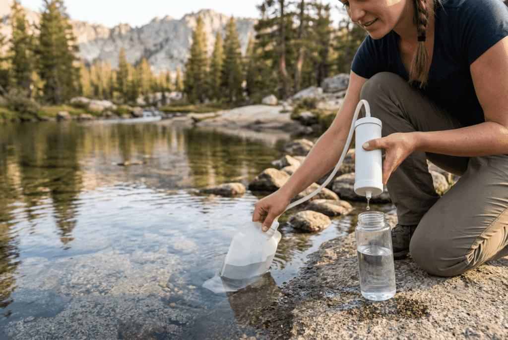
Best water filtration methods for California trail hikers
| Method | What it removes | Best for |
|---|---|---|
| Sawyer Squeeze | Bacteria, protozoa, microplastics | Long trips; nearly unlimited filter life with backflushing |
| Katadyn BeFree | Bacteria, protozoa, microplastics | Fast flow, easiest cleaning (just shake it) |
| SteriPen (UV) | Bacteria, protozoa, viruses | Clear water only; doesn’t remove sediment |
| MSR Guardian | Bacteria, protozoa, viruses | Silty or questionable sources; self-cleaning, heavier |
None of these are wrong choices, a 0.1-micron hollow-fiber squeeze filter like the Sawyer or BeFree covers everything California backcountry water actually threatens you with, since viruses are rarely a concern in U.S. wilderness sources. Save the heavier purifier options for international travel or genuinely silty desert water sources.
Water on a California trail deserves the same respect as any other serious terrain hazard, it just doesn’t look like one until you’re already in it. Assess before you step in, filter before you drink, and treat any dry wash as flood-capable terrain even under a clear sky. Get that part right and the rest of the trail is the easy part.
Frequently asked questions about water hazards on California trails
When are river crossings most dangerous in California?
Late spring through early summer, when Sierra snowmelt peaks, and in late afternoon on any given day, since flow builds throughout the day as upstream snowmelt works its way down. Early morning crossings are consistently safer for snowmelt-fed streams.
Is it safe to drink water from California streams without filtering?
No. Even clear, fast-moving alpine streams can carry Giardia and Cryptosporidium, and there’s no visual way to tell safe water from contaminated water. Always filter or purify, regardless of elevation or how remote the source looks.
What is the best water filter for day hiking in California?
A lightweight hollow-fiber squeeze filter like the Sawyer Squeeze or Katadyn BeFree handles everything California trail water realistically threatens, bacteria and protozoa, without the extra weight of a full purifier.
How do I know if a stream crossing is too dangerous to attempt?
If the water is above your knee and moving with visible force, or you can’t see the bottom clearly enough to place your feet with confidence, look for a different crossing point or wait. When in doubt, don’t cross.
Can flash floods happen in California on a sunny day?
Yes, this is one of the most common ways hikers get caught off guard. A storm dumping rain miles upstream can send a flash flood through a canyon or dry wash that never saw a drop of local rain.
What should I do if I fall into a river while hiking in California?
Shed your pack if it’s dragging you down, get into a defensive swimming position on your back with feet pointed downstream, and steer toward the nearest bank with your arms rather than trying to stand up in the current.