The 5 Best Hiking Trails in Amador County’s Gold Country, From a Mile-Deep Mine to the Largest Grinding Rock in North America
Focusing on the standout hiking trails in Amador County’s Gold Country, this is the companion to my Calaveras County Gold Country guide: the other side of the same Highway 49 Mother Lode corridor. Here’s the short version: Kennedy Mine delivers the most dramatic single piece of mining history in this guide; Chaw’se offers something no other trail here can: over a thousand years of continuous Miwok cultural use, and Miners Bend and the Amador City connector both pair naturally with a stroll through Sutter Creek’s historic downtown.
Disclosure: Please note that some of the links below are affiliate links and at no additional cost to you, I may earn a commission. Know that I only recommend hiking gear I personally stand behind; when you use my affiliate links, it helps me run this blog and keep all of this content free of charge for readers (like you).
Five stops make up this guide, spanning several small, well-preserved Gold Rush towns. One of them, the site historically known as Daffodil Hill, needs the honest closure note above rather than a normal trail write-up, so read that first if you’re planning around it.
Key takeaways
- Most dramatic mining history: Kennedy Mine: its eastern shaft plunged over a mile straight down before the mine closed in 1942, once the deepest in the Northern Hemisphere.
- Singular cultural history: Chaw’se at Indian Grinding Rock State Historic Park: 1,185 mortar holes, the largest collection of bedrock mortars in North America.
- Best downtown pairing: Miners Bend: historic mining remnants directly along Sutter Creek, walkable from Main Street.
- Currently closed, addressed honestly: the site once known as Daffodil Hill has been permanently closed to the public since 2018-2019.
- Best two-town connector: the Amador City and Bunker Hill trail: a paved route linking two adjacent historic mining towns.
- Fees vary meaningfully across this guide: some stops are free, one requires a modest guided-tour fee. My hiking safety guide is worth a look given how exposed and hot several of these Gold Country trails run in summer.
Kennedy Mine Trail (Jackson)
Trailhead access and parking at the Kennedy Mine Historic Site, Jackson (tour fee)
Grounds admission is free; guided tours run $12 for ages 13 and up, $6 for ages 6 to 12, and free under 6. The site is open Saturdays, Sundays, and holidays, 10 a.m. to 3 p.m., March through October.
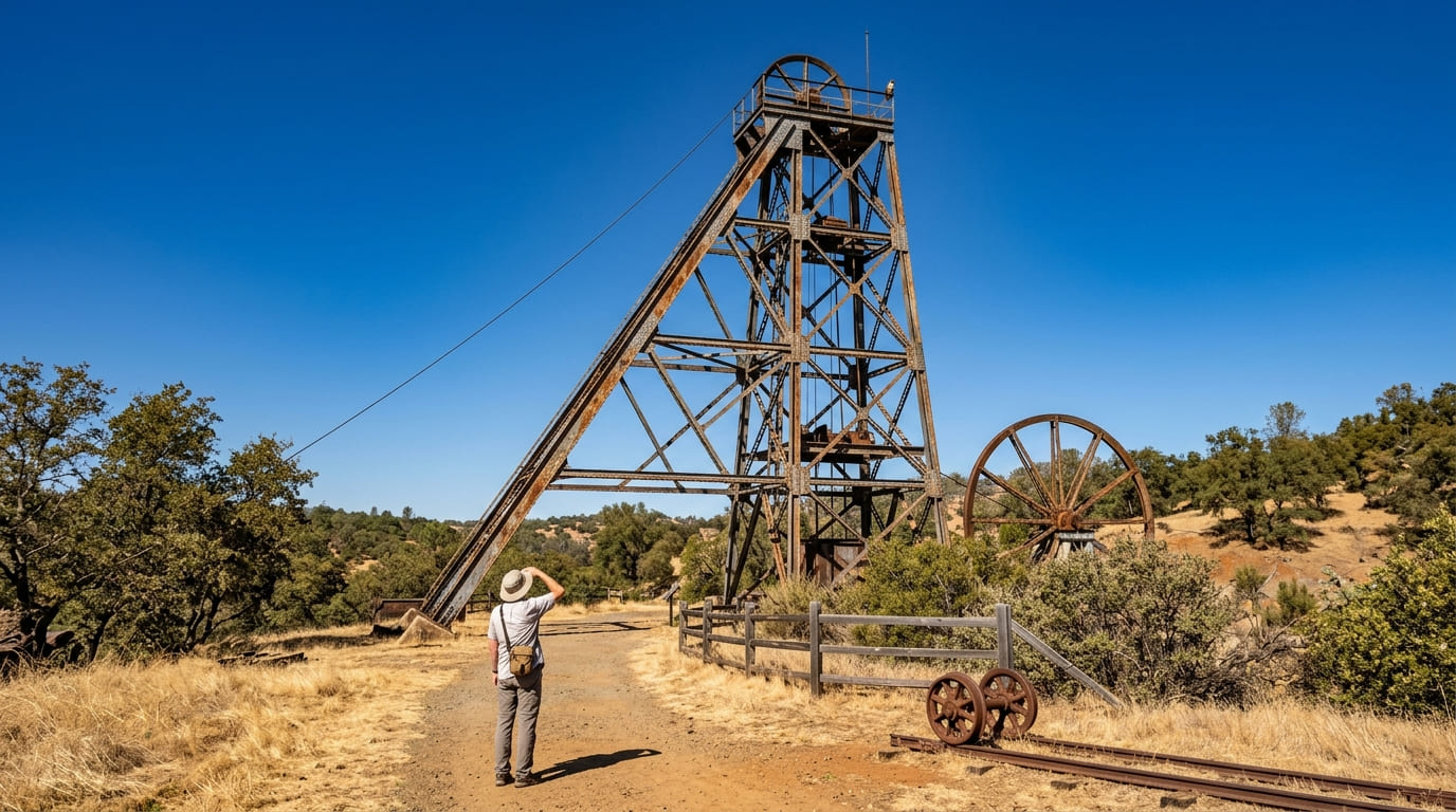
What you’ll see: massive mine tailing wheels and headframe structures
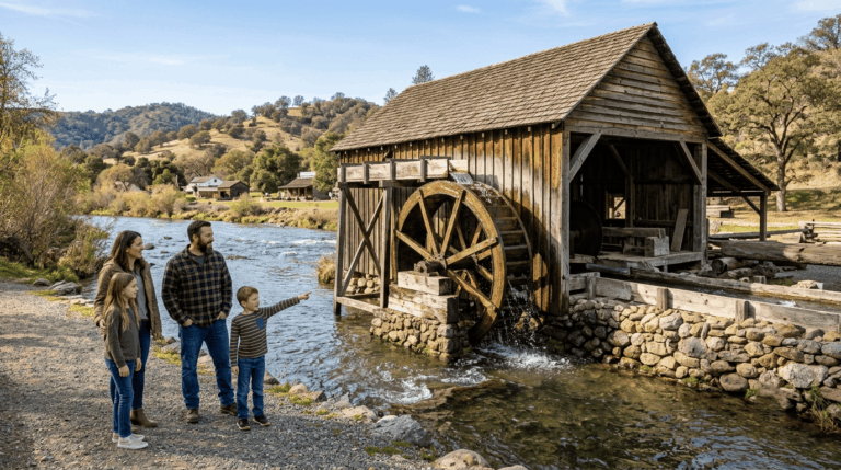
Kennedy Mine’s eastern shaft plunged over a mile straight down by the time it closed in 1942, the deepest shaft in the Northern Hemisphere at that point. Its distinctive tailing-elevator wheels, built around 1913 to carry waste rock over two hills to a settling pond, made it one of the most photographed mining relics in California.
Only two of the original wheels still stand today, one on each side of Jackson Gate Road, alongside the mine’s 125-ft headframe. In 1922, rescue crews tunneled from Kennedy’s depths in a failed attempt to reach 47 miners trapped by fire in the neighboring Argonaut Mine, a genuinely somber chapter in the site’s history.
Best time to hike Kennedy Mine Trail: check the tour schedule for building access
The grounds and trails are accessible during open hours, but guided building tours run on their own limited schedule; confirm timing separately if the interior tour is the goal, not just the exterior grounds.
Chaw’se Trail (Indian Grinding Rock State Historic Park)
Trailhead access and parking at Indian Grinding Rock State Historic Park, Pine Grove (day-use fee)
A day-use fee applies at this 135-acre state historic park, about 8 to 11 miles east of Jackson via Highway 88, at roughly 2,400 ft elevation.
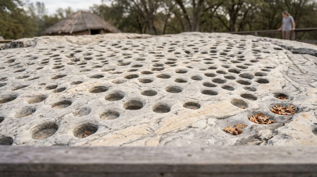
What you’ll see: the largest Native American grinding rock in North America
Chaw’se, Miwok for “grinding rock”, is a marbleized limestone outcrop containing 1,185 mortar holes, the largest such collection anywhere in North America, ground by generations of Northern Sierra Miwok processing acorns from the valley oaks surrounding the site. A reconstructed traditional village and regional museum add living cultural context beyond the archaeological feature itself.
Best time to hike Chaw’se Trail: fall for the reconstructed village’s Big Time Festival
The park’s annual “Big Time” gathering each fall celebrates ongoing Miwok culture at the reconstructed village, adding a living-culture dimension well beyond a typical historic-site visit.
Miners Bend Trail (Sutter Creek)
Trailhead access and parking near downtown Sutter Creek
A free trailhead near Sutter Creek’s well-preserved historic downtown, known for its 19th-century architecture and antique shops along Highway 49.
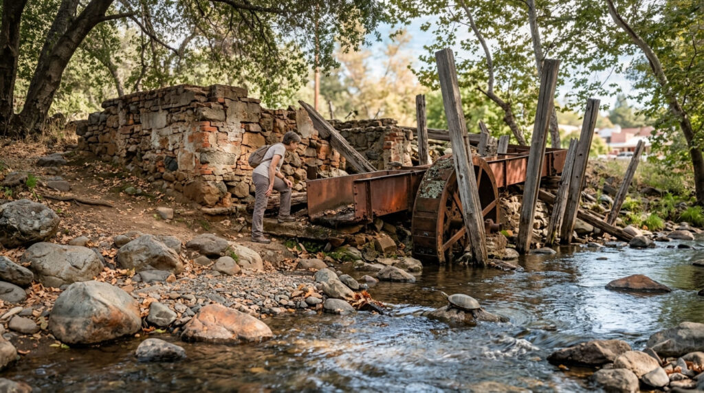
What you’ll see: remnants of historic mining operations along the creek
Miners Bend itself commemorates the spot where Sutter Creek’s original settlement began: a single tent raised for miners sheltering from rain on Sundays when they couldn’t reach Jackson or Drytown. Visible remnants of historic mining infrastructure line the creek within easy walking distance of Main Street.
Best time to hike Miners Bend Trail: a relaxed pairing with a Sutter Creek shopping day
This trail’s direct downtown proximity makes it a natural pre- or post-shopping stroll rather than a standalone destination hike.
The site once known as Daffodil Hill (Volcano)
A closure worth understanding, not a trailhead
Rather than a working ranch open to spring visitors, Daffodil Hill has been gated to the public since 2018-2019, following the Ryan family’s decision to permanently close access after the site’s infrastructure couldn’t sustain the overtourism it was drawing during peak bloom.
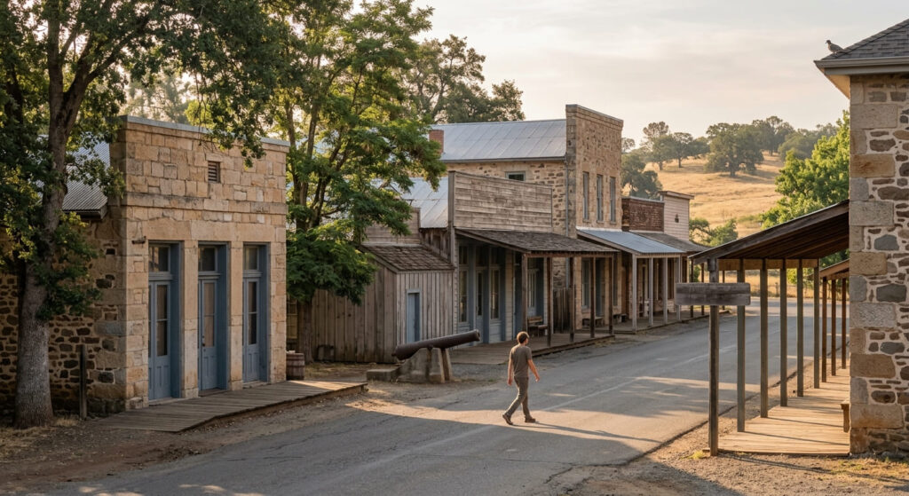
What you’ll actually find near Volcano instead: a genuinely small, historic Gold Rush town
Volcano itself, separate from the now-closed private ranch on its outskirts, remains a real, tiny, well-preserved historic town worth visiting on its own terms, with its own Gold Rush-era buildings and history, including the “Old Abe” cannon once used to guard against a feared Confederate uprising during the Civil War.
Best time to visit Volcano: any season, since the seasonal daffodil draw no longer applies
Without the narrow spring bloom window that used to define a Daffodil Hill visit, Volcano itself is worth a stop any time of year for its own compact, genuine Gold Rush history.
Amador City and Bunker Hill Trail
Trailhead access and parking between Amador City and Sutter Creek
A free trailhead connecting two adjacent historic towns: Amador City, one of California’s smallest incorporated cities, and Sutter Creek.
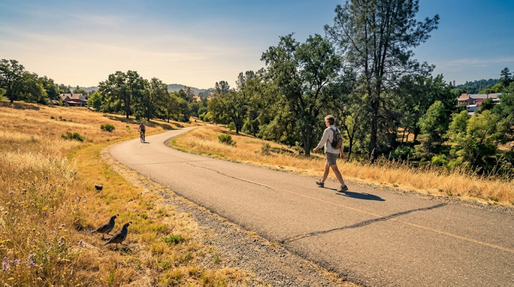
What you’ll see: a paved connector linking two historic mining towns
This roughly 4.5-mile, paved route gains about 777 ft while linking both towns’ historic districts in a single outing, genuinely walkable, if not entirely flat, letting hikers experience two distinct Gold Rush-era Main Streets on one trip.
Best time to hike the Amador City and Bunker Hill Trail: a reliable any-season connector
Its short length, paved surface, and creekside sections make this comfortable and useful across most of the year as a link between the two towns.
The trail I’d actually start with
If you’ve only got one stop, make it Kennedy Mine: nothing else in this guide delivers as dramatic a piece of mining history, tailing wheels included. Chaw’se is worth it specifically for the cultural depth no other trail here offers, and Miners Bend pairs naturally with a Sutter Creek shopping afternoon. Skip planning a trip around Daffodil Hill specifically; visit Volcano itself instead, on its own honest terms.
For the Calaveras County side of this same Gold Rush corridor, my Calaveras County Gold Country guide picks up right across the county line. And for this county’s river-focused trails, a genuinely different, water-centered side of Amador County, my Mokelumne River trails guide is the natural next stop, and my Amador County hiking guide rounds out everything else the county offers.
Frequently asked questions
How deep was the Kennedy Mine?
Its eastern shaft plunged over a mile straight down by the time the mine closed in 1942, reportedly the deepest shaft in the Northern Hemisphere at that point.
What is Chaw’se?
The Miwok word for “grinding rock”: a marbleized limestone outcrop at Indian Grinding Rock State Historic Park containing 1,185 mortar holes, the largest collection of bedrock mortars in North America.
Is Sutter Creek a historic Gold Rush town?
Yes: gold was discovered in the area in 1851, and the town’s Main Street still shows off its original mining-era architecture today, now mixed with antique shops and tasting rooms.
When do the daffodils bloom at Daffodil Hill?
They no longer bloom for public viewing: the site has been permanently closed to visitors since 2018-2019 due to overtourism concerns. The town of Sutter Creek has since planted its own public daffodil displays as a partial alternative.
Is Amador City one of California’s smallest cities?
Yes: it’s widely recognized as one of the smallest incorporated cities in the state, a genuine small-town counterpart to nearby Sutter Creek along the same connector trail.
Which Amador County Gold Country trail has the most history?
Kennedy Mine, for its dramatic mining-era engineering and the 1922 Argonaut Mine rescue attempt, and Chaw’se, for over a thousand years of continuous Miwok cultural use: both are strong answers depending on whether mining or Indigenous history matters more to you.