5 Best Hiking Trails Near Mount Shasta, From a Sacred Alpine Spring to a Historic Climber’s Hut
A quick geography note before anything else, since it’s worth knowing upfront: Mount Shasta itself, the town at its base, and all five trailheads in this guide are actually located in Siskiyou County, not Shasta County, Shasta County’s own seat, Redding, sits about an hour south. This site groups Mount Shasta content under the Shasta County hiking guide deliberately, since that’s how most people search for it. This guide covers the Hiking Trails Near Mount Shasta network; for the county’s waterfalls, see our Shasta County waterfall trails guide.
Disclosure: Please note that some of the links below are affiliate links and at no additional cost to you, I may earn a commission. Know that I only recommend hiking gear I personally stand behind; when you use my affiliate links, it helps me run this blog and keep all of this content free of charge for readers (like you).
Key takeaways
- Most spiritually significant: Panther Meadows, a sacred alpine spring and meadow revered by the Winnemem Wintu, Shasta, Karuk, and Pit River peoples.
- A real current hazard worth knowing about: Black Butte, a distinctive volcanic dome with a genuinely deteriorated section of trail.
- Quietest alternative: Gray Butte, comparable views to Panther Meadows with a fraction of the crowd.
- Best small-lake option: Heart Lake, a reflective alpine lake near Bunny Flat, Mount Shasta’s main trailhead.
- Most historic: Horse Camp, a 1922 Sierra Club stone hut at the start of the mountain’s standard climbing route.
- Elevation and snow drive nearly everything about timing here, most of these trails don’t fully open until midsummer, regardless of how mild it feels down in the town of Mount Shasta.
How these five Mount Shasta trails compare
| Trail | Distance | Difficulty | Fee/Permit | Best for |
|---|---|---|---|---|
| Panther Meadows | ~1 mi | Easy | Free | Sacred spring, wildflowers |
| Black Butte | ~5 mi round trip | Strenuous, real trail hazard | Free | Volcanic dome summit |
| Gray Butte | ~2.4-3.3 mi | Moderate | Free (self-permit for wilderness) | Quiet alternative to Panther Meadows |
| Heart Lake | Short walk from Bunny Flat | Easy | Free | Small alpine lake |
| Horse Camp (Avalanche Gulch) | ~2-3.2 mi round trip | Moderate | Free wilderness permit | Historic hut, standard climbing route |
Panther Meadows Trail
Trailhead access and parking at Panther Meadows, Mount Shasta
A Forest Service trailhead sits at roughly 7,500 feet on Mount Shasta’s southern slope, reached via Everitt Memorial Highway, one of the highest-elevation trailheads reachable by car in this entire guide. Free parking, no fee.
What you’ll see: an alpine meadow and sacred Native American spring
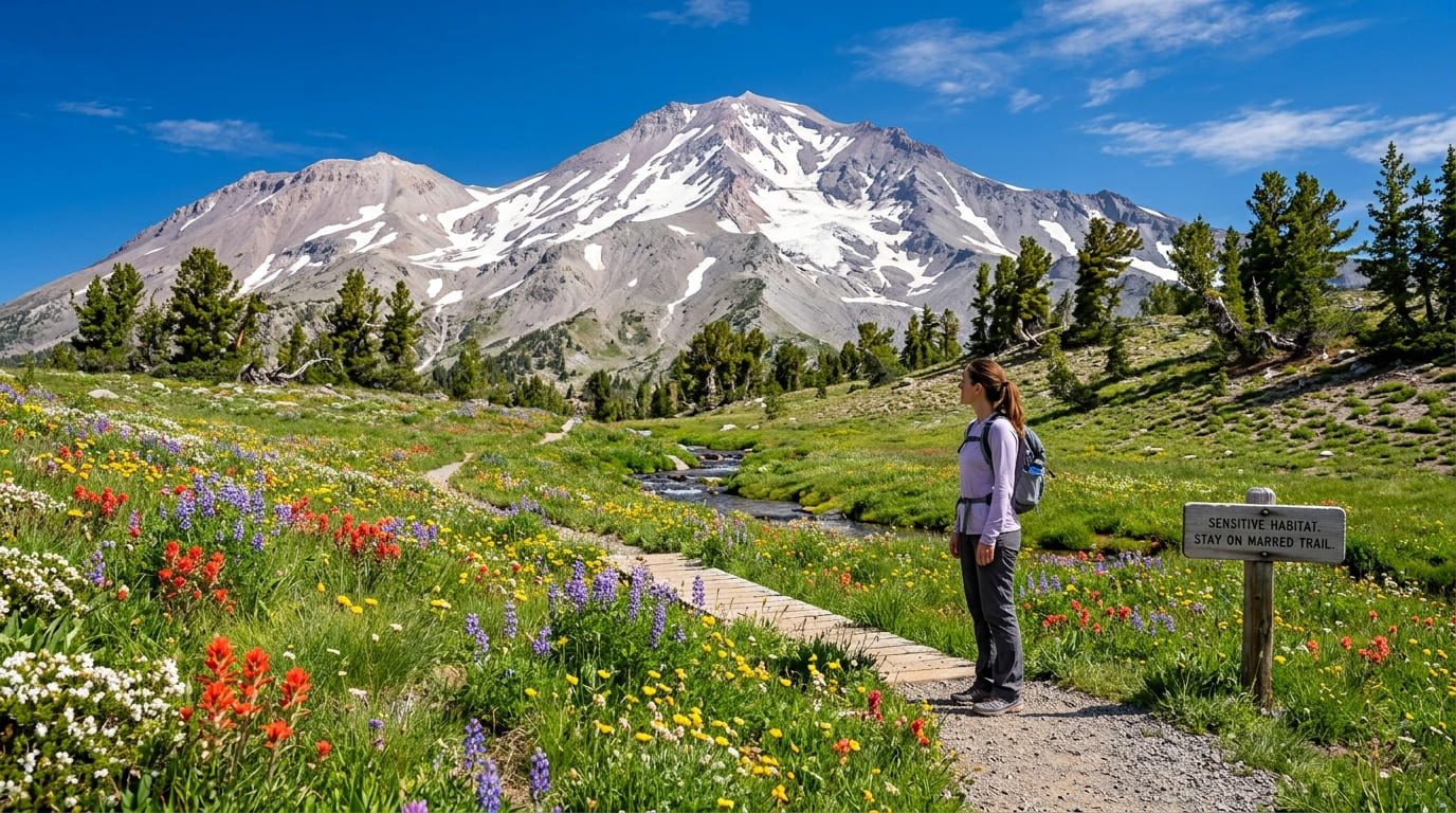
Panther Meadows is considered sacred by the Winnemem Wintu, Shasta, Karuk, and Pit River peoples, fed by a spring regarded as a place of deep spiritual significance. Please stay on marked trails and out of the spring and creek itself, the meadow’s ecosystem is genuinely fragile, and the Forest Service, local tribes, and volunteers have worked together in recent years to restore native vegetation here.
Best time to hike Panther Meadows: midsummer for wildflowers, once snow clears
This high-elevation meadow typically doesn’t fully open until midsummer, once winter snowpack finally melts out, an early-June visit can still mean snow underfoot even on a warm-feeling day down in town.
Black Butte Trail
Trailhead access and parking off Everitt Memorial Highway
A Forest Service road trailhead near the town of Mount Shasta leads to Black Butte, a genuinely separate volcanic peak from Mount Shasta itself, free parking, no fee.
What you’ll see: a distinctive volcanic dome, and a real current trail hazard worth knowing about
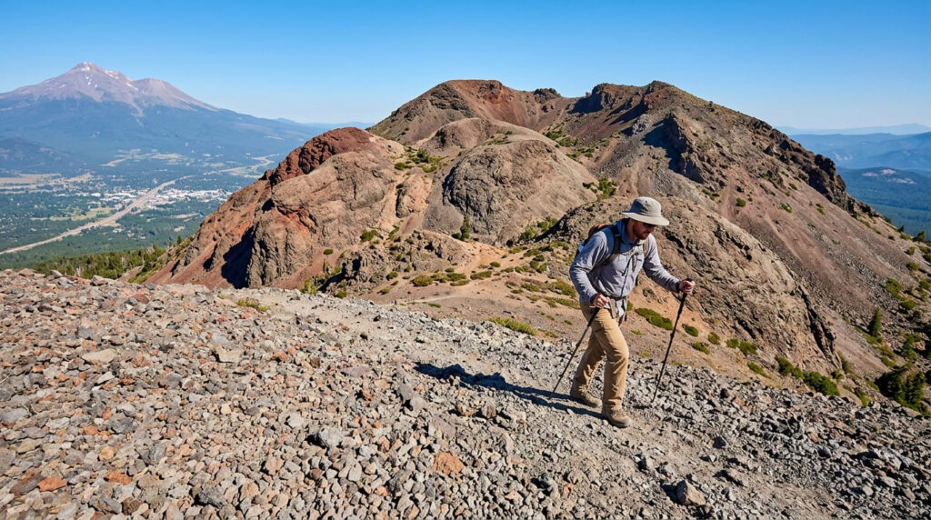
Black Butte is a cluster of overlapping lava domes, a satellite cone of Mount Shasta visible from both the town and Interstate 5, last erupting roughly 9,500 years ago. One thing I want to flag clearly: reduced trail maintenance funding in recent years has left a section of this trail genuinely deteriorated, a wire basket retaining wall has partially failed, with part of it collapsed across the trail and part hanging at a sharp angle overhead.
Exercise real caution in that section, or consider Gray Butte instead if you’re not comfortable with unstable footing.
Best time to hike Black Butte: summer only, loose volcanic scree underfoot
The upper slopes are covered in loose volcanic scree that’s genuinely more stable and manageable in dry summer conditions than after rain or snowmelt, when footing gets considerably more treacherous.
Gray Butte Trail
Trailhead access and parking near Panther Meadows
This trail shares the general Panther Meadows trailhead area, branching toward a different, quieter destination, no permit is needed for Gray Butte specifically, though a self-issue wilderness permit station sits nearby for hikers continuing to other destinations in the area.
What you’ll see: a quieter ridge walk with wide views of Mount Shasta’s south face
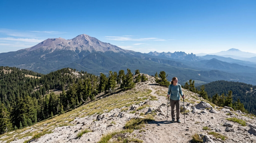
Distance runs about 2.4 to 3.3 miles round trip with 600 to 692 feet of gain, depending on the exact route, through shaded forest before opening onto sweeping 360-degree views, Mount Shasta to the north, the Trinity Alps and Castle Crags to the west, and the Cascades trailing south toward Lassen Peak.
Best time to hike Gray Butte: a less-crowded alternative to Panther Meadows
If Panther Meadows’ trailhead lot is full, this is the trade worth knowing about, genuinely comparable views and a real sense of solitude, especially on weekday visits.
Heart Lake Trail
Trailhead access and parking at the Bunny Flat Trailhead
Bunny Flat, at 6,950 feet along Everitt Memorial Highway, is Mount Shasta’s most popular general-access trailhead and the standard jumping-off point for summit attempts, free parking, no fee, though it fills up on summer weekends.
What you’ll see: a small alpine lake below Mount Shasta’s slopes
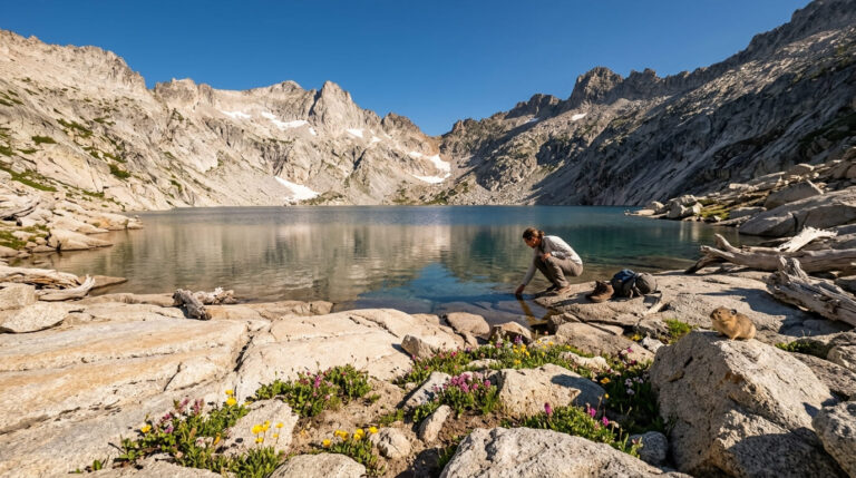
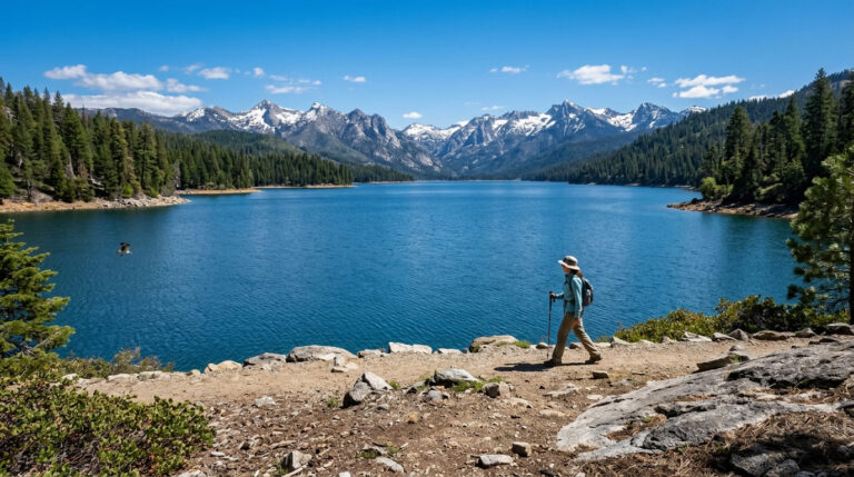
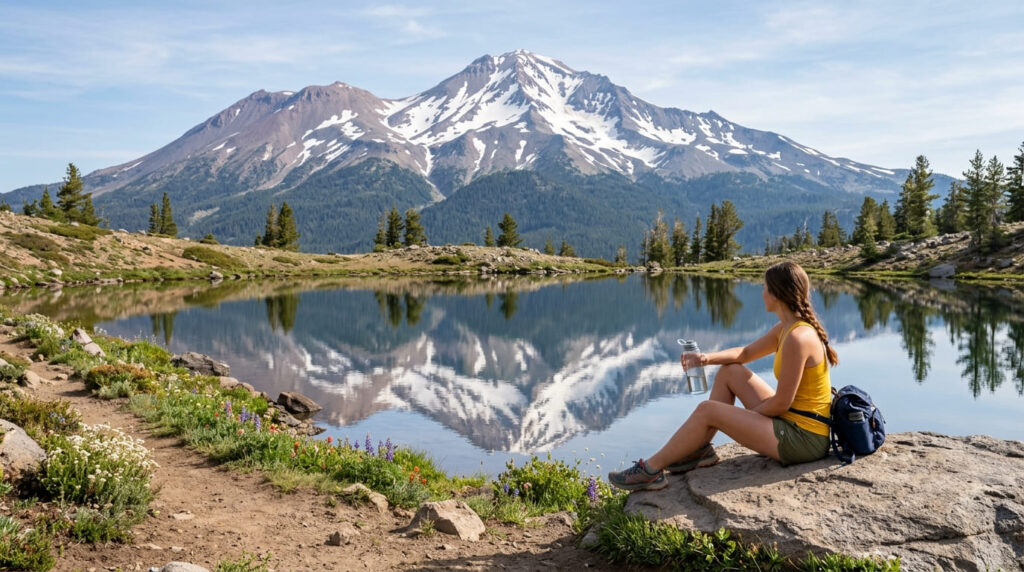
Heart Lake is a small, easily reached lake with genuine reflective views back up toward Mount Shasta’s slopes, a real lake-hike option among a set of trails otherwise focused on summits and ridgelines.
Best time to hike Heart Lake: early summer, once the trail clears of snow
Like most trails on this mountain, snowmelt timing governs access here, expect the trail to open sometime in early summer, with exact timing shifting year to year based on that winter’s snowpack.
Horse Camp Trail (Avalanche Gulch Route)
Trailhead access and parking at the Bunny Flat Trailhead (wilderness permit required)
Same trailhead as Heart Lake, but continuing up the mountain’s standard climbing route. A free, self-issued wilderness permit (available at the trailhead) is required for travel into the wilderness area beyond Bunny Flat; a separate paid summit pass is required specifically for travel above 10,000 feet if you’re continuing toward the actual summit.
What you’ll see: a historic stone alpine hut on Mount Shasta’s standard climbing route
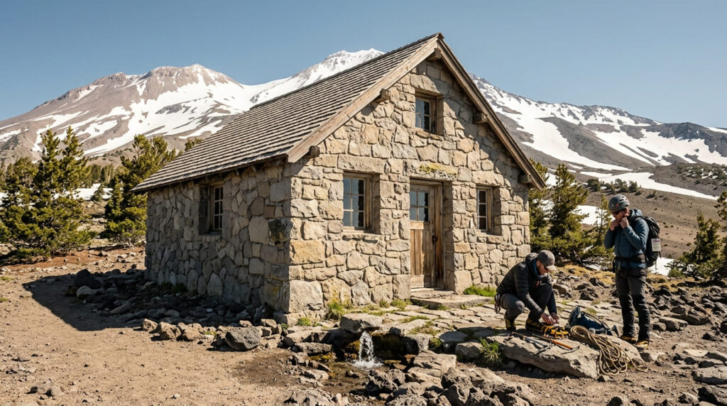
The trail climbs roughly 2 to 3.2 miles (sources vary) to Horse Camp at about 7,900-7,950 feet, home to the Shasta Alpine Lodge, a stone hut built in 1922 and still maintained by the Sierra Club Foundation today, with a caretaker on site, spring water, and composting toilets. This is the traditional first stop for climbers attempting Mount Shasta’s summit via Avalanche Gulch, the mountain’s most popular climbing route.
Best time to hike to Horse Camp: summer for the most stable, snow-free footing
Summer offers the most reliable snow-free hiking to the hut itself; the same route sees heavy winter and spring use by mountaineers on snowshoes attempting actual summit climbs, a very different undertaking than the hike to Horse Camp alone.
Frequently asked questions about hiking trails near Mount Shasta
Do you need a permit to hike Mount Shasta?
For day hikes to Horse Camp or the other trails in this guide, a free self-issued wilderness permit (available at the trailhead) generally covers you. A separate paid summit pass is required specifically for travel above 10,000 feet toward the actual summit.
Is Black Butte a volcano?
Yes, it’s a lava dome complex and a satellite cone of Mount Shasta, last erupting roughly 9,500 years ago.
Is Panther Meadows sacred to Native Americans?
Yes, it’s considered sacred by the Winnemem Wintu, Shasta, Karuk, and Pit River peoples, with the spring feeding the meadow regarded as a place of deep spiritual significance.
How far is Heart Lake from Bunny Flat?
It’s a short, easily managed walk from the Bunny Flat Trailhead, genuinely one of the more accessible short hikes on the mountain.
What is Horse Camp on Mount Shasta?
A historic property owned by the Sierra Club Foundation, centered on a stone hut built in 1922 at about 7,900 feet, the traditional first stop for climbers on the mountain’s standard Avalanche Gulch route.
Which Mount Shasta trail is best for beginners?
Panther Meadows and Heart Lake are both short, gentle, and don’t require any permit, better starting points than Black Butte’s loose scree or the longer approach to Horse Camp.