The 5 Best Hiking Trails in Mount Diablo, From One of the World’s Widest Views to Wind-Carved Sandstone Caves
Mount Diablo is a dedicated single-mountain destination, and it earns that focus. This one peak alone holds an incredible network of hiking trails in Mount Diablo, offering enough variety- from a globally significant summit view to a genuine wind-carved sandstone cave- to fill an entire guide on its own.
Disclosure: Please note that some of the links below are affiliate links and at no additional cost to you, I may earn a commission. Know that I only recommend hiking gear I personally stand behind; when you use my affiliate links, it helps me run this blog and keep all of this content free of charge for readers (like you).
In short: Summit Trail delivers the view Mount Diablo is actually famous for, Mary Bowerman Trail is the easy interpretive loop worth doing regardless of fitness level, and Donner Canyon’s Falls Trail is worth timing specifically around winter rain.
Five trails anchor this guide, spanning the mountain’s summit, its north-side canyons, and its south-side rock formations, presenting genuinely different characters packed into one 20,000-acre state park.
For the rest of this county’s hiking beyond Mount Diablo itself, my Contra Costa County Regional Park trails guide covers the East Bay Regional Park District’s other destinations, including the rolling hills covered in our Briones Regional Park trail details and my Contra Costa County hiking guide rounds out everything else the county offers.
Key takeaways
- The defining view: Summit Trail, reportedly one of the largest visible areas of any peak on Earth on exceptionally clear days.
- Best easy introduction: Mary Bowerman Trail, a short, flat interpretive loop with rare native plants, right at the summit.
- Best waterfall payoff: Donner Canyon’s Falls Trail, featuring seasonal, rain-dependent cascades through oak woodland.
- Most distinctive geology: Rock City, known for its genuinely kid-friendly wind-carved sandstone caves and pockmarks.
- Best wildflower display: Mitchell Canyon, often cited as the mountain’s single best spring bloom.
- Fees vary by entrance, not just by trail: $10 at the summit-access gates, and $6 at the two staging areas that don’t reach the summit. My guide to weather hazards on California trails is worth a look too, since this guide’s whole premise depends heavily on clear-air conditions.
Summit Trail (Mount Diablo State Park)
Trailhead access and parking at the Mount Diablo State Park summit area (day-use fee)
A $10 vehicle entrance fee applies at both the North Gate and South Gate entrances, the two routes offering vehicle access all the way to the summit area.
What you’ll see: one of the largest visible areas of any peak in the world
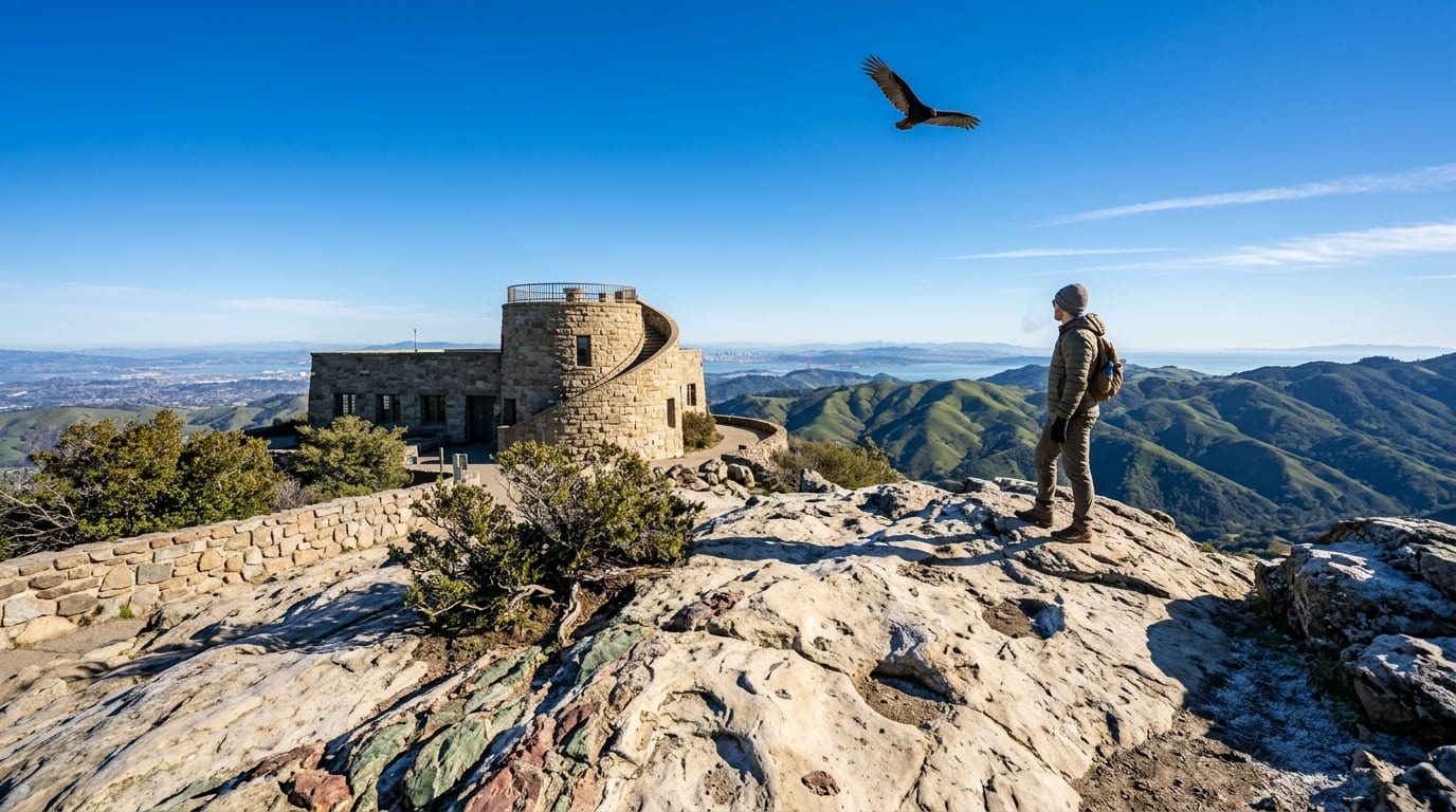
On exceptionally clear days, visibility from the 3,849-ft summit reportedly exceeds 100 miles, taking in the San Francisco skyline, the Golden Gate Bridge, the Pacific Ocean, the San Joaquin Valley, and the Sierra Nevada, a genuine visibility superlative that anchors this mountain’s entire reputation.
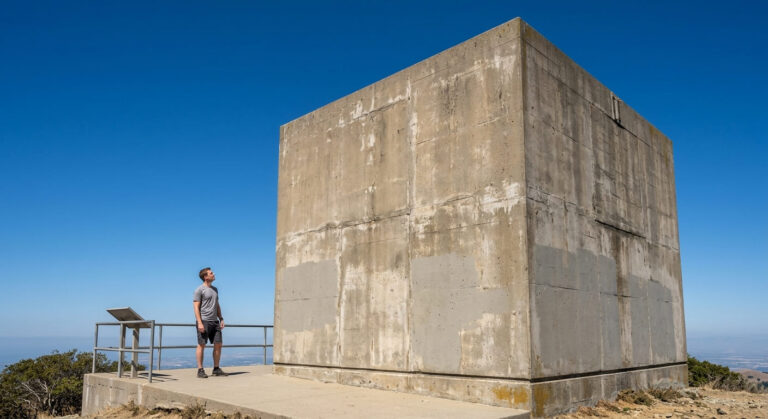
The Summit Visitor Center itself, built in the 1930s from sandstone containing embedded ancient marine fossils, tops off with an observation deck reached by a circular stairway.
Best time to hike Summit Trail: clear winter days after rain for the farthest views
Rain clears haze and air pollution from the atmosphere, making the days immediately following a winter storm the single best window for this mountain’s signature long-range visibility.
Mary Bowerman Trail
Trailhead access and parking at the same Mount Diablo summit area
Covered by the same $10 entrance fee as Summit Trail, with the trailhead beginning about 500 ft below the summit parking lot.
What you’ll see: a short interpretive loop with rare native plants
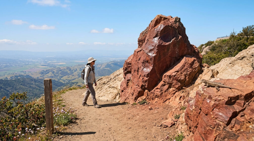
This flat, 0.7-to-1-mile loop was previously called the Fire Interpretive Trail before being renamed for botanist Mary Bowerman, who began studying the mountain’s flora in the 1930s and later co-founded Save Mount Diablo.
With only about 80 ft of elevation gain, it circles the peak with a 14-stop interpretive guide covering rare plants, geology, and wildlife, passing Devil’s Pulpit (a striking red chert monolith) along the way. Some sections run along an unguarded cliff edge, so watch your footing despite the easy overall grade.
Best time to hike Mary Bowerman Trail: spring for wildflowers and rare native plants in bloom
Spring brings peak bloom for both common wildflowers and several of the mountain’s rare, near-endemic plant species, which is the central reason to time this specific loop for that season.
Donner Canyon Trail (Falls Trail)
Trailhead access and parking at Regency Drive (free) or Mitchell Canyon ($6)
Located on the mountain’s north side, this free trailhead offers a genuinely different, canyon-based approach compared to the summit-focused trails above, with additional access options from Three Springs on Marsh Creek Road.
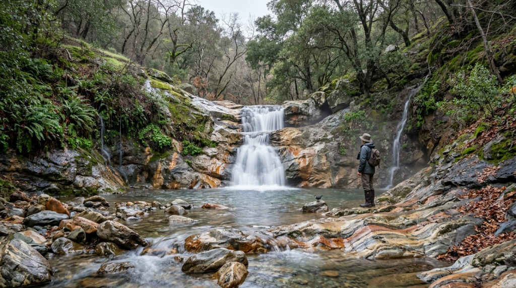
What you’ll see: seasonal waterfalls cascading through oak woodland
The Falls Trail within Donner Canyon passes several seasonal waterfalls cascading over multicolored rock formations, connecting into the broader Donner Creek Loop, a genuinely popular birding area that is well worth bringing binoculars for.
Best time to hike Donner Canyon: winter and spring for peak waterfall flow
This trail’s entire appeal depends on rain-fed creek flow. Plan to visit during or right after the rainy season, since the falls can run dry by summer.
Rock City / Wind Caves Trail
Trailhead access and parking at the Rock City day-use area
Located on the mountain’s south side about a mile from the South Gate entrance, this state park day-use area is a genuinely different geologic feature compared to the summit and canyon trails elsewhere in this guide.
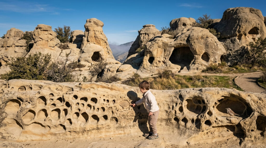
What you’ll see: sandstone formations with wind-carved caves and pockmarks
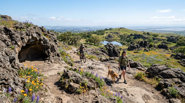
Distinctive sandstone riddled with wind-eroded caves, pockmarks, and honeycomb textures make this a genuinely kid-friendly area to explore, with visible embedded fossils adding an extra layer of interest beyond the formations themselves.
Best time to hike Rock City: cooler months, given the south-facing exposed terrain
This area’s south-facing aspect and minimal shade make a cooler-season visit considerably more comfortable than a summer midday stop.
Mitchell Canyon Trail
Trailhead access and parking at the Mitchell Canyon Staging Area (day-use fee)
A $6 vehicle entrance fee (exact cash only) applies at this north-side staging area, which is the mountain’s most popular such entrance, featuring a small visitor center open weekends and holidays. Unlike the North and South Gates, this entrance doesn’t offer vehicle access to the summit.
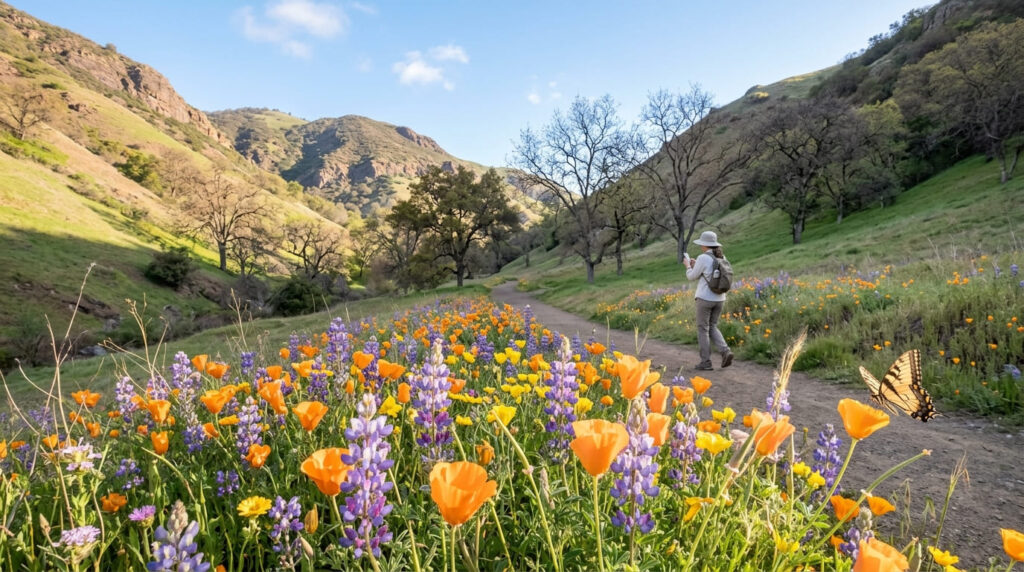
What you’ll see: one of Mount Diablo’s most celebrated spring wildflower displays
This canyon is frequently cited as one of the best wildflower hikes on the entire mountain, with a particularly strong and diverse spring bloom. The more demanding Mitchell Canyon–Back Creek Loop extends to about 7 miles with 1,700 ft of gain for hikers wanting more than a wildflower stroll.
Best time to hike Mitchell Canyon: spring for peak wildflower bloom
Spring is this trail’s defining season by a wide margin, closing out this guide’s Mount Diablo coverage on its most celebrated, most photographed bloom window.
The trail I’d actually start with
If you’ve only got one stop, make it the Mary Bowerman Trail, as it is the easiest way to experience the summit’s rare plants and views without much physical commitment, and it pairs perfectly with driving straight to the top. For hikers looking to tackle other popular East Bay summit hikes like Mission Peak, be sure to plan your trailhead strategy ahead of time.
Summit Trail is worth planning around a clear winter day specifically, and Donner Canyon’s Falls Trail deserves the same rain-dependent timing. Mitchell Canyon is the pick for spring wildflowers, and Rock City rewards a cooler-season visit given its exposed terrain.
Frequently asked questions
Is there a fee at Mount Diablo State Park?
Yes. A fee of $10 per vehicle applies at the North Gate and South Gate entrances, which offer summit access, or $6 (exact cash only) at the Macedo Ranch and Mitchell Canyon staging areas, neither of which reaches the summit by vehicle.
Is Mount Diablo’s view one of the largest in the world?
It’s frequently cited as one of the most panoramically prominent peaks in the country, with visibility reportedly exceeding 100 miles on exceptionally clear days, a genuine visibility superlative, even if “largest in the world” claims are hard to verify with precision.
Are there waterfalls on Mount Diablo?
Yes, Donner Canyon’s Falls Trail features several seasonal waterfalls cascading over multicolored rock, though they depend entirely on winter and spring rainfall and can run dry by summer.
What is Rock City at Mount Diablo?
It is a state park day-use area on the mountain’s south side featuring distinctive wind-carved sandstone formations, caves, and pockmarks, offering a genuinely different, kid-friendly geologic feature distinct from the rest of the mountain’s trails.
Is Mitchell Canyon good for wildflowers?
Yes, frequently cited as one of the best wildflower hikes on the entire mountain, with a particularly strong and diverse spring bloom.
Which Mount Diablo trail has the best views?
Summit Trail, without much competition. Its visibility on exceptionally clear days is the single defining feature of this entire mountain, reaching the Golden Gate Bridge, the Pacific Ocean, and the Sierra Nevada all at once.