Best Hiking Trails in California for Ocean Views, From the Golden Gate to San Diego
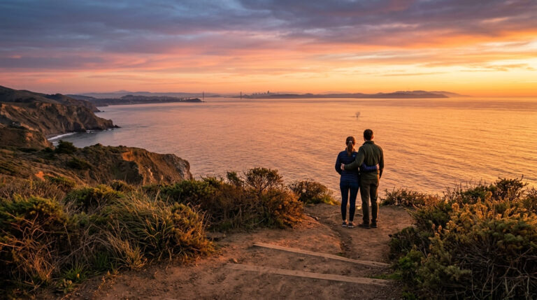
If you want water in every direction and don’t want to work too hard for it, these are the seven Best Hiking Trails in California for Ocean Views, I’d send you to first. None of them requires a permit. Most take under two hours round trip. What they share is elevation right at the coastline, bluffs, headlands, and overlooks positioned exactly where the Pacific does something dramatic, whether that’s framing the Golden Gate Bridge or throwing up gray whales offshore in December.
Disclosure: Please note that some of the links below are affiliate links and at no additional cost to you, I may earn a commission. Know that I only recommend hiking gear I personally stand behind; when you use my affiliate links, it helps me run this blog and keep all of this content free of charge for readers (like you).
Key Takeaways
- Best Golden Gate Bridge view on foot: Battery Spencer in the Marin Headlands, a short walk to the single most photographed angle of the bridge.
- Best “crown jewel” reputation: Point Lobos, though as of 2026 it’s rolling out California’s first day-use reservation system, so don’t just show up and expect a spot.
- Most fragile right now: Sunset Cliffs, stunning, but actively eroding, with bluff collapses recorded as recently as this spring.
- Best free roadside stop: Soberanes Point at Garrapata State Park, no lot, no fee, just pull over on Highway 1.
- Best whale-watching hike: the Bayside Trail at Cabrillo National Monument, peak season mid-December through March.
- One to check before you drive out: the Palos Verdes Bluffs area at Abalone Cove, an active landslide has kept the beach and tide pools closed since 2024.
1. Battery Spencer Trail, Marin Headlands (Marin County)
Why it made this list: the single best Golden Gate Bridge viewpoint on foot
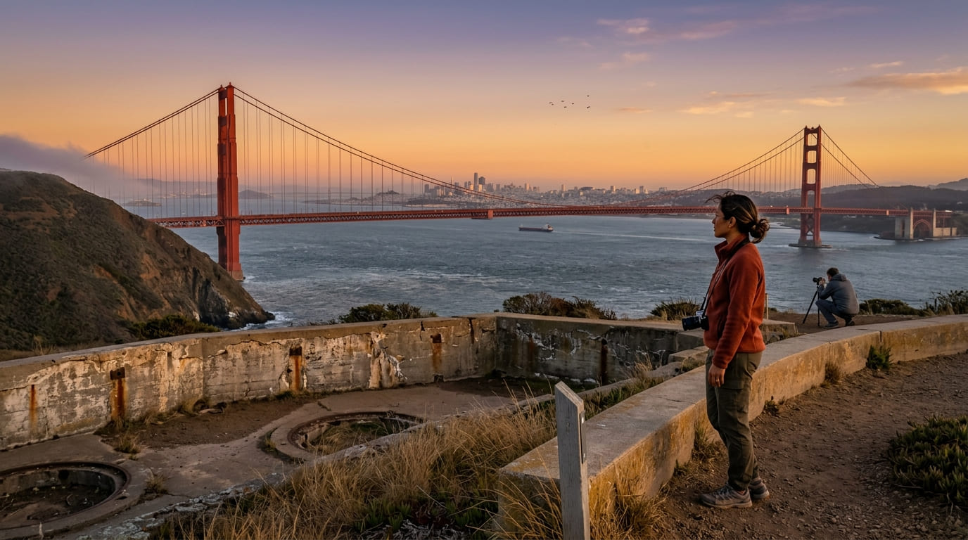
I’d put Battery Spencer at the top of this list for one reason: nothing else gets you this close to the classic elevated shot of the Golden Gate Bridge without a car door in the frame. It’s a short, easy walk from the parking pullout to the old WWII gun battery, and the bridge fills the whole view from here, Alcatraz and the city skyline stacked up behind it.
Practical tips: access and best timing
This spot is famous for two very different looks: golden hour, when the bridge towers catch the last light, and the minutes when fog rolls through the strait and swallows the roadway. Both are worth a trip.
It’s free, run by the National Park Service as part of the Golden Gate National Recreation Area, and the parking pullout fills fast on weekend evenings, I’d get there at least 30 minutes before sunset.
2. Soberanes Point Trail, Garrapata State Park (Monterey County, Big Sur)
Why it made this list: dramatic bluff-top views along the Big Sur coastline
This is my pick for the best free stop on this whole list. Soberanes Point sits west of Highway 1 at Garrapata State Park’s Gates 8 through 10, no entrance fee, no dedicated parking lot, just a wide shoulder to pull onto.
Don’t confuse this coastal loop with the Soberanes Canyon Trail, a separate inland route east of the highway that’s closed more often than not due to trail damage. They share a trailhead area but they’re not the same hike.
Practical tips: access and best timing
Gray whales pass close to this stretch of coast during their winter migration, and the bluffs here put you high enough to actually spot the blow.
Garrapata sits north of the ongoing Highway 1 slide repairs near Lucia, so it typically stays reachable even when Big Sur’s southern stretch is closed, still, I’d check Caltrans conditions before a long drive down from the Bay Area.
3. Point Lobos State Natural Reserve (Monterey County)
Why it made this list: often called the crown jewel of the California state park system
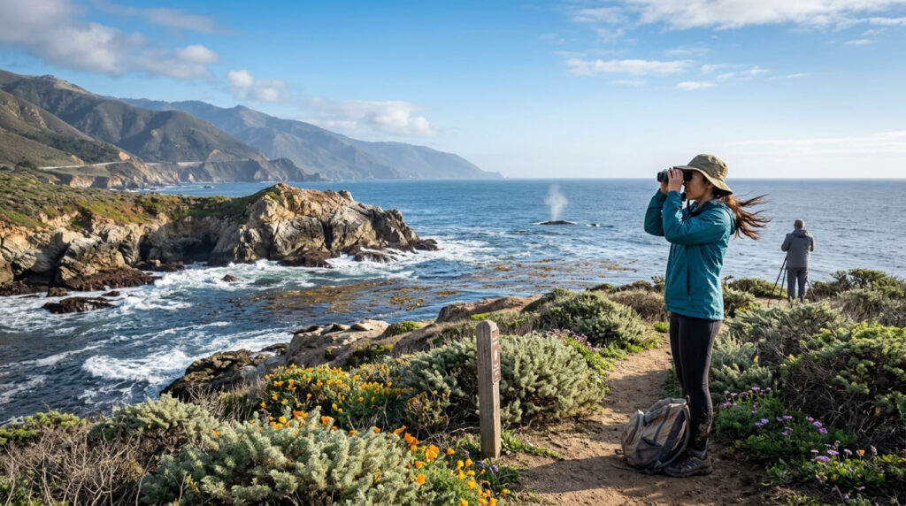
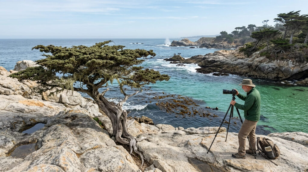
Ansel Adams and Edward Weston both spent years photographing this stretch of coast, and it’s still the best-preserved meeting of land and water I’ve hiked in California, cypress groves growing straight out of granite, sea otters working the kelp beds just offshore.
Our Monterey County Point Lobos trail guide breaks down the individual trails inside the reserve if you want more than the coastal overlooks.
Practical tips: access and best timing
Here’s the update that matters most: as of 2026, Point Lobos is becoming the first day-use park in the California State Parks system to require reservations for all visitors, including anyone walking or biking in.
The rollout has been gradual, so confirm current requirements on the official Point Lobos State Natural Reserve page before you go. Until reservations are fully in effect, parking stays capped at 150 vehicles, and arriving before 9:30 a.m. is still your best bet.
4. Sunset Cliffs Natural Park (San Diego County)
Why it made this list: unobstructed westward sunset views along dramatic sea cliffs
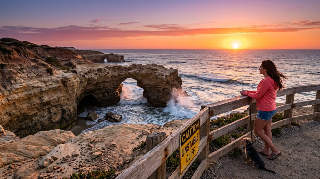
Sunset Cliffs earns its name honestly, a string of sandstone bluffs, sea caves, and natural arches facing due west with nothing between you and the horizon. It’s free, it’s a few minutes from downtown Ocean Beach, and it’s one of the most reliably beautiful sunset spots in Southern California.
Practical tips: access and best timing
I need to be direct about this park: it’s actively eroding, not just in the abstract sense every coastal bluff is. A section near the Arch collapsed in April 2026, and the city recorded another failure in January 2026 that took out a section of railing, an ongoing pattern that’s driving a proposed $32 million seawall project. Stay behind railings and barricades, and treat any crack in the rock as a warning, not a photo prop.
5. Rim Trail, Shell Beach (San Luis Obispo County)
Why it made this list: a flat, accessible bluff-top path with constant ocean views
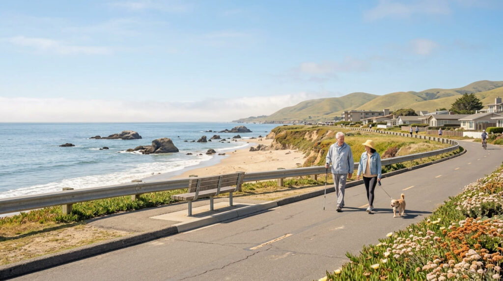
If you want ocean views without any real climbing, this is the trail I’d pick. The Rim Trail runs along the Shell Beach bluffs with a flat, mostly paved surface and water in view for nearly the entire walk, one of the easiest “big view” hikes on this list.
Our San Luis Obispo County coastal trails guide near Morro Bay covers more of the Central Coast’s gentler options if this style of hike is what you’re after.
Practical tips: access and best timing
The Central Coast’s mild, marine-buffered climate makes this one of the few trails on this list that’s comfortable in any season, no brutal summer heat, no bitter winter wind. That said, morning fog is common along this stretch, so if photos are the goal, I’d plan for midday or a clear afternoon rather than sunrise.
6. Bayside Trail, Cabrillo National Monument (San Diego County)
Why it made this list: rare bay-facing views instead of open ocean
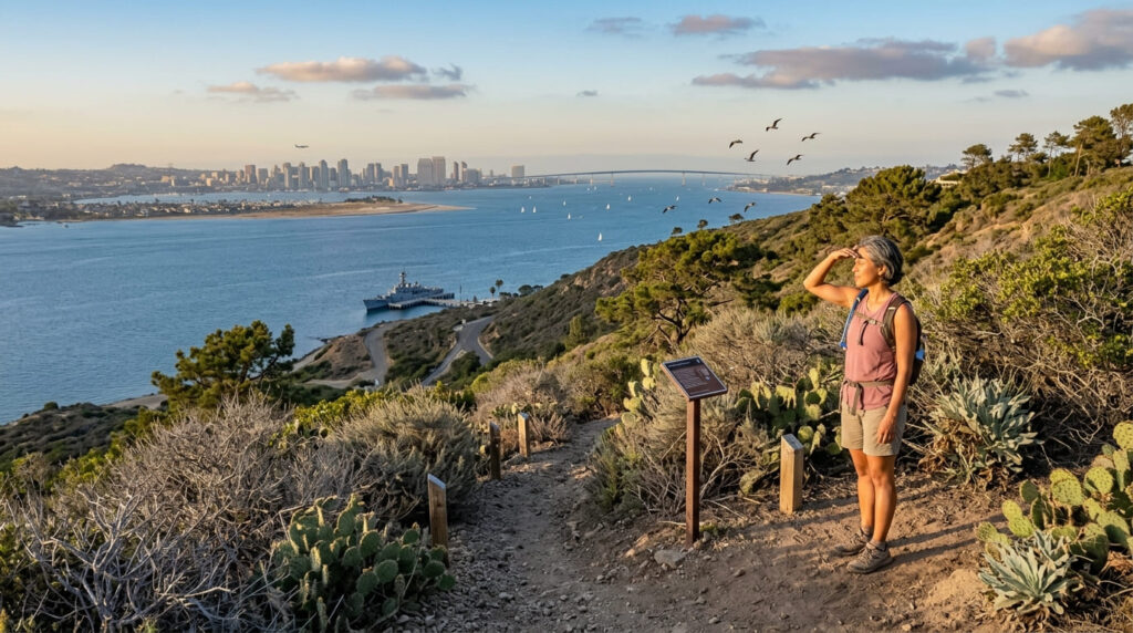
Every other entry on this list faces open ocean. The Bayside Trail flips that, a roughly 2.5-mile path along the Point Loma peninsula looking inward across San Diego Bay, with the downtown skyline and Coronado stacked up in the distance. It’s a different vantage, and worth the detour just for that contrast.
Practical tips: access and best timing
This is a fee site, part of the National Park Service, as of 2026 it’s $20 per vehicle, $15 per motorcycle, or $10 per pedestrian, valid for seven days, per the official Cabrillo National Monument visitor information.
The park runs 9 a.m. to 5 p.m. year-round, but the Bayside Trail closes at 4 p.m., so skip a late-afternoon start. Winter gray whale migration runs roughly mid-December through March, peaking in mid-January.
7. Palos Verdes Bluffs Trail, Abalone Cove Shoreline Park (Los Angeles County)
Why it made this list: tide pools, sea caves, and a distant lighthouse in one easy walk
On paper, this is one of the best combination hikes on the Palos Verdes Peninsula: blufftop views, tide pools, sea caves, and a distant look at Point Vicente Lighthouse, much like the stunning coastal and canyon scenery detailed in our Malibu coastal hiking and canyon insights. Also, our Los Angeles County coastal trails guide, Malibu to Palos Verdes, covers the rest of this coastline if Abalone Cove doesn’t work out for you.
Practical tips: access and best timing
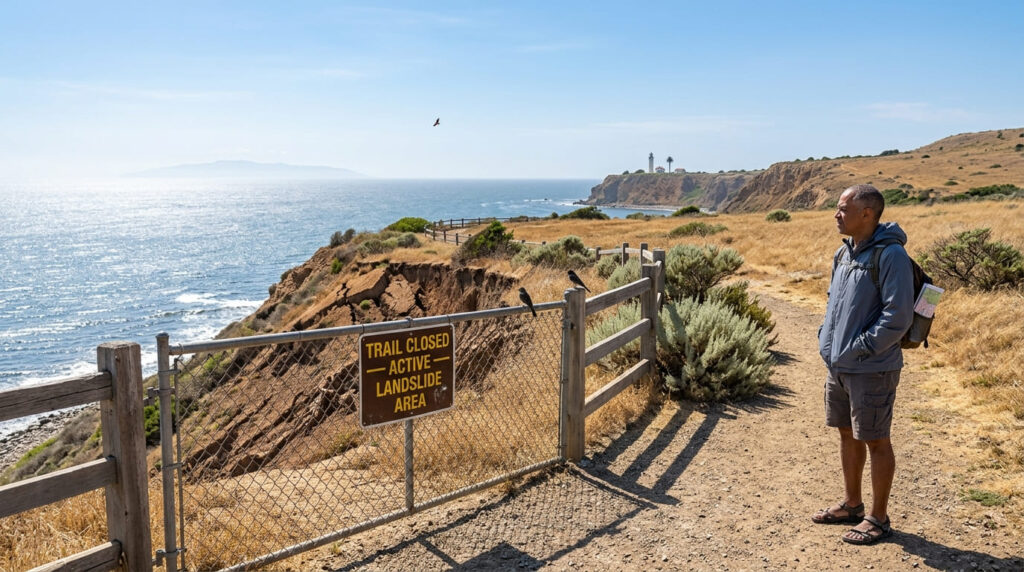
I have to flag something important before you plan a trip around this one. Rancho Palos Verdes has dealt with an active, accelerating landslide in the Portuguese Bend/Abalone Cove area since a state of emergency was declared in October 2023, and the beach-access trails down to the tide pools and sea caves have been closed since 2024, still closed as of this writing.
The blufftop parking area and park grounds remain open during regular hours, so the overlook views are reachable; the descent to the water isn’t. Our guide to checking trail closures before you go explains how to verify status like this, and the city’s own Rancho Palos Verdes trail conditions page is the best source before you drive out.
Quick comparison: all 7 ocean-view trails at a glance
| Trail | Round-Trip Distance | Fee / Permit | Best For | Current Access Note |
|---|---|---|---|---|
| Battery Spencer | ~0.5 mi | Free | Golden Gate Bridge views | Fully open |
| Soberanes Point | ~1, 2 mi | Free | Whale watching, sunset | Fully open; don’t confuse with Soberanes Canyon Trail |
| Point Lobos | Varies by loop | Fee; reservation rolling out 2026 | Photography, otters | Check reservation status before visiting |
| Sunset Cliffs | ~1, 2 mi | Free | Sunset views, sea arches | Active erosion, stay behind barricades |
| Rim Trail (Shell Beach) | ~2, 3 mi | Free | Easy/accessible ocean views | Fully open |
| Bayside Trail (Cabrillo) | ~2.5 mi | $10, $20 entrance fee | Whale watching, bay views | Trail closes 4 p.m. daily |
| Palos Verdes Bluffs (Abalone Cove) | Varies | Parking fee | Tide pools, sea caves | Beach/tide pool trails closed, bluff area open |
Before you go, a few honest notes
Two of these seven, Point Lobos and Abalone Cove, need a status check before you drive out. My honest pairing recommendation: Battery Spencer and Point Lobos both reward a golden-hour visit, so plan around sunset rather than midday. Sunset Cliffs and the Bayside Trail sit close enough together to do both in a Southern California afternoon.
Frequently Asked Questions About Best Hiking Trails in California for Ocean Views
Are hiking trails open in Palos Verdes?
Most are, but not all. The Palos Verdes Bluffs area at Abalone Cove has its blufftop park and parking open, but the beach-access trails down to the tide pools have been closed since 2024 due to an active landslide. Check the city’s trail alerts page before you go.
Are some hiking trails dangerous in Palos Verdes and along the coast generally?
Yes, Sunset Cliffs and the Palos Verdes bluffs are both actively eroding, with real bluff collapses recorded in 2026. Stay behind posted railings and barricades on both, and never climb below a “closed” sign at either location.
What is the best coastal trail in California for beginners?
The Rim Trail at Shell Beach, it’s flat, mostly paved, and delivers water views for nearly its whole length without any real elevation gain. Battery Spencer is a close second at under a mile round trip.
Are ocean-view trails windy?
Most of them, yes. Exposed headlands like Battery Spencer and Soberanes Point catch wind straight off the Pacific, so I’d pack a windbreaker even on a warm day, coastal wind and coastal sun don’t always feel the way you’d expect.
What time of day is best for ocean-view photography?
Golden hour, hands down, especially at Battery Spencer and Sunset Cliffs, both of which face west or northwest. Midday tends to wash out the color and flatten the cliffs into silhouettes.
Is fog a problem on California’s ocean-view trails?
It can be, particularly at Battery Spencer and along the Central Coast near Shell Beach, where marine layer is common in the morning. It usually burns off by early afternoon in summer, so a later start often beats a sunrise one if a clear view matters more to you than empty trails.