Malibu Canyon Hiking Guide: Escondido Falls, Solstice & Zuma
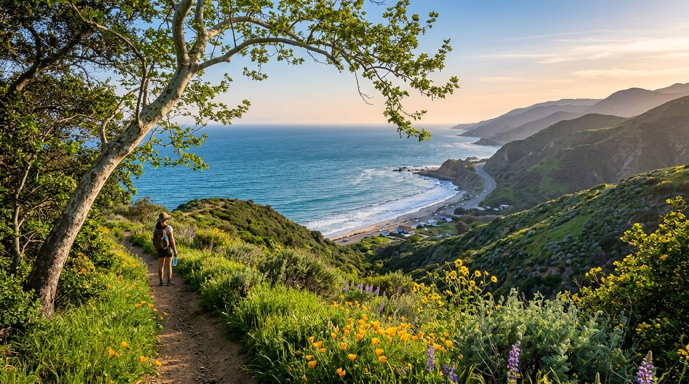
Pacific Coast Highway runs along Malibu like a ribbon laid between mansions and surf, and almost everyone who drives it keeps their eyes on the water. Turn the other way. Between the beach houses, narrow roads climb into canyons where creeks run under sycamores, a stone-and-brick ruin stands beside a waterfall, and a trail starts at the end of a road named Bonsall. Malibu California hiking trails don’t announce themselves, but they are everywhere, and three canyons in the Santa Monica Mountains make the best starting set: Escondido, Solstice and Zuma.
Disclosure: Please note that some of the links below are affiliate links and at no additional cost to you, I may earn a commission. Know that I only recommend hiking gear I personally stand behind; when you use my affiliate links, it helps me run this blog and keep all of this content free of charge for readers (like you).
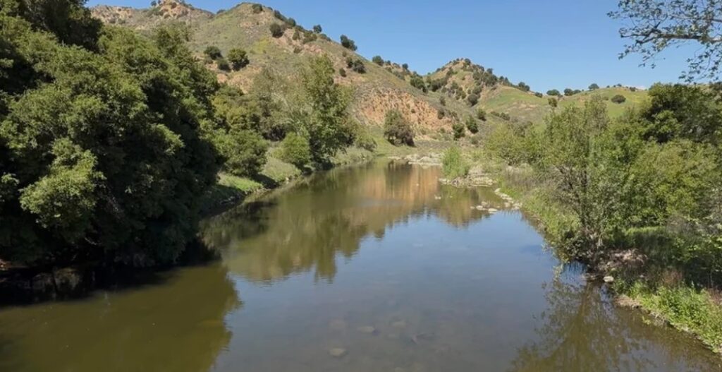
This guide walks all three, with distances, trailheads, parking, dog rules, and a frank section on what wildfire has done to access. It’s on the Los Angeles County side of the range, and our Los Angeles County hiking trails guide puts it in context.
Malibu Canyon Hikes at a Glance
If you’re comparing Malibu California hiking trails, these three canyons cover the main choices: a waterfall walk, a history walk, and a quiet canyon.
| Canyon | Highlight | Typical hike | Parking |
|---|---|---|---|
| Escondido Canyon Park | 150-foot multi-tiered falls (lower tier open to the public) | Roughly 3.5 miles round trip | Small paid lot off PCH |
| Solstice Canyon | Waterfall, ruins and ocean views | 2.1 miles round trip on the main trail | Lot on Corral Canyon Road |
| Zuma Canyon | Open canyon, ridge views, Backbone Trail links | About 2.8 miles round trip on the main trail | Dirt lot at the end of Bonsall Drive |
Check Trail Status Before You Go
Malibu burns. The Woolsey Fire of November 2018 burned parts of Solstice Canyon, the Franklin Fire of December 2024 reached the Corral Canyon area, and the Palisades Fire of January 2025 closed much of the range. The National Park Service closed Solstice Canyon on January 10, 2025, “until further notice,” and the Mountains Recreation and Conservation Authority (MRCA) closed Escondido Canyon Park and other Malibu parks the same month. Escondido Canyon Park was still on MRCA’s closure list in late May 2025 and was absent from its mid-June 2025 list.
Closures change with fire weather and storms. During severe fire weather, land in the Santa Monica Mountains can close without notice, and rain can close unpaved lots like the one at Zuma Canyon for a day or two. Check the park agency before you drive, and see our guide to California hiking trail closures.
Escondido Falls, Malibu, California
Escondido Falls is the headliner, a 150-foot, multi-tiered fall that MRCA calls the highest in the Santa Monica Mountains. It is also seasonal. MRCA says the waterfall depends on rainfall and is minimal or nonexistent in dry weather, so go in the days after winter rain.
The trailhead. Escondido Canyon Park, Malibu, CA, is reached from PCH about a mile south of Kanan Dume Road. You park in the small Winding Way lot, which costs $12, and the lot is small, with reports ranging from about a dozen to 15 cars, so it fills early on weekends. You can’t park inside the park itself.
The walk. The first stretch isn’t a trail at all. You follow the paved Winding Way for about a mile past private estates, with ocean glimpses and several blind curves, so stay to the edge. At the Edward Albert Escondido Canyon Trailhead sign, you drop into the canyon, cross the creek several times, and follow it upstream to the base of the lower falls. The round trip comes to roughly 3.5 miles by most counts. Public parkland ends at the lower tier.
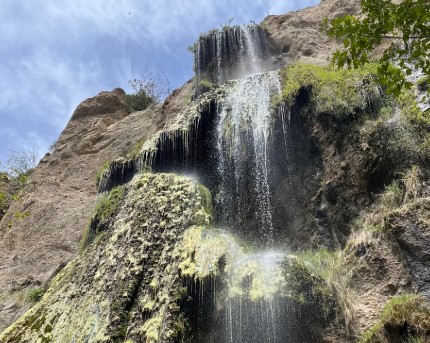
The upper falls are closed. The upper tiers sit on private property, and MRCA asks hikers not to climb to them to protect fragile habitat and avoid serious falls. Scrambling there means trespassing, and you may be responsible for any rescue.
Rules. Dogs on leash, mountain bikes, and horses are allowed in the park. No restrooms exist beyond the PCH lot, and smoking and open fires are prohibited because the canyon is a high fire risk zone. MRCA’s Escondido Canyon Park page lists current details.
Solstice Canyon, Malibu, CA
Solstice Canyon is the easy one, and the most layered. A level, partly paved trail follows a creek under oaks and sycamores to a waterfall and the ruins of a ranch house, then a ridge trail climbs back for an ocean view.
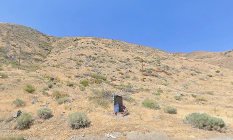
The trailhead. The main lot sits at the intersection of Corral Canyon Road and Solstice Canyon Road, about a quarter mile inland from PCH, open from 8 a.m. to sunset. Parking is limited, and cars parked illegally on Corral Canyon Road are towed, so carpool and arrive early. A restroom stands about 100 feet up the main trail, and drinking fountains sit at the lot and about a quarter mile in.
The trails. The National Park Service lists these options:
| Trail | Distance | Difficulty |
|---|---|---|
| Solstice Canyon Trail | 2.1 miles round trip | Easy; paved for about half a mile |
| Dry Canyon Trail | 1.2 miles round trip | Easy; a 150-foot waterfall flows only after winter rain |
| TRW Loop Trail | 1.5 miles round trip | Easy |
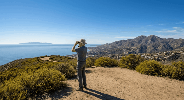
| Rising Sun Trail | 1.5 miles | Moderate; a ridge climb with ocean views |
| Sostomo Trail / Deer Valley Loop | 3.9 miles | Moderate to strenuous |
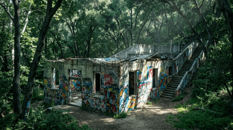
On the main trail, you pass the stone remains of the Keller House, a hunting cabin more than a century old that wildfire damaged in 2007. At the waterfall, you reach the ruins of the Roberts Ranch house, the so-called Tropical Terrace, designed by architect Paul Revere Williams, who in 1929 became the first Black member of the American Institute of Architects and later designed the LAX Theme Building. The waterfall is perennial, but the NPS notes that it can shrink to a trickle. Return by climbing the Rising Sun Trail for the view, and expect two and a half to three hours for the full loop.
Rules. Dogs must be on a leash no longer than six feet and are not allowed at the waterfall. Bicycles are limited to the Solstice Canyon Trail. The stream corridor is closed to protect habitat, and climbing on the ruins is prohibited. The National Park Service’s Solstice Canyon page lists current details.
Zuma Canyon Trailhead, Malibu, CA
Zuma is the quiet canyon. The name comes from a Chumash word for “abundance,” and perennial streams in Zuma and Trancas canyons support dense plant and animal life.
The trailhead. The Zuma Canyon Trailhead sits at the end of Bonsall Drive, north of Zuma Beach, in an unpaved lot. To get there, turn inland from PCH at Busch Drive across from Zuma Beach, turn right on Rainsford Place, then left on Bonsall. Bonsall has no eastbound exit onto PCH, so you return the same way. The trailhead has restrooms and water for dogs and horses, and the unpaved lot can close for a day or two after rain.
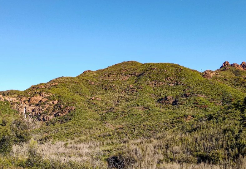
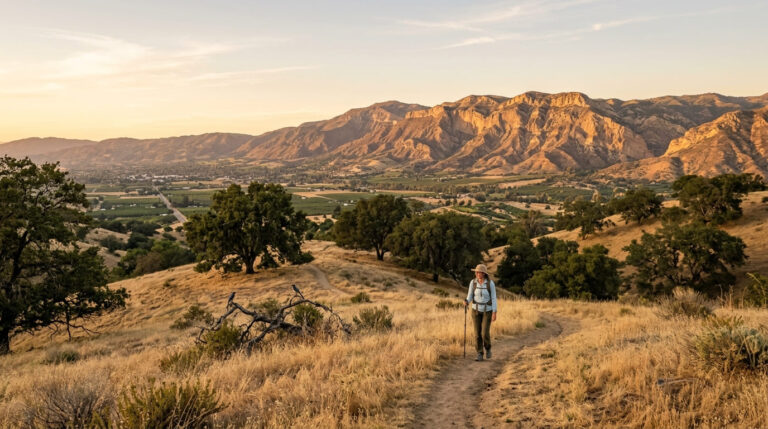
The trails. The Zuma Canyon Trail climbs gently up a sandy arroyo, crossing the creek several times, and runs about 2.8 miles round trip. A short branch, the Zuma Loop Trail, adds about a mile and rises to views of the canyon. Longer routes link to the Zuma Ridge Motorway and the 67-mile Backbone Trail, and an 11.1-mile loop covers the lower canyon’s trail network. Cyclists are not allowed on any trails in lower Zuma Canyon, and dogs must be on leashes no longer than six feet. The trailhead closes at sunset.
There is a second way in. The Newton Canyon Trailhead, on Kanan Dume Road south of Mulholland Highway, serves the Zuma Ridge Trail and the Backbone Trail, and the National Park Service notes that its lot fills quickly on weekends, with overflow parking about a quarter mile north. Zuma is exposed chaparral, so it gets hot, and early starts reward you with ocean views and fewer crowds.
Which Malibu Hike Should You Pick?
- Want a waterfall after rain? Escondido Falls, or Solstice’s waterfall for a gentler walk.
- Hiking with kids or a slow pace? The Solstice Canyon Trail, easy and partly paved.
- Want solitude and a longer day? Zuma Canyon, with links to the Backbone Trail.
- Hiking with a dog? All three allow leashed dogs, but not at Solstice’s waterfall. See our guide to the best dog-friendly hiking trails in California.
Combining two canyons in one day is tempting, but each has its own parking squeeze and closing time. Solstice’s lot opens at 8 a.m. and closes at sunset; Escondido’s walk starts on a paved road that you share with residents, and Zuma’s trailhead closes at sunset too. One canyon in the morning and a beach stop after is a more comfortable pace.
Best Time for Malibu California Hiking Trails
Winter and early spring are the sweet spot. Rain brings the waterfalls to life, the hills turn green, and the air clears for ocean views, and our guides to California waterfall hikes after rain and spring wildflower hikes have more ideas. Summers are hot and dry, the falls shrink, and shade is limited, so start at dawn. Our guide to California hiking trails for ocean views has more coastal-view options.
Safety and Trail Rules
- Wildlife. The NPS warns of rattlesnakes, ticks, bees, and poison oak in the range. Stay on the trail and read our guide to wildlife hazards on California trails.
- Water. Stream water isn’t safe to drink because of possible contamination and giardia. Carry your own.
- Creeks and rain. Canyon creeks rise quickly after storms, and rain makes trails slippery. Read about water hazards on California trails.
- Cell service. Reception is unreliable or absent in much of the area.
- Fire. Smoking and fires of any kind are not allowed on the trails.
What to Bring
These are short hikes, but the coast gives them a bite. Carry more water than you expect to drink, because summers here are hot and dry and shade is patchy. Wear shoes with good tread, since creek crossings and loose trail surfaces are common, and bring sun protection and a light layer for the ocean breeze. Download your map before you leave, because cell reception is unreliable. If you plan a longer Zuma or Backbone Trail day, carry a headlamp and basic first-aid supplies, as the National Park Service recommends.
More Malibu and Coastal Trails
If you want more after these canyons, our guide to coastal hiking trails from Malibu to Palos Verdes covers the shoreline, and our roundup of waterfall hiking trails in Los Angeles County adds more falls. For the next stretch of coast beyond the county line, see coastal hiking trails in Ventura County. Farther into the mountains, the Backbone Trail and Sandstone Peak, the highest in the range, offer longer days.
The Honest Bottom Line
Malibu California hiking trails aren’t a secret, but they are fragile. Fire has reshaped these canyons repeatedly, waterfalls depend on winter rain, and a lot of the best access is a small lot, a closed gate, or a dirt road away. Go after a storm, check the agency page the morning you leave, and carry your own water. Then follow a creek into the hills, and let the beach houses fall away behind you.
Malibu Hiking FAQ
Is Escondido Falls open?
Check MRCA’s Escondido Canyon Park page. The park was closed after the January 2025 Palisades Fire and was off MRCA’s closure list by mid-June 2025.
Can you hike to the upper Escondido Falls?
No. The upper falls are on private property and are not open to the public.
Does it cost anything to park?
At Escondido Canyon Park, $12 at the Winding Way lot. Solstice Canyon and Zuma Canyon don’t list a fee on the NPS pages I checked.
Is Solstice Canyon good for beginners?
Yes. The main trail is easy and partly paved.
Where is the Zuma Canyon trailhead?
At the end of Bonsall Drive, north of Zuma Beach, reached from Busch Drive.
Are dogs allowed?
Yes, on leashes, but not at Solstice Canyon’s waterfall.
When does Escondido Falls flow?
After rain. It can be minimal or dry in summer.
Do the Malibu canyons have cell service?
Not reliably.