7 California Hikes Where Spring Wildflowers Actually Deliver
You don’t need a once-a-decade superbloom to see wildflowers in California; you need to be in the right place at the right elevation. Bloom season runs February in the low desert through June in the high country, and seven of the best hiking trails in California for wildflowers cover that whole window, from poppy-covered foothills to a desert palm oasis. Each one delivers a show in a normal year, not just the rare exceptional one, and I’ll mention exactly where access has changed recently so you’re not the one who drives three hours to a closed trailhead.
Disclosure: Please note that some of the links below are affiliate links and at no additional cost to you, I may earn a commission. Know that I only recommend hiking gear I personally stand behind; when you use my affiliate links, it helps me run this blog and keep all of this content free of charge for readers (like you).
Key takeaways:
- Most reliable statewide pick: Antelope Valley California Poppy Reserve, featuring 1,745 acres and 8 miles of trail built specifically around the state flower.
- Best beginner-friendly option: Chimney Rock at Point Reyes (under 2 miles, flat, and free, with no permit needed). (See our guide to trail difficulty levels if you’re building out a season of easier hikes.)
- Best two-for-one: North Table Mountain’s Phantom Falls Trail, where the same winter rain that fuels the bloom also fuels the waterfalls.
- Most remote, least crowded: Carrizo Plain National Monument, with no services, no cell signal, and some of the most dramatic bloom photography in the state.
- Honest trade-off to know upfront: three of these seven have access caveats right now (a fire-damaged grove, a storm-prone access road, and a permit-gated alternate trail), covered in each section, not buried.
| Trail | County | Distance | Fee/Pass | Signature bloom |
|---|---|---|---|---|
| Antelope Valley California Poppy Reserve | LA/Kern border | 1.7–3.5 mi loops (8 mi total) | ~$10/vehicle | California poppies |
| Figueroa Mountain (Davy Brown Trail) | Santa Barbara | 7.5 mi RT | Free | Lupine, poppies, chocolate lily |
| Carrizo Plain National Monument | San Luis Obispo | 0.5–7 mi options | Free | Hillside daisies, goldfields |
| Borrego Palm Canyon Trail | San Diego | ~3 mi RT | $10/vehicle | Desert annuals + palm oasis |
| Vernal Pool Trail, Santa Rosa Plateau | Riverside | 3.4 mi loop | $6 adult / $3 child | Fairy shrimp pools, chocolate lily |
| Chimney Rock Trail, Point Reyes | Marin | 1.8 mi RT | Free | Coastal wildflowers |
| Phantom Falls Trail, North Table Mountain | Butte | ~4 mi RT | ~$6 CDFW Lands Pass | Lupine + waterfalls |
Antelope Valley California Poppy Reserve (Los Angeles/Kern County border)
Why it made this list: California’s official state flower in full bloom
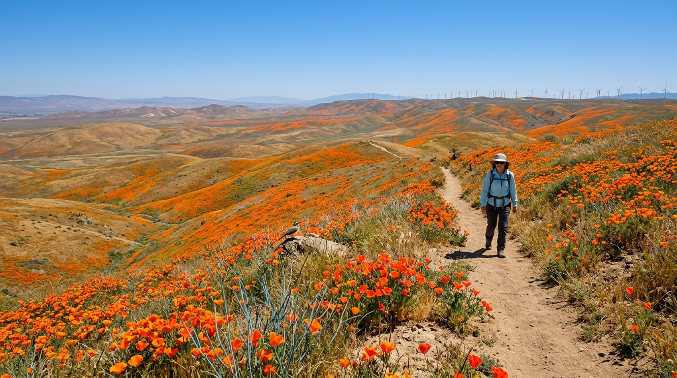
This is the reserve the poppy was practically designed for. In a good year, the rolling Mojave grassland hills go solid orange, and the reserve’s 1,745 acres and 8 miles of interlocking trails let you chase the best color of the day without repeating ground, while coastal canyon trips like our Malibu trail and canyon breakdown offer a completely different regional adventure.
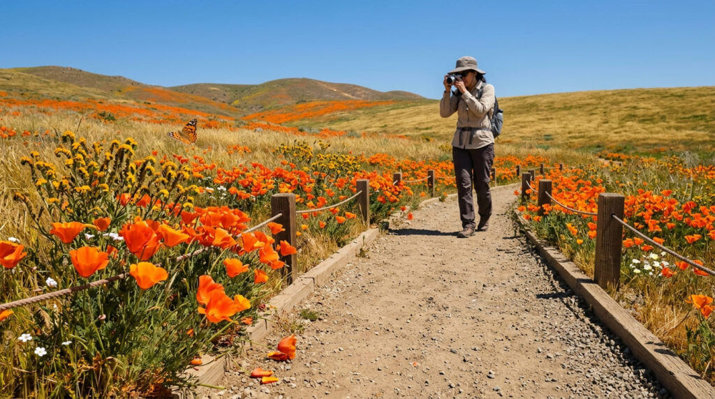
Start on the Poppy Trail (2 mi) or North Loop, then add the Antelope Butte/Lightning Bolt Loop (3.5 mi) if the flowers are still going.
Practical tips: access and best timing
Bloom season runs mid-February through May, with March usually the sweet spot, but don’t assume every year is a superbloom. The 2026 season, for example, had flowers present but didn’t reach the unbroken carpets that define an actual superbloom, per the reserve’s own updates.
Call the Wildflower Hotline (661-724-1180, updated weekly) before you drive out. Expect a roughly $10 per-vehicle day-use fee, and stay on the marked trail: off-trail walking crushes the seed bank for next year, and rangers enforce it. (Our trail etiquette guide covers this kind of low-impact rule if you’re new to reserve hiking.) If the poppies are thin, Arthur B. Ripley Desert Woodland State Park is a free, 7-mile detour west with a different bloom entirely.
Figueroa Mountain (Santa Barbara County)
Why it made this list: a reliable Central Coast superbloom destination
Figueroa Mountain earns its reputation the boring way: it just blooms well most years, thanks to a rain-catching elevation of 4,534 feet.
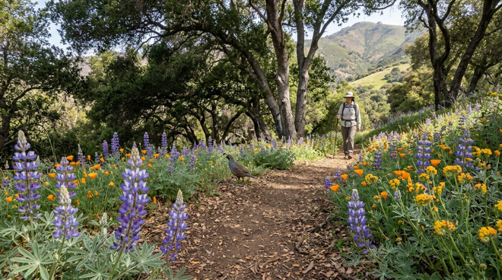
Lupine, poppies, fiddleneck, and chocolate lilies show up in layers as you climb, which is why locals treat it as the go-to Central Coast bloom check. For more of the range, see our Santa Ynez Mountains trail guide.
Practical tips: access and best timing
For the main event, take the Davy Brown Trail out of Davy Brown Campground toward Fir Canyon and the Figueroa Mountain Lookout (7.5 miles round trip, about 2,400 feet of elevation gain, entirely on U.S. Forest Service land with no permit required). Late March through April is peak. You’ll also see references to the Grass Mountain Trail near Midland School, but don’t plan around it unless you’ve confirmed it’s open.
That trail crosses private Midland School land, requires a separate online permit, and has closed for rain damage in past seasons. Figueroa Mountain Road itself can close temporarily after storms too, so check Los Padres National Forest’s current conditions page first.
Carrizo Plain National Monument (San Luis Obispo County)
Why it made this list: the site of California’s most famous superbloom years
Carrizo Plain is where the internet’s most-shared superbloom photos usually come from: the Temblor Range going solid gold above Soda Lake’s white salt flat. It’s also the most remote entry here by a wide margin, which is exactly why it stays this good: almost nobody lives out here to trample it.
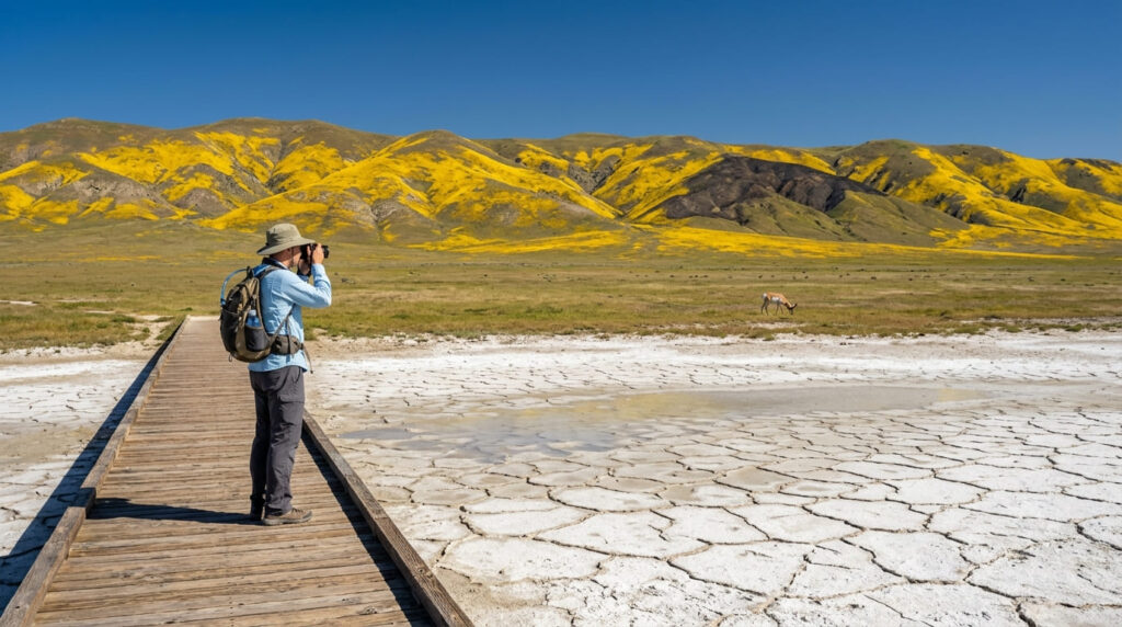
Walk the short boardwalk to Soda Lake for an easy start, or the 7-mile Caliente Ridge Trail for panoramic views of the whole plain. BLM and CNPS botanists actually classified 2026 a monument-level superbloom, even in a year most other desert sites in the state fell short. For more of the county’s hiking beyond the monument, see our San Luis Obispo County trail guide.
Practical tips: access and best timing
Access is via Soda Lake Road off Highway 58 from the north or Highway 33/166 from the south. The road is partly paved, partly graded dirt, and prone to temporary closures after storms (it closed about three weeks in early 2026 for cleanup).
There are no services inside the monument at all (no water, food, or fuel), so fill up before you leave Highway 58. Part of the monument also burned in the July 2025 Madre Fire, so expect some burn-scar sections mixed with the bloom. Check BLM’s current road-status page the morning you leave, not the night before.
Borrego Palm Canyon Trail, Anza-Borrego Desert State Park (San Diego County)
Why it made this list: desert wildflowers alongside a native palm oasis
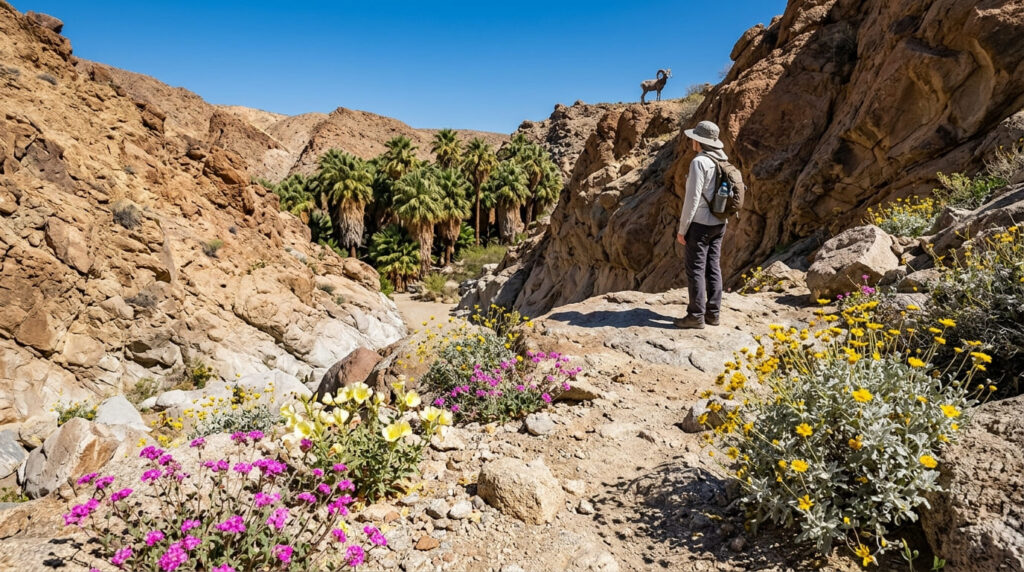
This is the trail that put Anza-Borrego on the map before it was even a state park, and it remains the best single hike for pairing desert wildflowers with something you don’t expect out here: a shaded native fan palm oasis. For more of the park’s desert hiking, our San Diego County desert trails guide covers several nearby options.
Practical tips: access and best timing
Budget about 3 miles round trip and 450 feet of elevation gain from the trailhead at the west end of Borrego Palm Canyon Campground. The first palm grove has been closed since a January 2020 arson fire, and per California State Parks’ most recent update, the trail now ends at a viewpoint overlooking the grove rather than walking through it.
It is still a good hike, just not the walk-into-the-oasis experience some older write-ups describe. Desert bloom here peaks earlier than the rest of this list, often February–March, and is rainfall-dependent enough that a dry winter means a quiet year. Expect a $10 vehicle day-use fee.
Vernal Pool Trail, Santa Rosa Plateau Ecological Reserve (Riverside County)
Why it made this list: a rare vernal pool ecosystem found at very few other sites
Here, the wildflowers are a side effect of something rarer: seasonal vernal pools that host a species of fairy shrimp found nowhere else on Earth.
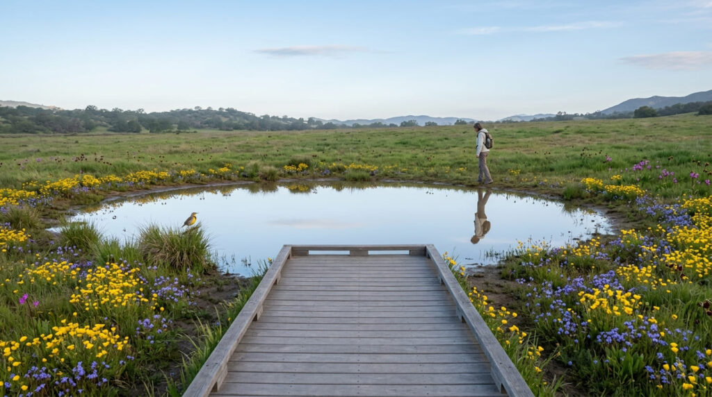
As the pools recede through spring, goldfields and purple downingia ring the shrinking waterline while chocolate lilies and shooting stars fill the surrounding bunchgrass prairie. For more nearby options, check our Temecula trail guide, as the reserve sits just outside town.
Practical tips: access and best timing
The Vernal Pool Trail is an easy 3.4-mile loop with about 300 feet of elevation gain, roughly 90 minutes at a relaxed pace. The best window is January through May, since the pools depend directly on winter rain: no rain, no pools, no fairy shrimp. Entry runs about $6 per adult and $3 per child, and dogs aren’t allowed on this particular trail even though they’re permitted elsewhere in the reserve.
Chimney Rock Trail, Point Reyes National Seashore (Marin County)
Why it made this list: coastal wildflowers with ocean bluff views
Every other entry here is inland or desert. Chimney Rock is the coastal counterpart: a bluff-top walk above Drakes Bay where sun cups, coastal larkspur, and checkermallow bloom alongside gray whale migration season.
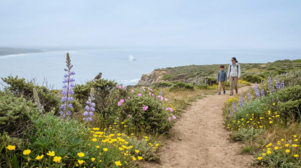
It’s also the shortest, flattest hike on this list, which makes it the easiest recommendation for a family outing. Pair it with our Muir Woods and Point Reyes trail guide if you’re spending a full day in the park.
Practical tips: access and best timing
It’s an easy 1.8 miles round trip with about 160 feet of elevation gain, and it’s free (no fee, no permit), managed by the National Park Service. Peak bloom runs April into May, later than every desert or foothill entry on this list, making it a good second wave once inland blooms have faded. Dogs aren’t allowed, parking is limited to about 20 vehicles, and Chimney Rock Road narrows to a single lane in places, so give way to oncoming traffic.
North Table Mountain Ecological Reserve (Butte County)
Why it made this list: a volcanic tableland famous for waterfalls and wildflowers together
North Table Mountain is the rare entry where you don’t choose between wildflowers and waterfalls: the Phantom Falls Trail delivers both on the same basalt mesa, since the same winter rain feeds the vernal pools, the lupine carpets, and the seasonal waterfalls at once.
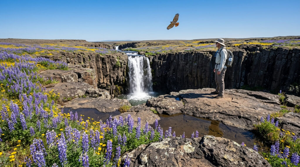
If a wet winter has you chasing runoff elsewhere too, our guide to California waterfalls after rain rounds up more of the same rain-fed timing logic.
Practical tips: access and best timing
Plan on roughly 4 miles round trip with about 480 feet of elevation gain past Ravine Falls and Phantom Falls. Peak bloom normally runs March into April, though it shifts early some years (in 2026 it peaked around March 20 through mid-April and was largely done by May), so don’t assume a calendar date guarantees the flowers.
Visitors 16 and older need a CDFW Lands Pass, about $6 for a day pass, purchasable online or by QR code at the trailhead. There’s almost no shade on the mesa, so go early and bring more water than you think you need.
The honest bottom line
If you only hike one of these, make it Antelope Valley for the classic postcard shot, or Figueroa Mountain if you’d rather skip the crowds. But the move is treating this as a season, not a single trip: desert entries in February, foothills in March and April, and coast in May.
Three of these seven trails have current access caveats (a closed palm grove, a storm-prone access road, and a permit-gated alternate route), so if you double-check conditions before a long drive, our trail closures guide is worth a bookmark for this list and beyond.
Frequently asked questions about the best hiking trails in California for spring wildflowers
When is peak wildflower season in California?
There’s no single peak: desert sites like Borrego Palm Canyon often peak in February–March, foothill and Central Coast sites like Figueroa Mountain and Antelope Valley peak in March–April, and coastal sites like Chimney Rock peak in April–May.
What causes a California superbloom?
A superbloom needs an unusually wet winter (typically at or above 200% of normal rainfall), followed by moderate spring temperatures that let the germinated seeds actually flower instead of getting scorched early.
Is it illegal to pick wildflowers in California?
Yes, in state parks, ecological reserves, and BLM monuments like the ones on this list, picking or walking off-trail into wildflowers is prohibited to protect the seed bank for future years, and rangers do enforce it.
How do you check current wildflower bloom conditions?
Call or check a dedicated hotline, such as the Antelope Valley Wildflower Hotline (661-724-1180) or the Theodore Payne Wildflower Hotline (both updated weekly), or check the specific park or monument’s own social media before you drive out.
Are desert wildflowers different from mountain wildflowers?
Yes. Desert blooms are short-lived annuals that germinate fast after rain and peak earlier, often February–March, while higher-elevation and coastal wildflowers tend to peak later, April through June, with different species entirely.
What is the best month for wildflowers in California?
If you had to pick one, March gives you the widest spread (desert and foothill sites are typically active, and coastal sites are just getting started), but the honest answer is that “best month” depends entirely on which region you’re hiking.