5 Best Hiking Trails in San Luis Obispo County, From the Tallest of the Nine Sisters to an Elephant Seal Rookery
San Luis Obispo County packs a genuinely wide range of the best hiking trails in San Luis Obispo into a small footprint: volcanic peaks rising straight out of the city, a freshwater dune lake, a shaded canyon waterfall, and one of the state’s great wildlife-viewing stops. These five stay inland and central; for coastal bluffs and summits, read our detailed Montaña de Oro hiking guide or explore our dedicated Morro Bay guide. This guide is part of our full San Luis Obispo County hiking guide.
Disclosure: Please note that some of the links below are affiliate links and at no additional cost to you, I may earn a commission. Know that I only recommend hiking gear I personally stand behind; when you use my affiliate links, it helps me run this blog and keep all of this content free of charge for readers (like you).
Key takeaways:
- Best flagship summit: Bishop Peak: the tallest of the Nine Sisters volcanic peaks, and SLO’s most iconic hike.
- Best sunset view: Cerro San Luis (Madonna Mountain): downtown views and a correction on that landmark “M” worth knowing.
- Best wildlife-and-dunes combo: Oso Flaco Lake: a boardwalk across a coastal dune lake to an undeveloped beach.
- Best shaded any-season option: Reservoir Canyon: an oak-and-sycamore canyon with a waterfall, minutes from downtown.
- Best pure wildlife stop: Piedras Blancas: a free boardwalk over one of California’s largest elephant seal rookeries.
- Two of these trails (Bishop Peak, Cerro San Luis) are genuinely exposed summit hikes; the other three stay shaded or flat, so pick based on how much sun and climbing you actually want.
How these five SLO County trails compare
| Trail | Distance | Difficulty | Fee | Best for |
|---|---|---|---|---|
| Bishop Peak Trail | ~4.2 mi round trip (Patricia Dr.) | Moderate-strenuous | Free | Tallest Nine Sisters summit |
| Cerro San Luis (Madonna Mountain) | ~2.2 mi to the “M” (longer to summit) | Moderate | Free | Sunset, city lights |
| Oso Flaco Lake Trail | ~2 mi round trip | Easy | Small day-use fee | Dune lake, bird watching |
| Reservoir Canyon Trail | ~3 mi to the falls (5-5.5 mi to the summit) | Easy (falls) to moderate-hard (summit) | Free | Shade, any-season option |
| Piedras Blancas Boardwalk | ~0.5 mi (plus optional 3.2 mi coastal extension) | Very easy | Free | Elephant seal viewing |
Bishop Peak Trail
Trailhead access and parking at Patricia Drive, San Luis Obispo
Free residential-street parking at the top of Patricia Drive fills fast on weekends; arrive early. From here, the round trip to the 1,559-foot summit runs about 4.2 miles with roughly 1,175 feet of elevation gain (a shorter 3.5-mile option exists from the separate Highland Drive trailhead nearby).
What you’ll see: the tallest of the Nine Sisters volcanic peaks
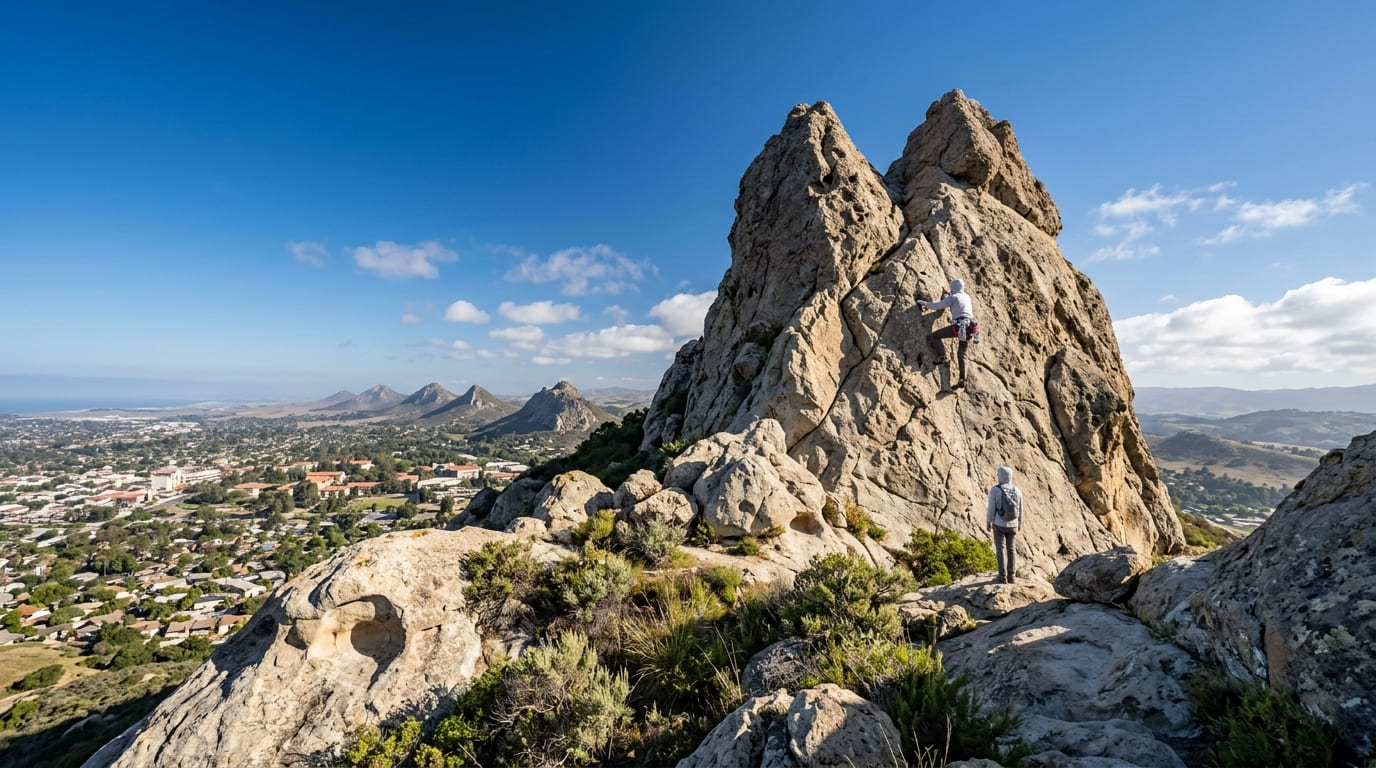
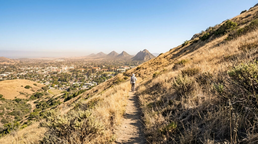
Bishop Peak is the tallest in a chain of volcanic plug peaks called the Nine Sisters, stretching from San Luis Obispo to Morro Bay, and its rocky, miter-shaped crown (the mountain’s namesake, since “Obispo” is Spanish for “bishop”) delivers sweeping views over Cal Poly, downtown SLO, and the neighboring Morros. Only hikers and climbers are permitted on this specific trail; mountain bikes aren’t allowed.
Best time to hike Bishop Peak: early morning to beat the heat and crowds
The upper slopes are largely exposed, and this is one of the most popular hikes in the county, so an early start genuinely helps with both the heat and the parking situation at Patricia Drive.
Cerro San Luis Trail (“Madonna Mountain”)
Trailhead access and parking near the Fernandez trailhead
A free dirt lot off Fernandez Road, near the Madonna Inn, serves this second Nine Sisters peak; dogs are welcome here, and no fee or permit is required.

What you’ll see: the landmark hillside “M” and downtown SLO views
The whitewashed “M” on the hillside stands for Mission Prep, a local high school, not for the nearby Madonna Inn, an easy mix-up given the mountain’s popular “Madonna Mountain” nickname- but the two aren’t actually connected. The hike to the M and reserve overlook runs about 2.2 miles round trip, with views over Cal Poly, downtown SLO, and Bishop Peak across the valley; continuing to the true summit is a longer undertaking.
Best time to hike Cerro San Luis: sunset for city light views
The mountain’s downtown-facing vantage makes it a genuine sunset destination; the summit even hosts a citywide-visible holiday light display each winter. Bring a light for the walk down if you’re timing this for dusk.
Oso Flaco Lake Trail (Guadalupe-Nipomo Dunes)
Trailhead access and parking at Oso Flaco Lake
A small day-use fee applies at the state-managed lot, the southernmost trailhead in this guide, at the edge of the 22,000-acre Guadalupe-Nipomo Dunes complex. For hikers exploring this southern corner of SLO County, staying at nearby Pismo Beach campgrounds makes an ideal trip pairing.
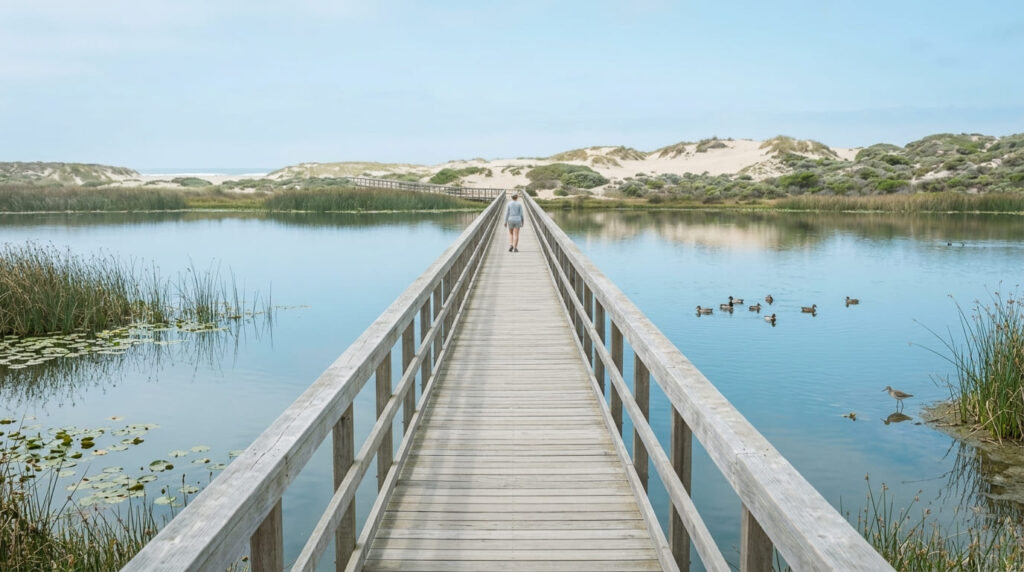
What you’ll see: a boardwalk across a coastal dune lake to the beach
A paved path leads to a wooden boardwalk crossing the lake itself, then continues through dune habitat to an undeveloped beach, about 2 miles round trip total, with much of the route wheelchair accessible up to the dune boardwalk (the final sandy beach stretch is not). One real caution from the state park itself: surf here is genuinely dangerous, with strong rip currents even on calm-looking days; never turn your back on the waves. Our water hazards on California trails guide covers ocean and river safety basics worth knowing before any beach-adjacent hike.
Best time to hike Oso Flaco Lake: spring for migratory birds
Over 200 bird species pass through here, including peregrine falcons and the protected Western snowy plover, with spring migration the best window for variety and volume.
Reservoir Canyon Trail
Trailhead access and parking at Reservoir Canyon Natural Reserve
A free lot sits about a mile north of downtown SLO on Highway 101, the most convenient in-town trailhead in this entire guide.

What you’ll see: a shaded oak woodland canyon near downtown SLO
The first mile-plus stays easy and shaded beneath oaks and sycamores, reaching a 15-to-20-foot waterfall (with a small cave behind it) about 3 miles round trip, genuinely suitable for kids and older hikers. Continuing past the falls to the ridge and summit turns this into a real climb, 5 to 5.5 miles round trip with over 1,300 feet of gain, with rewarding views back over the city.
Best time to hike Reservoir Canyon: a comfortable any-season option
Consistent canopy makes the lower waterfall section a reliable choice nearly year-round, a genuine fallback when Bishop Peak or Cerro San Luis feel too hot and exposed.
Piedras Blancas Elephant Seal Viewing Boardwalk (San Simeon)
Trailhead access and parking at the Piedras Blancas Vista Point
Free parking off Highway 1, about 45 miles north of San Luis Obispo and 4 miles north of Hearst Castle, makes this the northernmost stop in this guide. Open daily 8 a.m. to sunset; leashed dogs are permitted on the boardwalks and parking area (though not on the sandy beach).
What you’ll see: one of California’s largest elephant seal rookeries
Two quarter-mile boardwalks put you within close, safe view of thousands of northern elephant seals hauled out on the beach below, one of the state’s largest such rookeries, and one of the most reliable close-up wildlife photo opportunities covered anywhere on this site. Hikers wanting more can continue on an easy 3.2-mile round-trip coastal trail toward the Piedras Blancas Light Station boundary, with more seals and ocean views along the way.
Best time to hike Piedras Blancas: winter for peak breeding season
Breeding and pupping season runs roughly December through March, when seal numbers and activity peak, though some seals are present at the rookery in every season of the year.
Frequently asked questions about hiking trails in San Luis Obispo County
How tall is Bishop Peak?
1,559 feet, making it the tallest of the Nine Sisters, the chain of volcanic peaks running between San Luis Obispo and Morro Bay.
Why is Cerro San Luis called Madonna Mountain?
Because local businessman Alex Madonna purchased ranch land on the mountain’s slopes in the 1950s and built the Madonna Inn at its base; the mountain’s landmark “M,” however, refers to a different local institution, Mission Prep high school, not the Madonna family.
Is Oso Flaco Lake Trail wheelchair accessible?
Largely, yes; the paved path and boardwalk sections are accessible, though the final stretch onto the sandy beach itself is not.
Is Reservoir Canyon Trail shaded?
Yes, especially the first mile-plus to the waterfall; consistent oak and sycamore canopy makes it one of the more comfortable options in this guide during summer heat.
When do elephant seals arrive at Piedras Blancas?
Some seals are present year-round, but the peak breeding and pupping season runs roughly December through March, when numbers and activity are highest.
Which SLO County trail is easiest for beginners?
The Piedras Blancas boardwalk and Oso Flaco Lake Trail are both flat, short, and genuinely easy, making them better starting points than the two summit hikes (Bishop Peak and Cerro San Luis) covered elsewhere in this guide.