7 Hiking Trails in California with Waterfalls Worth Timing Around a Storm
A storm changes California waterfalls fast; some go from a trickle to a roar within 24 to 48 hours. The seven hiking trails in California with waterfalls below are all worth timing around rain, but this guide also does something most waterfall guides skip: it tells you plainly which of these are open right now. Two entries here have current closures, and pretending otherwise would waste your drive.
Disclosure: Please note that some of the links below are affiliate links and at no additional cost to you, I may earn a commission. Know that I only recommend hiking gear I personally stand behind; when you use my affiliate links, it helps me run this blog and keep all of this content free of charge for readers (like you).
Key takeaways:
- Most dramatic transformation: Escondido Falls goes from a near-trickle in summer to one of the Santa Monica Mountains’ best short hikes after a winter storm.
- Rarest natural feature: Alamere Falls is one of only a few tidefalls in California, dropping straight onto the beach, and one of only four in the entire country (or three in the continental U.S.).
- Most waterfalls per mile: Cataract Falls packs roughly eight to a dozen named cascades (sources vary on the exact count) into a short, steep stretch of Cataract Creek.
- Tallest, once corrected: Feather Falls is one of California’s tallest, at 410 feet, not the ~640 feet often quoted online, which traces back to an old, uncorrected estimate.
- Honest trade-off to know upfront: McWay Falls and Berry Creek Falls are both currently closed at the falls themselves, covered below with current status and what’s still accessible nearby, not glossed over.
| Trail | County | Distance | Waterfall height | Current status |
|---|---|---|---|---|
| Escondido Falls | Los Angeles | 3.5–3.8 mi RT | 150 ft (upper tier closed; ~50 ft lower falls accessible) | Open |
| Alamere Falls | Marin | 13.2 mi RT (official route) | 40 ft | Open, tide-dependent |
| Cataract Falls | Marin | 2.6–3.2 mi RT | Multiple cascades, ~8–12 | Open |
| McWay Falls | Monterey | Viewable only from Hwy 1 pullout | 80 ft | Overlook Trail closed |
| Feather Falls | Butte | 8–9 mi loop | 410 ft | Open, exposed post-fire |
| Berry Creek Falls | Santa Cruz | N/A currently | ~65 ft | Closed indefinitely |
| Horsetail Falls | El Dorado | ~2 mi RT | ~500–791 ft (sources vary) | Open, high fatality risk |
Escondido Falls Trail (Los Angeles County)
Why it made this list: one of LA County’s tallest waterfalls, transformed by rain
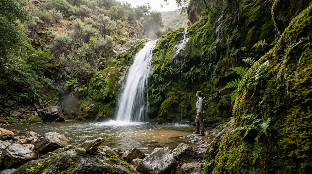
As explored further in our Malibu Canyon Hiking Guide, Escondido Falls goes from a modest trickle in a dry summer to a dramatic cascade within days of a significant Malibu storm, dropping over moss-covered rock into a shaded canyon pool. It’s an easy, family-friendly hike that starts on a residential road before dropping into Escondido Canyon Park.
Practical tips: access and best timing
Budget 3.5–3.8 miles round trip with roughly 400–600 feet of elevation change (sources vary slightly on both). Flow typically peaks 24–48 hours after a storm, once runoff has fully reached the creek; hiking the same day it rains often means muddy trail and less-impressive flow than waiting a day or two.
The dramatic 150-foot upper tier is closed, both for safety and because it crosses private property; what you’ll reach is the roughly 50-foot lower falls, still a good payoff, just not the full height some older photos suggest. Parking at the Winding Way lot runs about $12; street parking on PCH is free but ticket-prone. For more LA County waterfall options, see our Los Angeles waterfall trail guide.
Alamere Falls Trail (Marin County)
Why it made this list: a rare tidefall that depends entirely on winter rain
Alamere Falls is one of only a handful of tidefalls in the world and one of just four in the United States: a freshwater waterfall that drops directly onto an ocean beach.
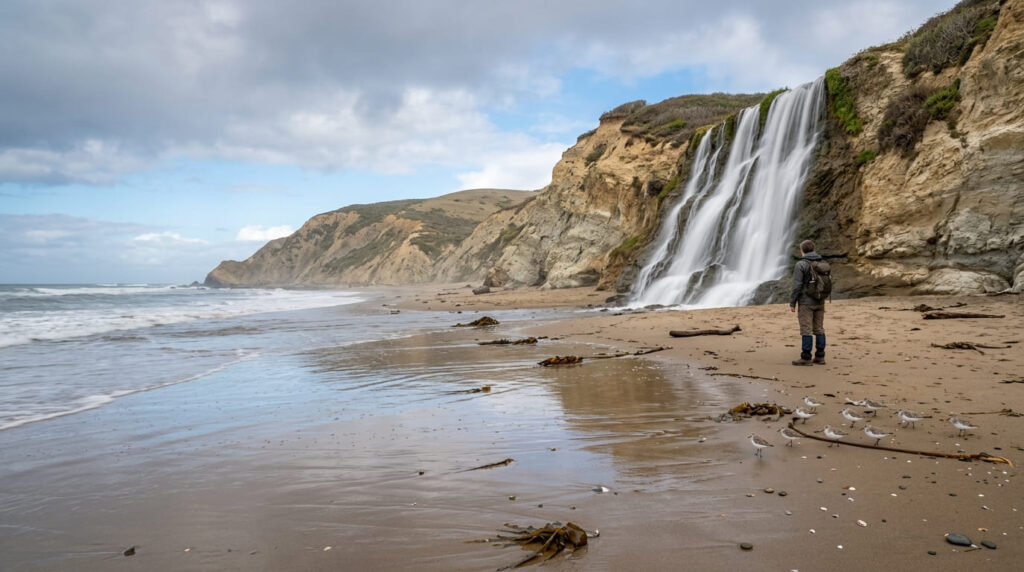
Without recent rain, Alamere Creek can slow to barely a trickle over the bluff; after a storm, it’s one of the most dramatic sights on the California coast.
Practical tips: access and best timing
Per the National Park Service, the official route from the Palomarin Trailhead runs 13.2 miles round trip via Wildcat Campground and the beach; it is a long route, but avoids the unofficial “shortcut” trail down eroding, unstable cliffs that the NPS explicitly discourages and that many older guides still describe as the standard route.
You must time your visit with low tide; if waves are already reaching the base of the bluffs when you arrive, do not attempt to reach the falls. The final approach along the beach and any social trail sections can turn slick after rain, so sturdy, grippy footwear matters more here than on most of this list. For more of the immediate coastline, see our Marin coastline trail guide.
Cataract Falls Trail (Marin County)
Why it made this list: a dozen-cascade chain that comes alive after storms
Cataract Falls is widely considered the Bay Area’s single best waterfall hike, with a chain of cascades, described variously as eight to a dozen depending on how they’re counted, tumbling through a mossy, fern-draped forest on Mount Tamalpais’s northern flank. After a good rain, the difference between the upper and lower falls becomes especially noticeable, since they respond to runoff at different rates.
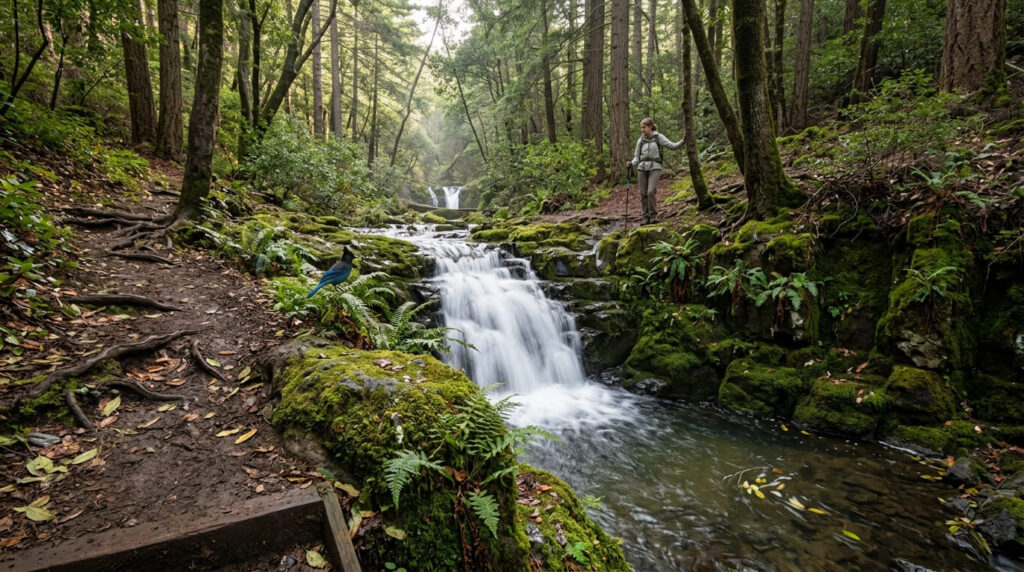
Practical tips: access and best timing
The most common version runs 2.6–3.2 miles round trip from the Alpine Lake trailhead to Laurel Dell picnic area and back, with a longer 7-mile loop option via the High Marsh Trail for those with more time. There’s no fee or permit required to park at the Cataract Falls trailheads, but parking fills up quickly on weekends. The lower stairs get slippery when wet, so trekking poles help. For more Mount Tam options, see our Mount Tamalpais trail guide.
McWay Falls Trail (Monterey County, Big Sur)
Why it made this list: one of the only waterfalls in California that drops directly onto a beach
McWay Falls is an 80-foot waterfall that free-falls onto the sand of a private cove at Julia Pfeiffer Burns State Park, flowing year-round but swelling visibly after rain. It’s one of the most photographed spots on the entire Big Sur coast.
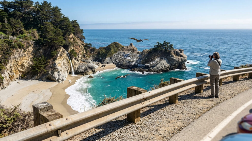
Practical tips: access and best timing
The McWay Falls Overlook Trail, the short walk that gets you close, remains closed for a long-term retaining wall repair project that California State Parks expects to continue through 2026. You can still see the falls from a Highway 1 pullout, but not from inside the park. The beach itself has always been closed to hikers regardless; this has only ever been an overlook view, even when the trail is fully open. For more of the coastline, see our Big Sur trail guide.
Feather Falls Trail (Butte County)
Why it made this list: one of the tallest waterfalls in California
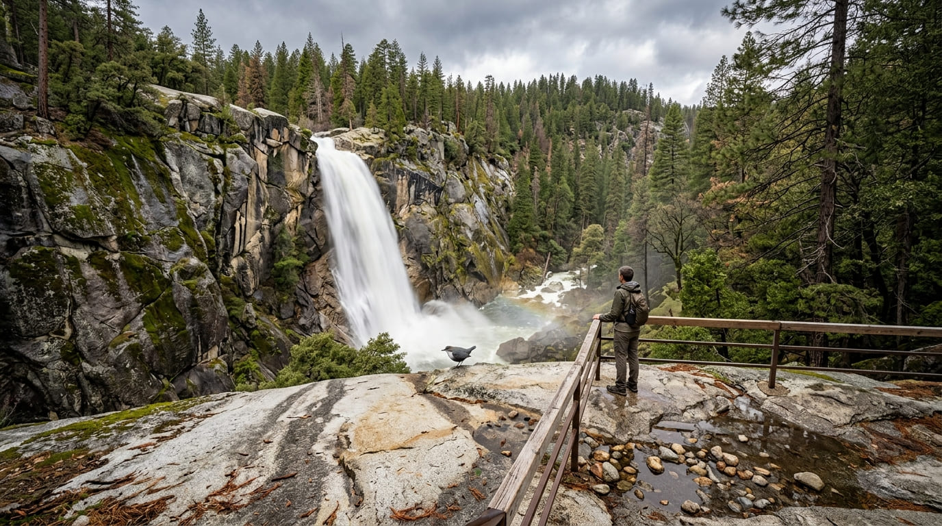
Feather Falls drops 410 feet in a single plunge, a height confirmed by the U.S. Forest Service’s own scenic area page and the USGS, not the roughly 640 feet sometimes quoted online, which traces back to an old, since-corrected estimate.
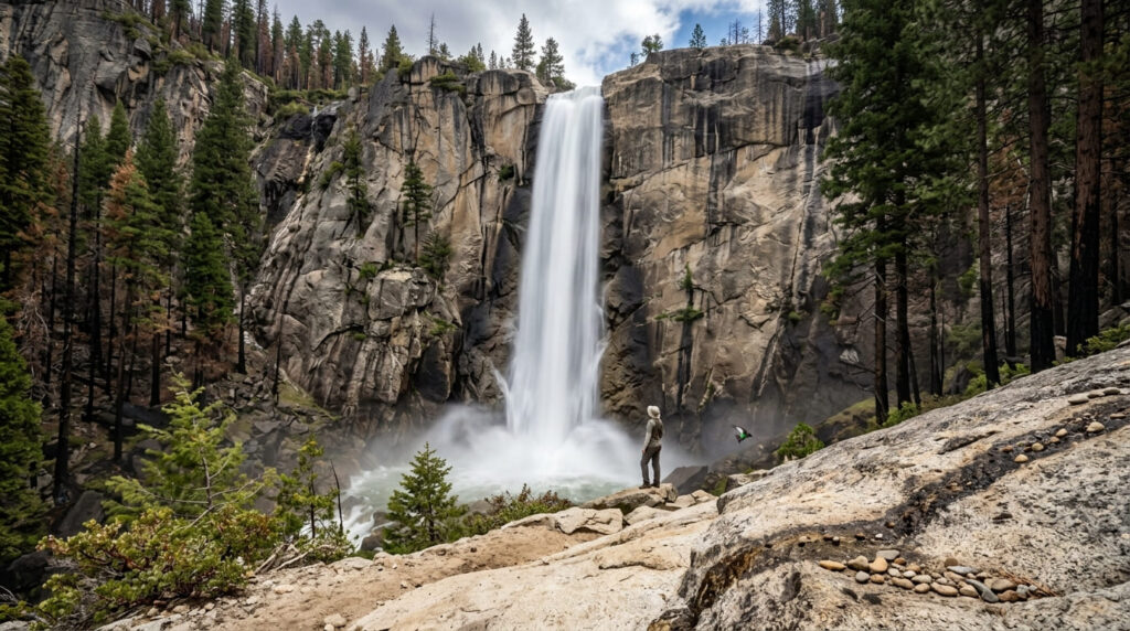
It’s still one of the tallest year-round waterfalls in the state, and dramatically more powerful in the weeks following Sierra foothill storms.
Practical tips: access and best timing
The loop runs roughly 8–9 miles combining the upper and lower trail sections, with elevation gain estimates ranging from about 1,100 to 1,700 feet depending on the source and exact route. It’s free, with no permit required, in Plumas National Forest.
The trail officially reopened in late 2025 following extensive post-fire restoration. However, because the 2020 North Complex Fire burned much of the tree canopy, the route is now fully sun-exposed; bring considerably more water and sun protection than older trip reports suggest. (Note that while the trail is open, the campground remains unbuilt).
Berry Creek Falls Trail (Santa Cruz County)
Why it made this list: one of the most photographed waterfalls in the Bay Area, at its best after storms
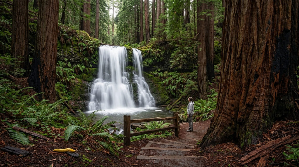
Berry Creek Falls is widely regarded as one of the Bay Area’s most scenic waterfalls, framed by old-growth redwoods in Big Basin Redwoods State Park, with a flow that historically responded quickly to winter rain.
Practical tips: access and best timing
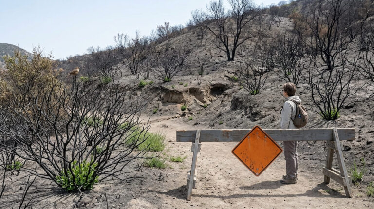
As of the most recent status check, the falls are not currently reachable. Big Basin’s post-CZU-fire recovery has been gradual and uneven, and the waterfall corridor specifically remains closed; Skyline-to-the-Sea Trail is open heading north from the main day-use area, but the southern section toward Berry Creek Falls is closed.
This is a step beyond the general “limited access” note that applies to Big Basin’s easier trails, like the Redwood Loop covered in our summer hiking guide. Check California State Parks’ Big Basin page or our trail closures guide before planning a trip around this one; it’s worth knowing about for when it does reopen, but not worth the drive today.
Horsetail Falls Trail (El Dorado County)
Why it made this list: a dramatic granite-slab cascade near Lake Tahoe
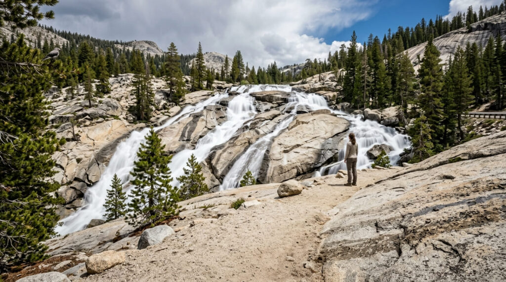
Horsetail Falls sheets down exposed granite slabs at the edge of Desolation Wilderness, visible from Highway 50 itself. Height estimates conflict across sources: Wikipedia cites 791 feet across multiple stages, while other write-ups describe it as closer to 500 feet, likely a function of how the multi-tiered cascade gets measured, so this guide presents the range rather than a false-precision single number.
Practical tips: access and best timing
The hike to the base is short, roughly 2 miles round trip from the Twin Bridges/Pyramid Creek trailhead off Highway 50, with a $10 parking fee. Desolation Wilderness requires entry permits year-round; day-use permits are typically free and self-issued at the trailhead, but you should verify current requirements before heading out.
The story here is safety, not scenery: this trail sees a fatality roughly every couple of years, almost always from people climbing onto wet granite near the falls for a photo. Our terrain hazards guide covers exactly this kind of wet-rock risk in more depth; after rain or snowmelt, stay well back from the creek and don’t approach the slabs. For more of the area, see our El Dorado County waterfall trail guide.
The honest bottom line
If you want the single most dramatic post-storm transformation, Escondido Falls delivers the biggest before-and-after for the least effort. If you want the rarest sight on this list, Alamere Falls’ tidefall is worth the long hike.
But two of these seven, McWay Falls and Berry Creek Falls, aren’t fully accessible right now, and Horsetail Falls carries documented fatality risk that deserves more respect than the dramatic photos suggest. Check current conditions before any of these, especially right after a storm when trail and road conditions change fastest.
Frequently asked questions about California waterfalls after rain
How soon after rain do California waterfalls peak?
Most seasonal waterfalls peak 24 to 48 hours after a storm passes, once runoff has fully worked its way through the watershed; hiking the same day it rains often means muddier trails and less dramatic flow than waiting a day or two.
Are trails safe to hike right after a storm?
Not always; wet granite, slick stairs, swollen creek crossings, and loose or muddy trail surfaces are all more dangerous immediately after rain, so waiting a day for trails to firm up is often the safer and more rewarding choice.
Which California waterfalls flow year-round vs. seasonally?
Larger, spring-or-snowmelt-fed waterfalls like McWay Falls and Feather Falls flow year-round with seasonal swings in volume, while smaller rain-dependent falls like Escondido Falls can dry to a trickle or stop entirely by late summer.
Is it dangerous to hike near waterfalls after rain?
Yes, more than usual; wet rock is dramatically more slippery than it looks, and trails like Horsetail Falls have fatality histories tied specifically to people approaching slick granite near moving water.
How do you find out how much rain a trail area got?
County and National Weather Service rainfall totals, along with recent AllTrails or park-agency trail condition reports, are the most reliable way to gauge both how much a waterfall will have swelled and how muddy or hazardous the trail itself might be.
What is the tallest waterfall in California?
Yosemite Falls, at 2,425 feet, is the tallest in California and among the tallest in North America; among the trails on this list, Feather Falls’ verified 410-foot drop is one of the tallest outside Yosemite.