The 5 Best Hiking Trails in Big Sur, From a Waterfall That Drops Onto a Private Beach to Purple Sand at Sunset
Big Sur doesn’t need much introduction, but here’s the short version for these five trails specifically: McWay Falls is the single most photographed spot on this coastline, Soberanes Canyon is the shaded redwood counterpart to all that open coastal scenery, and Pfeiffer Beach is worth timing deliberately around sunset rather than treating as a quick stop. All five Best Hiking Trails in Big Sur sit within a short drive of each other along Highway 1, between Carmel and points south.
Disclosure: Please note that some of the links below are affiliate links and at no additional cost to you, I may earn a commission. Know that I only recommend hiking gear I personally stand behind; when you use my affiliate links, it helps me run this blog and keep all of this content free of charge for readers (like you).
Two Julia Pfeiffer Burns State Park trails, two Garrapata State Park trails, and Pfeiffer Beach’s short walk to Keyhole Rock make up this roundup. I’ll flag real fees and current access status for each; Big Sur’s roads and trails have a well-earned reputation for closures, so “is it actually open” matters more here than on most California hikes.
Key takeaways
- The iconic shot, currently obstructed: McWay Falls; its own overlook trail is closed for repairs; see below for where to actually view it right now.
- The fuller-day alternative at the same park: Ewoldsen Trail (only the western half of the loop is open), and the real hike if McWay Falls’ short walk left you wanting more.
- Best shaded canyon hike: Soberanes Canyon, redwoods and creek, open as a 1.25-mile out-and-back.
- Best wildlife-viewing bluffs: Soberanes Point, winter gray whale migration, land-based and free.
- Most photographically singular: Pfeiffer Beach, purple sand and a rock arch that frames the sunset on clear winter evenings.
- Fees and access vary trail to trail here more than almost anywhere else in California; my guide to terrain hazards on California trails is worth a look given how many of these routes run along eroding coastal cliffs.
McWay Falls Trail (Julia Pfeiffer Burns State Park)
Trailhead access and parking at Julia Pfeiffer Burns State Park (day-use fee)
The park’s small lot sits directly off Highway 1 and fills fast on any clear day; a day-use fee applies (commonly cited around $10). Right now, the Overlook Trail itself is closed for a retaining wall repair project expected to continue through 2026.
What you’ll see: an 80-foot waterfall dropping directly onto a private beach
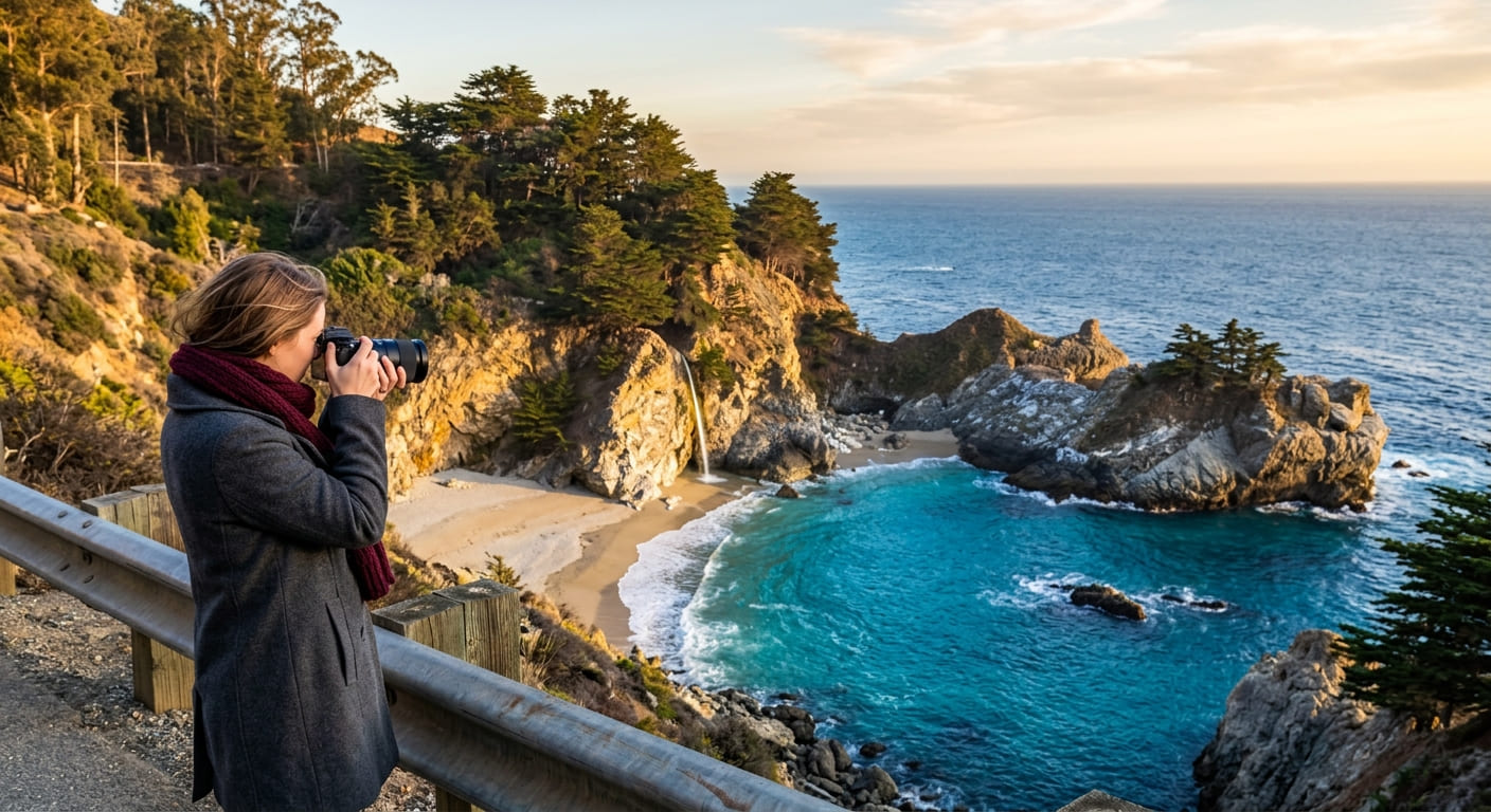
McWay Falls is one of the only waterfalls in California that free-falls straight onto a beach, but the cove itself has always been closed to visitors, viewable only from the overlook trail above. With that trail currently closed, the falls are visible from a small pullout on Highway 1 instead, a real but noticeably more distant view than the trail normally offers.
Best time to hike McWay Falls: midday for the clearest overlook light
This timing advice is written for when the trail reopens; the falls face a direction that photographs best around midday. For now, check current status before planning a trip specifically around this stop.
Ewoldsen Trail (Julia Pfeiffer Burns State Park)
Trailhead access and parking at the same Julia Pfeiffer Burns entrance
Same lot and fee as McWay Falls, but head inland into the canyon instead of toward the coastal overlook. Confirmed open as of the same current park update.
What you’ll see: a redwood canyon loop with ocean overlooks
A genuine climb through redwood forest to ridge-top ocean overlooks, considerably more elevation and forest scenery than the short McWay Falls walk at the same park, and the trail to actually stretch your legs on if you’re at Julia Pfeiffer Burns for more than a photo stop.
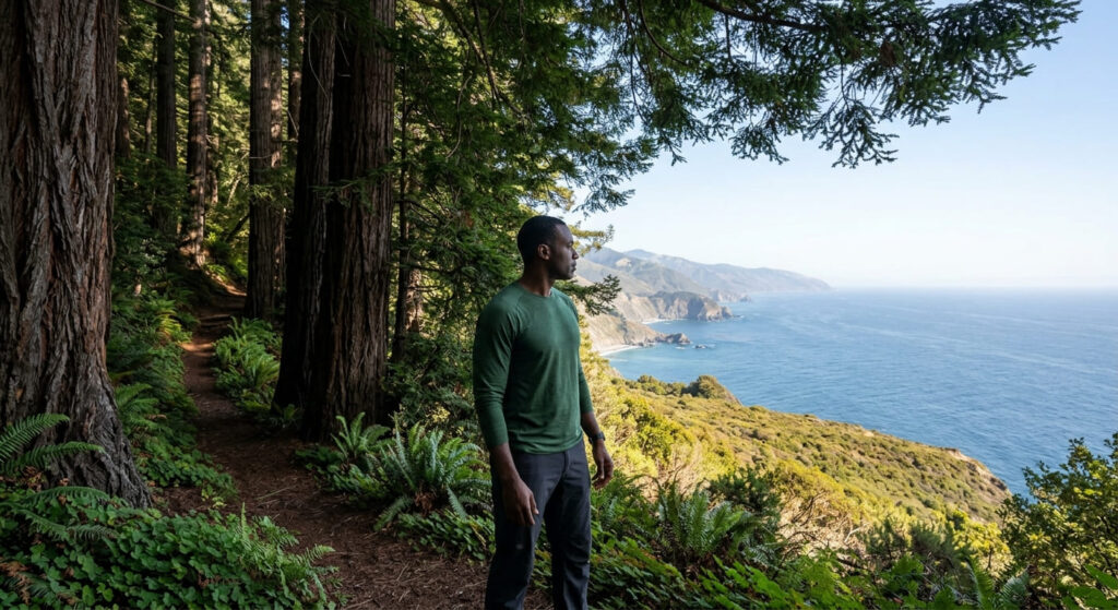
Best time to hike the Ewoldsen Trail: a longer alternative to the McWay Falls overlook
Worth doing specifically because McWay Falls’ own trail is currently closed; this is the real hike at this park right now, not just the fuller-day option it’s normally billed as.
Soberanes Canyon Trail (Garrapata State Park)
Trailhead access and parking at Garrapata State Park (free)
A gated trailhead on the east side of Highway 1, across from Gate 8 of the Garrapata coastal trail, the only no-fee trailhead in this guide, and the source of its single highest-search-volume entity.
What you’ll see: a redwood-lined canyon climbing into the Santa Lucia Range
The trail runs about 1.25 miles one-way into a shaded canyon of coast redwoods and giant chain ferns, genuinely different from the open coastal character of everything else in this guide. The historic full loop via Rocky Ridge has been closed since 2016 due to washed-out trail sections; this is a stable, long-standing closure, not a new one, so plan on an out-and-back rather than a loop.
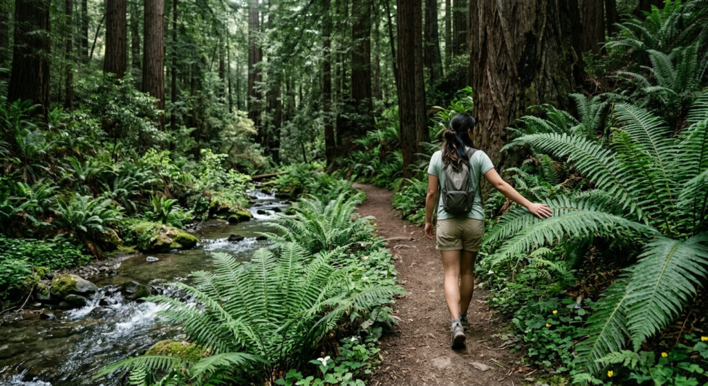
Best time to hike Soberanes Canyon: spring for wildflowers along the creek
Spring brings the best wildflower display along the creek; the shaded canopy also makes this a genuinely more comfortable option than the exposed coastal trails on a hot day.
Soberanes Point Trail (Garrapata State Park)
Trailhead access and parking at the Garrapata State Park coastal lot
A separate free pullout from the Soberanes Canyon trailhead at the same park, on the west side of Highway 1 heading toward the bluffs rather than inland.
What you’ll see: whale-watching bluffs and a rocky point
Open coastal bluffs and a rocky headland deliver some of the best land-based whale watching in this entire guide, alongside sea lions, harbor seals, and sea otters in the water below.
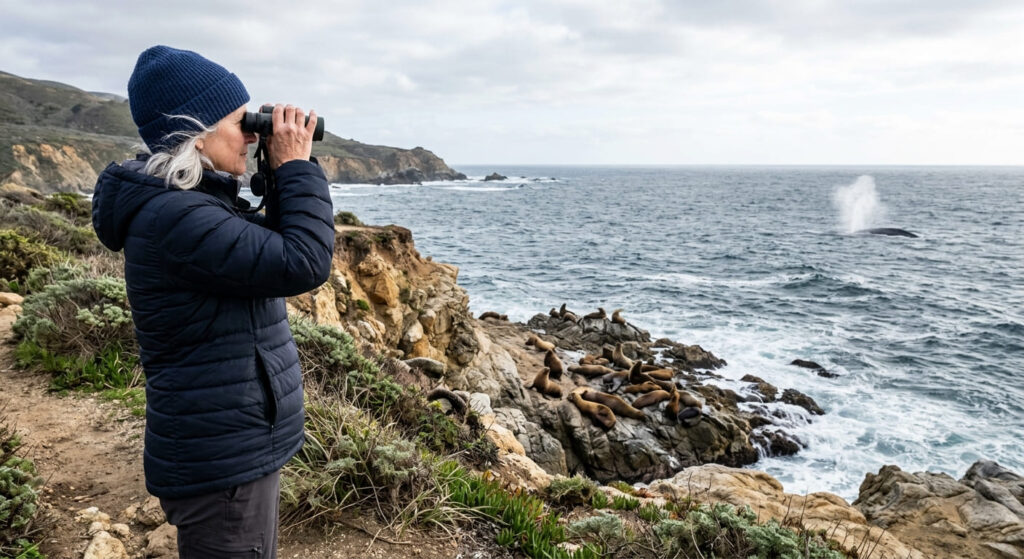
Best time to hike Soberanes Point: winter for gray whale migration
Winter gray whale migration is the defining reason to time a visit here specifically; the bluffs work well any season, but whale sightings are the real seasonal draw.
Pfeiffer Beach: Keyhole Rock Trail
Trailhead access and parking at Pfeiffer Beach (fee road)
A narrow, easy-to-miss one-lane road off Highway 1 leads down to a small lot (about 65 spaces); a $15 per-vehicle fee applies, and the lot fills early, especially in the hour or two before sunset.
What you’ll see: purple sand and a rock arch that frames the setting sun
Manganese garnet deposits give patches of the sand a genuine purple tint, and offshore, Keyhole Rock’s natural arch is the beach’s signature feature. Swimming isn’t safe here given the surf, but walking the sand and watching waves surge through the rock formations is the point.
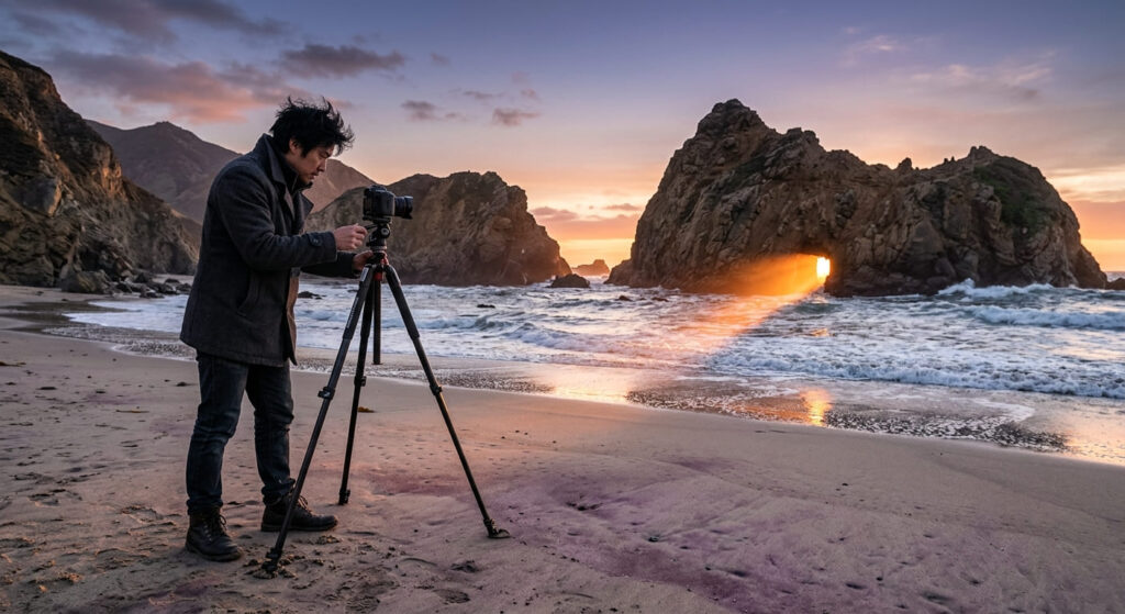
Best time to hike Pfeiffer Beach: sunset on clear winter evenings for the Keyhole effect
From roughly mid-December through late January, the setting sun aligns with the arch on clear evenings, sending a beam of light through the opening, a genuinely rare effect that draws photographers specifically for this narrow window. Arrive at least 90 minutes before sunset if you’re chasing it.
The trail I’d actually start with
Given the current closure, start with the Ewoldsen Trail rather than McWay Falls itself; you’ll still get the Highway 1 pullout view of the falls on the drive, plus a real hike at the same park. Soberanes Canyon is the pick for shade and redwoods, Soberanes Point for whale season, and Pfeiffer Beach deserves its own trip timed to sunset rather than a rushed stop between the others.
If you’re continuing up the coast, Point Lobos sits about 20 minutes north and pairs naturally with a Big Sur day. For more of California’s best ocean-view hiking beyond this stretch, my complete Big Sur destination guide covers the wider area beyond these five trails. For the rest of what this county offers, my Monterey County hiking guide ties it all together.
Frequently asked questions
What hiking trails are open in Big Sur?
As of this writing, the Ewoldsen Trail (only the western half of the loop is open), Soberanes Canyon Trail (to about 1.25 miles in), Soberanes Point Trail, and Pfeiffer Beach are all open. Always check current status before a trip, since closures here change with weather and repair schedules.
What hiking trails are closed in Big Sur?
The McWay Falls Overlook Trail is currently closed for a retaining wall repair project expected to continue through 2026. The Rocky Ridge portion of the Soberanes Canyon loop has been closed since 2016 and remains so.
Is there a fee to hike at Julia Pfeiffer Burns State Park?
Yes, a day-use fee applies, commonly cited around $10, worth confirming the current exact amount with California State Parks directly.
Is Soberanes Canyon Trail hard?
No, genuinely moderate, a shaded, mostly gradual 1.25-mile one-way walk into the canyon. It only becomes difficult if you attempt the closed Rocky Ridge section, which isn’t recommended.
Can you walk down to McWay Falls beach?
No. The cove has always been closed to public access, viewable only from the overlook trail above, which is itself currently closed, leaving the Highway 1 pullout as the only current viewing option.
Is Pfeiffer Beach parking free?
No, a $15 per-vehicle fee applies at the small lot, which fills early, especially around sunset.