The 5 Best Hidden Gem Hiking Trails in Los Angeles County
If you’ve already worked through the classic city trails, the San Gabriel Mountains, and the coast from Malibu to Palos Verdes, this list of hidden gem hiking trails in Los Angeles is for you. These five trails don’t show up in most “best of LA” guides, and that’s the point: a Nazi-sympathizer ruin turned graffiti canvas, the actual site of California’s first gold discovery, a park built over an active oil field, and two Santa Clarita canyons most Angelenos have never heard of. If you’re interested in the history behind California’s trail network generally, this post provides more details, mile for mile, than any other in this batch.
Disclosure: Please note that some of the links below are affiliate links and at no additional cost to you, I may earn a commission. Know that I only recommend hiking gear I personally stand behind; when you use my affiliate links, it helps me run this blog and keep all of this content free of charge for readers (like you).
One access note up front, and it’s a more complicated one than usual: Murphy Ranch’s status right now is genuinely mixed depending on which approach you take, and I want to be upfront about that before you plan a trip around it.
Key takeaways
- The famous one, access-uncertain right now: Murphy Ranch, one approach is officially closed for fire recovery, the other has an unclear current status. Check before you go.
- The gold rush site: Placerita Canyon, genuinely predates the 1848 California Gold Rush by six years, and it’s shaded and family-friendly.
- The urban surprise: Kenneth Hahn State Recreation Area, a park built over a former oil field, with some of the best skyline views in this entire LA County series.
- The geology lesson: Towsley Canyon, tar seeps, a slot canyon called the Narrows, and old film-location history.
- The pastoral one: Cheeseboro Canyon, quiet valley oak woodland that feels nothing like the rest of this urban county.
- This entire post skews toward repeat visitors. If you’re new to LA hiking, start with my city trails guide first; these five reward you for already knowing the famous names.
Quick-glance comparison
| Trail | Distance (RT) | Elevation Gain | Current Status |
|---|---|---|---|
| Murphy Ranch | 3.4–3.85 mi | ~325–633 ft | Open |
| Placerita Canyon | 1.4–4.8 mi (route-dependent) | ~213–577 ft | Open |
| Kenneth Hahn Loop | 2–2.8 mi | ~210–400 ft | Open |
| Towsley Canyon | 2.1–5.4 mi (route-dependent) | ~416–1,110 ft | Open |
| Cheeseboro Canyon | 2–8.4 mi (route-dependent) | ~118–587 ft | Open |
Most of these ranges reflect a genuine choice of shorter or longer loop options at each park, not conflicting data, worth knowing before you commit to a distance.
Murphy Ranch: LA’s strangest ruin, with a genuinely unclear way in right now
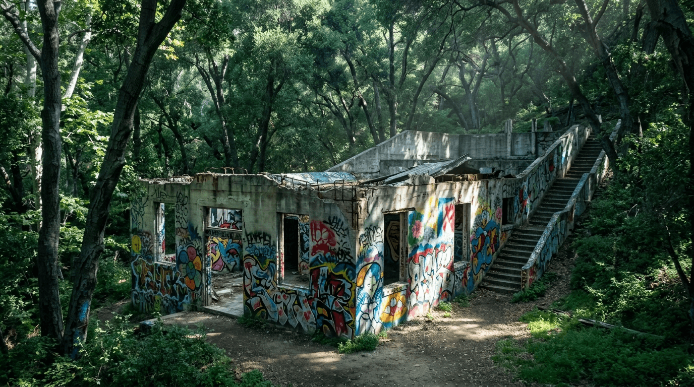
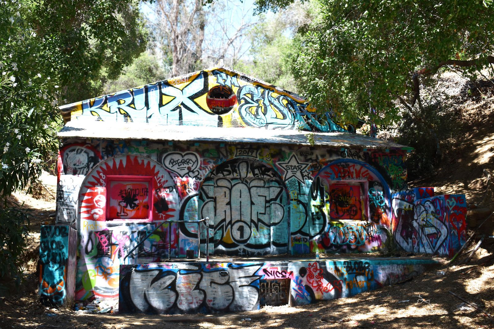
This is the trail everyone eventually asks about once they’ve exhausted the famous names, a 1930s Nazi-sympathizer compound, abandoned, raided by federal authorities in 1941, later an artists’ colony, now a graffiti-covered ruin in a canyon most visitors have never heard of.
Trailhead access: two routes, two different current pictures
The traditional hiker’s approach is Sullivan Ridge Fire Road, from street parking at Capri Drive and Casale Road in Pacific Palisades, no fee, no permit. The alternate approach is Rustic Canyon Trail, starting near the polo field at Will Rogers State Historic Park. As of the state park’s most recently updated closure order (effective June 12, 2026), Rustic Canyon Trail is explicitly listed as closed due to Palisades Fire impacts.
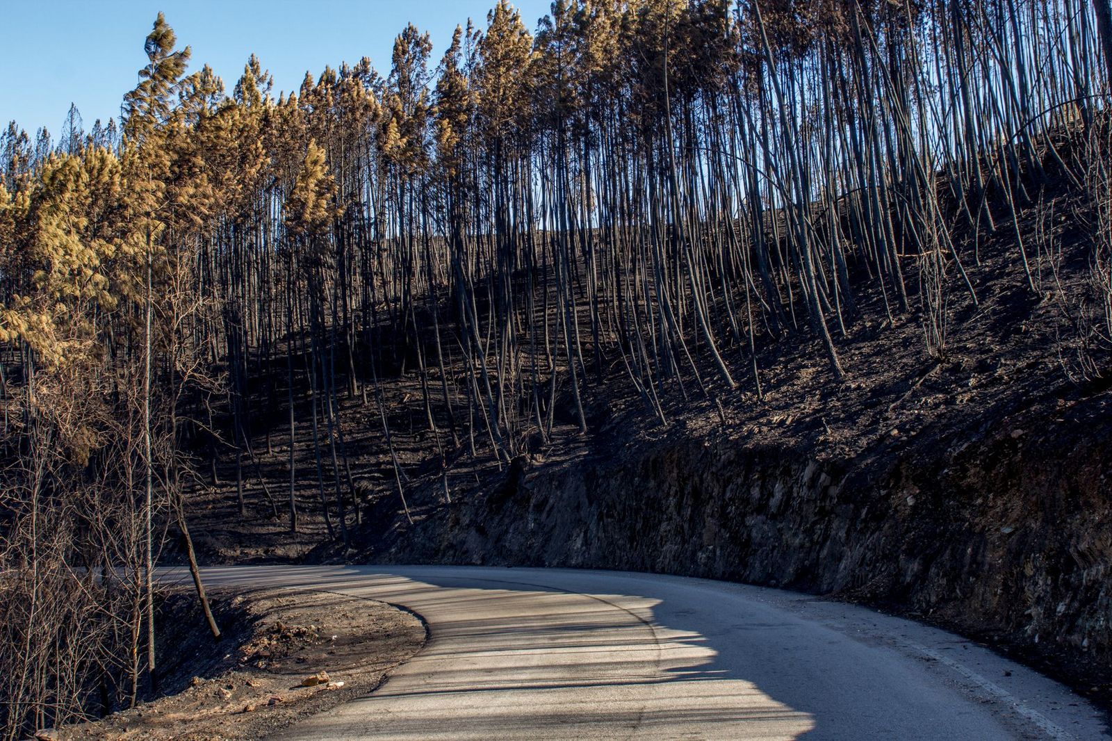
I could not find a similarly current, explicit confirmation for the Sullivan Ridge Fire Road approach; the most recent specific report I found was from December 2025. Given how much of this immediate area burned, check Topanga State Park’s current closure page before you go, regardless of which route you’re planning to take.
Difficulty, distance, and elevation gain, for whichever route is open
Via Sullivan Ridge Fire Road, it’s roughly 3.85 miles round trip with about 325 feet of elevation change. Via Rustic Canyon from Will Rogers, expect closer to 3.5 miles with more elevation swing (around 633 feet) and a rougher, less-maintained path with creek crossings.
What you’ll see: an abandoned Nazi compound and its graffiti-covered ruins
Built in the 1930s by Nazi sympathizers preparing a self-sufficient stronghold, the ranch was raided and shut down in 1941, briefly became an artists’ colony in the 1960s and 70s, and was abandoned again after a 1978 fire. What remains, a power station, long concrete staircases, crumbling walls, is now covered in decades of graffiti. Some of the more dangerous structures were demolished by the city in 2016 for safety reasons, so don’t expect the full compound you may have seen in older photos.
Best time to hike Murphy Ranch: daytime, in a group, and only once you’ve confirmed access
This has historically been one of the more isolated trails on this list, with real cell service gaps in Rustic Canyon and a trail I’d point solo hikers toward my solo hiking guide before attempting alone.
Placerita Canyon: where California’s gold rush actually started
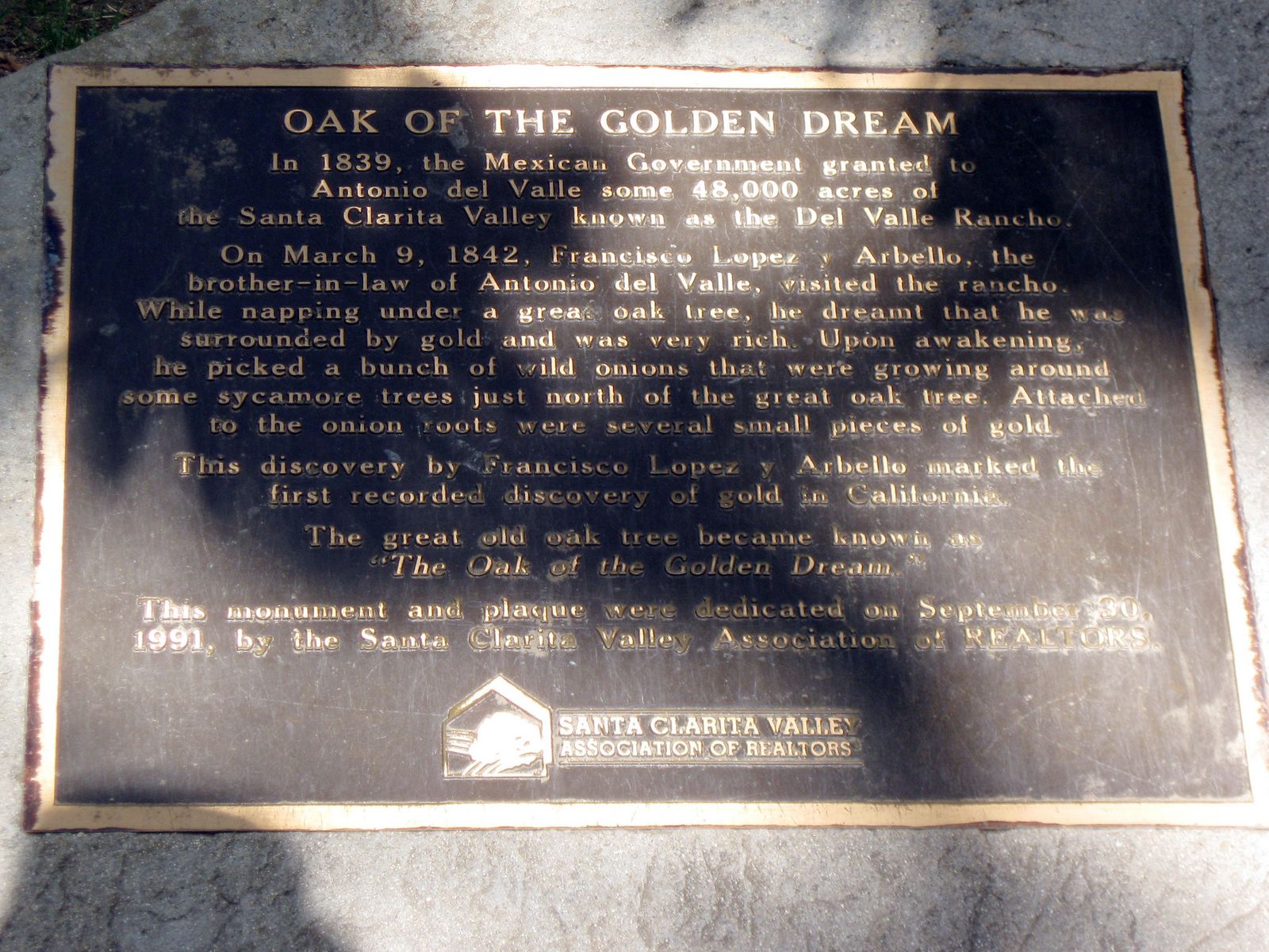
Six years before Sutter’s Mill, this shaded canyon in Santa Clarita is where a rancher napping under an oak tree found gold clinging to wild onion roots he’d dug up for a snack. That’s not local legend, it’s the accepted origin story of the Oak of the Golden Dream.
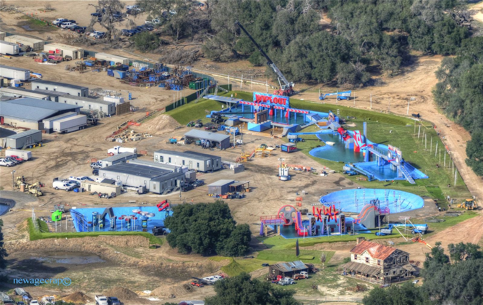
Trailhead access: free nature center parking with restrooms
Placerita Canyon Nature Center has a free lot, restrooms, and a small visitor center, one of the more amenity-rich trailheads in this entire hidden-gem cluster.
Difficulty, distance, and elevation gain: pick your version
The easiest option is the Nature Center Loop at 1.4 miles and 213 feet of gain, much of it paved and wheelchair-accessible. The classic Canyon Trail runs about 2.5 miles with under 300 feet of gain. Push all the way to the seasonal waterfall and you’re at 4.8 miles round trip with 577 feet of gain.
What you’ll see: oak woodland and the actual 1842 gold discovery site
Beyond the Oak of the Golden Dream, you’ll pass the Walker Cabin (built 1920) and, on the longer route, a seasonal waterfall that runs best after winter rain.
Best time to hike Placerita Canyon: genuinely any season
Dense oak canopy keeps this shaded and comfortable nearly year-round, one of the few trails in this entire LA County series I’d recommend without much seasonal caveat.
Kenneth Hahn State Recreation Area: a park built on top of an oil field
If you skipped this one because you already did Baldwin Hills Scenic Overlook in my city-trails post, don’t; Kenneth Hahn is a different, quieter part of the same Baldwin Hills, and it earns its spot here specifically as the uncrowded alternative.
Trailhead access: multiple free lots, weekend vehicle fee
Parking is generally free, though a $6 per-vehicle fee applies on weekends and holidays at the main entrance. The park is closed on Mondays and Tuesdays, worth knowing before you plan a weekday visit.
Difficulty, distance, and elevation gain on the Community Loop
The standard Community Loop runs 2–2.8 miles with roughly 200-400 feet of gain, connecting several named trail segments through the park.
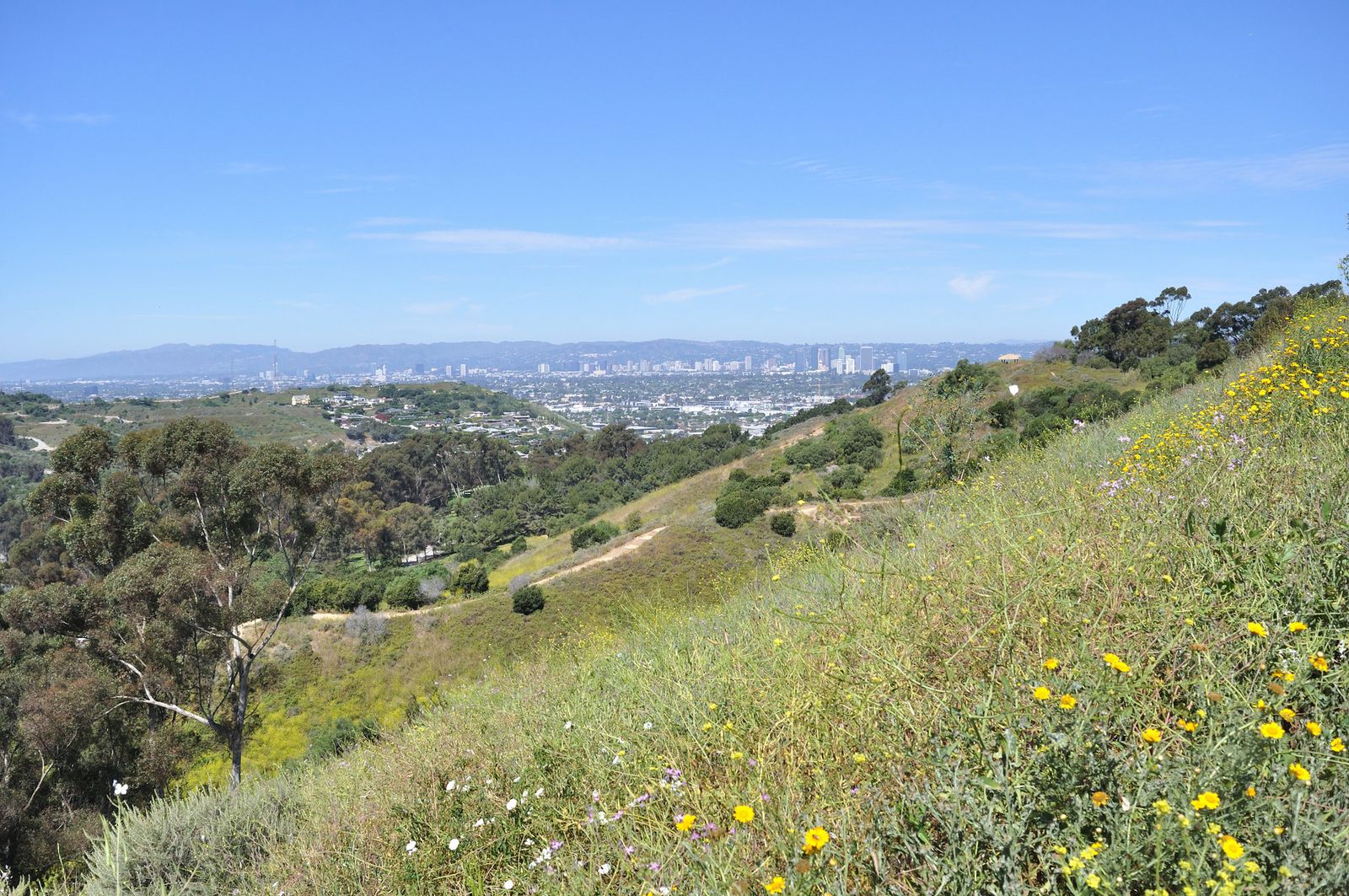
What you’ll see: an old oil field, a man-made lake, and skyline views
The park sits directly beside the still-active Inglewood Oil Field, a working reminder that this “L.A.’s Central Park” nickname is a genuine reclamation story, not just marketing. Inside the park, Gwen Moore Lake and a Japanese garden sit not far from views stretching to downtown LA and, on clear days, the San Gabriel Mountains.
Best time to hike Kenneth Hahn: a genuinely uncrowded alternative to Baldwin Hills and Runyon
This is consistently one of the least-crowded parks in this entire series, even on weekends, worth remembering if the 282 steps at Baldwin Hills Scenic Overlook or the famous Runyon Canyon loop‘s crowds ever wear you out.
Towsley Canyon: tar pits, a slot canyon, and old Western film locations
Ed Davis Park at Towsley Canyon is a genuine “why haven’t more people heard of this” hike, five minutes off the 5 Freeway, with geology most visitors don’t expect from a Santa Clarita park.
Trailhead access: free and paid lots off The Old Road
Take the Calgrove exit off I-5 to Ed Davis Park. Two lots near the entrance are free; a smaller lot deeper in the park charges a small fee, though most visitors never need it.
Difficulty, distance, and elevation gain: short loop or the full Towsley View Loop
The Towsley Canyon Short Loop runs about 2.1 miles with 416 feet of gain. The full Towsley View Loop (also called the Don Mulally Trail) is the real draw at roughly 5.4 miles and 1,075–1,110 feet of gain, a meaningfully bigger climb than the heading file’s original estimate suggested, so budget accordingly.
What you’ll see: The Narrows, tar seeps, and a historic Spanish-style lodge
About 0.9 miles in, you’ll pass through The Narrows, a slot-like canyon of upturned sedimentary rock, alongside naturally bubbling tar and asphalt seeps once used by the Tataviam people. Towsley Lodge, a Spanish-style ranch house available for private events, sits atop a grassy knoll nearby.
Best time to hike Towsley Canyon: cooler months for the exposed upper ridge
The canyon floor stays reasonably shaded, but the upper loop sections are exposed, worth timing for cooler weather, much like Echo Mountain in my San Gabriel Mountains post.
Cheeseboro Canyon: the quietest, most pastoral trail on this entire list
If everything else in this LA County series feels urban or coastal, Cheeseboro Canyon is the outlier, rolling valley oak woodland and a former cattle ranch that feels more like Central California than Los Angeles County.
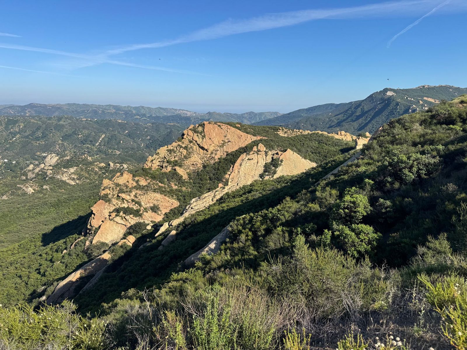
Trailhead access: a free NPS lot off Chesebro Road, Agoura Hills
The trailhead sits inside the Santa Monica Mountains National Recreation Area, with a free parking lot at the end of Chesebro Road, no fee, unlike most of Post 3’s coastal trailheads.
Difficulty, distance, and elevation gain: several honest options
The Lower Cheeseboro Canyon Loop is an easy 2 miles with 118 feet of gain, family-friendly and mostly flat. The standard out-and-back Cheeseboro Canyon route runs 8.4 miles with about 587 feet of gain. Full ridge-and-canyon loops push past 9.5–10.8 miles with over 1,100 feet of gain, for anyone wanting a genuine training day.
What you’ll see: valley oaks, wildflowers, and a former cattle operation
This canyon was part of the historic Modelo Ranch cattle operation, and the wide, gentle trail still winds through some of the largest stands of valley oak in the Santa Monica Mountains. Spring brings wildflowers; trailside reviews also mention regular rattlesnake sightings.
Best time to hike Cheeseboro Canyon: spring for wildflowers, early for shade
There’s minimal shade along most of this trail, so an early start matters more here than the gentle elevation profile might suggest.
Which of these five is worth your time first
If you want the story everyone will ask you about later, Murphy Ranch is unmatched, just confirm access before you drive out. If you want a sure thing with real history and shade, Placerita Canyon is the safest bet on this list. And if you’re just looking for the quietest possible version of a Los Angeles hike, Cheeseboro Canyon is about as far from Runyon Canyon’s crowds as this county gets.
Frequently asked questions
What are the best hidden gem hiking trails in Los Angeles County?
Murphy Ranch, Placerita Canyon, Kenneth Hahn State Recreation Area, Towsley Canyon, and Cheeseboro Canyon all offer a genuinely different experience from LA’s famous trails, without the same crowds.
Is Murphy Ranch Trail legal to hike, and what is its history?
Yes, hiking to the ruins is legal via the open approach trail, trespassing onto unstable structures themselves is not recommended and is discouraged by signage. The site was a 1930s Nazi-sympathizer compound raided by federal authorities in 1941, later an artists’ colony, and now sits abandoned. Its current trail access is genuinely mixed right now, see the note earlier in this post.
Is Placerita Canyon good for beginners and families?
Yes, especially the Nature Center Loop, which is short, largely paved, and ADA-compliant along its Heritage Trail segment.
Are Los Angeles County’s lesser-known trails safe to hike solo?
Most are, with normal precautions. Murphy Ranch is the exception worth extra caution on, given its isolation and patchy cell service; my guide to solo hiking covers what to plan for on a trail like this.
What is the least crowded hiking trail in Los Angeles County?
Of the five in this post, Kenneth Hahn State Recreation Area and Cheeseboro Canyon are both consistently quieter than Runyon Canyon or Griffith Park, even on weekends.
Do hidden gem trails in LA County require an Adventure Pass?
No, Murphy Ranch, Placerita Canyon, Kenneth Hahn, Towsley Canyon, and Cheeseboro Canyon are all city, county, state, or NPS-managed land, not U.S. Forest Service trailheads, so none of them require a National Forest Adventure Pass.