5 Best Hiking Trails in the Southern Sierra, Kern County, From a Nationally Known Rafting River to a Summit with Mount Whitney in View
Kern County’s Southern Sierra centers on Kernville and the Kern River corridor, the southernmost reach of Sequoia National Forest, a genuinely different landscape than the desert trails covered elsewhere in Kern County, and part of our full Kern County hiking guide. Elevations here run from low chaparral foothills near Kernville up to nearly 10,000 feet along Sherman Pass Road, giving this one county a genuinely wide range of hiking within a short drive. One correction worth flagging upfront: several of these trails are commonly described as requiring a National Forest Adventure Pass, and that’s not accurate for Sequoia National Forest. Discovering the premier Hiking Trails in Southern Sierra territory means enjoying massive elevation shifts without worrying about unnecessary pass fees.
Disclosure: Please note that some of the links below are affiliate links and at no additional cost to you, I may earn a commission. Know that I only recommend hiking gear I personally stand behind; when you use my affiliate links, it helps me run this blog and keep all of this content free of charge for readers (like you).
Key takeaways
- Best river access: Kern River Trail, following a nationally known whitewater rafting river popular with anglers too.
- Best swimming hole: Salmon Creek Falls, a genuine waterfall and swimming spot on a Kern River tributary near Johnsondale.
- Best summit view, no permit required: Sherman Peak, a Southern Sierra summit with a view all the way to Mount Whitney, without the crowds or permit system of the Whitney trails themselves.
- Longest ecological transition: Cannell Trail, a historic pack trail climbing from foothill chaparral into high Sierra forest over 14 miles.
- Best remote waterfall: Nobe Young Falls, a shorter, easier stop on the South Fork Kern River.
- None of these five trails require a National Forest Adventure Pass, that fee system applies to four specific Southern California forests (Angeles, Cleveland, Los Padres, San Bernardino), not Sequoia National Forest.
How these five Southern Sierra trails compare
| Trail | Distance | Difficulty | Fee/Permit | Best for |
|---|---|---|---|---|
| Kern River Trail | Flexible, several miles (network) | Easy-moderate | Free | River access, rafting views |
| Salmon Creek Falls Trail | Short day hike | Easy-moderate | Free | Waterfall, swimming |
| Sherman Peak Trail | A few miles round trip | Moderate | Free | Summit view to Mount Whitney |
| Cannell Trail | ~14 mi round trip | Strenuous | Free | Long ecological transition |
| Nobe Young Falls Trail | Shorter than Sherman Peak | Easy-moderate | Free | Remote waterfall |
Kern River Trail (Kernville)
Trailhead access and parking near Kernville, no pass required
Free trailheads follow the Kern River through Sequoia National Forest near Kernville, part of a broader network of river trails in the area (including the longer Whiskey Flat and River Trail routes) rather than one single fixed path; no National Forest Adventure Pass applies here.
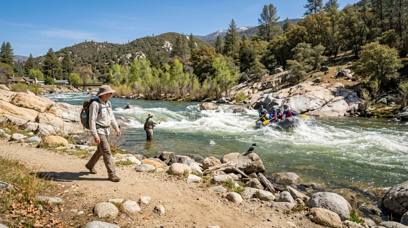
What you’ll see: a river corridor popular for whitewater rafting and trout fishing
The Kern River is a nationally known whitewater rafting destination, and this trail gives you a front-row view of rafters navigating rapids alongside anglers fishing calmer stretches down toward Lake Isabella recreation areas, a genuinely active, multi-use river corridor rather than a quiet backcountry trail.
Shorter sections stay easy and shaded near town, while connecting routes like the Whiskey Flat and River Trails extend the experience much further upriver for hikers who want a longer day.
Best time to hike Kern River Trail: spring for high water, summer for comfortable access
Spring delivers the most dramatic (and most raftable) river flow, driven by Sierra snowmelt; summer brings calmer water and more comfortable trailside temperatures, making both ends of the warm season worth considering depending on what you want to see.
Salmon Creek Falls Trail (Near Johnsondale)
Trailhead access and parking near Johnsondale, Sequoia National Forest, no pass required
A Forest Service trailhead near the small community of Johnsondale serves this trail. Contrary to what some trail listings suggest, no National Forest Adventure Pass is required, that system applies to four specific Southern California forests, not Sequoia National Forest.
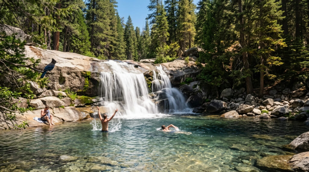
What you’ll see: a waterfall and swimming hole along a Kern River tributary
Salmon Creek Falls delivers a genuine waterfall-and-swimming-hole combination on a tributary of the Kern River, a real recreational draw distinct from the pure scenery focus of the other trails in this guide.
Best time to hike Salmon Creek Falls: summer for swimming, spring for flow
Spring brings the strongest waterfall flow from snowmelt; summer brings warmer, more swimmable water, a familiar tradeoff for seasonal waterfalls throughout this region.
Sherman Peak Trail (Sequoia National Forest)
Trailhead access and parking off Sherman Pass Road, no pass required
A Forest Service trailhead along the scenic, seasonal Sherman Pass Road serves this trail, no Adventure Pass applies here either, the same correction as the other Sequoia National Forest trails in this guide.
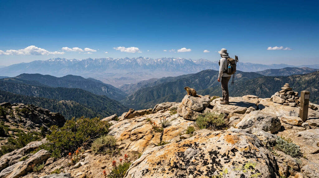
What you’ll see: a Southern Sierra summit with views to the Kern Plateau, and Mount Whitney itself
At nearly 10,000 feet, Sherman Peak looks out over the Kern Trench and the broader Kern Plateau, with the Lower 48’s tallest peak, Mount Whitney, visible in the distance on clear days, a genuine high-Sierra summit view without the permit system or elevation commitment of the Mount Whitney-area trails covered in our Inyo County guide.
Best time to hike Sherman Peak: summer and early fall, once snow clears
Sherman Pass Road is seasonal and typically doesn’t fully open until early summer, check current road status before planning a trip, since this trail simply isn’t reachable while the road remains snow-closed.
Cannell Trail (Kernville)
Trailhead access and parking near Kernville, a historic pack trail
This trail begins about 2 miles north of Kernville on Sierra Way (Mountain Highway 99), following the route of a historic pack trail once used to move livestock and supplies into the high Sierra backcountry, free access, no pass required.
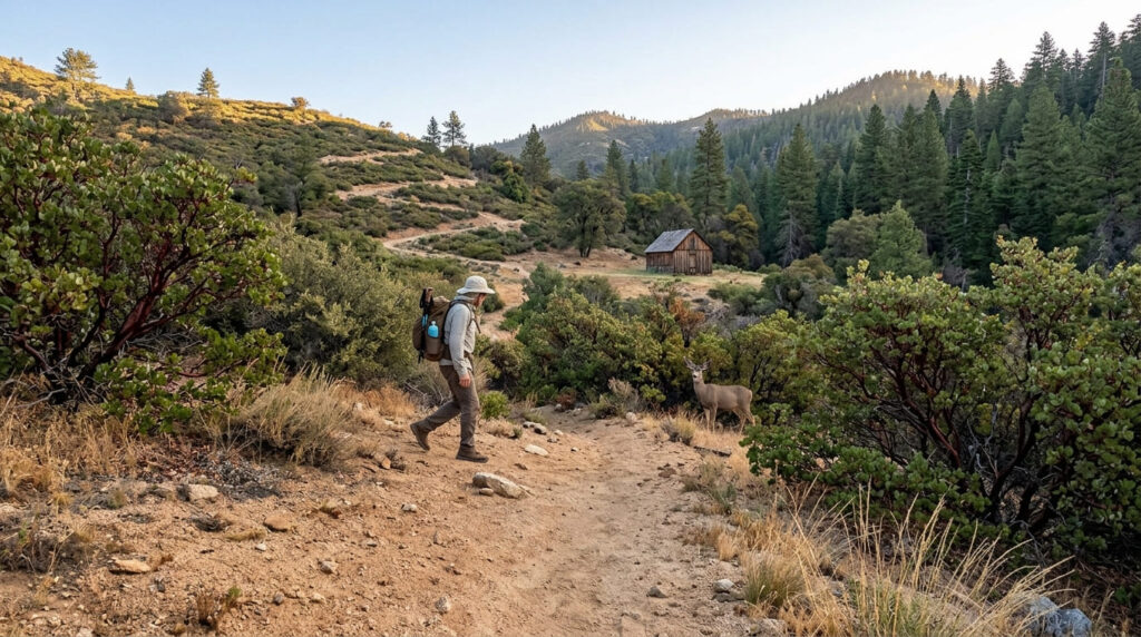
What you’ll see: a long climb from foothill chaparral into high Sierra forest
This is a genuine ecological transition trail, running about 14 miles round trip and climbing from roughly 2,800 feet to 7,200 feet, chaparral and exposed foothill terrain give way to mixed pine and fir forest as you climb, passing the historic Cannell Meadow Forest Service cabin, built in the early 1900s, along the way.
Best time to hike Cannell Trail: spring and fall to avoid extreme foothill heat
The lower sections of this trail are genuinely hot and exposed in summer, spring and fall offer meaningfully more comfortable conditions for the long climb, especially in the trail’s lower chaparral stretches.
Nobe Young Falls Trail (Kern River Area)
Trailhead access and parking off Sherman Pass Road, no pass required
A Forest Service trailhead near Sherman Pass Road serves this trail, a shorter, easier option than the full Sherman Peak summit trail nearby, with the same correction applying: no Adventure Pass is required.
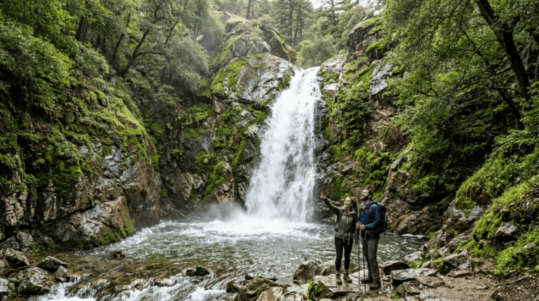
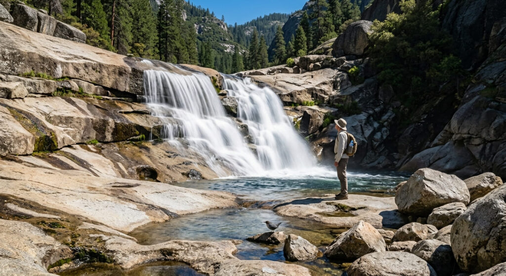
What you’ll see: a waterfall along the South Fork Kern River
Nobe Young Falls sits on the South Fork Kern River, a genuinely different and more remote stretch of the river system than the main Kernville corridor covered earlier in this guide, a shorter, easier stop for hikers who want a waterfall without Sherman Peak’s full summit commitment.
Best time to hike Nobe Young Falls: spring for peak flow
Like most seasonal Sierra waterfalls, spring snowmelt drives the strongest flow here, with a real chance of the falls thinning considerably by late summer in a dry year.
Frequently asked questions about hiking trails in the Southern Sierra, Kern County
Is the Kern River good for rafting?
Yes, it’s a nationally known whitewater rafting destination, with commercial outfitters running trips through the Kernville area alongside the hiking and fishing access covered in this guide.
Do you need an Adventure Pass for Kern County Sierra trails?
No, none of the five trails in this guide require a National Forest Adventure Pass. That system applies to four specific Southern California forests (Angeles, Cleveland, Los Padres, and San Bernardino), not Sequoia National Forest.
Can you swim at Salmon Creek Falls?
Yes, it’s a genuine swimming-hole waterfall on a Kern River tributary near Johnsondale, popular in summer once the water warms up.
Is Sherman Peak Trail hard?
It’s a moderate summit hike with real elevation gain, but it’s genuinely more accessible than it sounds, no permit, no long approach, and a payoff view that includes Mount Whitney on clear days.
Is Cannell Trail a historic pack trail?
Yes, it follows the route of a historic pack trail once used to move livestock and supplies into the high Sierra backcountry, now a roughly 14-mile round-trip hiking route from chaparral foothills to high-elevation forest.
Which Kern County Sierra trail is best for a waterfall hike?
Salmon Creek Falls is the better choice if swimming matters to you; Nobe Young Falls is the better choice if you want a shorter, easier hike with less summer crowding.