Lake Isabella Hiking & Outdoor Guide: Trails, Swimming & Camping
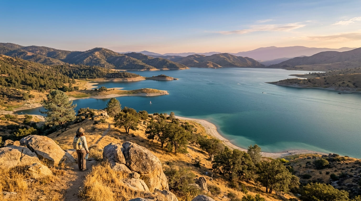
Before the water came, the Kern River Valley held a town called Isabella and another called Kernville. In 1953, the U.S. Army Corps of Engineers closed Isabella Dam where the river’s two forks meet, and both old townsites went under. What rose in their place is Lake Isabella, California, a reservoir of about 11,000 acres sitting near 2,500 feet in the southern Sierra Nevada, ringed by the low, oak-and-pine mountains of the Sequoia National Forest.
Disclosure: Please note that some of the links below are affiliate links and at no additional cost to you, I may earn a commission. Know that I only recommend hiking gear I personally stand behind; when you use my affiliate links, it helps me run this blog and keep all of this content free of charge for readers (like you).
Today Lake Isabella in Kern County sits about 40 miles northeast of Bakersfield, and it works as a front door to the Kern River country: lake-view trails, camping, fishing, windsurfing, and a long, honest conversation about Lake Isabella swimming. This guide covers all of it, plus the lake-level swings, the algae advisories, and the best seasons. It belongs to our Kern County hiking trails guide, and it points you toward the forest above the water.
Lake Isabella at a Glance
| Detail | What to know |
|---|---|
| Location | Kern County, southern Sierra Nevada; about 40 miles northeast of Bakersfield |
| What it is | A reservoir created in 1953 by Isabella Dam on the Kern River |
| Size | About 11,000 acres |
| Elevation | Roughly 2,500 feet |
| Land manager | Sequoia National Forest, Kern River Ranger District (recreation); U.S. Army Corps of Engineers (dam and water levels) |
| Nearest town | Lake Isabella, CA (ZIP 93240); Kernville and Wofford Heights are nearby |
| Getting there | Highway 178 from Bakersfield; Highway 155 from Delano |
| Summer weather | Temperatures can top 100°F |
| Swimming | Permitted at the lake, but algae advisories change by site and season |
Lake, Dam, Town: Sorting Out Lake Isabella, CA
Search for Lake Isabella, CA, and you’ll find three things sharing one name. The lake is the reservoir. The dam holds it back and is run by the Corps of Engineers. The town of Lake Isabella, a community of 3,573 people in the 2020 census, sits at the lake’s southwestern edge, about six miles south of Wofford Heights.
The town began as Isabella in 1893, named for Queen Isabella of Spain while her name was popular during that year’s Columbian Exposition. The post office took the name Lake Isabella in 1957. The reservoir also marks the dividing point between the Upper and Lower Kern River, so the Kern River’s two forks flow in and the water leaves through the dam toward the Lower Kern. Kernville and the town of Lake Isabella both draw visitors with the lake and the river’s whitewater rafting.
Getting to Lake Isabella
From Bakersfield, take Highway 178 up the Kern River Canyon. The drive takes roughly an hour. Highway 155 reaches the lake from Delano on the Central Valley side, and Highway 178 continues east over Walker Pass. Supplies, fuel and food are easiest in the town of Lake Isabella, so stock up before heading to the more remote shoreline campgrounds and trailheads.
Lake Levels: Why the Lake Looks Different Every Year
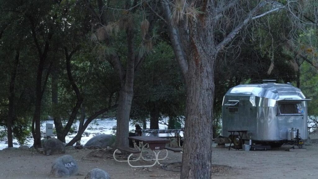
Lake Isabella has a dramatic recent past. In April 2006, engineers found a seepage problem at the auxiliary dam, and the Corps limited how full the lake could get. A multi-year dam safety project raised both dams by 16 feet and added a new emergency spillway, with the major construction finished in 2022 and a ribbon-cutting in April 2023. The lake was then allowed to fill toward its full capacity of roughly 568,000 acre-feet.
Full is rare. Storage depends on each year’s snowpack and on water released downstream. The Corps’ daily report for October 6, 2026 listed about 146,500 acre-feet in storage, roughly a quarter of capacity. A lower lake means longer walks to the waterline and different boat-ramp conditions, so check the Corps’ daily reservoir report and the Forest Service’s recreation alerts before you plan around the shoreline.
The Best Hikes Near Lake Isabella
The Forest Service’s Kern River Ranger District covers 663,000 acres and more than 578 miles of trails, and the best views of the lake come from the hills above it. Distances below come from Forest Service figures where available.
| Hike | Distance | Elevation | Best for |
|---|---|---|---|
| Isabella Peak and Coso Mine Loop | About 2.5 miles round trip | About 480 feet of gain | A short lake-view climb |
| Kern River Trail (32E49) | 5.3 miles | 2,000 to 2,200 feet | Spring wildflowers, easy grades |
| Remington Ridge Trail (32E51) | 7.4 miles | 2,500 to 6,400 feet | A long, steep ridge climb |
| Sunday Peak Trail (31E66) | 1.7 miles one way | 7,200 to 8,300 feet | Cool forest, family day hike |
Isabella Peak and the Coso Mine Loop. The trailhead sits just inside the entrance of Hungry Gulch Campground off Highway 155, also called Wofford Heights Boulevard. The loop climbs a hillside in a few switchbacks, and at about 0.3 miles, a junction sends you left toward the peak. A couple of benches and viewpoints come before the summit, where the whole lake basin opens below you. Shade is scarce, and wind is common on top, so carry water and a layer.
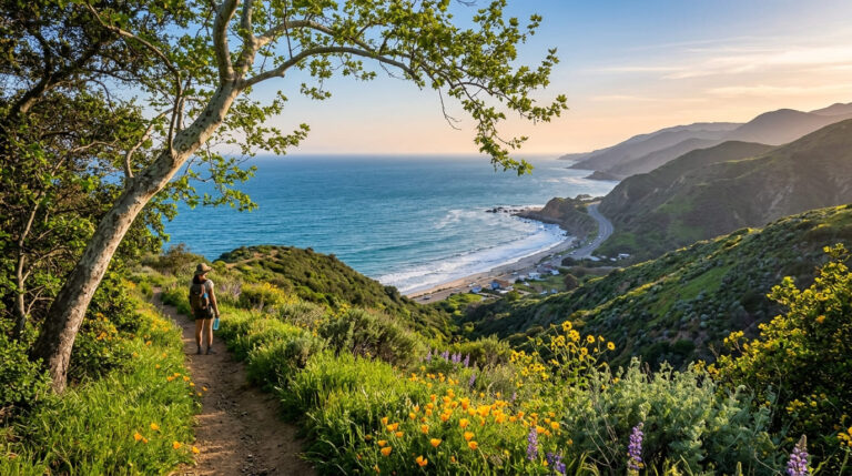
Kern River Trail. This is the gentle one. It starts at Highway 178 and Delonegha Road and follows the river through open oak-and-grass hillsides on gradual grades. The Forest Service notes strong wildflower displays from mid-March to late April, which makes spring the time to go.
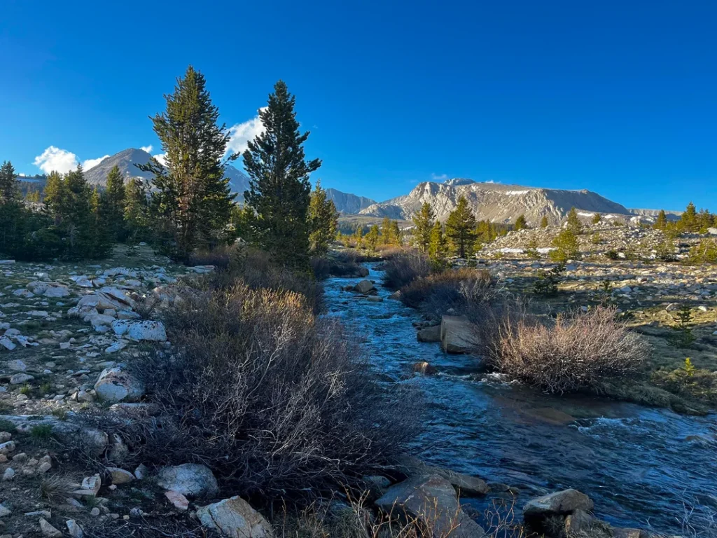
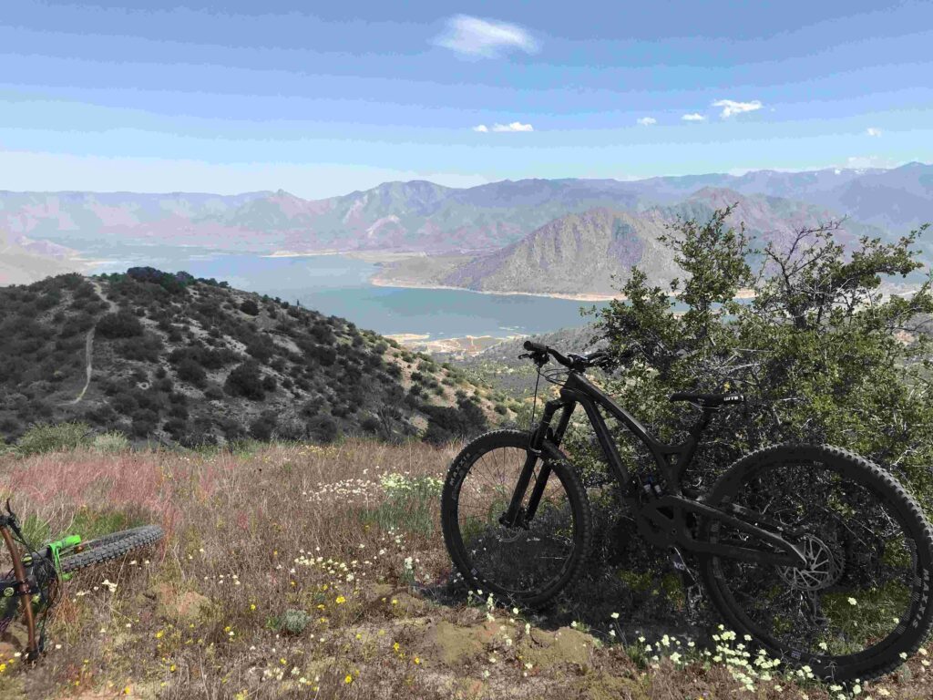
Remington Ridge Trail. It begins 1¾ miles west of Hobo Campground on Old Kern Canyon Road, and the Forest Service calls the climb moderate to steep. The route runs from oak woodland through brush to pine-and-oak forest, and views of Isabella Lake, Kern Canyon, and the Kern Plateau open up higher on the ridge. Views of the lake come in the higher portion, so plan on a serious climb, and start early because the route is exposed.
Sunday Peak Trail. The Forest Service describes this as a good family day hike through mixed conifer forest on a moderate grade, with a lunch spot on top and clear-day views of the Kern Valley, the plateau and high Sierra peaks. It begins at the Girl Scout Camp parking area on Forest Highway 90, a long drive up from the lake. A fire lookout once stood on the summit. Fires have shaped these forests in recent years, so check conditions before you drive up.
For more mileage, the Pacific Crest Trail crosses the Kern River Ranger District in two places; our guide to the Pacific Crest Trail through California covers planning. The Forest Service’s Kern River Ranger District page lists every trail, campground, and active alert.
Lake Isabella Swimming: What to Know Before You Get In
The Forest Service lists swimming, water skiing, and windsurfing among the lake’s popular activities, so yes, you can swim at Lake Isabella. The question is when and where.
Algal blooms. Blue-green algae, or cyanobacteria, tend to bloom in warm, still water, and Lake Isabella sees advisories in many summers. Kern County Public Health tests the lake monthly at roughly 15 to 17 locations and uses California’s three-tier system: Caution, Warning, and Danger. In its late-June 2025 advisory, Caution applied at marina and launch sites, and Danger applied at several shoreline sites including Kissack Bay and Hanning Flat. You can’t tell whether a bloom carries toxins by looking, so obey every posted sign. Dogs and children are the most vulnerable, and symptoms include rash, eye irritation, mouth ulcers, vomiting, and flu-like illness.
Wind and boats. Wind can come up fast and hard on this lake, and water skiing is popular. Swim near shore, away from boat lanes, and treat every beach as unguarded.
Lake level. Shorelines shift with the water, and a low lake can leave mud flats and unfamiliar drop-offs. Wade in slowly.
The Kern River is a different animal. Swimming at the lake is one thing; swimming in the river above or below it is another. The Kern is cold and fast, with hidden branches and rocks, and local news reports that more than 300 people have drowned in it since 1968. Wear a life jacket near moving water. For the full picture, read our guide to water hazards on California trails, and for trails that pair a hike with a swim, see swimhiking in California.
Camping Around the Lake
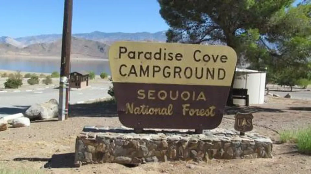
The Forest Service counts eight developed campgrounds around Lake Isabella. Paradise Cove, on the south shore off Highway 178, is open year-round, and its sites have lake views. Auxiliary Dam Campground also sits on the southern end near the town of Lake Isabella. A few east-side areas, including Stine Cove and Hanning Flat, have been listed as open-camping sites. The developed campgrounds run under a concessionaire permit, and the Forest Service campground pages list current fees and booking details.
Rules to know: camp only in designated sites, because shoreline camping is not allowed; campfires, barbecues, and camp stoves need a California campfire permit; and fire restrictions can ban flames outright, so check the Forest Service’s alerts. Quiet hours run 10 p.m. to 6 a.m. For options beyond the lake, see our guide to campgrounds near California’s top hiking trails.
Fishing, Boating and Wind
Lake Isabella is known for trout in the colder months, plus black and white crappie, bluegill, catfish, and largemouth bass. The wind that challenges swimmers is the reason windsurfers come. Paddlers do better on the sheltered northern arm.
Best Time to Visit
Spring and fall are the most comfortable seasons for hiking: mild air, spring wildflowers on the lower trails, and fewer crowds. Summer belongs to the water, but temperatures can top 100°F, so start trails at dawn and carry plenty of fluids. Our weather hazards on California trails guide covers heat, and a hydration pack built for hot-weather hikes helps on exposed ridges. In winter, the lower elevations are usually snow-free but can be too muddy for trails, while higher routes like Sunday Peak may hold snow.
Safety and Trail Rules
- Water. The Forest Service advises boiling all river and stream water for five minutes before drinking.
- Dogs. Pets are allowed on the trails with a six-foot leash. Keep them out of the water when algae signs are posted, and read our guide to hiking with dogs in California.
- Wildlife. The Forest Service has posted bear alerts for the district, so store food properly.
- Fire. Check restrictions before every trip, and don’t smoke while hiking.
- Services. The Kern River Ranger District office in Kernville, at 11380 Kernville Road (760-376-3781), can supply maps.
Beyond the Lake
If you have time, the Upper Kern around Kernville offers whitewater rafting, and the Trail of 100 Giants, a paved interpretive trail through giant sequoias, sits farther north in the forest. It’s accessible mostly from May to November, and Forest Service alerts have listed closures, so check first. For more trail ideas in the region, see our guides to the Southern Sierra in Kern County, desert hiking trails in Kern County, and the Sequoia National Forest in Fresno County.
The Honest Bottom Line
Lake Isabella isn’t a pristine alpine lake, and the water can be low, warm, and sometimes off-limits when algae bloom. But it’s a big, accessible reservoir with a good trail system above it, and it puts you at the edge of the Kern River country within about an hour of Bakersfield. Go in spring or fall, hike the ridges for the views, check the advisory signs before you swim, and respect the river.
Lake Isabella FAQ
Can you swim in Lake Isabella?
Yes, but check for algae advisories first and heed every posted sign. Swim without expecting a lifeguard.
Where is Lake Isabella, California?
In Kern County at the southern end of the Sierra Nevada, about 40 miles northeast of Bakersfield.
How do you get to Lake Isabella from Bakersfield?
Take Highway 178 up the Kern River Canyon, about an hour’s drive.
What is the best hike with a lake view?
Isabella Peak is the quickest, at about 2.5 miles round trip. Remington Ridge offers longer views from higher up.
Is Lake Isabella full right now?
Probably not. In early October 2026, the lake held roughly a quarter of its capacity. Check the Corps of Engineers’ daily report.
Can you camp at Lake Isabella?
Yes, in eight developed campgrounds and designated open-camping areas.
Are dogs allowed on the trails?
Yes, on a six-foot leash.
When is the best time to visit?
Spring and fall for hiking, summer for water, with heat and algae in mind.