Hollywood Sign Hiking Guide: Trails, Rules & Parking
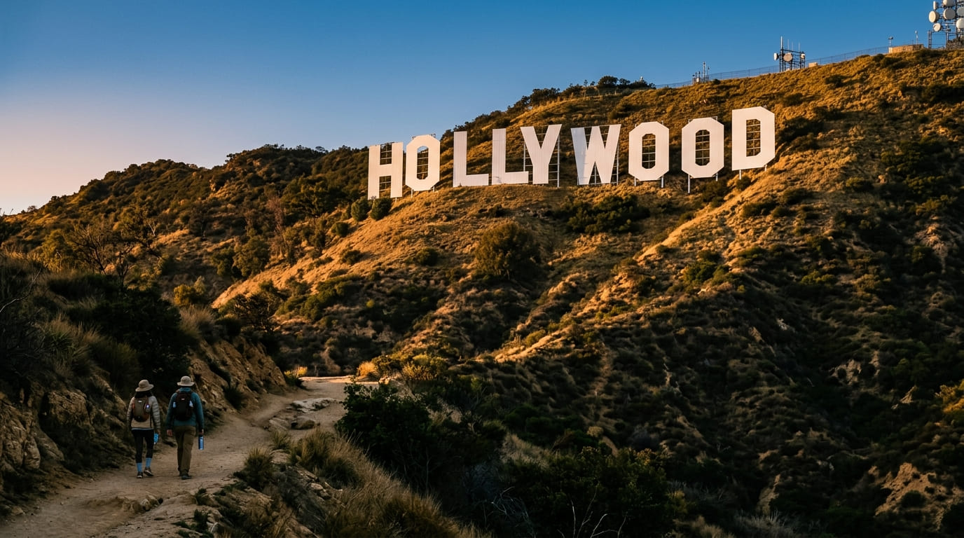
From half the city, you can see nine white letters stacked against a brown hillside. Every visitor who sees them asks the same thing: can I walk up and touch it? The answer is no. But a Hollywood Sign hike is still one of the best half-days in Los Angeles, because the trails climb past the letters, over the top of the H, and out to a summit where the whole basin spreads below you. This guide covers how to hike to the Hollywood Sign, which Hollywood Sign trail fits your legs, where to park, what’s fenced off, and why a 1923 real estate ad still holds a mountain.
Disclosure: Please note that some of the links below are affiliate links and at no additional cost to you, I may earn a commission. Know that I only recommend hiking gear I personally stand behind; when you use my affiliate links, it helps me run this blog and keep all of this content free of charge for readers (like you).
Hollywood Sign Hike at a Glance
| Detail | What to know |
|---|---|
| Where it is | Mount Lee, in Griffith Park, Los Angeles |
| The sign | 45-foot letters spread across about 350 feet |
| Can you touch it? | No. It is fenced, camera-monitored, and protected by an officer stationed nearby |
| Cost and permits | Free; no permit |
| Trail hours | Sunrise to sunset |
| Best first route | Brush Canyon Trail, about 6.4 miles round trip |
| Shortest route | Cahuenga Peak, about 3 miles round trip, steep |
| Dogs | Allowed on leash |
| Bikes | Not allowed on dirt trails |
Can You Hike Up to the Hollywood Sign?
Yes, with a catch. You can hike up to the Hollywood Sign’s mountain, but not to the letters. The sign sits on the south slope of Mount Lee, a fenced-off area that also hosts radio towers, and the Hollywood Sign Trust says the sign is protected by a fence and security cameras around the clock, with an LAPD officer stationed nearby. Trespassing is illegal.
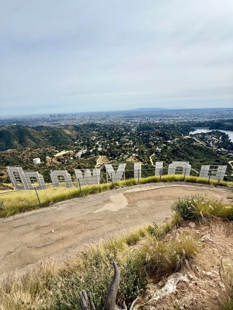
What the trails give you is the next-best thing. Mount Lee Drive curls up the back of the mountain and brings you to a bend directly above the H, with a tall chain-link fence between you and the letters. A short dirt path beyond leads to the summit, about 1,700 feet up, with the city spread out to the south and Burbank and the San Gabriel Mountains to the north. Stay on authorized trails and stay out of closed areas.
The Hollywood Sign Trail Options
The Trust lists three official trails: the Mt. Hollywood Trail, the Brush Canyon Trail, and the Cahuenga Peak Trail. A fourth route, through a residential neighborhood, appears in many guides.
| Route | Distance | Elevation gain | Best for |
|---|---|---|---|
| Brush Canyon Trail to Mount Lee | About 6.4 miles round trip | About 1,050 feet | Reaching the summit above the sign |
| Mt. Hollywood Trail | About 5.3-mile loop | About 1,250 feet | Sign views from the Observatory side |
| Cahuenga Peak Trail | About 3 miles round trip | About 875 feet | A short, steep climb with a view of the sign from above |
| Innsdale Drive route | About 4.6 miles round trip | About 750 feet | A shorter approach, through a neighborhood |
Sources measure these routes a little differently, so expect small variations.
Mount Hollywood is not the sign’s mountain. The peak most visitors hear about, Mount Hollywood, rises about 1,625 feet and sits east of the sign. The letters sit on Mount Lee. The Mt. Hollywood Trail gives you good looks at the sign across the park, but it doesn’t deliver you above it.
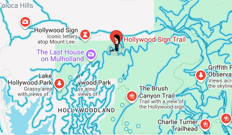
The closed classic. The old Hollyridge Trail, once the shortest way up, started at the top of Beachwood Drive. Public access at that trailhead is closed, and the park now points hikers toward Brush Canyon.
Brush Canyon Trail: The Best Way to Hike to the Hollywood Sign
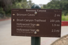
For most people, Brush Canyon is the route. It starts at the end of Canyon Drive in Bronson Canyon and climbs on wide fire roads, with the last stretch on pavement.
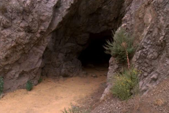
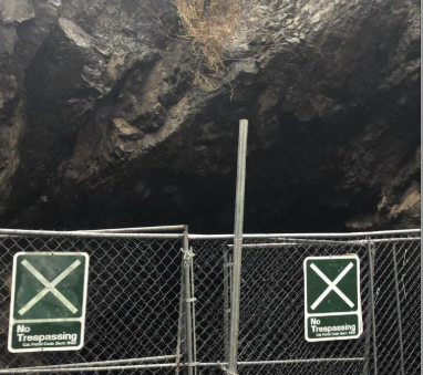
Pass the gate and head up the center of the canyon. Within about a quarter mile, a side path leads to Bronson Cave, the old quarry tunnel that played the Batcave in the 1960s Batman series. Past the trees, the trail climbs the east side of the canyon, and from here you’re fully in the sun. At about 1.25 miles, an overlook looks down over Hollywood, and some hikers turn around right here, satisfied.
Keep going. At roughly 1.3 miles, the trail meets Mulholland Fire Road. Turn left and head west, where the sign starts appearing in glimpses, a reminder you’re headed the right way. The road levels out and winds around ridges, passes the junction with Hollyridge Trail, and reaches Mount Lee Drive at about 2.15 miles.
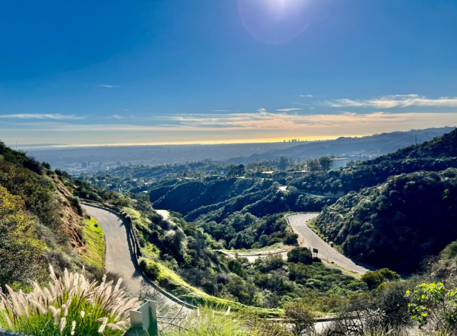
Turn right on Mount Lee Drive. This last paved stretch climbs about 430 feet over roughly 0.95 miles. Look east for a view of Griffith Observatory. Near the top, the road makes a horseshoe bend, and you’re standing right over the H. Walk along the fence to the top of the road, then take the dirt path to the summit, about twenty feet above. The round trip is 6.4 miles, and most hikers need around three hours.
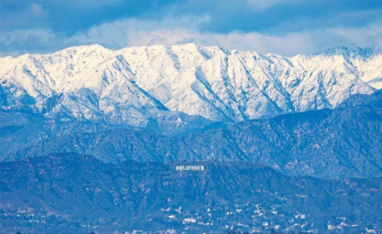
Add Cahuenga Peak. If you have the energy, a narrow, rugged path called Aileen Getty Ridge Trail leaves the bend in the road and crosses a ridge to Cahuenga Peak, about a third of a mile away. At 1,820 feet, it’s the highest point in Griffith Park, and the climb adds roughly 0.7 miles to the day. The trail takes its name from a donor to the Save the Sign campaign, which in 2010 helped buy the peak and donate it to the city.
Cahuenga Peak and the Shorter Routes
Cahuenga Peak Trail. The Trust calls this the shortest but hardest of its three, at about 3 miles and 875 feet of gain, and rates it hard. The trailhead is on Wonder View Drive, with street parking on Lake Hollywood Drive and a quarter mile of pavement to reach the trail. It’s usually quieter than the other routes, and it offers a view of the sign from above and behind.
Innsdale Drive route. From Lake Hollywood Park, a dirt road climbs toward the sign, with the letters overhead within the first quarter mile. The route then crosses residential streets and a paved connection to Mount Lee Drive, with the total reaching about 4.6 miles round trip. The Trust doesn’t list it among its three official trails, and the route passes homes and posted signs, so behave like a guest. Stay on the road, keep voices and speakers low, and respect “restricted entry” signs for the slopes above the trail. Access in this area has changed before.
Getting to the Trailheads and Parking
- Brush Canyon (Canyon Drive). Free lots fill quickly, and the gate closes at sunset. Keep valuables out of sight.
- Griffith Observatory. The classic Mt. Hollywood trails start in this area. The easiest way to reach it is the DASH Observatory/Los Feliz shuttle, which the city says runs seven days a week.
- Lake Hollywood Park and Canyon Lake Drive. Parking limits differ on each side of the street, so read every sign.
- Wonder View Drive. Park on Lake Hollywood Drive and walk the quarter mile of pavement.
Rideshare drop-offs save the most trouble on busy weekends. Griffith Park’s posted hours are 5 a.m. to 10:30 p.m., but authorized hiking trails follow sunrise to sunset.
Best Time for a Hollywood Sign Hike
Go early. Brush Canyon is nearly shadeless, and Los Angeles heat builds quickly by mid-morning. Winter through early spring is the easiest season: temperatures are moderate, and the hillsides turn green after rain. In summer, start at sunrise and carry more water than you think you need. Clear air after a storm gives the best views, and our guides to weather hazards on California trails and hydration packs for hot-weather hikes help with heat planning.
Fire Danger and Trail Closures
Fire matters here. The Hollywood Sign Trust warns of extreme fire danger on the trails, parts of which are still recovering after a major 2007 wildfire, and LA Parks advises hikers to avoid trails and hillsides during high winds and red flag warnings. Trail closures happen with little notice, so check the Trust’s hiking page and see our guide to California hiking trail closures before you go.
What to Bring and Trail Rules
- Water. The routes are exposed and have no shade to speak of.
- Sun protection and sturdy shoes. Fire roads are wide, but the loose surface rewards good tread.
- A leash. Dogs are welcome on leash; the park rules also forbid smoking and alcohol, and bikes aren’t allowed on the trails.
- Respect for the neighborhoods. The paths run beside homes. Our hiking trail etiquette rules apply doubly here.
- Awareness of wildlife. Coyotes roam Griffith Park, and rattlesnakes live in the brush. Stay on the trail.
The Story of the Letters
The sign began as a sales pitch. In 1923, a $21,000 billboard reading “Hollywoodland” went up to advertise a housing development in Beachwood Canyon, and it was meant to be temporary. After decades of neglect, the Hollywood Chamber of Commerce arranged in 1949 to repair it and drop the last four letters, “LAND,” so the sign would name the district rather than a subdivision. By the 1970s, the sign had deteriorated badly, and in 1978 a campaign led by Alice Cooper and Hugh Hefner, with donations of $27,700 per letter, rebuilt it in steel. The Hollywood Sign Trust, formed that same year, has maintained it since. The sign turned 100 in 2023.
See the Sign Without the Hike
If you’re short on time or energy, the best long-distance front views come from Griffith Observatory and from Hollywood & Highland, and Lake Hollywood Park puts you closer. For a lighter outing in the same neighborhood, our Runyon Canyon hiking guide pairs sign views with an urban canyon walk. The sign is also a favorite of photographers; see our guide to California hikes for photographers.
More Los Angeles Hikes
- The Los Angeles County hiking trails guide maps every region.
- Our roundup of the best hiking trails in Los Angeles puts Griffith Park next to Runyon Canyon.
- For quieter options, see our guide to lesser-known Los Angeles County trails.
- Visiting California for the first time? Start with our guide to hikes for first-time visitors.
The Bottom Line
You will not touch the Hollywood Sign, and you should not try. But a Hollywood Sign hike delivers something better than a selfie against a fence: a long climb through a park older than the sign itself, a view from above the H, and a story about a billboard that outlived its subdivision. Start at sunrise on Brush Canyon, carry plenty of water, check closures first, and leave the letters to the camera crews.
Hollywood Sign Hike FAQ
Can you touch the Hollywood Sign?
No. The sign is fenced and watched by cameras and an officer.
Is it legal to hike to the Hollywood Sign?
Yes, on authorized trails in Griffith Park. You can’t enter the fenced area around the letters.
What’s the best Hollywood Sign trail for beginners?
Brush Canyon is the most balanced. Cahuenga Peak is shorter but harder.
How long does the hike take?
Brush Canyon takes about three hours round trip. The Innsdale route takes closer to two and a half.
Do you need a permit or ticket?
No. The trails are free. For hikes that do need passes, see our guide to California hiking trail permits.
Can you hike to the Hollywood Sign at night?
No. Authorized trails are open from sunrise to sunset.
Are dogs allowed?
Yes, on a leash.
Where is the easiest place to see it?
Griffith Observatory, Hollywood & Highland, and Lake Hollywood Park.