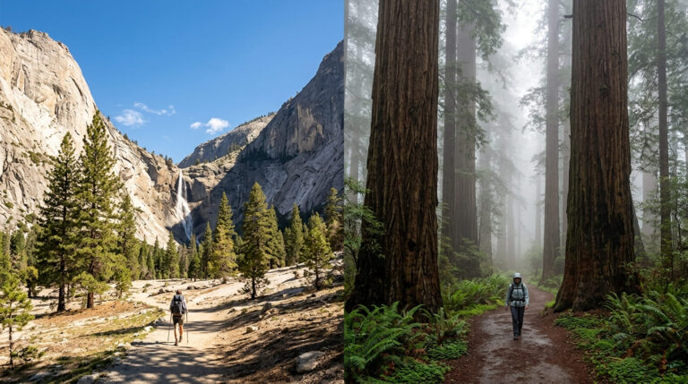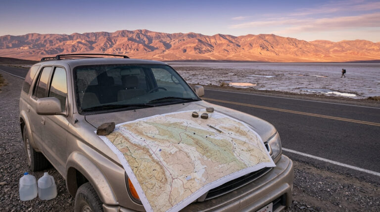
The Best Hiking Trails in California for Your First Visit, From Tunnel View to Death Valley
If I had exactly one day to convince someone that California earns its reputation, I’d skip the hidden gems and go straight for the postcard shots. The best hiking trails in California for first time visitors aren’t the ones locals brag about finding – they’re the ones that already look familiar before you’ve taken a single step, because you’ve seen them in a hundred photos already.
Disclosure: Please note that some of the links below are affiliate links and at no additional cost to you, I may earn a commission. Know that I only recommend hiking gear I personally stand behind; when you use my affiliate links, it helps me run this blog and keep all of this content free of charge for readers (like you).
This list runs on name recognition and a payoff you can capture in one frame, from a Yosemite pullout you can reach in flip-flops to a Death Valley canyon you should never enter after 10 a.m. in summer. Every entry below has exact mileage, 2026 access notes, and the trade-off I’d want to know about before driving out there.
Key takeaways
- Most iconic single shot: Tunnel View in Yosemite hands you El Capitan, Half Dome, and Bridalveil Fall in one frame, and you barely leave the parking pullout to get it.
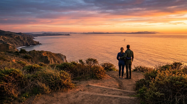
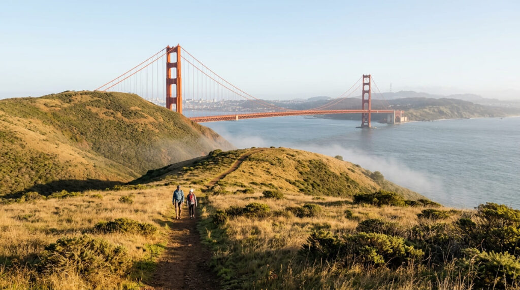
- Best angle nobody else photographs: the Coastal Trail in the Marin Headlands shows the Golden Gate Bridge from the north side, a view most visitors never think to seek out.
- Highest search demand in this entire research project: the Hollywood Sign hike and Rainbow Falls at Devils Postpile are tied at the top – proof that first-timers search by name, not by “hidden gem.”
- Shortest big payoff: La Jolla’s Coast Walk Trail packs sea caves and a sea lion colony into a walk you can finish in under 30 minutes.
- Biggest logistics trap: Rainbow Falls runs on a mandatory summer shuttle out of Mammoth Mountain – skip that detail, and you won’t get into the valley at all.
- The one timing rule I won’t bend on: don’t hike Golden Canyon in Death Valley after 10 a.m. in summer. That’s not my opinion; that’s the Park Service’s own posted warning.
1. Tunnel View Overlook, Yosemite National Park (Mariposa County)
Why this delivers California’s most recognized view in one frame
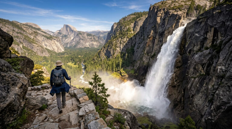
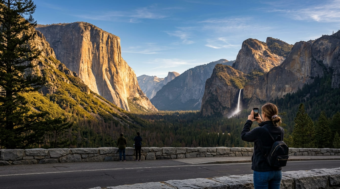
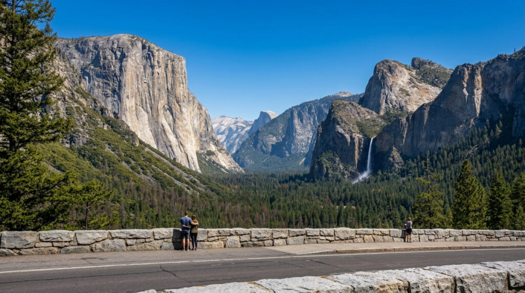
Tunnel View earns its spot at the top of this list: it’s the exact framing of El Capitan, Bridalveil Fall, and Half Dome that most visitors already recognize from a postcard before they’ve ever set foot in the park. My rule for anyone with only a few hours in Yosemite Valley is simple: do this stop first. It orients you to everything else you’ll see that day, and it costs you almost no effort to get there.
Before you go: fees, no reservations, and a pass that covers three other stops on this list
Tunnel View sits right off Wawona Road (CA-41), and it’s one of the only entries on this entire list you can reach almost entirely by car, with just a short walk from the pullout to the railing. As of 2026, Yosemite isn’t running a timed-entry reservation system, including through peak summer – you need the standard entrance pass, $35 per vehicle for seven days.
One freshness note before you book anything: starting January 1, 2026, non-U.S. residents age 16 and up pay an added $100 per person. To waive this, international visitors must purchase the $250 Non-Resident America the Beautiful Pass (the standard $80 pass is for U.S. residents only). This pass also covers your entrance to Death Valley later on this list, which makes it the better deal if you’re hitting multiple federal parks on this trip.
If you need a place to sleep before an early start, our guide to where to stay near Yosemite covers lodging within a short drive of this exact pullout, and our Yosemite South Entrance trail guide lists four more short hikes near the same Wawona Road corridor.
2. Coastal Trail, Marin Headlands (Marin County)
Why the Golden Gate Bridge looks different from this side
Most tourist photos of the bridge come from the San Francisco side or the classic Battery Spencer pullout. The Coastal Trail approaches from Conzelman Road down toward the bridge’s north vista point instead, and that changes the whole composition you’re looking back at the span with the headlands themselves in the foreground. It’s a short outing on its own, but it also connects into the wider Marin Headlands trail network if you want to turn it into a longer afternoon.
Before you go: timing around the fog
Budget about 0.8 miles round trip for the Conzelman-to-Vista Point segment itself, with a gentle grade the whole way. The catch is San Francisco’s summer fog, which can roll in and erase the entire view by early afternoon on some days; mornings right after the fog burns off, or a clear day in fall, are your safest bet.
Entry to the Golden Gate National Recreation Area is free, and parking at the trailheads costs nothing either, which is rare for a view this good. Our Marin Headlands trail guide covers four more short hikes in the same parking area if you want to make a morning of it.
3. Runyon Canyon Park Loop Trail (Los Angeles County)
Why this is LA’s hiking culture packed into one loop
Runyon Canyon isn’t the prettiest trail on this list, and I won’t pretend otherwise; it’s a well-worn fire road through the Hollywood Hills.
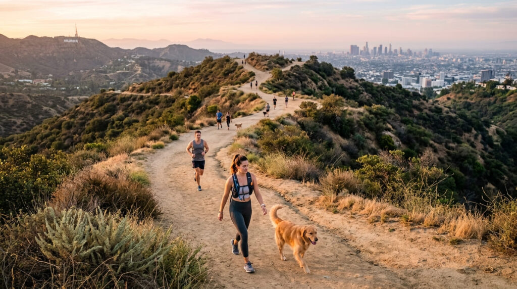
What makes it a first-timer’s stop is everything around the trail itself: the off-leash dog culture that gives the park its identity, the workout-class energy, and side views toward the Hollywood Sign and Griffith Park from the upper ridge.
The main loop runs about 2.6 miles with roughly 700 feet of climbing, which is enough to get your legs working without needing trekking poles.
Before you go: timing, parking, and the sunset closure
The park closes at dusk, and the Fuller Avenue and Vista Street entrances both fill their street parking early, especially on weekends. Go at sunrise if crowds bother you; the same climb at 7 a.m. feels like a different trail than at noon.
For full route maps and parking tips before you go, see our comprehensive Runyon Canyon trail breakdown. Our dog-friendly hiking trails guide covers exactly which sections here run off-leash if you’re bringing a dog along, and our Los Angeles trail guide pairs this stop with nearby Griffith Park options.
4. Hollywood Sign Hike via Brush Canyon Trail (Los Angeles County)
Why this gets you closer to the sign than anything else legal
Brush Canyon Trail, starting from Bronson Canyon in Griffith Park, is the single most-searched named trail we found anywhere in our entire Los Angeles County keyword research.
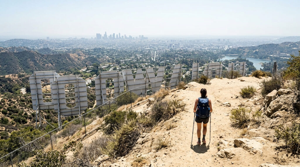
The trail climbs to Mount Lee, directly behind and above the sign – and I’ll say this plainly because it matters: no legal trail walks you up to the letters themselves. What you get instead is an elevated view from behind and to the side, which is still the closest anyone is allowed to stand.
Before you go: sun exposure and the bat cave detour
Plan on roughly 6.5 miles round trip with about 1,050 feet of elevation gain, and know upfront that the entire route sits in open sun with almost no shade cover – carry more water than you think you’ll need. Free parking lots along Canyon Drive fill early, especially on weekends, so an early start solves two problems at once.
If the full distance doesn’t fit your schedule, the short detour to the Bronson “Bat Cave” near the trailhead gives you a five-minute payoff without the climb. The Hollywood Sign Trust, which manages public access to the landmark, keeps the current list of approved trails if conditions change.
5. La Jolla Coast Walk Trail (San Diego County)
Why sea caves and sea lions fit into a 20-minute walk
This is the shortest entry on the list, and that’s exactly the point. The bluff-top path runs from near the Cave Store out along sandstone cliffs riddled with sea caves, with sea lions and harbor seals regularly hauled out on the rocks around Point La Jolla just below.
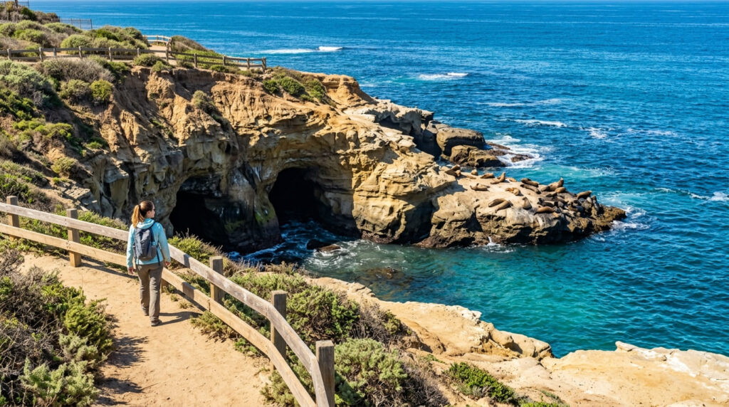
You can do the out-and-back in under half an hour, which makes it an easy add-on to a coastal San Diego day that already includes lunch and shopping on Prospect Street.
Before you go: parking is the hard part here
The trail itself covers about 1.2 miles round trip with minimal elevation change, but weekend parking around Coast Boulevard and Prospect Street is famously tight by mid-morning. Arrive before 9 a.m. or plan on a rideshare – it will save you more time than the hike itself takes. Dogs are welcome on the trail, though not on the adjacent beach during posted daytime hours.
6. Rainbow Falls Trail, Devils Postpile National Monument (Madera County)
Why this ties for the most-searched named trail in the state
Rainbow Falls is a 101-foot drop on the Middle Fork San Joaquin River, and it ties the Hollywood Sign hike for the highest search demand of any named trail anywhere in this project’s keyword research – which tells you first-time visitors are searching for it by name well before they book a trip to Mammoth Lakes.
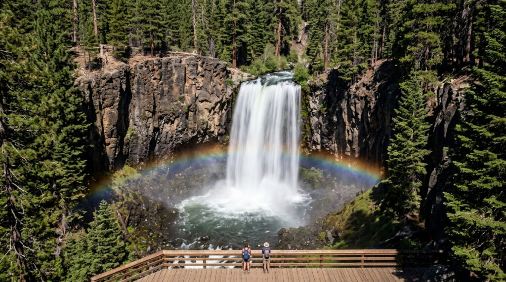
Budget about 5 miles round trip from the Devils Postpile Ranger Station, or as little as 2.5 miles round trip if you start from the closer Rainbow Falls trailhead near shuttle stop 9.
Before you go: the mandatory shuttle that catches people off guard
As of the 2026 season, access into Reds Meadow Valley runs on a mandatory shuttle out of Mammoth Mountain Main Lodge, generally operating Thursday through Sunday from early July through mid-October while Reds Meadow Road stays under active reconstruction.
Check the current shuttle schedule before you drive up, since the days and hours shift with the construction schedule. The walk itself is hot, dry, and mostly unshaded, so bring more water than the short distance suggests you’ll need. Our Mammoth Lakes trail guide covers the rest of the trails you can reach from the same shuttle stops.
7. Golden Canyon Trail, Death Valley National Park (Inyo County)
Why this is the easiest way to see Death Valley’s badlands on a first visit
Most hikers turn around at the Red Cathedral junction, about 2 miles round trip from the parking area on Badwater Road, which is enough to see the canyon’s colorful mudstone walls without committing to a full day.
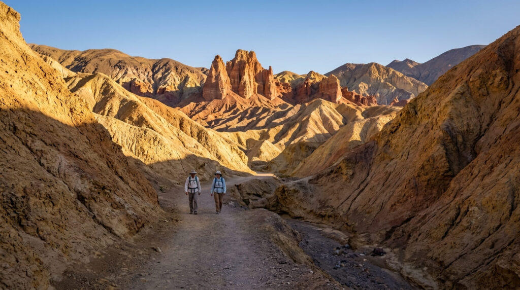
If you want more, the trail extends into a 7.8-mile loop up to Zabriskie Point and back down through Gower Gulch, with elevation gain ranging from about 535 to 834 feet depending on which version you hike. Either way, this is the most approachable introduction to Death Valley’s badlands scenery that I’d send a first-timer toward.
Before you go: the one rule that matters more than any other on this list
The National Park Service posts a direct warning against hiking this trail after 10 a.m. in summer, and I’d treat that as a hard rule rather than a suggestion – Death Valley’s heat is not the kind you tough out. Plan your visit for November through April if you can.
The entrance fee, as of 2026, is $30 per vehicle for seven days. The park is totally cashless and does not have staffed entrance gates on most roads, so you will need to pay by card at a fee machine, a visitor center, or online. If you’re not sure how a rating of “easy” or “moderate” translates to your own fitness level on trails like this one, our hiking difficulty guide breaks down exactly what those labels mean on California terrain, and our Death Valley trail guide covers four more hikes within the same Furnace Creek area.
The bottom line on the best hiking trails in California for first-time visitors
None of these seven trails will surprise a longtime California hiker, and that’s the whole point. If you’re building a first trip around name recognition and a reasonable amount of walking, this is the list I’d hand someone landing at LAX or SFO for the first time: Tunnel View and Golden Canyon for the big-park icons, Runyon Canyon and the Hollywood Sign for the LA experience, La Jolla for an easy coastal add-on, and the Marin Headlands and Rainbow Falls for the two views most tourists don’t know to ask for.
Pick the cluster closest to where you’re already staying, and build the rest of the trip around it rather than trying to string all seven together in one visit.
Frequently asked questions about the best hiking trails in California for first time visitors
What is the most iconic hike in California?
Tunnel View in Yosemite is the closest thing California hiking has to a single “must-see” shot, since it frames El Capitan, Half Dome, and Bridalveil Fall together from one overlook. The Hollywood Sign hike comes in a close second for name recognition, though it takes much more effort to reach.
How many days do you need to see California’s best hikes?
Realistically, budget two to three days per region rather than trying to link all seven in one trip. Los Angeles (Runyon Canyon plus the Hollywood Sign) fits in a day, San Diego’s La Jolla trail is an afternoon add-on, and Yosemite, the Eastern Sierra, and Death Valley each deserve their own separate leg of the trip given the driving distances between them.
Do you need a car to visit these trails?
For nearly all of them, yes. Runyon Canyon and La Jolla’s Coast Walk Trail can be reached by rideshare without much trouble. Still, Yosemite, the Marin Headlands, Devils Postpile, and Death Valley all require a vehicle, and in Devils Postpile’s case, a shuttle transfer once you arrive.
What should first-time visitors know about California hiking?
Sun exposure catches more first-timers off guard than elevation does – several of these trails, including the Hollywood Sign hike and Golden Canyon, have little to no shade. Carry more water than feels necessary, and check each trail’s current conditions before you go, since access rules and shuttle schedules change from year to year.
Are these trails good for jet-lagged travelers?
Most of them, yes. Tunnel View requires almost no walking, La Jolla’s Coast Walk Trail is under a mile and a half round trip, and the shorter Golden Canyon option is a flat 2 miles. Save Brush Canyon Trail’s 6.5-mile climb to the Hollywood Sign for a day after you’ve adjusted.
What time of year is best for a first California hiking trip?
Spring and fall work best across the whole state. Summer brings dangerous heat to Death Valley and fog to the coast, while winter can close high-elevation access like the Devils Postpile shuttle season entirely. If your trip has to happen in summer, front-load the desert stops for early morning and save the coastal trails for the afternoon.