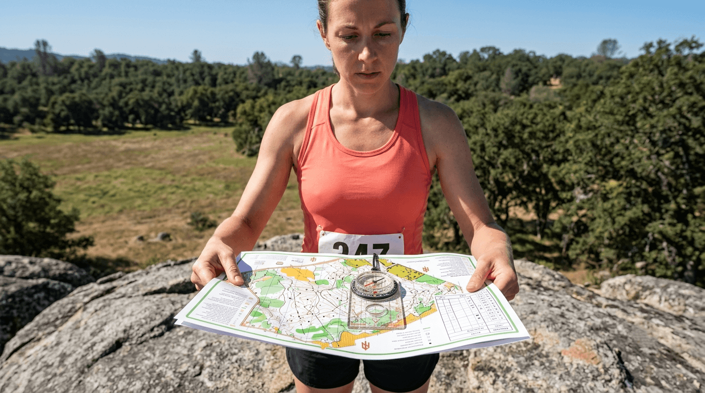
Orienteering on California Trails: A Beginner’s Guide to Map & Compass Skills
Most hikers navigate by app until the day the app doesn’t work, no signal, dead battery, or a screen too glare-washed to read in bright Sierra sunlight. Orienteering is the sport built entirely around not needing any of that, using nothing but a detailed map and a compass to find your way between points in sequence. It’s a genuine competitive sport with an active California community, but the real value for most hikers is what it teaches: real navigation skill that doesn’t depend on a signal bar, and that gets sharper the more you practice it. Getting started with orienteering in California will give you the ultimate backcountry confidence.
Disclosure: Please note that some of the links below are affiliate links and at no additional cost to you, I may earn a commission. Know that I only recommend hiking gear I personally stand behind; when you use my affiliate links, it helps me run this blog and keep all of this content free of charge for readers (like you).
Key takeaways
- Orienteering is a navigation sport, not just map-reading, competitors race between control points in sequence using only a map and compass, with time and precision both counting.
- The skills transfer directly to backcountry hiking: attack points, handrails, and contour reading all apply the moment you step off a marked trail.
- Orienteering maps are far more detailed than standard hiking topo maps, larger scale, tighter contour intervals, and vegetation density mapped by color.
- California has five active orienteering clubs: BAOC (Bay Area), LAOC (Los Angeles), Gold Country Orienteers, San Diego Orienteering, and Truckee Orienteering Club.
- Most club events welcome complete beginners with free instruction and a beginner-friendly White course, you don’t need any prior experience to show up.
- A compass needs its declination set correctly for your specific California location, since the offset between magnetic and true north varies by region and shifts slowly over time.
What is orienteering and how does it work?
Orienteering is a competitive or recreational navigation sport where you use a detailed topographic map and compass to find a sequence of control points in the fastest time, without a marked trail to follow. The sport rewards route judgment as much as speed, the fastest runner doesn’t always win if their navigation costs them more time than their pace saves, which is exactly what makes it such a different challenge than trail running or hiking.
Orienteering vs. hiking with a map: what makes it a distinct activity
Hiking with a map is route-following, you’re staying on a known trail and checking your position against it. Orienteering is time-competitive, precision-navigation work, choosing your own route between unmarked points under real time pressure. Both build the same foundational map-reading skill; orienteering just adds speed and decision-making under pressure on top of it.
Types of orienteering: foot, trail, mountain bike, and ski orienteering in California
Foot orienteering is the standard, most common format, and the one nearly every beginner starts with. Trail orienteering (Trail-O) uses paths and precision map-reading rather than off-trail running, making it accessible for hikers with mobility limitations who still want the navigational challenge. Mountain bike orienteering and ski orienteering add their respective sports on top of the same navigation skill set, applying identical map-reading fundamentals at higher speed.
California’s active club scene is built primarily around foot orienteering, though club events sometimes include other formats depending on the season and location.
Why every California hiker should learn basic orienteering skills
Cell dead zones cover huge portions of the Sierra Nevada backcountry and much of rural Northern California, which turns map-and-compass literacy from a nice-to-have hobby skill into a genuine safety net for anyone who regularly hikes beyond cell coverage.
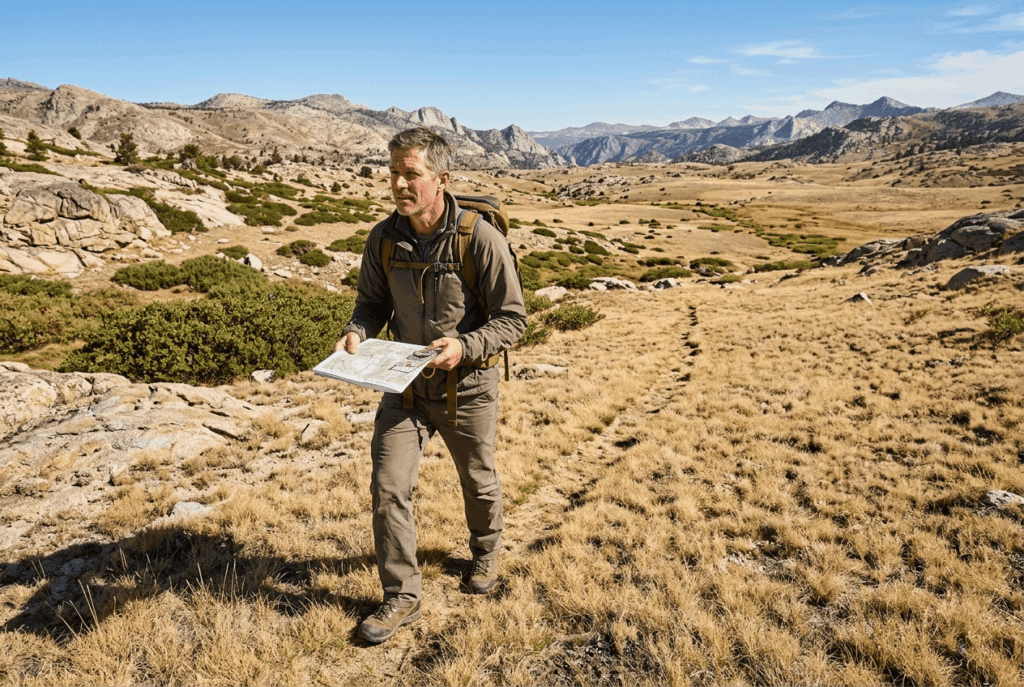
How orienteering skills transfer directly to California backcountry navigation
Contour reading, attack point technique, handrail features (following a linear feature like a stream or ridge toward your destination), and catching features (a backstop feature that tells you you’ve gone too far) are all core orienteering techniques that apply directly to cross-country hiking and route-finding anywhere in California’s backcountry.
None of this requires competing in an actual event; the skills are useful the moment you learn them. They are particularly valuable for off-trail routes like those found in peak bagging.
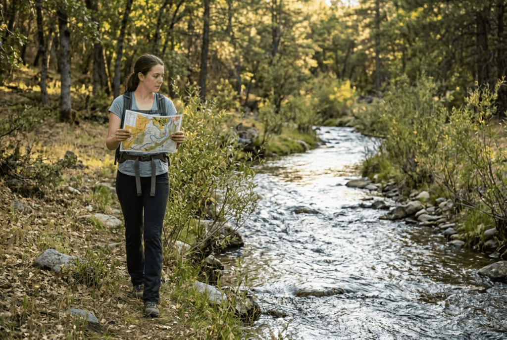
Orienteering equipment: what you need to get started in California
How an orienteering map differs from a regular topographic hiking map
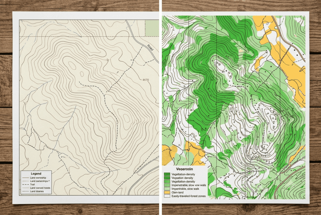
Orienteering maps use a larger scale (typically 1:10,000 or 1:15,000) with 5-meter contour intervals, far more detail than a standard USGS topo map provides. Standardized ISOM symbols color-code terrain by navigability: green shades indicate vegetation density, white means open, easily traveled forest, and yellow marks open land like fields.
A standard hiking topo map, by comparison, prioritizes land ownership boundaries and roads over this level of terrain detail, genuinely useful for planning a drive to a trailhead, but far less useful once you’re navigating off-trail through dense terrain.
How to choose and use an orienteering compass for California trail navigation
A thumb compass, worn on the thumb for fast reference while running, is the standard choice for competitive orienteering; a baseplate compass is slower to use but more versatile for general hiking and navigation, and it’s the better first purchase if orienteering is just one of several outdoor skills you’re building.
Either way, set your declination correctly for your specific location, California’s declination currently runs positive (east) across most of the state, but the exact figure varies regionally and drifts slowly over time, so check a current source like NOAA’s declination calculator rather than relying on an old number printed on a map from years ago. You can see the full set of recommended navigation gear in our hiking gear checklist.

Basic orienteering techniques every California hiker should know
Four techniques cover most of what you need: map orientation (keeping the map aligned with the terrain, not just north-up), handrail navigation, attack points, and contour interpretation.
The attack point method: the most useful orienteering technique for California trail hikers
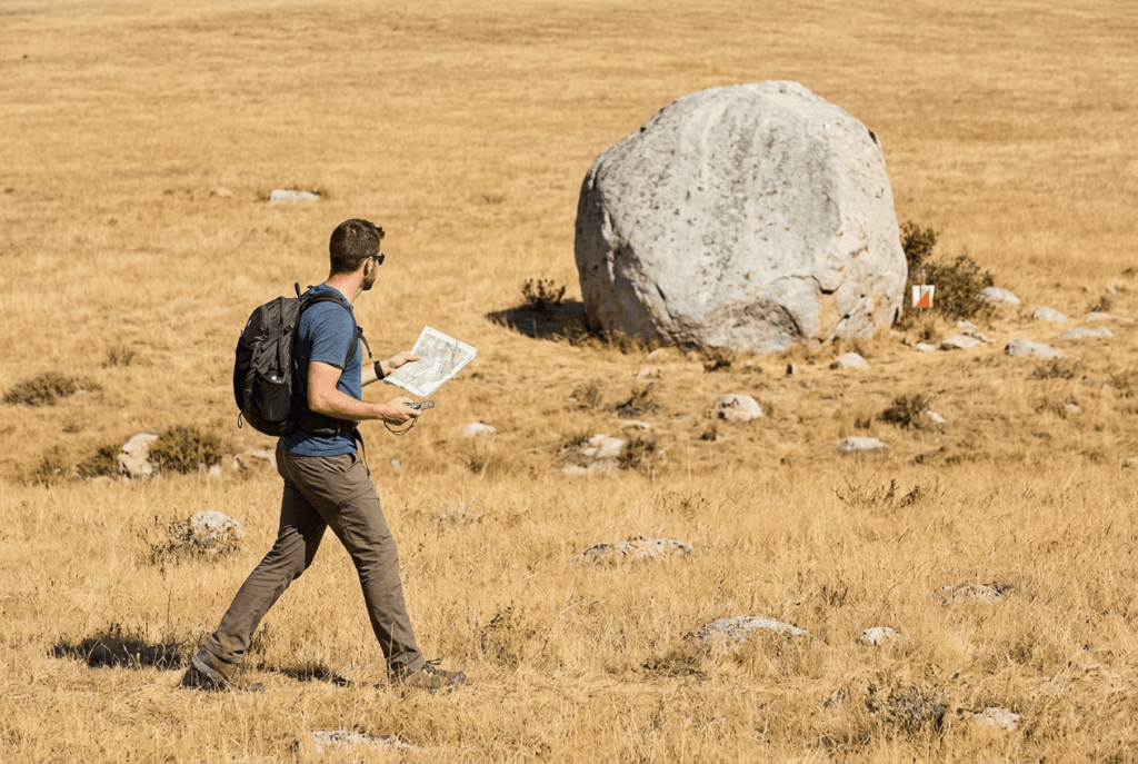
An attack point is a large, easy-to-find feature near your actual destination, a trail junction, a distinctive boulder, a stream bend, that you navigate to first, then fine-navigate the final short stretch from. This dramatically reduces your odds of getting lost in featureless Sierra Nevada terrain, since you’re only relying on precise navigation for a short final leg instead of the whole route, and a mistake near the attack point is far easier to correct than a mistake made miles earlier on the route.
How to use contour lines for navigation in California’s mountain terrain
V-shapes in contour lines point upstream into valleys; tightly closed rings mark a hilltop; contour lines that touch or merge indicate a cliff; and a convex bulge in the lines marks a ridge.
These same shapes read identically whether you’re navigating Sierra Nevada granite or a coastal range hillside, which is what makes contour literacy such a durable, widely transferable skill. Always check the route’s overall difficulty rating before setting off into off-trail wilderness terrain.
How to find orienteering events in California
California orienteering clubs and their trail events
The Bay Area Orienteering Club (BAOC) runs regular events across the Bay Area, including local parks like Tilden and Joseph D. Grant County Park, and is currently the fourth-largest orienteering club in the country.
The Los Angeles Orienteering Club (LAOC) covers Southern California, including events in the Angeles National Forest, while Gold Country Orienteers, San Diego Orienteering, and the Truckee Orienteering Club round out active club coverage across Northern, Southern, and Sierra-adjacent California.
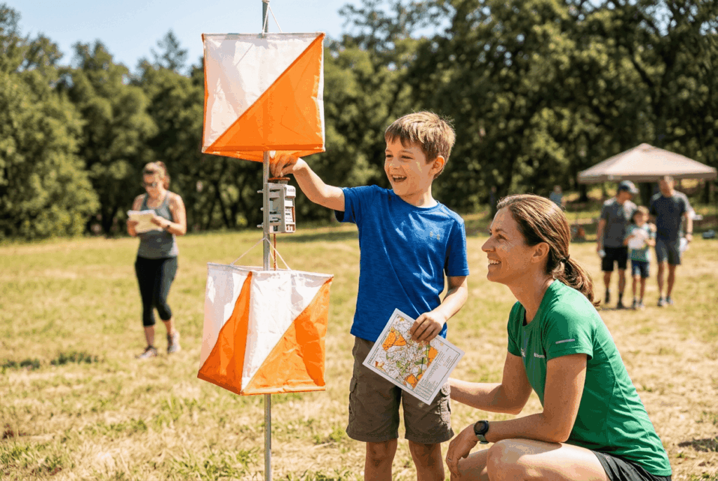
Most events offer free beginner instruction and a beginner-friendly White course, so you genuinely don’t need prior experience to show up, just arrive early enough to catch the instruction before your first course.
Orienteering rewards exactly the skill most hikers never build on purpose: real confidence reading a map and compass without a screen to fall back on, a topic expanded upon further in various expert navigation and wilderness survival books. Try one beginner event with a local club, and the attack point and contour techniques will change how you navigate every hike afterward, competitive or not.
Frequently asked questions about orienteering in California
What is orienteering and how do you do it?
Orienteering is a navigation sport where you use a map and compass to find a sequence of control points, choosing your own route rather than following a marked trail. Most beginners start with a club’s beginner-friendly White course, which uses simpler terrain and clearer features.
What equipment do I need to start orienteering in California?
Just a compass to begin with, most club events provide the orienteering map and an SI card (electronic timing punch) for a small fee. A baseplate compass works fine for beginners; a dedicated thumb compass is worth upgrading to once you’re hooked.
How is an orienteering map different from a regular hiking trail map?
Orienteering maps use a larger scale and tighter contour intervals than standard topo maps, with color-coded vegetation detail (green for dense brush, white for open forest, yellow for fields) that a typical hiking map doesn’t include.
Are there orienteering clubs or events in California?
Yes, five active clubs cover the state: BAOC (Bay Area), LAOC (Los Angeles), Gold Country Orienteers, San Diego Orienteering, and Truckee Orienteering Club, most running regular events with free beginner instruction.
Can orienteering skills help me navigate California backcountry trails?
Yes, directly, attack points, handrail navigation, and contour reading are exactly the skills you need once you’re off a marked trail, whether you’re peak bagging or just taking a cross-country shortcut.
Is orienteering good for children and families in California?
Yes, most California clubs offer beginner courses and instruction suitable for kids, and orienteering’s built-in sense of exploration and problem-solving makes it a genuinely popular family activity at local club events.