The 5 Best Hiking Trails in Eldorado National Forest’s Crystal Basin, From Granite Reservoirs to a Historic Lookout
This guide covers the hiking trails in Eldorado National Forest throughout the Crystal Basin Recreation Area, the cluster of reservoirs and forest trails west of Desolation Wilderness that don’t require a wilderness permit. Here’s the short version: Ice House Reservoir is the easiest, most family-manageable trail in this guide, Loon Lake sits right at the edge of real wilderness terrain (permit required if you cross that line), and Big Hill Lookout gives you a view of the whole Crystal Basin from a working fire tower.
Disclosure: Please note that some of the links below are affiliate links and at no additional cost to you, I may earn a commission. Know that I only recommend hiking gear I personally stand behind; when you use my affiliate links, it helps me run this blog and keep all of this content free of charge for readers (like you).
Five trails anchor this guide: Loon Lake, Union Valley Reservoir, Ice House Reservoir, Big Hill Lookout, and a subalpine meadow hike along the same forest corridor.
All of them fall under the general Forest Service day-use fee system rather than the Desolation Wilderness permit system covered in my Desolation Wilderness guide, except for Loon Lake, which straddles both; I’ll explain exactly where that line falls.
Key takeaways
- Closest to real wilderness terrain: Loon Lake is a genuine Desolation Wilderness trailhead, so the permit-free rule in this guide has one real exception here.
- Largest reservoir in the cluster: Union Valley Reservoir, the biggest lake in Crystal Basin, with adjustable shoreline hiking options.
- Easiest, most family-friendly: Ice House Reservoir, a straightforward loop around the smallest of the three main reservoirs.
- Best panoramic payoff: Big Hill Lookout, a working fire tower with views across the entire Crystal Basin (not “Red Peak,” which is actually a much harder, wilderness-permit peak elsewhere, more on that below).
- Best wildflower meadow: a subalpine meadow hike along the same Ice House–Wrights Lake Road corridor as several other trails in this guide.
- Every trail here needs a Forest Service day-use fee ($5/day or $30/year) except where a Desolation Wilderness-specific fee applies instead. My guide to hiking safety in California covers the broader fee and permit landscape if you’re new to National Forest recreation.
Quick-glance comparison
| Trail | Distance (RT) | Elevation gain | Fee | Best for |
|---|---|---|---|---|
| Loon Lake | ~6–8 mi (adjustable) | ~700–900 ft | $10 day-use (Desolation Wilderness trailhead) | Edge-of-wilderness scenery |
| Union Valley Reservoir | 4–13 mi (adjustable) | Varies by distance | Free | Largest reservoir, flexible distance |
| Ice House Reservoir | ~3–6 mi (adjustable) | Under 500 ft | Free | Easiest, family-friendly |
| Big Hill Lookout | Short spur hike | Moderate | Adventure Pass | Crystal Basin panorama |
| Subalpine meadow hike | ~4–5 mi | ~700–1,300 ft | Adventure Pass | Wildflowers |
Loon Lake: the edge of real wilderness terrain
This is the one trail in this guide where the “no permit needed” rule genuinely has an exception, so I want to be clear about where that line actually falls.
Trailhead access and parking at the Loon Lake Recreation Area
Reached via Ice House Road, about 31 miles north of Placerville a genuinely scenic but increasingly rough drive as you approach the lake. Loon Lake is literally one of the officially listed Desolation Wilderness trailheads, and a $10 day-use parking fee applies here specifically, distinct from the standard Forest Service day-use fee used elsewhere in this guide.
Difficulty, distance, and elevation gain around Loon Lake
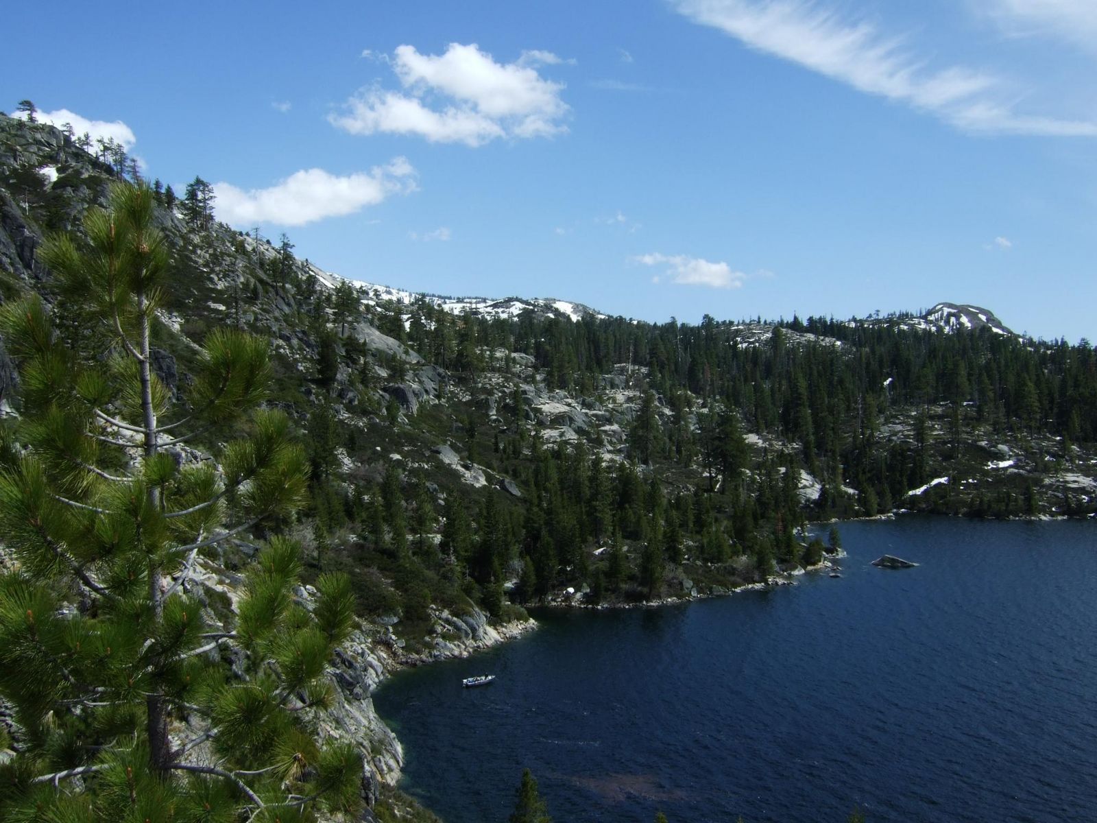
Commonly hiked in the 6 to 8 mile range, often turning around at the Pleasant Campground sign about 4 miles in, gaining roughly 700 to 900 ft. The trail follows the Rubicon Trail corridor along the lake’s forested shoreline, with open granite sections offering good lake views.
What you’ll see: a high-elevation reservoir ringed by granite peaks
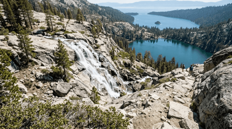
Loon Lake sits at the north end of Crystal Basin, bigger, rockier, and wilder-looking than the more family-friendly reservoirs farther down the road, framed by granite slabs and views toward the Crystal Range.
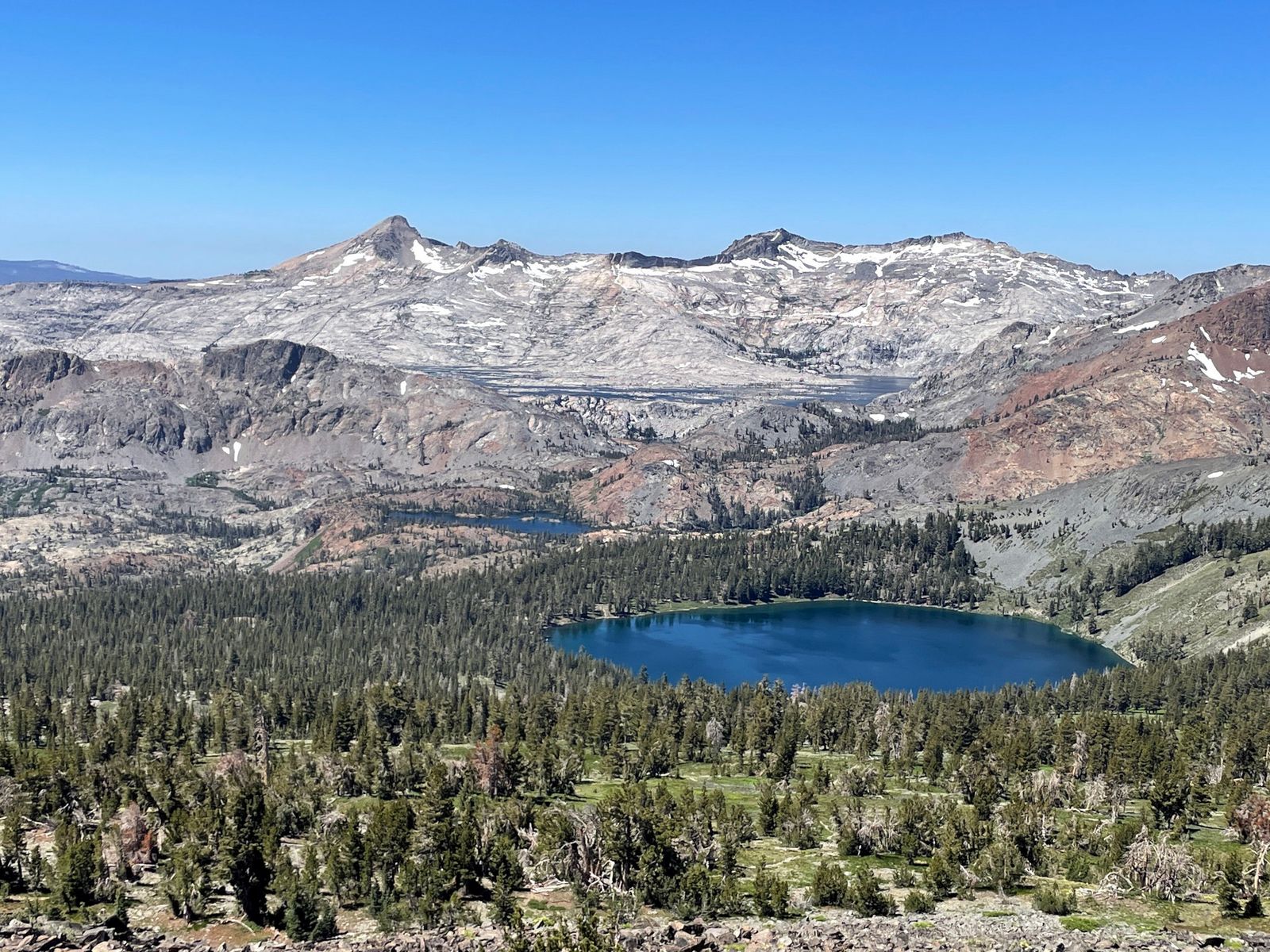
If you continue past the immediate lakeshore into Desolation Wilderness itself, a free self-issue wilderness permit is required at the trailhead, the same system covered in full in my Desolation Wilderness guide.
Best time to hike Loon Lake: summer only, the access road closes for snow
The unpaved approach road is seasonally gated by snow, making summer the only realistic window to check current road status before making the drive out.
Union Valley Reservoir: the largest lake in Crystal Basin
If you want flexible distance more than a specific destination, this is the trail I’d point you to.
Trailhead access and parking at the Union Valley Reservoir day-use area
Free Forest Service day-use lots ring the reservoir, reached via Ice House Road about 14 miles north of Highway 50, the largest and most boating-oriented lake in the Crystal Basin cluster.
Difficulty, distance, and elevation gain on the Union Valley shoreline trails
Genuinely adjustable: shorter shoreline walks run around 4 miles, while the paved bike-and-hike path along the east shore extends past 13 miles for those wanting a full day, with elevation gain scaling accordingly (documented routes here range from under 400 ft to over 1,300 ft depending on distance).
What you’ll see: the largest reservoir in the Crystal Basin Recreation Area
Ringed by conifer forest with sandy beach access when water levels are low, Union Valley is the scale entity of this guide, noticeably bigger than both Ice House Reservoir and Loon Lake, and the most popular boating destination in the cluster.
Best time to hike Union Valley Reservoir: midsummer for full reservoir views
Water levels fluctuate through the season; midsummer typically offers the fullest, most scenic views before late-season drawdown exposes more shoreline.
Ice House Reservoir: the easiest, most family-friendly loop
This is the trail I’d send a family with young kids to, out of everything in this guide.
Trailhead access and parking at the Ice House Reservoir day-use area
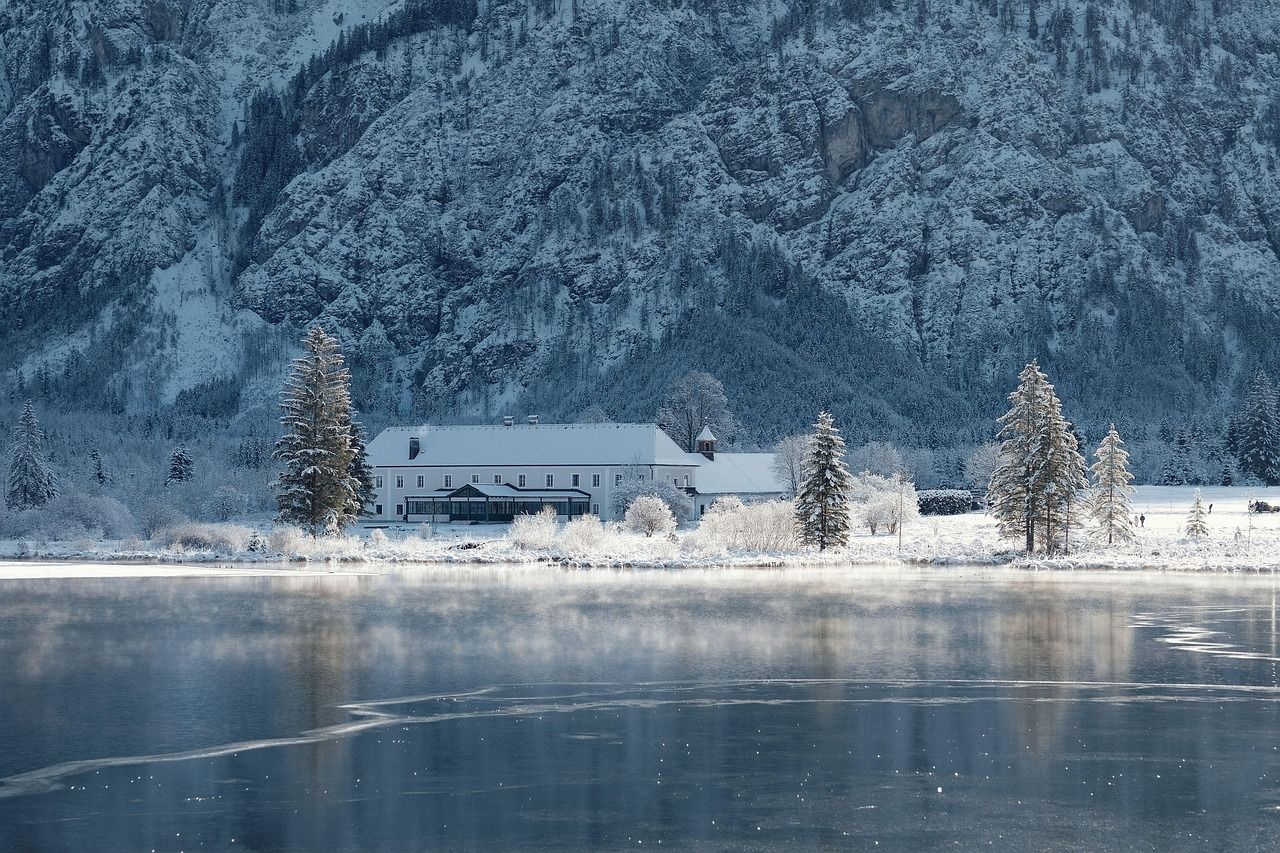
Free Forest Service access at about 5,500 ft elevation, reached via Ice House Road, the smallest of the Crystal Basin cluster’s three main reservoirs, and consequently the most manageable for a casual visit. Bassi Falls, covered in my waterfall trails guide, launches from the same general road corridor nearby.
Difficulty, distance, and elevation gain on the Ice House Reservoir loop
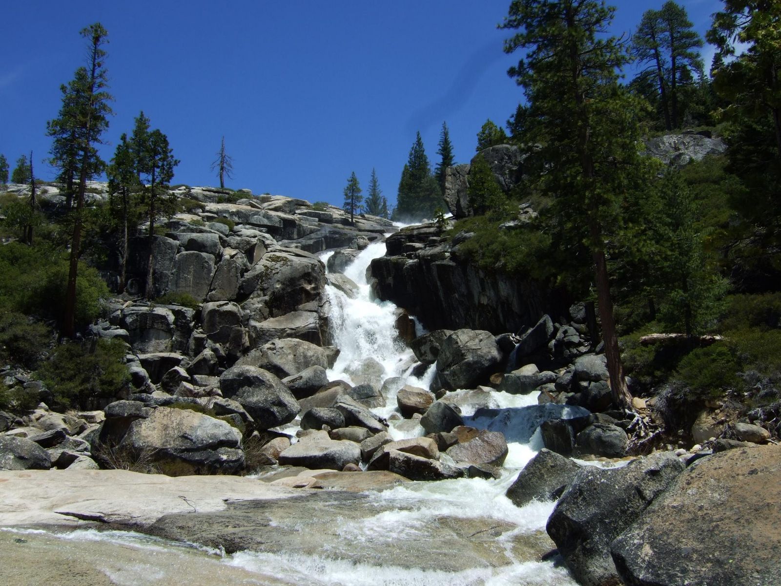
Genuinely easy and adjustable, a short walk around the sandy lake bowl on the shorter end, up to about 6 miles with under 500 ft of gain if you cover more of the shoreline. This overlaps well with the audience for my family-friendly trails guide for this county.
What you’ll see: mixed conifer forest around a compact reservoir
Ponderosa pine and mixed conifer ring the shoreline. The Caldor Fire burned extensively across Eldorado National Forest in 2021, and while I couldn’t independently confirm this specific reservoir’s shoreline was within the burn perimeter, it’s genuinely worth checking current Forest Service alerts before you go, given how much of the broader forest is still in active recovery.
Best time to hike Ice House Reservoir: check current Forest Service alerts first
This is the single most practical piece of advice for this specific trail road repairs, seasonal closures, and post-fire recovery work have all affected access here in recent years, so a quick alert check before driving out is worth the two minutes it takes.
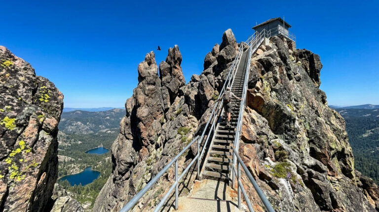
Big Hill Lookout: the Crystal Basin’s best panorama, not Red Peak
I want to be upfront about a naming issue before describing this trail: this is genuinely Big Hill, not Red Peak, and the difference matters.
Trailhead access and parking near Union Valley Reservoir
A short spur road off Ice House Road, about 3 miles past the main Union Valley Reservoir turnoffs, leads to the base of Big Hill. A Forest Service day-use fee is required for parking.
Difficulty, distance, and elevation gain to the Big Hill lookout
This is a genuinely short approach relative to its payoff; most of the elevation is covered by the access road itself, with a brief final walk up to the 6,155-ft summit. Treat any specific mileage figure with some caution, since sources describe this more consistently as a short spur hike than a long approach trail.
What you’ll see: a working fire lookout with views across the entire Crystal Basin
An active fire lookout tower with a residence building sits on the summit, staffed seasonally during fire season, confirmed directly by the Eldorado National Forest’s fire lookout program, with views that genuinely take in Union Valley Reservoir, Loon Lake, Ice House Reservoir, and Desolation Wilderness beyond, the single most comprehensive panorama in this entire post.
Best time to hike Big Hill: clear summer days for the farthest views
Wildfire smoke can noticeably reduce visibility here in late summer some years; a clear day genuinely changes how much of the Crystal Basin you can actually see from the top.
Subalpine meadow hike: wildflowers along the Ice House–Wrights Lake corridor
This closes out the guide on its gentlest, most seasonal entry.
Trailhead access and parking near the Crystal Basin Recreation Area
Reached via a Forest Service road off the general Ice House–Wrights Lake Road corridor; a Forest Service day-use fee applies. Several similar meadow access points exist along this same corridor, including the confirmed, well-documented Camas Meadow nearby.
Difficulty, distance, and elevation gain to the meadow
Comparable meadow hikes in this exact area run roughly 4 to 5 miles round trip with 700 to 1,300 ft of gain, through upper montane forest dominated by lodgepole pine.
What you’ll see: a wildflower-filled subalpine meadow loop
Open meadow habitat transitions into surrounding conifer forest, with a genuine diversity of wetland and “edge” wildflower species, Labrador tea and red mountain heather among them, in the classic Crystal Basin meadow-and-forest ecotone.

Best time to hike this meadow trail: July for peak wildflower bloom
Meadow wildflowers in this corridor typically peak from late June through July, tapering as the season dries out into August.
The trail I’d actually start with
If you’ve only got one stop in Crystal Basin, make it Ice House Reservoir; it’s the easiest, most flexible trail in this guide and asks the least of you logistically. Union Valley Reservoir is the natural next step once you want more distance and boating scenery.
Big Hill Lookout is worth the detour specifically for the panorama once you’ve got a full day. Loon Lake deserves its own visit precisely because of its edge-of-wilderness status; don’t assume the permit-free rule applies if you keep walking past the lakeshore.
For the rest of El Dorado County’s very different terrain, from Lake Tahoe’s shoreline trails to the alpine granite of Desolation Wilderness, my Lake Tahoe trails guide and the other guides in this series round out the full picture.
Frequently asked questions
Do you need a Forest Service day-use fee for Eldorado National Forest?
Yes, for most day-use trailheads in this guide, $5 per day or $30 per year. Loon Lake is the exception, where a $10 day-use fee tied to its role as a Desolation Wilderness trailhead applies instead.
Was Eldorado National Forest affected by wildfire?
Yes, the 2021 Caldor Fire burned 221,835 acres across the forest, primarily along the Highway 50 and Echo Summit corridor. Recovery is ongoing in parts of the forest, so checking current Forest Service alerts before visiting is genuinely worthwhile, especially for trails you haven’t visited recently.
Is Loon Lake open year-round?
No. The unpaved access road is seasonally gated by snow, making summer the only realistic hiking window most years.
What is the Crystal Basin Recreation Area?
It’s the cluster of reservoirs and forest trails including Loon Lake, Union Valley Reservoir, and Ice House Reservoir in the western portion of Eldorado National Forest, distinct from the permit-required Desolation Wilderness immediately to the east.
Is Red Peak Lookout still standing?
The actual Red Peak, a 9,311-ft summit inside Desolation Wilderness, isn’t a developed lookout site at all; it’s a genuine wilderness peak reached by a long, permit-required hike. The developed fire lookout near Union Valley Reservoir that most visitors are actually asking about is Big Hill, which does still have an active, seasonally staffed tower.
When does snow close Eldorado National Forest roads?
Typically from late fall through late spring at the higher-elevation Crystal Basin access roads, though exact dates vary by year and snowpack. Ice House Road and the Loon Lake approach are among the roads most affected by seasonal closure.