5 Best Hiking Trails in Tahoe National Forest, From a Fire Lookout Atop Granite Spires to Three Alpine Lakes off I-80
The best Hiking Trails in Tahoe National Forest showcase some of the Sierra Nevada’s most dramatic terrain, stretching from high-elevation granite spires to pristine alpine lake basins. Highlighting signature routes like the Sierra Buttes trail, Loch Leven Lakes trail, Grouse Ridge trail, and the Castle Peak Trail in the Donner Summit Corridor, this guide focuses on high-country routes distinct from our Nevada City and Gold Country guide elsewhere in Nevada County. As part of our broader Nevada County hiking guide, it covers everything you need to explore this region’s standout high-elevation hikes.
Disclosure: Please note that some of the links below are affiliate links and at no additional cost to you, I may earn a commission. Know that I only recommend hiking gear I personally stand behind; when you use my affiliate links, it helps me run this blog and keep all of this content free of charge for readers (like you).
Key takeaways
- Most photogenic summit: Sierra Buttes, a historic fire lookout reached via a stairway bolted into dramatic granite spires.
- Best highway-adjacent lakes: Loch Leven Lakes, three granite-basin alpine lakes just off Interstate 80.
- Widest lake-basin panorama: Grouse Ridge, a former lookout site with views over dozens of small alpine lakes.
- Quietest alternative: Feeley Lake, a lower-traffic option in the same Grouse Ridge recreation area.
- Best transportation-history summit: Castle Peak, a volcanic peak overlooking the historic Donner Summit corridor, reached via the Pacific Crest Trail.
- None of these five trails require a National Forest Adventure Pass; that fee system applies to specific Southern California forests, not the Tahoe National Forest.
How these five Tahoe National Forest trails compare
| Trail | Distance | Difficulty | Fee/Permit | Best for |
|---|---|---|---|---|
| Sierra Buttes Trail | ~5-9 mi round trip (route-dependent) | Strenuous | Free | Fire lookout, dramatic views |
| Loch Leven Lakes Trail | ~7-7.9 mi round trip | Strenuous | Free | Three alpine lakes, I-80 access |
| Grouse Ridge Trail | Variable | Moderate | Free | Widest lake-basin panorama |
| Feeley Lake Trail | Shorter than Grouse Ridge | Easy-moderate | Free | Quiet alternative |
| Castle Peak Trail | ~7-9 mi round trip (route-dependent) | Moderate-strenuous | Free | Donner Summit history + views |
Sierra Buttes Trail
Trailhead access and parking near Sardine Lake: no pass required
A Forest Service trailhead near Sardine Lake in the Lakes Basin Recreation Area serves this trail. No National Forest Adventure Pass is required here, contrary to what some trail listings suggest; that fee system applies to specific Southern California forests, not the Tahoe National Forest.
Sierra Buttes itself technically sits just across the line in neighboring Sierra County, though it’s part of the same Tahoe National Forest trail network covered in this guide.
What you’ll see: a historic fire lookout atop dramatic granite spires
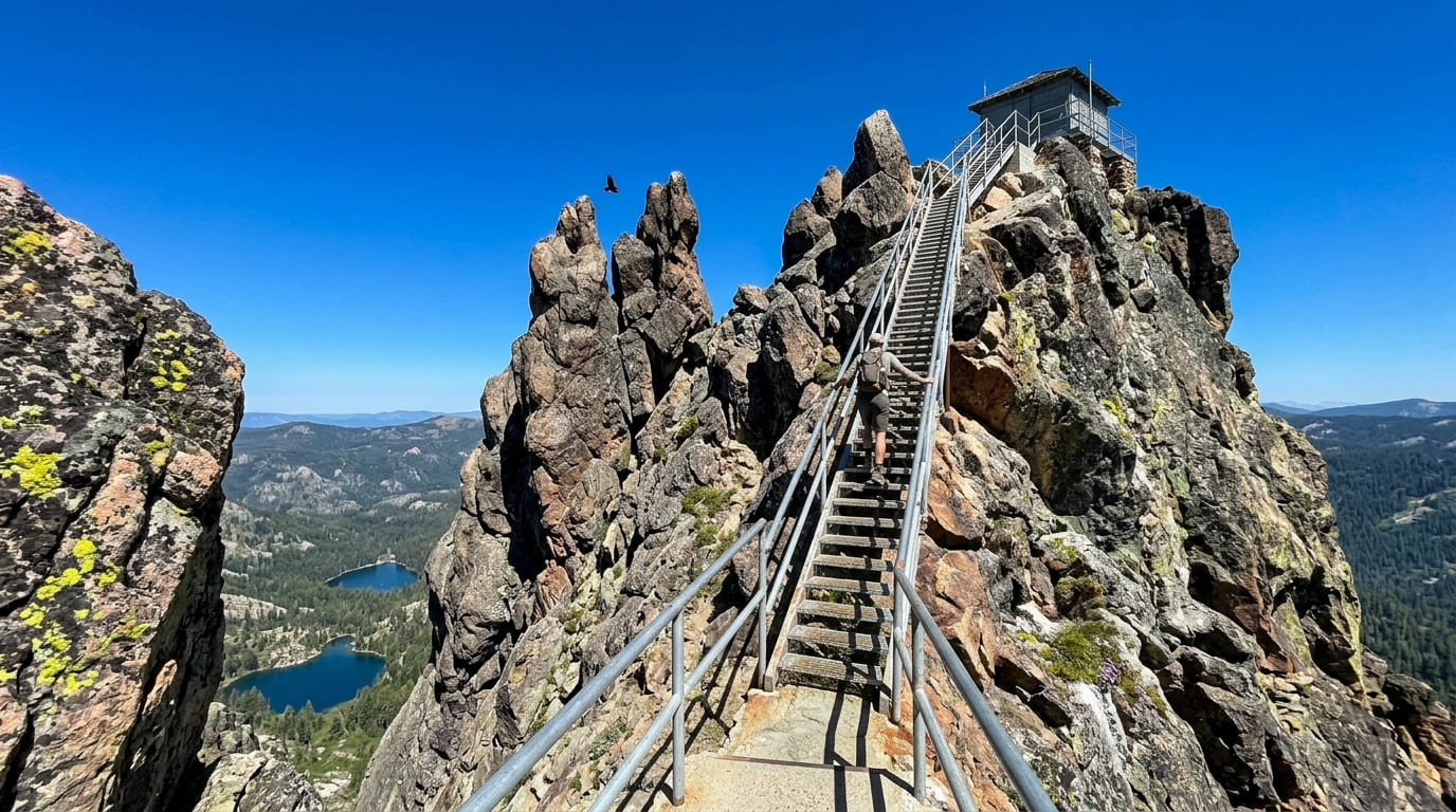
The jagged, multi-pinnacled Sierra Buttes rise sharply above the North Yuba River canyon, topped by a fire lookout tower first built in 1915 and rebuilt with its signature stairway in 1963-64. The final approach involves climbing roughly 180 metal steps bolted directly into the granite spires.
This stretch is genuinely exposed, though railed, with 360-degree views stretching to Mount Lassen and, on clear days, Mount Shasta. From the lookout deck, you can also look straight down on Upper and Lower Sardine Lakes far below, one of the more dramatic vantage points in the entire Sierra Nevada.
Best time to hike Sierra Buttes: summer and early fall, once snow clears
This high-elevation trail typically isn’t reliably snow-free until June, and access depends on which trailhead and route you choose: the shorter approach from Packer Lake/Sardine Lake runs about 5 miles round trip, while starting from Sierra City via the Pacific Crest Trail stretches to well over 9 miles.
Loch Leven Lakes Trail
Trailhead access and parking near Big Bend, off Interstate 80
A Forest Service trailhead sits just off Interstate 80 near Big Bend, one of the most convenient highway-adjacent trailheads in this entire guide, with a restroom on site and no fee or pass required.
What you’ll see: a chain of three granite-basin alpine lakes
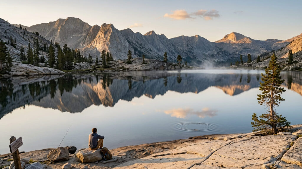
The trail climbs out of the South Yuba River canyon through pine forest and exposed granite to reach Lower, Middle, and High Loch Leven Lakes, a hike of roughly 7 to 7.9 miles round trip depending on how far you go, with genuine swimming, fishing, and picnicking at all three.
Best time to hike Loch Leven Lakes: weekday mornings (popular given its freeway access)
This trail’s convenient interstate access is a double-edged sword: it also means real weekend crowds. Weekday mornings are a genuine practical advantage here that some more remote trails in this guide don’t require.
Grouse Ridge Trail
Trailhead access and parking at Grouse Ridge Campground: no pass required, rough access road
A Forest Service campground trailhead in the Grouse Ridge Recreation Area serves this trail, reached via a genuinely rough access road, so high clearance is a real advantage here. As with Sierra Buttes, no National Forest Adventure Pass applies.
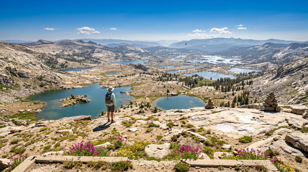
What you’ll see: a high-elevation lookout and views over dozens of alpine lakes
From the former fire lookout site, views extend over a genuinely wide scattering of small alpine lakes across the Grouse Ridge basin, offering the broadest lake-basin panorama in this entire guide, with multiple lakes reachable on connecting trails for hikers who want to keep exploring. The area is also a popular jumping-off point for multi-day backpacking trips deeper into the Grouse Ridge Recreation Area’s lake network.
Best time to hike Grouse Ridge: midsummer for wildflowers and full lakes
Midsummer pairs peak wildflower bloom with the fullest lake levels, creating the ideal combined window before late-summer dry-down thins both out.
Feeley Lake Trail (Grouse Ridge Area)
Trailhead access and parking at the same Grouse Ridge Campground area
Located in the same Grouse Ridge Recreation Area, this hike is typically accessed via the nearby Carr Lake Trailhead. It offers a shorter route directly to the water rather than climbing to the lookout summit, with the same free, no-pass access.
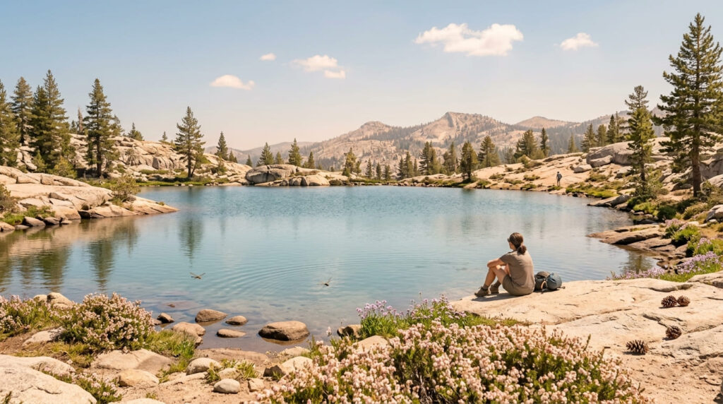
What you’ll see: a quiet, less-visited alpine lake away from the main lookout trail
Feeley Lake offers a genuinely lower-traffic alternative within the same recreation area, a real option if Grouse Ridge’s main lookout route sounds busier than you want.
Best time to hike Feeley Lake: a quieter midsummer alternative to Grouse Ridge
The same midsummer wildflower-and-full-lake window that suits Grouse Ridge applies here, just with meaningfully fewer people sharing the trail.
Castle Peak Trail (via the Pacific Crest Trail, Donner Pass)
Trailhead access and parking at the Boreal/Castle Peak Trailhead, Donner Summit
A Forest Service trailhead at Donner Summit joins the Pacific Crest Trail for the approach to Castle Peak. Free access, no pass required.
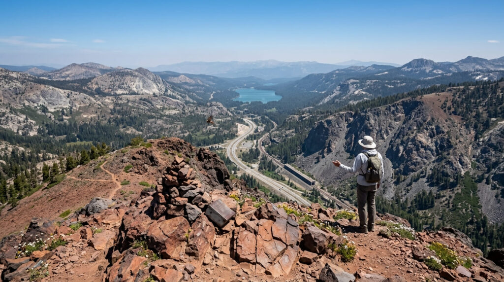
What you’ll see: a volcanic peak with views over the Donner Summit corridor
Castle Peak’s volcanic-rock summit overlooks the historic Donner Summit corridor, where the transcontinental railroad, Interstate 80, and the Pacific Crest Trail all converge in one compact stretch of the Sierra, creating a genuine transportation-history-meets-mountain-view combination unique to this trail in this guide, with the Sierra crest stretching out in multiple directions from the summit itself.
Best time to hike Castle Peak: summer for the most stable, snow-free trail conditions
Like the other high-elevation trails in this guide, summer offers the most reliable snow-free footing; early-season attempts can mean real lingering snow even when lower-elevation trails nearby feel fully clear.
Frequently asked questions about hiking trails in the Tahoe National Forest
Do you need an Adventure Pass for Tahoe National Forest?
No, none of the trails in this guide require a National Forest Adventure Pass. That fee system applies to specific Southern California national forests, not the Tahoe National Forest.
Is there a fire lookout on Sierra Buttes?
Yes, a historic lookout tower, originally built in 1915 and rebuilt with its current stairway in the 1960s, sits atop the summit, reached by climbing roughly 180 steps bolted into the rock.
Can you swim at Loch Leven Lakes?
Yes, all three lakes (Lower, Middle, and High Loch Leven) offer genuine swimming, along with fishing and picnicking.
Is the road to Grouse Ridge rough?
Yes, the access road to Grouse Ridge Campground is genuinely rough, and high-clearance vehicles have a real advantage over standard cars.
Is Castle Peak Trail part of the Pacific Crest Trail?
Yes, the approach to Castle Peak from Donner Summit joins the PCT directly.
Which Tahoe National Forest trail has the most lakes?
Grouse Ridge, without much competition: its lookout viewpoint overlooks dozens of small alpine lakes scattered across the basin, more than any other trail in this guide.