5 Best Hiking Trails in Auburn and the Sierra Foothills, From a Waterfall-Filled Regional Park to a Century-Old Railroad Bridge
This is a genuinely different kind of hiking than our Lake Tahoe guide elsewhere in Placer County, lower elevation, Gold Country history instead of granite peaks, and warm enough to hike well into fall. These five trails span a regional park, a state recreation area along the American River, and a 19th-century quarry, all within a short drive of Auburn. This guide is part of our full Placer County hiking guide. Highlighting Hiking Trails in Auburn is the best way to explore the Gold Country and American River canyons.
Disclosure: Please note that some of the links below are affiliate links and at no additional cost to you, I may earn a commission. Know that I only recommend hiking gear I personally stand behind; when you use my affiliate links, it helps me run this blog and keep all of this content free of charge for readers (like you).
Key takeaways
- Best waterfall hike, with a real access update: Hidden Falls Regional Park, multiple seasonal waterfalls, though weekend visits now require an advance parking reservation and fee.
- Best swimming-hole combo: Codfish Falls, a genuine waterfall swimming hole along the North Fork American River.
- Most historic bridge crossing: Robie Point to No Hands Bridge, a 1912 railroad-bridge-turned-footbridge still used by Western States 100 and Tevis Cup competitors today.
- Best canyon views, with a naming nuance worth knowing: Stagecoach Trail, a historic 1852 stagecoach route near the Confluence, connected to (but distinct from) the trail that actually overlooks the old Auburn Dam site.
- Most obscure, most historic quarry: Griffith Quarry Park, the source of granite used in the California State Capitol itself.
- Three of these trails (Codfish Falls, Robie Point/No Hands Bridge, Stagecoach Trail) sit within Auburn State Recreation Area and share a day-use fee; Hidden Falls and Griffith Quarry are run separately by Placer County.
How these five Auburn-area trails compare
| Trail | Distance | Difficulty | Fee/Permit | Best for |
|---|---|---|---|---|
| Hidden Falls Regional Park | ~3-4.5 mi (adjustable) | Easy-moderate | Free weekdays; reservation + fee on weekends | Multiple waterfalls |
| Codfish Falls Trail | Moderate day hike | Moderate | ASRA day-use fee | Swimming-hole waterfall |
| Robie Point to No Hands Bridge | ~8.7 mi round trip | Moderate | ASRA day-use fee | Historic bridge, ultrarunning history |
| Stagecoach Trail | ~1.8 mi (Confluence to Russell Rd) | Easy-moderate | ASRA day-use fee | Historic stagecoach route, river views |
| Griffith Quarry Park | ~3 mi of trails | Easy | Free | 19th-century granite quarry history |
Hidden Falls Regional Park Trail
Trailhead access and parking at Hidden Falls Regional Park, Auburn, a real update on fees
One correction worth making clearly: this is not simply a free trailhead. Parking reservations are currently required on all weekends and a specific list of high-usage holiday dates, with a fee attached, free, unreserved parking is generally only available on regular weekdays. Book ahead through Placer County’s online reservation system rather than assuming you can just show up on a Saturday.
What you’ll see: multiple seasonal waterfalls along a rolling foothill trail
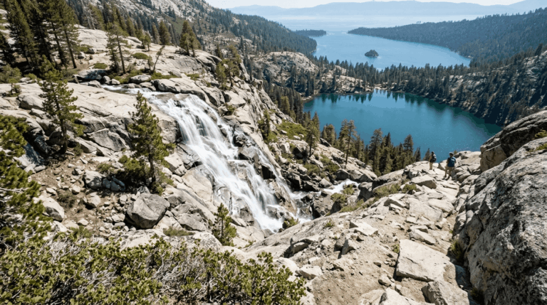
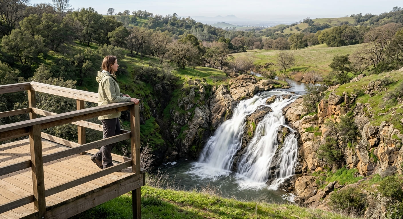
This 1,200-acre park has more than 30 miles of trails, but the signature route is the roughly 3-mile Hidden Falls Access Trail loop to the park’s namesake waterfalls, with a longer 4.5-mile Seven Pools Loop for hikers wanting more distance, both pass observation decks overlooking the falls, plus swimming areas, picnic spots, and sweeping views toward the Sacramento Valley and Sutter Buttes.
Best time to hike Hidden Falls: winter and spring for peak waterfall flow
Like most seasonal Sierra foothill waterfalls, flow peaks with winter rain and spring runoff and can thin considerably by late summer. One more current note: the park closes entirely on days of extreme fire weather, sometimes with as little as 12 hours’ notice, worth checking before a same-day trip in fire season.
Codfish Falls Trail (Auburn State Recreation Area)
Trailhead access and parking at the Ford’s Bar Trailhead, Auburn SRA
A day-use fee applies at this Auburn State Recreation Area trailhead, distinct from the county-run Hidden Falls park, the fee covers this trail plus the other Auburn SRA trails covered later in this guide.
What you’ll see: a swimming-hole waterfall along the North Fork American River
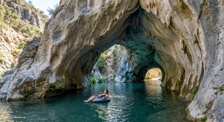
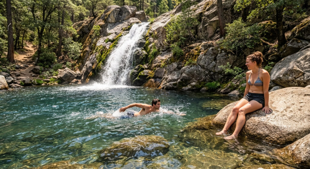
Codfish Falls is a genuine swimming destination in addition to a hiking one, tucked along the North Fork American River, a real draw for summer visitors looking to cool off after the hike in.
Best time to hike Codfish Falls: summer for swimming, spring for flow
Spring delivers the strongest waterfall flow; summer brings warmer, more swimmable water, giving this trail two distinct reasons to visit depending on the season.
Robie Point to No Hands Bridge Trail
Trailhead access and parking at Robie Point, Auburn
A trailhead at Robie Point, on the edge of Auburn, follows a section of the historic Western States Trail, the same route used by the Western States 100 ultramarathon and the Tevis Cup 100-mile equestrian ride. The out-and-back to No Hands Bridge and back runs about 8.7 miles round trip. The same Auburn State Recreation Area day-use fee applies here.
What you’ll see: a 1912 railroad bridge crossed by ultrarunners and equestrians today
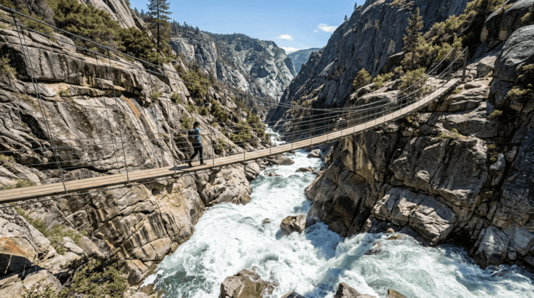
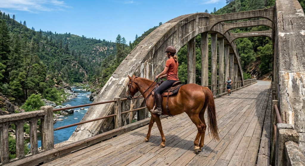
No Hands Bridge, officially the Mountain Quarries Railroad Bridge, was built in 1912 to carry limestone trains to Auburn, and was briefly the longest concrete arch railroad bridge in the world.
Its nickname has more than one popular origin story: some say it comes from the bridge lacking handrails for decades, while others credit legendary Tevis Cup rider Ina Robinson, who would famously drop her reins and cross on horseback with her arms out, calling “Look, no hands!” Either way, it’s been listed on the National Register of Historic Places since 2004, and remains the final American River crossing for both the Western States 100 and the Tevis Cup today.
Best time to hike to No Hands Bridge: any season, a popular training route for ultrarunners
This trail sees genuine year-round traffic from runners and equestrians training for the actual Western States 100 and Tevis Cup events, not just casual hikers, expect real company on this trail regardless of when you visit.
Stagecoach Trail (Auburn State Recreation Area)
Trailhead access and parking near the Confluence, Auburn SRA
The Confluence, where the North and Middle Forks of the American River meet at the Highway 49 crossing, is the main trailhead hub for this entire corner of Auburn State Recreation Area, with roadside parking that gets genuinely crowded on summer weekends.
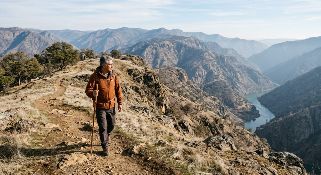
A quick clarification worth making: Stagecoach Trail itself, originally an 1852 stagecoach route, runs about 1.8 miles from the Confluence to Russell Road. The views over the old Auburn Dam construction site come from the connected Robie Point Firebreak Trail nearby, part of the same trail network radiating from this hub, rather than from Stagecoach Trail specifically.
What you’ll see: river confluence views and remnants of the abandoned Auburn Dam project
The Confluence itself offers genuine views where the North and Middle Forks meet, and the broader trail network here, including the nearby overlook trail, passes remnants of the Auburn Dam project, a partially built dam whose construction was halted after a 1975 earthquake raised seismic safety concerns, then permanently shelved in the 1990s after decades of political back-and-forth.
Best time to hike Stagecoach Trail: cooler months, largely exposed canyon terrain
This canyon-rim area has minimal shade across most of its length, making cooler months meaningfully more comfortable than a summer midday attempt.
Griffith Quarry Park Trail (Penryn)
Trailhead access and parking at Griffith Quarry Park, Penryn
A free, small Placer County park trailhead sits in Penryn, just off Interstate 80, genuinely the most obscure, least-visited entry in this entire guide.
What you’ll see: a historic 19th-century granite quarry
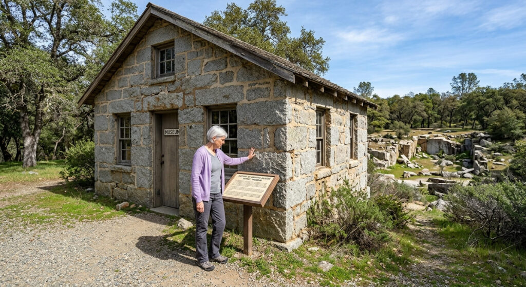
The quarry was established in 1864 by Welsh immigrant Griffith Griffith (his actual name, not a typo), and supplied high-quality granite for a number of important buildings in San Francisco and Sacramento, including portions of the California State Capitol. It was also the site of the state’s first commercially successful granite polishing mill, built in 1874.
The original quarry office, built from the same Penryn granite, now houses a small museum, open weekend afternoons.
Best time to hike Griffith Quarry Park: a quick, uncrowded any-season stop
This park’s small size and low profile make it a reliably quiet stop nearly any time of year, a good pairing with a longer hike elsewhere in this guide rather than a full outing on its own.
Frequently asked questions about hiking trails in Auburn and the Sierra Foothills
Is there a fee at Auburn State Recreation Area?
Yes, a day-use fee applies, covering Codfish Falls, the Robie Point to No Hands Bridge route, and Stagecoach Trail, all part of the same recreation area.
Is Codfish Falls good for swimming?
Yes, it’s a genuine swimming-hole waterfall along the North Fork American River, popular with summer visitors in addition to hikers.
Why is it called No Hands Bridge?
There are two popular explanations: the bridge lacked handrails for decades, and separately, legendary Tevis Cup rider Ina Robinson was known for crossing it on horseback with her arms out and no hands on the reins.
Is the Western States 100 race route open to the public?
Yes, the Western States Trail, including the Robie Point and No Hands Bridge section, is open to hikers, runners, and equestrians year-round, not just on race day.
What happened to the Auburn Dam project?
Construction was halted after a 1975 earthquake raised seismic safety concerns, and the project was permanently shelved by the 1990s after decades of political debate, remnants are still visible along trails near the Confluence.
Which Auburn-area trail is best for a quick visit?
Griffith Quarry Park, without much competition, its small size, free entry, and short trail network make it the fastest, easiest stop in this entire guide.