The 5 Best Hiking Trails Near Mono Lake, From Otherworldly Tufa Towers to a Waterfall-Filled Canyon
Hiking Trails Near Mono Lake doesn’t look like anywhere else in California, a 65-square-mile alkaline lake with no outlet, ringed by limestone towers that formed underwater and are only visible today because decades of water diversion lowered the lake around them. Here’s the short version: South Tufa is the single best introduction to the lake’s namesake landmark, Panum Crater adds genuine volcanic history a few minutes away, and Lundy Canyon is worth a separate trip entirely for fall color and waterfalls that have nothing to do with the lake itself.
Disclosure: Please note that some of the links below are affiliate links and at no additional cost to you, I may earn a commission. Know that I only recommend hiking gear I personally stand behind; when you use my affiliate links, it helps me run this blog and keep all of this content free of charge for readers (like you).
Five trails anchor this guide, though one of them needs an honest asterisk right now, see the closure notice above before you plan around the Old Marina boardwalk. If you’re continuing your trip from Mammoth Lakes, Mono Lake sits about 25 miles north via Highway 395, a genuinely different landscape from the alpine lakes basin.
Key takeaways
- The essential stop: South Tufa, the largest concentration of Mono Lake’s namesake limestone towers, on a short interpretive loop.
- Currently closed, substitute included: the Mono Lake County Park boardwalk has been closed since the May 2025 Inn Fire but lawn and restrooms are open; I’ve covered the nearby Old Marina shoreline trail instead.
- Best short volcanic detour: Panum Crater, the youngest volcano in the Mono Craters chain, erupted just 600 to 700 years ago.
- Most remote and least-visited: Black Point Fissures, genuine cross-country route-finding to a rare underwater-cinder-cone formation.
- Best fall color and waterfalls in the basin: Lundy Canyon, the longest, most demanding trail in this guide, and the only true canyon hike.
- Sun exposure and wind are real factors on nearly every trail here, there’s almost no shade anywhere around the lake itself. My guide to weather hazards on California trails is worth a look before a summer visit.
Quick-glance comparison
| Trail | Distance (RT) | Elevation gain | Fee | Best for |
|---|---|---|---|---|
| South Tufa | ~0.8–1.3 mi | Under 30 ft | $5/adult (16+) | The essential tufa-tower stop |
| Old Marina Shoreline Trail | ~1.5 mi | Minimal | Free | Migratory birds, shaded approach |
| Panum Crater | ~1.6 mi | ~324 ft | Free | Youngest volcano in the Mono Craters |
| Black Point Fissures | ~2 mi | ~400 ft | Free | Remote, rare geology |
| Lundy Canyon | ~4.5–6 mi (adjustable) | ~1,200 ft | Free | Waterfalls, beavers, fall color |
South Tufa Trail: the essential introduction to Mono Lake
If you’ve only got time for one stop at Mono Lake, this is it, and every source I checked agrees.
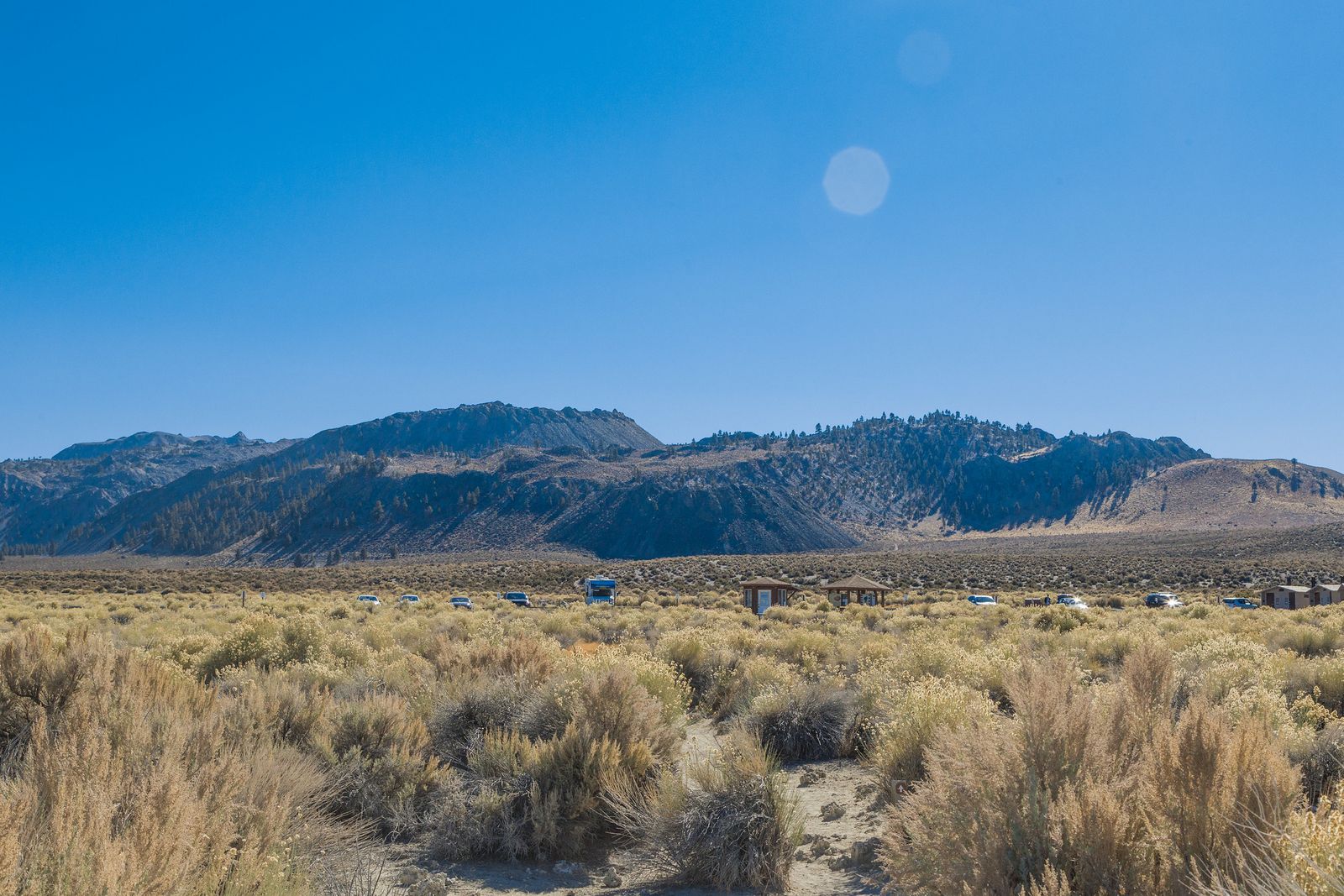
Trailhead access and parking at the South Tufa Reserve (day-use fee)
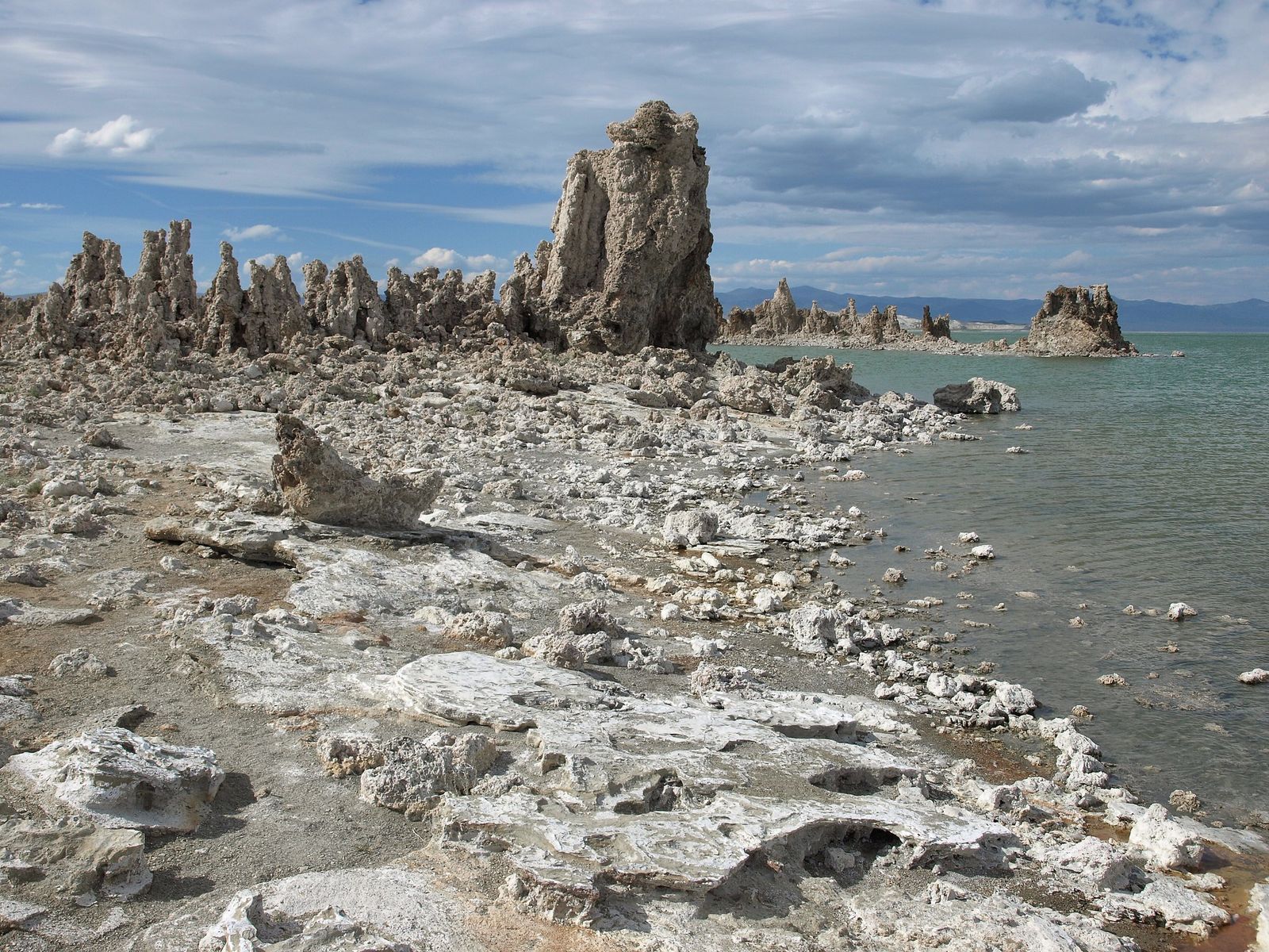
The reserve sits off Highway 120, about 5 miles east of the Highway 395 junction, with ample parking and vault toilets. The fee is $5 per adult (16 and up); 15 and under are free, and America the Beautiful/Interagency passes are accepted.
Difficulty, distance, and elevation gain on the South Tufa loop
A genuine 0.8 to 1.3-mile loop with under 30 ft of elevation gain, flat, easy, and fully self-guided, though the first quarter mile is the most consistently accessible stretch; footing gets uneven and occasionally muddy closer to the shore.
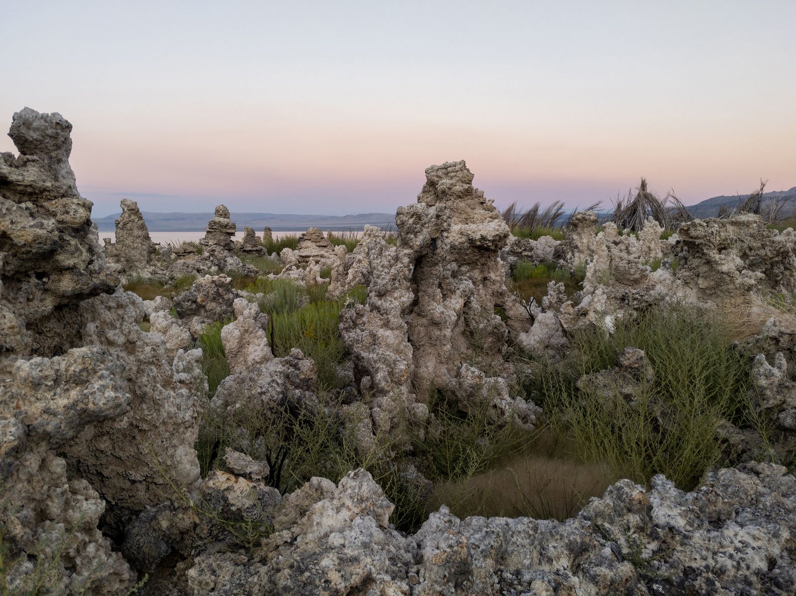
What you’ll see: Mono Lake’s iconic limestone tufa towers
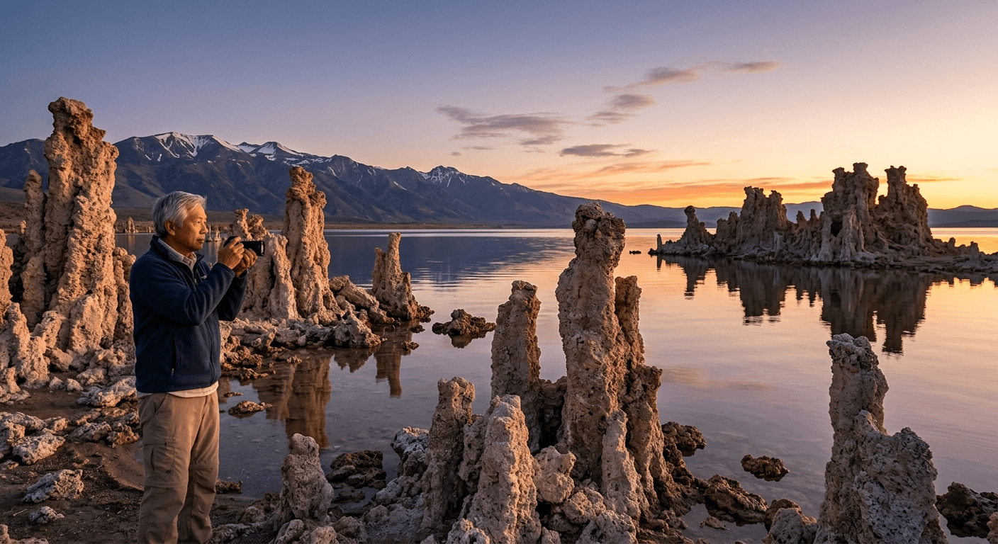
This is the largest and most spectacular concentration of tufa in the entire lake, calcium-carbonate towers up to 30 ft tall, formed underwater where freshwater springs met the lake’s alkaline water, and only exposed today because decades of water diversion to Los Angeles lowered the lake around them. As of a recent report, the lake still sits roughly 8 to 9 feet below its target public trust level of 6,392 feet.
Best time to hike South Tufa: sunrise or sunset for the best tufa photography
Low-angle light silhouettes the towers dramatically at both ends of the day; midday sun and wind are the two most common visitor complaints, so plan around them if photography is the goal.
Old Marina Shoreline Trail: a shaded alternative on the north shore
I want to be upfront that this isn’t the trail the breakdown for this guide originally specified, see the closure notice above for why.
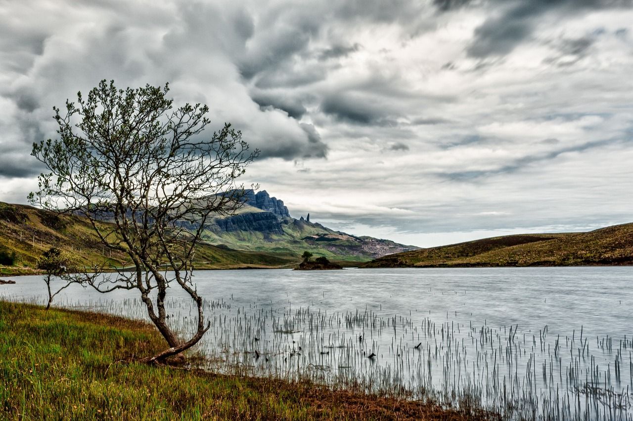
Trailhead access and parking at the Old Marina, north shore of Mono Lake
Free parking at the Old Marina lot, directly off Highway 395 about a mile north of Lee Vining, a different access point than the fee-based South Tufa Reserve.
Difficulty, distance, and elevation gain on the Old Marina trail
An easy, accessible out-and-back running about 0.75 miles each way (roughly 1.5 miles round trip), flat the entire way.
What you’ll see: a cottonwood-shaded approach to a tufa-free stretch of shoreline
This stretch of shoreline lacks South Tufa’s dense tower concentration, but offers a shadier, more intimate approach through cottonwoods, and it’s a genuinely strong bird-watching spot in its own right, given Mono Lake’s status as a globally significant migratory stopover for California gulls and phalaropes.
Best time to hike the Old Marina trail: spring and fall for migratory birds
Spring and fall bring the heaviest bird activity; check current trail and county park status before visiting, since parts of the surrounding park remain affected by the 2025 Inn Fire closure covered above.
Panum Crater Trail: the youngest volcano in the Mono Craters chain
This is the trail I’d add onto a South Tufa visit if you’ve got another 30 minutes, a completely different kind of landscape just a few minutes’ drive away.
Trailhead access and parking at Panum Crater, south of Mono Lake
A free Forest Service pullout just off Highway 120, south of the lake, at the base of the youngest volcano in the Mono Craters chain.
Difficulty, distance, and elevation gain around the Panum Crater rim
A 1.6-mile loop with about 324 ft of gain, combining an easier rim trail with a steeper, looser plug-dome route, moderate, over loose volcanic rock and sand rather than a packed trail surface.
What you’ll see: the youngest and northernmost of the Mono Craters
Panum Crater erupted just 600 to 700 years ago, genuinely recent in geologic terms, and its central plug dome is strewn with obsidian and pumice, the most recently active volcanic feature in this entire guide.
Best time to hike Panum Crater: any season, a short, exposed volcanic walk
The trail’s short length makes it workable most of the year, though there’s no shade anywhere on the loop regardless of when you go.
Black Point Fissures Trail: remote, unmarked, genuinely rare geology
This is the trail for someone who wants solitude and doesn’t mind a bit of genuine route-finding to get it.
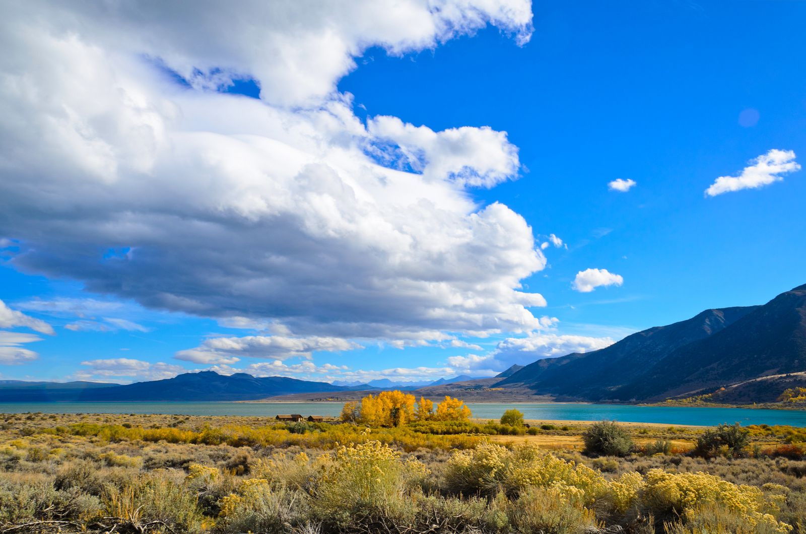
Trailhead access and parking on the north shore of Mono Lake
A free, minimally developed Forest Service access point on the lake’s north shore, the most remote, least-visited trailhead in this entire guide.
Difficulty, distance, and elevation gain to the Black Point fissures
Roughly 2 miles round trip with about 400 ft of gain, but there’s no maintained trail, this is a cross-country route over sand, rock, and sagebrush, and finding the actual fissures requires some genuine exploration once you’re in the general area.
What you’ll see: deep volcanic cracks formed as an underwater cinder cone cooled
These narrow, deep fissures formed roughly 13,000 years ago as an underwater volcanic cinder cone cooled and cracked rapidly, back when Mono Lake’s water level was much higher than today, a genuinely rare formation type, and the only one of its kind in this entire guide.
Best time to hike Black Point: cooler months, the north shore is fully exposed
There’s no shade anywhere on this route, and its remote, unmarked nature makes heat exposure a real safety consideration, not just a comfort issue, cooler months are a genuinely better choice here than for any other trail in this guide.
Lundy Canyon Trail: waterfalls, beavers, and the best fall color in the basin
This closes out the guide on its most physically demanding and visually different entry, a real canyon, not a lakeshore walk.
Trailhead access and parking at Lundy Lake, Mono Basin
A free Forest Service trailhead at the end of Lundy Lake Road, a short drive from Mono Lake’s north shore, genuinely the only true canyon-hike destination in this otherwise lakeshore-and-volcano-focused guide.
Difficulty, distance, and elevation gain through Lundy Canyon
The accessible canyon floor runs about 3 miles one-way to the Hoover Wilderness boundary, commonly hiked as a 4.5 to 6-mile round trip with about 1,200 ft of gain depending on how far you go, genuinely the longest, most demanding trail in this guide.
What you’ll see: waterfalls, beaver ponds, and some of the best fall color in the Mono Basin
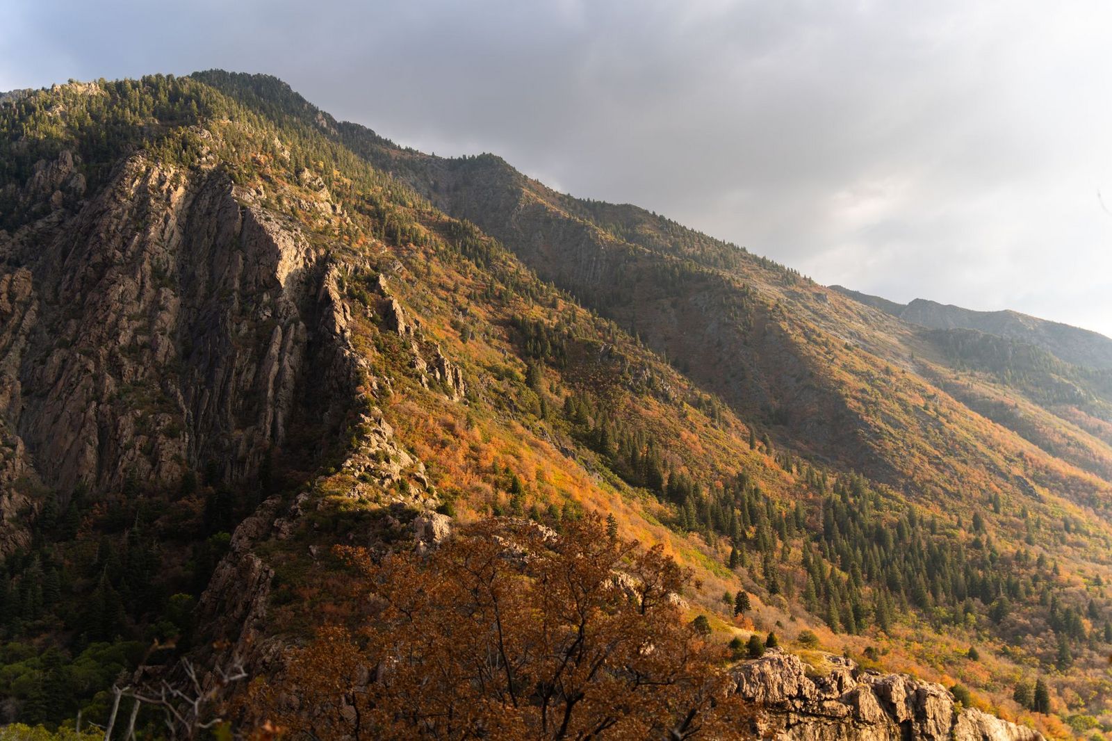
Lundy Canyon Falls drops 60 to 70 ft in twin horsetail plunges just past the trailhead, with active beaver ponds and dense aspen groves lining the route, widely regarded as the single best fall color display anywhere in the Mono Basin. Continuing beyond the wilderness boundary toward Twenty Lakes Basin involves a genuinely steep, unstable talus chute, a serious undertaking, not a casual extension.
Best time to hike Lundy Canyon: late September for peak aspen color
This is the one piece of timing advice in this guide that draws visitors specifically for it, late September aspen color here is a genuine regional draw, distinct from anything else in the Mono Basin.
The trail I’d actually start with
If you’ve only got one stop at Mono Lake, make it South Tufa, nothing else in this guide captures the lake’s signature landscape as directly or as easily. Panum Crater is the natural add-on if you’ve got another half hour, and Lundy Canyon deserves its own dedicated trip, ideally timed to late September. Skip the Old Marina boardwalk plans until you’ve confirmed current status, and check on Black Point’s remote conditions before committing to that one solo.
For the alpine terrain just south of here, my Eastern Sierra high-altitude trails guide covers Bloody Canyon, which offers its own dramatic views down to Mono Lake from above. And for the rest of the county, my guides to the Ansel Adams Wilderness and Mono County’s hot springs and hiking combos, and the scenic Convict Lake loop round out what else this area has to offer, or see the full Mono County hiking guide for the complete picture.
Frequently asked questions
What are tufa towers?
Tufa are limestone formations made of calcium carbonate, created underwater where freshwater springs meet Mono Lake’s alkaline water. Decades of water diversion lowered the lake, exposing towers that originally formed below the surface, some now standing up to 30 ft tall.
Is there a fee to hike at South Tufa?
Yes, $5 per adult for anyone 16 or older, with children 15 and under free. America the Beautiful and other Interagency annual passes are accepted in place of the fee.
Can you swim in Mono Lake?
Yes, and it’s a genuinely memorable experience, the water is roughly three times saltier than the ocean, making you noticeably more buoyant than in a normal swim. There are no fish in the lake, though it supports enormous populations of brine shrimp and alkali flies.
Is Panum Crater a volcano?
Yes, it’s the youngest and northernmost volcano in the Mono Craters chain, having erupted an estimated 600 to 700 years ago, making it geologically very recent.
Is Lundy Canyon good for fall color?
Yes, widely regarded as the best fall color display in the entire Mono Basin, thanks to dense aspen groves along the canyon floor. Late September is the specific window most visitors time their trip around.
Is Mono Lake older than Lake Tahoe?
Yes, considerably, Mono Lake is estimated to be at least 760,000 years old, and possibly over 1 million, making it one of the oldest lakes in North America. Lake Tahoe, by comparison, formed around 2 million years ago in one estimate but reached its current form far more recently through a combination of faulting and volcanic activity, the comparison depends on exactly which formation stage you’re measuring, but Mono Lake is generally considered one of the oldest continuously existing lakes on the continent.