Glacier & High Elevation Hiking in the Sierra Nevada: What to Know
High elevation hiking in California generally starts around 8,000 feet, which is roughly where altitude begins measurably affecting the human body, and it runs all the way up to Mount Whitney’s 14,505 ft summit, the highest point in the contiguous United States. I’ve spent four-plus years cataloging trails across this state, and the Sierra Nevada’s high country is where good planning matters more than almost anywhere else I cover: the margin between a spectacular day and a genuine medical emergency is thinner than most hikers expect. This guide covers altitude sickness, glacier and snowfield hazards, and what actually changes about your body above 8,000 feet.
Disclosure: Please note that some of the links below are affiliate links and at no additional cost to you, I may earn a commission. Know that I only recommend hiking gear I personally stand behind; when you use my affiliate links, it helps me run this blog and keep all of this content free of charge for readers (like you).
Key takeaways:
- Altitude effects typically begin around 8,000 ft; acute mountain sickness (AMS) can occur at that elevation and becomes more common the higher you go.
- HACE and HAPE, the severe forms of altitude illness, are medical emergencies requiring immediate descent, not a “wait and see” approach.
- Oxygen availability at Mount Whitney’s summit (14,505 ft) is roughly 60% of sea level, which is why pace, not fitness alone, has to change at altitude.
- California’s Sierra Nevada glaciers are shrinking fast. Mount Lyell’s glacier, once Yosemite’s largest, has stopped flowing entirely, and researchers project the range could be glacier-free by 2100.
- Most Sierra high-country trails aren’t reliably snow-free and open until sometime between late May and July, and the exact date varies significantly year to year.
What is high-elevation hiking, and where does it begin in California?
Altitude starts changing your body’s oxygen delivery around 5,000 ft, but most hikers don’t notice real effects until somewhere around 8,000 ft, which is the threshold this guide treats as the start of genuine “high-elevation hiking.”
California’s high-elevation hiking zones: Sierra Nevada, White Mountains, and the Cascades
The Sierra Nevada crest holds the largest concentration of high-altitude trails in the state, including Mount Whitney at 14,505 ft, the highest point in the contiguous U.S. The White Mountains, east of the Sierra near Bishop, hold the Ancient Bristlecone Pine Forest above 10,000 ft, some of the oldest living trees on Earth, growing in genuinely thin air. California’s Cascade volcanoes, Mount Shasta and Lassen Peak, add a third, geologically distinct high-elevation zone in the northern part of the state.
Does California have glaciers you can hike near?
Yes, though there are fewer than there used to be, and the number keeps shrinking. Palisade Glacier, in the John Muir Wilderness near Bishop, is currently the largest and most active. Maclure Glacier, near Yosemite’s Mount Lyell, still shows slow measurable flow, but Lyell Glacier itself, once Yosemite’s largest, has lost active motion entirely and is now classified as stagnant ice rather than a true glacier. A 2025 study published in Science Advances found these glaciers are likely disappearing for the first time in roughly 11,700 years, and projected the Sierra Nevada could be glacier-free by 2100. If seeing one matters to your trip planning, don’t wait.
Altitude sickness: understanding and preventing AMS on California’s high trails
Symptoms of altitude sickness every Sierra Nevada hiker must recognize
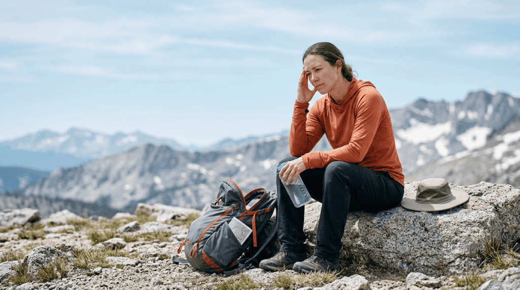
Acute mountain sickness (AMS) shows up as headache plus at least one of: nausea, fatigue, dizziness, or loss of appetite, usually within 6–24 hours of reaching altitude. It’s common; research suggests over a quarter of people hiking above 8,000 ft develop some symptoms. AMS on its own isn’t usually dangerous, but it’s also your body’s clearest warning sign to stop ascending, not push through.
How to acclimatize before high-elevation hiking in the Sierra Nevada
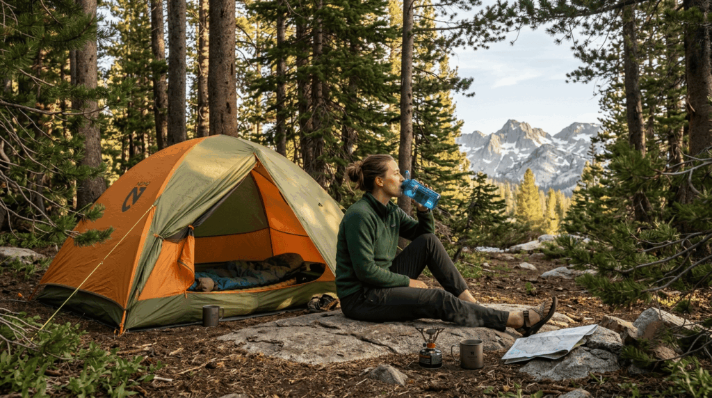
Spend a night or two at an intermediate elevation (roughly 6,000–8,000 ft) before a big summit push, since acclimatization takes time your itinerary has to actually allow for. Hydrate well before and during your climb, and avoid alcohol the night before a high-elevation push, since it worsens dehydration and can mask early AMS symptoms. Some hikers discuss preventive medication like acetazolamide (Diamox) with their doctor before a trip; that’s a conversation for a physician, not something to self-prescribe from a blog post. Check our water and electrolytes guide for altitude hydration specifics.
When to descend immediately: altitude sickness emergency signs
| Condition | Warning signs | Action |
|---|---|---|
| AMS (mild-moderate) | Headache, nausea, fatigue, dizziness | Stop ascending, rest, hydrate; descend if not improving |
| HACE | Confusion, loss of coordination (can’t walk heel-to-toe), severe headache | Descend immediately — can be fatal within hours |
| HAPE | Breathlessness at rest, persistent cough, extreme fatigue | Descend immediately — can be fatal within hours |
HACE and HAPE are not “push through it” situations. Both are medical emergencies where the only reliably effective treatment is getting to lower elevation, and both can kill within hours if ignored.
Physical demands of high-elevation hiking in California
How oxygen reduction at altitude changes your hiking pace in the Sierra Nevada
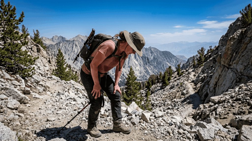
VO2 max, your body’s capacity to use oxygen during exertion, drops roughly 10% for every 3,000 ft gained above 5,000 ft, according to altitude physiology research, though individual response varies. At Mount Whitney’s 14,505 ft summit, oxygen availability is roughly 60% of what it is at sea level. In practice, that means a pace that feels easy at 5,000 ft can leave you genuinely breathless at 12,000 ft. Plan for a slower pace and more rest breaks than your sea-level fitness would suggest, not less. Always check the trail difficulty rating against your actual altitude experience, not just your sea-level fitness.
Training for high-elevation hiking: how to prepare your body before you go
Build a real cardiovascular base with regular sea-level training, then add progressive altitude exposure if you can; even day trips above 8,000 ft in the weeks before a big climb help. Loaded hikes (training with the pack weight you’ll actually carry) build the specific strength altitude hiking demands, and a baseline of good iron levels supports the oxygen-carrying capacity your body leans on harder at altitude, worth a conversation with a doctor if you have any history of anemia.
Glacier and snowfield hazards in the Sierra Nevada
Sierra glaciers and snowfields bring hazards day hikers rarely deal with elsewhere: bergschrunds (crevasse-like gaps where a glacier pulls away from the rock above it), unstable moraine, glacial stream crossings that can spike in the afternoon as snow melts, and sun cupping that makes snow travel deceptively exhausting. River crossings near glacial zones are covered in depth in the water hazards guide.
Microspikes vs. crampons: what traction gear do you need for Sierra snowfields?
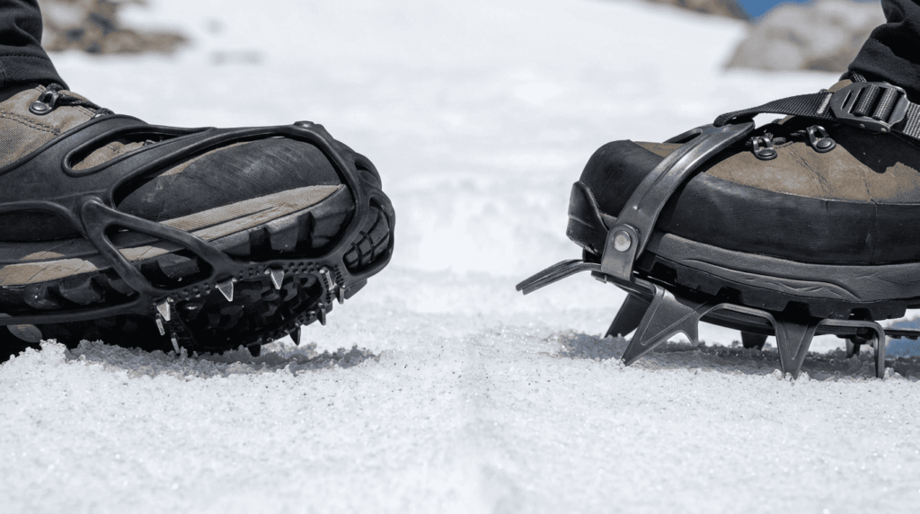
| Microspikes | Crampons | |
|---|---|---|
| Best for | Consolidated snow, moderate slope, established trail | Steep ice, technical glacier travel, firm névé |
| Boot compatibility | Most hiking boots and trail shoes | Stiffer mountaineering-specific boots typically required |
| When you need them | Most spring/early summer Sierra snow crossings | Genuine glacier travel or steep, hard snow/ice |
Most day hikers crossing spring snowfields on established Sierra trails need microspikes, not crampons. Crampons are for terrain steep and icy enough that a slip would be genuinely dangerous, which is a smaller subset of what most hikers encounter.
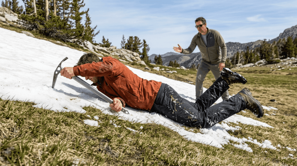
Ice axe use on California’s high Sierra snowfields: when is it required?
An ice axe (and the self-arrest technique to use it) becomes relevant when snow is firm enough that a fall could turn into an uncontrolled slide, typically May through July on steeper Sierra couloirs and passes. If you don’t already know the self-arrest technique, practice it on a low-consequence slope before you need it for real, or rent gear and skip routes that require it until you do.
High-elevation trail conditions in California: a month-by-month overview
When do Sierra Nevada high-elevation trails open each year?
Tioga Pass, the main gateway to Yosemite’s high country, typically opens sometime between mid-May and late June, though the exact date depends entirely on snowpack; it’s opened as early as May 4 and as late as July 22 in recent years. Don’t plan a specific high-country trip date months without a fallback; check current conditions through Yosemite’s official NPS site or the Inyo National Forest trail hotline as your trip approaches. Also review the seasonal hazards calendar for a month-by-month risk breakdown.
What to expect on California’s high-elevation trails in late spring vs. late summer
Late spring means snow-covered trail beds, high and fast-moving water crossings, and real isolation, since most hikers wait for drier conditions. Late summer trades that for dry, dusty trail, afternoon thunderstorm risk on exposed ridgelines, and increasingly wildfire smoke that can turn a clear-day view into a hazy one with little warning. Neither season is strictly “easier”; they’re different risk profiles. The weather hazards guide covers thunderstorm timing and smoke in detail.
Essential gear for high-elevation and glacier-adjacent hiking in California
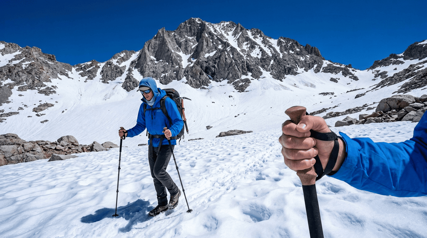
Beyond the standard Ten Essentials, high-elevation trips call for a real layering system (temperatures swing hard between sun and shade, and after dark), trekking poles for snow and loose talus, and an emergency bivy given how much colder and more remote this terrain is than a typical day hike.
Sun protection at high elevation: why UV exposure increases sharply above 10,000 feet
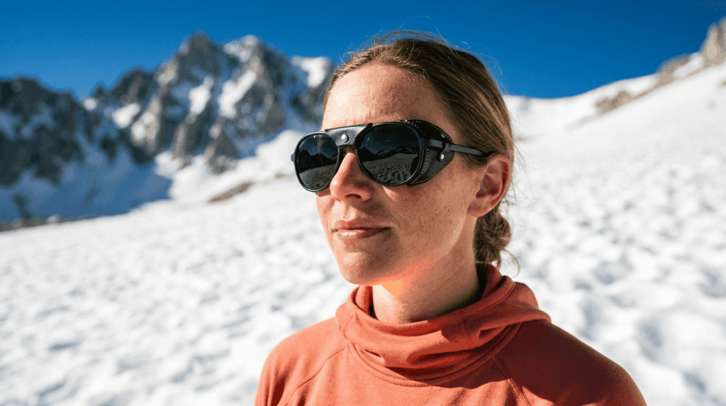
Thinner atmosphere at altitude lets more UV radiation through, commonly estimated at roughly 10–12% more per 1,000 meters of elevation gain, and snow can reflect a large share of that UV at you, compounding the exposure well beyond what the elevation increase alone would suggest. SPF 50+ sunscreen, UPF-rated clothing, and glacier glasses rated UV400 aren’t overkill above 10,000 ft; sunburn and snow blindness both happen faster there than people expect.
If you’re building toward your first high-elevation trip, our hiking safety guide covers the broader preparation basics, and honestly assessing a route’s difficulty rating matters even more once altitude is added to the equation.
Frequently asked questions: high-elevation hiking in California
What hiking trails are open in Glacier National Park?
If you’re looking for Montana’s Glacier National Park, check that park’s official NPS site directly. This guide covers California’s Sierra Nevada glaciers (Palisade, Maclure, and the shrinking ice near Mount Lyell), which are a different mountain range entirely.
Which hiking trail reaches the highest altitude in California?
The Mount Whitney Trail, topping out at 14,505 ft, is the highest-elevation hiking trail in California and the contiguous United States.
What is altitude sickness and how do you prevent it while hiking?
Altitude sickness (AMS) is headache plus symptoms like nausea or fatigue caused by reduced oxygen at elevation; prevention centers on gradual ascent, proper hydration, and stopping to acclimatize rather than pushing through early symptoms.
Do I need microspikes or crampons for Sierra Nevada hiking?
Most spring and early-summer snow crossings on established Sierra trails call for microspikes; crampons are for steeper, icier, more technical glacier or snowfield terrain that a smaller share of hikers actually encounter.
When do high-elevation Sierra Nevada trails open each year?
Typically, sometime between mid-May and late June, though this varies significantly by year based on snowpack, always check current conditions rather than planning around a fixed calendar date.
How do I train for high-altitude hiking in California?
Build a solid cardiovascular base at sea level, add progressive altitude exposure where possible, train with the pack weight you’ll actually carry, and talk to a doctor about iron levels if you have any history of anemia.