Best Waterfall Hikes in California
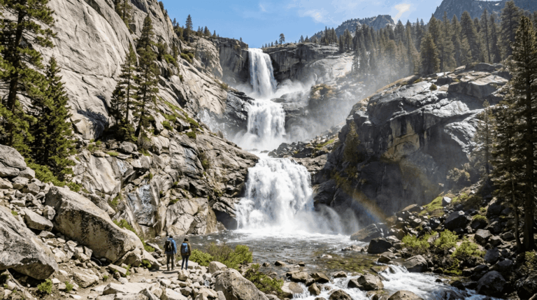
California doesn’t just have waterfalls; it has more than 1,000 named ones, spread across enough different biomes that a single state produces snowmelt giants, spring-fed curtains, and tidefalls that drop straight onto a beach. That range is the whole appeal and also the whole planning problem: finding the best waterfall hikes in California changes completely depending on season, region, and how far you’re willing to hike. Show up in August expecting Upper Yosemite Falls at full force, and you’ll find a trickle; show up at the right coastal fall in February, and you’ll catch it at its most dramatic. Here’s the real breakdown, by region, with the timing and mileage that actually matter.
Disclosure: Please note that some of the links below are affiliate links and at no additional cost to you, I may earn a commission. Know that I only recommend hiking gear I personally stand behind; when you use my affiliate links, it helps me run this blog and keep all of this content free of charge for readers (like you).
Key takeaways
- California has more than 1,000 named waterfalls, across Sierra snowmelt falls, coastal fog- and rain-fed falls, and year-round spring-fed falls in the north.
- Timing matters more than any other single factor. Sierra Falls peak in May–June with snowmelt, coastal falls peak in winter and spring rain, and a handful of spring-fed falls run strong year-round.
- Yosemite Falls is the tallest waterfall in North America at 2,425 ft, and the full hike to its top is a genuinely strenuous 7.2-mi round trip with 2,700 ft of gain.
- Not every famous waterfall is close. Alamere Falls at Point Reyes is a 13-mi round trip, and several Sierra falls require real backcountry mileage.
- Waterfall-based pools are more dangerous than they look. Undercut currents, slick rock, and cold water make many of them unsafe to swim in, regardless of how calm the surface appears.
- McWay Falls is one of the few tidefalls in the country. It drops onto a beach reshaped by a 1985 landslide, with no legal beach access, and its usual overlook trail is currently closed for repairs as of 2026, so check the current status before visiting.
Quick-reference: California’s best waterfall hikes at a glance
| Waterfall | Region | Height | Round trip | Best season |
|---|---|---|---|---|
| Yosemite Falls | Yosemite Valley | 2,425 ft | 7.2 mi (or ~1 mi to base) | May–June |
| Vernal & Nevada Falls | Yosemite Valley | Tiered | ~5.4–7 mi | April–June |
| Burney Falls | Shasta County | 129 ft | 1.3 mi | Year-round |
| Feather Falls | Plumas NF | 410 ft | ~8 mi | Spring |
| Rainbow Falls | Mono County | 101 ft | 2.5 mi | Summer, midday |
| Chilnualna Falls | Wawona | Multi-tier | 8.4 mi | April–June |
| Eaton Canyon Falls | LA County | — | 3.8 mi | Year-round |
| Sturtevant Falls | LA County | 50 ft | 3.4 mi | Spring |
| McWay Falls | Big Sur | 80 ft | Overlook closed for repairs (2026) | Year-round |
| Alamere Falls | Point Reyes | — | 13 mi | Year-round, tide-dependent |
Use this table as a starting filter, then check current conditions before you commit flow, crowding, and access all shifts by season more than the table alone can capture.
Why California has some of the best waterfall hikes in the United States
Few states combine alpine snowmelt, spring-fed volcanic terrain, and a fog-drenched coastline the way California does, and that geographic range is exactly why its waterfall hikes don’t fit one template.
When is the best time to see waterfalls in California?
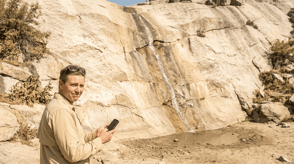
Sierra Nevada falls, fed by snowmelt, peak in May and June and can shrink to a trickle by late summer. Yosemite Falls itself is often dry by August in a normal year, which surprises visitors who assume a waterfall this famous flows year-round. Coastal falls run the opposite pattern, strongest during winter and spring rains and weaker by summer, since they depend on storm runoff rather than snowpack. A handful of Northern California falls, including Burney Falls, are spring-fed and run at nearly constant volume year-round, making them the most reliable bet outside the snowmelt window and a smart pick if your trip dates aren’t flexible. See the seasonal hazards guide for a fuller month-by-month California conditions breakdown.
Types of waterfalls you’ll find on California hiking trails
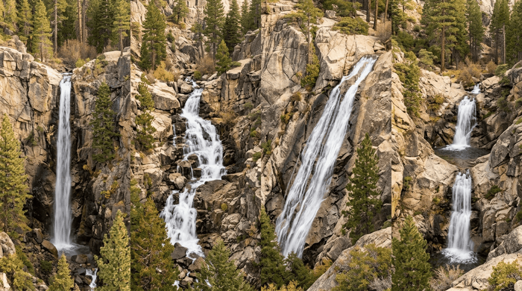
Plunge falls drop vertically with little contact with the rock face behind them (Yosemite Falls’ upper tier is a classic example); cascade falls tumble over a series of rock steps; horsetail falls maintain some contact with the rock as they fall, creating a feathered look; and tiered falls drop in multiple distinct stages, like Yosemite’s Vernal and Nevada Falls in sequence.
Best waterfall hikes in Yosemite National Park
Yosemite is the single most-searched waterfall cluster in the state, and for good reason, few places pack this many major falls into one valley. Permits and reservations for Yosemite can be checked through Recreation.gov.
Yosemite Falls Trail: how to hike to the tallest waterfall in North America
The full trail to the top of Yosemite Falls (2,425 ft total drop, the tallest in North America) is a strenuous 7.2-mi round trip with about 2,700 ft of elevation gain, no permit required for a day hike. For a far easier option, the Lower Yosemite Fall loop is about a mile, flat, and gets you close enough to feel the spray during peak flow. Check the trail difficulty guide to assess whether the strenuous upper trail matches your fitness.
Vernal Fall and Nevada Fall: the Mist Trail waterfall loop in Yosemite
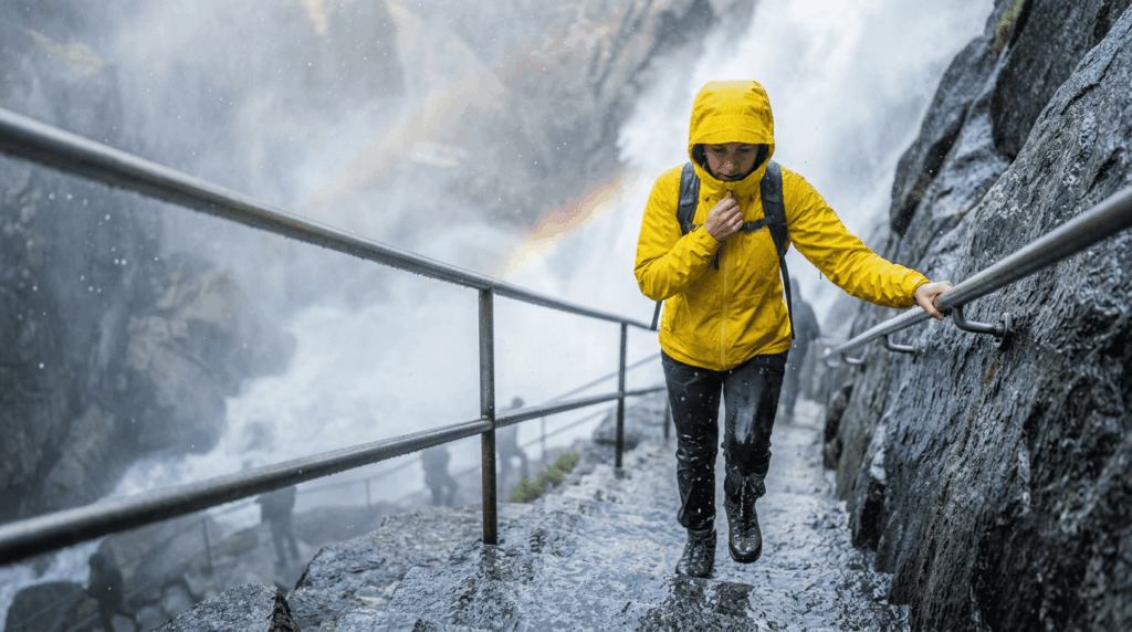
The Mist Trail from Happy Isles delivers two waterfalls in one hike: Vernal Fall first, then Nevada Fall further up, and doubles as an alternate approach to the John Muir Trail. Expect genuine crowds and a wet, slippery granite staircase near Vernal Fall’s base in spring, when spray from the fall soaks the trail itself; a rain jacket earns its weight here even on a clear day. Turning around after Vernal Fall alone is a completely reasonable choice if the full loop to Nevada Fall feels like too much.
Best waterfall hikes in Northern California
NorCal’s waterfall cluster trades Yosemite’s crowds for quieter access and, in a few cases, year-round flow that doesn’t depend on snowmelt timing.
McArthur-Burney Falls: the “Eighth Wonder of the World” near Mount Shasta
Burney Falls drops 129 ft and is fed by underground springs at a nearly constant 100 million gallons a day, which is why it keeps flowing even through California’s driest summers. Theodore Roosevelt is widely credited with calling it the “Eighth Wonder of the World,” and the loop trail to see it is an easy 1.3 mi. Current park conditions are available through California State Parks.
Feather Falls: Northern California’s tallest accessible waterfall
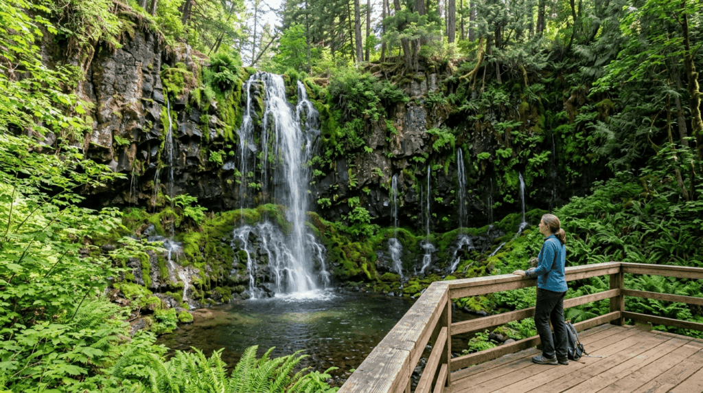
Feather Falls, in Plumas National Forest, drops 410 ft. Current USGS-based measurements corrected the height down from the long-repeated 640-ft figure, though it’s still commonly described as the sixth-tallest year-round waterfall in the country. The loop trail runs roughly 8 mi with around 1,100 ft of elevation gain, rated moderate, and flow peaks in spring.
Best waterfall hikes in the Sierra Nevada
Beyond Yosemite Valley, the wider Sierra Nevada holds waterfall hikes ranging from an easy shuttle-served walk to genuine backcountry mileage, including the iconic Eagle Falls near Lake Tahoe.
Rainbow Falls near Mammoth Lakes: the Sierra’s most colorful waterfall hike
Rainbow Falls, near Devils Postpile National Monument in Mono County, is a roughly 2.5-mi round trip best visited around midday, when the sun angle creates a visible rainbow in the mist. Summer access typically runs through the mandatory shuttle system rather than direct car access.
Chilnualna Falls in Wawona: Yosemite’s hidden waterfall gem
Chilnualna Falls, accessed from the quieter Wawona area in southern Yosemite, drops in four tiers over an 8.4-mi round trip, significantly less crowded than the Valley Falls, and a good option for hikers who want Yosemite waterfall scenery without Yosemite Valley traffic.
Best waterfall hikes in Southern California
SoCal’s waterfall hikes prove the region isn’t just desert and beach; the San Gabriel Mountains alone hold several genuinely good options within an hour of downtown LA.
Eaton Canyon Falls: Los Angeles’s most popular waterfall hike
Eaton Canyon, at roughly 3.8 mi round trip and rated easy, runs with water year-round and gets genuinely crowded on weekends given its proximity to LA. Arrive early for parking, and expect company at the falls themselves regardless of when you go.
Sturtevant Falls in the San Gabriel Mountains, Los Angeles County
Sturtevant Falls, a 50-ft drop reached from the Chantry Flat trailhead, runs about 3.4 mi round trip at a moderate rating, with flow that varies seasonally and can thin out considerably by late summer.
Best coastal and redwood waterfall hikes in California
Coastal waterfalls trade snowmelt drama for something rarer, a couple of genuine tidefalls found almost nowhere else in the country.
McWay Falls in Big Sur: California’s only tidefall waterfall
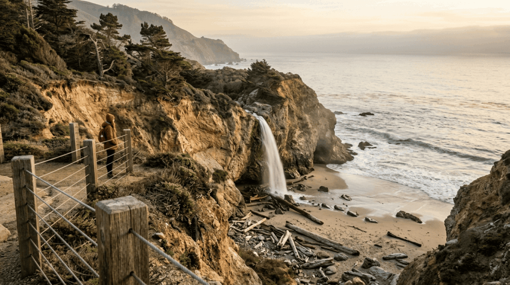
McWay Falls, an 80-ft drop in Julia Pfeiffer Burns State Park in Monterey County, drops onto a beach that was substantially reshaped by a 1985 landslide. Beach access itself is closed and illegal year-round, so this has always been a look-don’t-touch waterfall. As of 2026, the usual 0.7-mi overlook trail is closed for a long-term retaining wall repair project, and the falls can currently only be viewed from a small pullout on Highway 1. Check California State Parks’ current status before planning a visit, since this kind of closure is exactly the sort of detail that lags behind older blog posts and trail apps.
Alamere Falls at Point Reyes: the waterfall that drops onto the beach
Alamere Falls, a genuine tidefall in Marin County, is reached via a roughly 13-mi round trip from the Palomarin Trailhead, with no fully maintained trail for the final beach approach. This is a full-day commitment, not a casual add-on, and it deserves the same trip-planning seriousness as any other long, remote California hike detailed across our Point Reyes hiking routes.
Waterfall hike safety: what to know before you chase falls in California
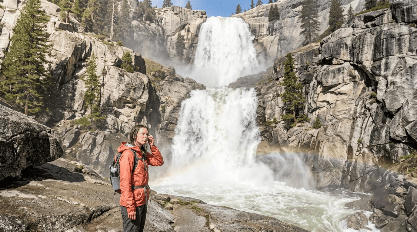
Waterfall base pools look inviting and are frequently far more dangerous than they appear. Slippery rock, undercut currents that can trap a swimmer underwater, and cold snowmelt temperatures all combine at exactly the spot most people want to jump in. Flash flooding is also a real risk immediately below and above certain falls, particularly in narrow canyon terrain where a storm well upstream can raise water levels with little local warning. Treat any pool at the base of a waterfall the same way you’d treat any other water hazard: assess before you enter, never assume a calm surface means a safe current underneath, and skip swimming entirely at falls with posted warnings or a known history of incidents. For planned swimming near waterfalls, also review the swimhiking guide for cold water safety specifics.
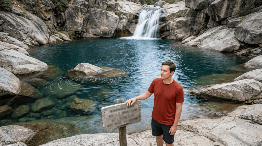
California’s waterfalls reward planning around timing as much as planning around distance. The “best” hike genuinely depends on whether you’re chasing peak snowmelt, a reliable year-round flow, or a rare coastal tidefall. Pick your region, check the season against the fall type, and treat the water itself with real caution once you’re standing at the base.
Frequently asked questions about California’s best waterfall hikes
What are the best waterfall hikes in California?
Yosemite Falls and the Mist Trail (Vernal and Nevada Falls) top most lists for scale and accessibility, while Burney Falls offers the most reliable year-round flow and McWay Falls in Big Sur offers a rare coastal tidefall.
When is the best time to visit California waterfalls?
May and June for Sierra snowmelt falls at peak flow, winter and spring for coastal falls fed by rain, and essentially any time of year for spring-fed falls like Burney Falls.
How do I hike to Yosemite Falls?
The full 7.2-mi round-trip trail to the top starts near Camp 4 in Yosemite Valley and gains about 2,700 ft; for an easier option, the roughly 1-mi Lower Yosemite Fall loop gets you close to the base without the full climb.
Are there waterfall hikes near Los Angeles?
Yes, Eaton Canyon Falls (about 3.8 mi round trip, easy) and Sturtevant Falls (about 3.4 mi round trip, moderate) are both within about an hour of downtown LA in the San Gabriel Mountains.
Is it safe to swim at the base of waterfalls in California?
Not always, even when it looks calm, undercut currents, slippery rock, and cold water make many waterfall pools genuinely dangerous. Check for posted warnings and known incident history before swimming, and when in doubt, stay out.
What California waterfalls flow year-round?
Burney Falls, spring-fed at a near-constant 100 million gallons a day, is the most reliable year-round example. Most Sierra snowmelt falls and coastal rain-fed falls, by contrast, vary dramatically by season.