Eagle Falls Hiking Guide at Lake Tahoe
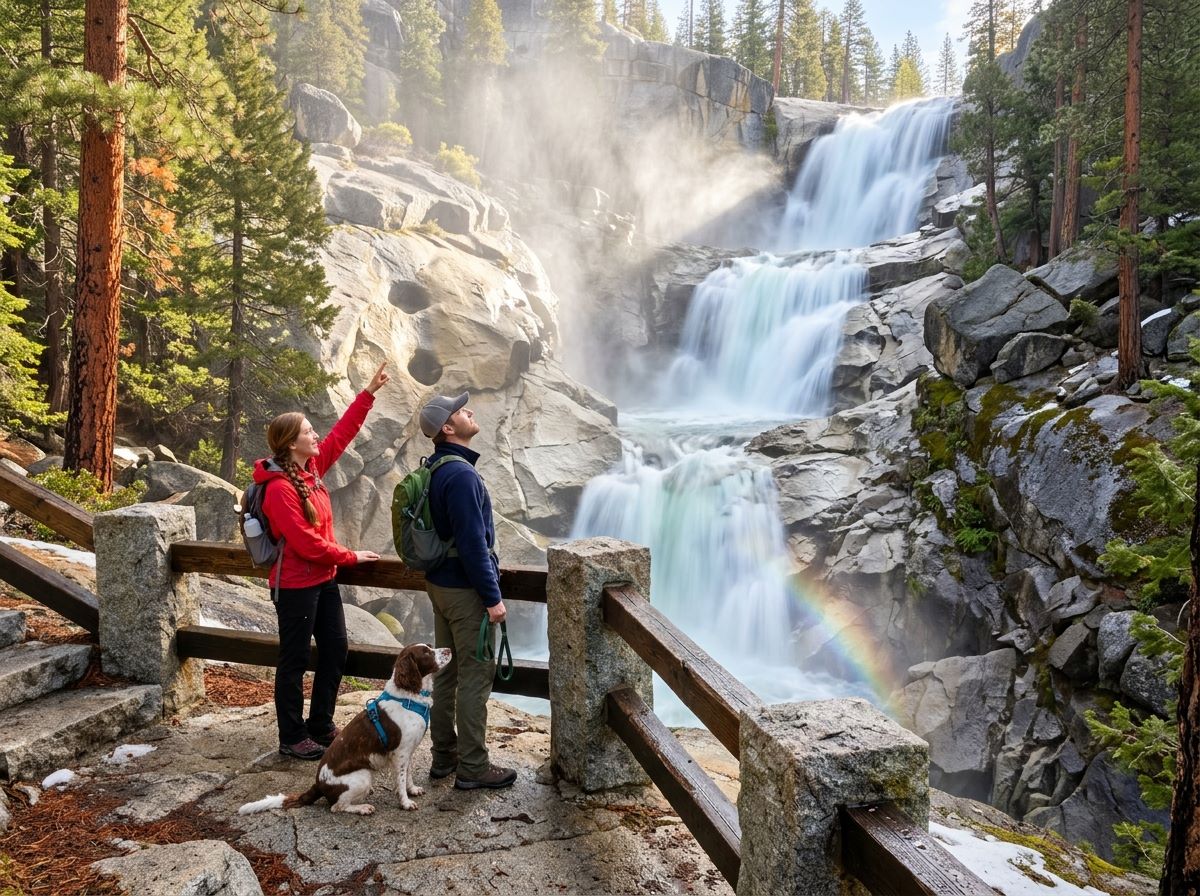
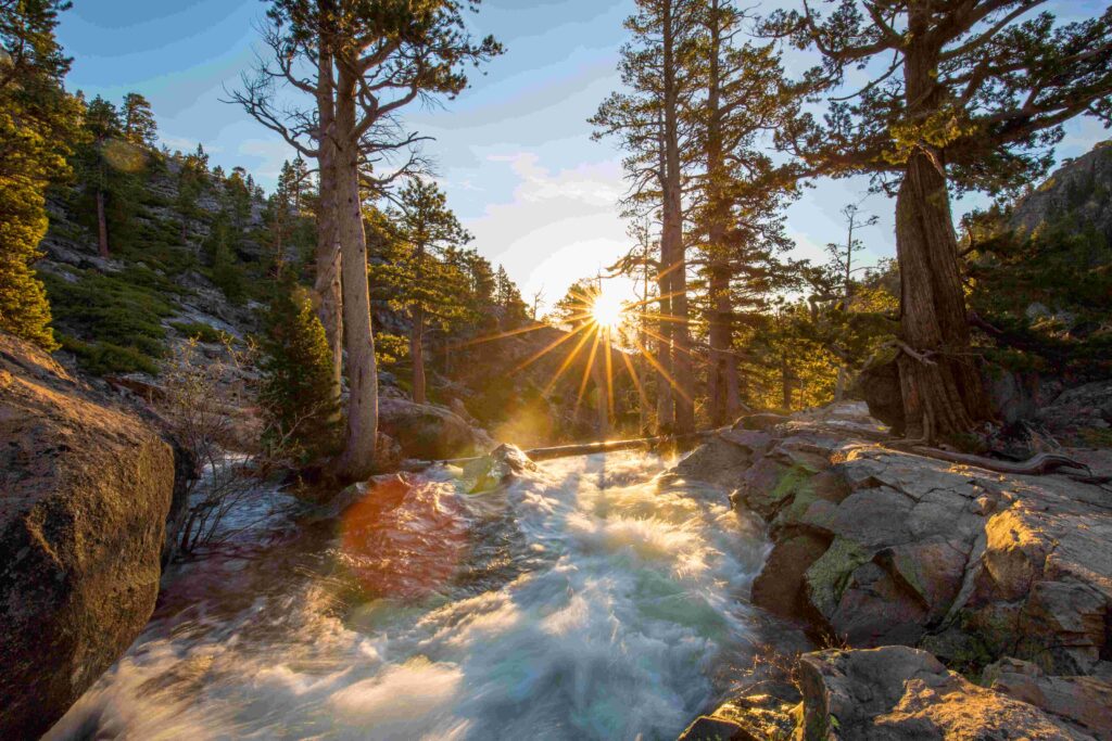
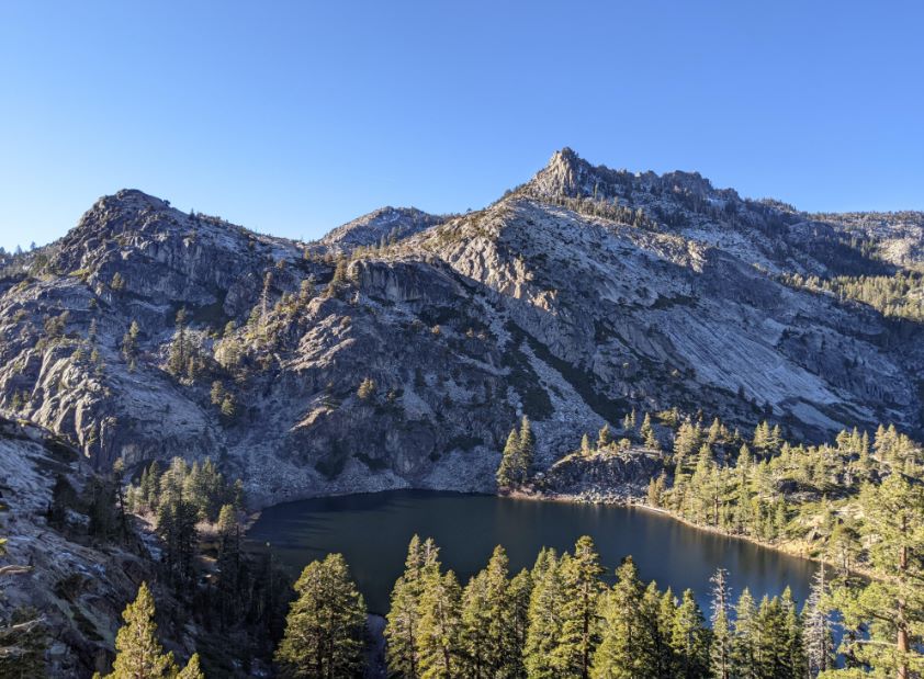
The Eagle Falls Trail starts in a shaded Forest Service lot on Highway 89, across the road from Emerald Bay, at about 7,100 feet. Within minutes, the trail turns to rocky steps, with Upper Eagle Falls close by along Eagle Creek, and about a mile later it ends at Eagle Lake, a granite-edged lake inside Desolation Wilderness. That mix of falling water, a short climb, and a lake at the top makes it a popular short hike, and the same trailhead is a doorway to the Velma Lakes, Dicks Lake, and Dicks Pass for hikers who want more.
Disclosure: Please note that some of the links below are affiliate links and at no additional cost to you, I may earn a commission. Know that I only recommend hiking gear I personally stand behind; when you use my affiliate links, it helps me run this blog and keep all of this content free of charge for readers (like you).
The trail itself is the easy part. The parking lot, the permit box, and the crowds decide how the day goes. This guide covers Eagle Falls Lake Tahoe from the road to the lake: where to park, what the day-use permit costs, how the trail climbs, how it differs from Lower Eagle Falls, and when to go.
Key Takeaways
- Eagle Falls Trail begins at the Eagle Falls Picnic Area and Trailhead on Highway 89, roughly 9 miles northwest of South Lake Tahoe and across the highway from Emerald Bay.
- Eagle Lake is about 1.0 mile one way from the trailhead, with roughly 430 feet of climbing according to CalEXPLORnia, and most hikers allow 1 to 1.5 hours round trip.
- Eagle Falls trailhead parking costs $5 per vehicle per day. The lot is small, and the Forest Service says it can be extremely crowded on weekends.
- A free Desolation Wilderness day-use permit is self-issued at the trailhead. Overnight trips need a reserved permit from Recreation.gov.
- The trailhead is typically open from mid-May through mid-October, depending on weather.
- During the summer shuttle season, both Emerald Bay Shuttle routes stop at the Eagle Falls trailhead.
Eagle Falls Lake Tahoe at a Glance
| Detail | What to know |
|---|---|
| Trailhead | Eagle Falls Picnic Area and Trailhead, Highway 89, about 7,100 feet |
| Distance to Eagle Lake | About 1.0 mile one way |
| Climb to Eagle Lake | Roughly 430 feet (third-party figure) |
| Parking | $5 per vehicle per day |
| Hours | Open 24 hours a day; typically open mid-May to mid-October |
| Facilities | Restrooms when the lot is open, picnic tables, no drinking water |
| Day-use permit | Free, self-issued at the trailhead |
| Dogs | Allowed on leash |
| Campfires | Not allowed at the trailhead or in Desolation Wilderness |
Where the Eagle Falls Trailhead Sits
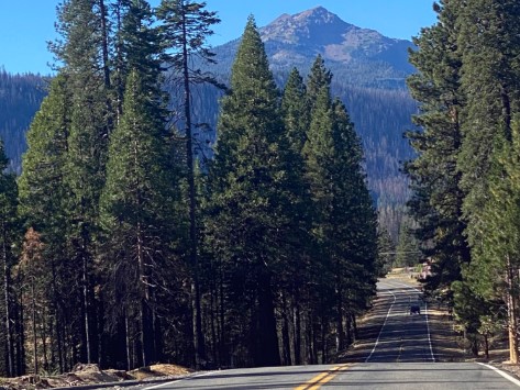
From South Lake Tahoe, take Highway 89 northwest for about 9 miles, according to the Forest Service. The trailhead is across the highway from Emerald Bay. From Tahoe City and Truckee, take Highway 89 south to Emerald Bay.
The trailhead is on Forest Service land managed by the Lake Tahoe Basin Management Unit, not inside Emerald Bay State Park, which is why the rules, fees, and dog policy differ from the park across the road.
The area is part of El Dorado County, and our guide to hiking trails around Lake Tahoe shows how it fits among the shoreline and alpine routes on both sides of the lake. If you want the state park side of the highway, with Vikingsholm and Fannette Island, our Emerald Bay State Park guide covers it.
Eagle Falls Trailhead Parking
Parking is the main obstacle. The Forest Service charges $5 per vehicle per day at the lot and says the area can be extremely crowded on weekends, so it suggests early morning or late afternoon visits. Interagency Annual, Senior, and Access passes (America the Beautiful) let the holder park free here.
Overnight permit holders do not pay the parking fee if they print the parking pass and display it, though the Forest Service notes that the pass does not guarantee a space.
| Option | What to know |
|---|---|
| Eagle Falls trailhead lot | $5 per vehicle per day; restrooms and picnic tables; no drinking water |
| Emerald Bay Shuttle (summer) | Both routes stop at the Eagle Falls trailhead; in 2026 it ran June 26 to September 7 for $5 one way or $10 round trip |
| Highway 89 shoulder | Parking restrictions and enforcement are in place; in 2026 the shuttle program added nearly 400 feet of temporary barriers |
| Emerald Bay State Park lot | Separate state lot at Vikingsholm, $10 per vehicle per day |
The Tahoe Transportation District runs the shuttle with the transit provider Via. Weekend service began at 8 a.m. and weekday service at 9 a.m., and routes ran until 5 p.m. During last year’s shuttle season, California Highway Patrol wrote 248 citations, issued 13 moving violations, and had 10 vehicles towed for illegal parking, according to a Tahoe Transportation District release.
Dates and fares can change each year, so confirm them before you plan around the shuttle. The Forest Service’s Eagle Falls page lists current fees, season, and conditions.
Do You Need a Permit for Eagle Falls Trail?
Yes. The trail enters Desolation Wilderness, and the permit rules split by trip type.
| Trip | Permit | Cost |
|---|---|---|
| Day hike | Free self-issued day-use permit at the trailhead | Free |
| Overnight | Reserved Desolation Wilderness permit on Recreation.gov | $5 per person for one night, $10 per person for 2 to 14 nights; children 12 and under free; plus a $6 non-refundable reservation fee per permit |
The Eldorado National Forest’s Desolation day-use permits page says day use is not subject to fees or quotas at any time of year, and that permits are only required when the permit boxes are installed at the trailheads. During the winter, day-use permits are not required, roughly October to March depending on weather.
Overnight trips are different: permits are required year-round, and a quota runs from the Friday before Memorial Day through September 30, with 70 percent of each day’s quota reservable online from six months to one day ahead. You can learn more in our Desolation Wilderness reservation guide
.
Your permit names a first-night zone, and after that night you can camp elsewhere. For a wider look at passes across the state, see our guide to California hiking trail permits and passes.
Eagle Falls Trail Lake Tahoe: What the Hike Is Like
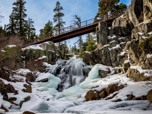
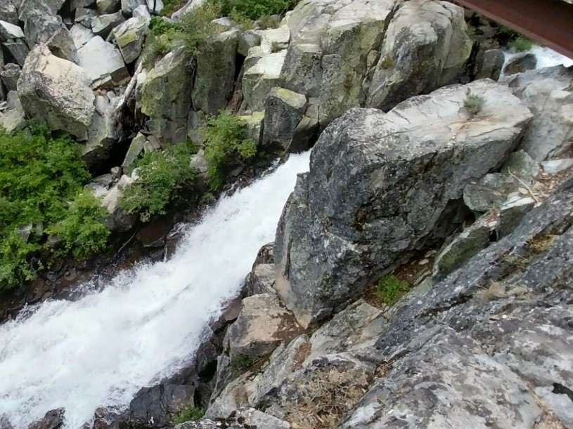
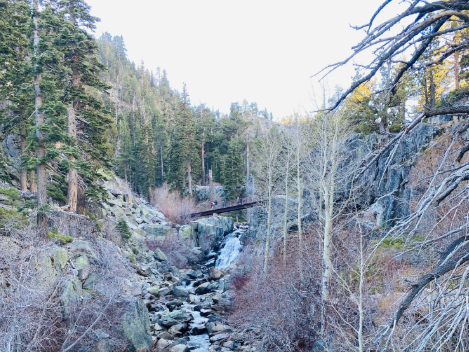
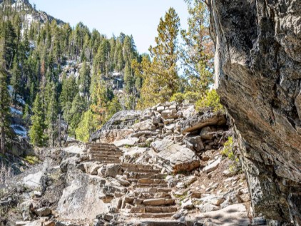
The trail climbs almost from the first step. Hikers describe rocky steps, uneven ground, and a steady uphill rhythm, with Upper Eagle Falls along Eagle Creek as an early reward. Past the falls, hikers report that the forest opens in places, granite becomes more prominent, and the trail feels farther from the highway than it is. Eagle Lake, at about 1.0 mile, is the endpoint most visitors choose.
At roughly 430 feet of climbing, it is moderate on paper. In practice, the steps and the altitude make it feel harder than the mileage suggests.
The trailhead sits at about 7,100 feet, so hikers arriving from sea level may feel it. Our guide to high-elevation hiking in the Sierra Nevada explains how altitude affects pace and hydration.
Stay off the wet rocks and the ledges. Emergency officials have repeatedly warned visitors to be careful around waterfalls, rock formations, and cold water.
In 2019, the North Tahoe Fire Protection District urged people not to underestimate the power of waterfalls, rivers, and cold-water temperatures after a woman fell at Eagle Falls while taking photos. Stay on the trail and behind any barriers, and keep children close, especially during spring runoff.
Beyond Eagle Lake: Velma Lakes, Dicks Lake and Dicks Pass
Eagle Falls is also a trailhead for longer routes. These one-way distances come from the Forest Service’s Desolation Wilderness mileage chart as republished by Sierra Rec Magazine.
| Destination | Miles one way | Difficulty |
|---|---|---|
| Eagle Lake | 1.0 | Moderate |
| Dicks Lake | 4.3 | Difficult |
| Middle Velma Lake | 4.4 | Difficult |
| Fontanillis Lake | 4.9 | Difficult |
| Dicks Pass | 5.3 | Difficult |
Dicks Lake and Dicks Pass are said to be named for Captain Dick Barter, who lived on Fannette Island in the late 19th century, according to CalEXPLORnia.
Our roundup of Desolation Wilderness hiking trails covers other routes into the wilderness, and our list of South Lake Tahoe hiking trails adds shorter options nearby.
Eagle Falls Trail vs Lower Eagle Falls
The two names cause confusion, but they are different outings.
| Eagle Falls Trail | Lower Eagle Falls | |
|---|---|---|
| Starts at | Eagle Falls trailhead, Highway 89 | Vikingsholm side of Emerald Bay |
| Land manager | Forest Service | California State Parks |
| Parking | $5 per vehicle per day | State lot, $10 per vehicle per day or $3 per hour |
| Effort | Short, steep climb to Upper Eagle Falls and Eagle Lake | Quarter mile behind the Vikingsholm Visitor Center, after a steep mile down from the lot |
| Dogs | Allowed on leash | Not allowed |
For the Lower Eagle Falls route, State Parks describes a steep one-mile trail down to Vikingsholm and says Lower Eagle Falls sits a quarter mile behind the Visitor Center.
Best Time to Hike Eagle Falls Trail
| Window | What to expect |
|---|---|
| Mid-May to mid-October | Typical season for the trailhead, depending on weather; restrooms operate when the lot is open |
| Spring and early summer | Guides report the falls are strongest during runoff |
| Peak weekends | Extremely crowded, according to the Forest Service; go early morning or late afternoon |
| Winter | Seasonal parking, no restroom or trash service, and no day-use permit needed roughly October to March |
Weekdays are the easiest way to avoid the lot problem. If you are building a longer Tahoe trip, our guide on where to stay near Lake Tahoe covers South Shore lodging with easy trail access.
Dogs, Fires and Trailhead Rules
Dogs must be on leash at the Eagle Falls trailhead, and the Forest Service asks owners to pack out pet waste or bury it 6 to 8 inches deep. Our list of dog-friendly hiking trails in California covers more leashed options.
Campfires, including charcoal and other solid fuels, are not allowed at the trailhead or in Desolation Wilderness, though portable stoves are allowed with a valid permit. You cannot camp or stay overnight at the trailhead.
Planning Your Day
Bring your own water, because the trailhead has no drinking water. Wear shoes with good traction, start early, and decide before you leave whether the goal is Eagle Lake or something longer. If it is longer, plan a bigger day. Our California hiking gear checklist covers the basics. If waterfalls are the draw, our guide to the best waterfall hikes in California places Eagle Falls beside the state’s other cascades.
Frequently Asked Questions
How long is Eagle Falls Trail?
Eagle Lake is about 1.0 mile one way, so the out-and-back is about 2 miles. Most hikers allow 1 to 1.5 hours round trip.
How much is Eagle Falls trailhead parking?
$5 per vehicle per day. America the Beautiful annual, senior, and access passes cover the fee, and overnight permit holders do not pay.
Do I need a permit to hike Eagle Falls Trail?
Yes. Day hikers fill out a free self-issued Desolation Wilderness permit at the trailhead. Overnight trips need a reserved permit.
Can I park along Highway 89 for Eagle Falls?
Roadside parking is restricted and enforced in the Emerald Bay corridor. In summer, the Emerald Bay Shuttle stops at the trailhead.
Is Eagle Falls Trail dog friendly?
Yes, on leash. Dogs are not allowed on the trails at the neighboring Emerald Bay State Park.
What is the best time to hike Eagle Falls Trail?
Mid-May through mid-October is the usual trailhead season. Go on a weekday or at the start or end of the day to avoid crowds.