Hetch Hetchy Hiking & Wapama Falls Guide
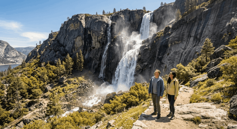
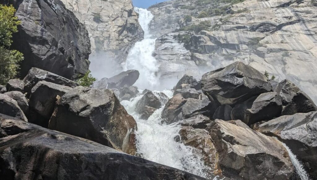
Hetch Hetchy Yosemite begins with a strange sequence: you park beside a 430-foot dam, walk across it, and step into a tunnel. On the other side, the trail runs along a reservoir that supplies drinking water to about 2.7 million people in the San Francisco Bay Area. In spring, two of North America’s tallest waterfalls pour over thousand-foot cliffs above the water, and the trail leads you right to the base of one of them.
Disclosure: Please note that some of the links below are affiliate links and at no additional cost to you, I may earn a commission. Know that I only recommend hiking gear I personally stand behind; when you use my affiliate links, it helps me run this blog and keep all of this content free of charge for readers (like you).
That is the contradiction at the heart of this corner of the park. Hetch Hetchy was once a valley that people compared to Yosemite Valley, and it is now a working reservoir in a peaceful corner of Yosemite with trails of its own. Let’s walk through it in the order your questions will come: where it is, how to get in, which hike to pick, and how to cross the footbridges at Wapama Falls safely.
What is Hetch Hetchy, and where is it in Yosemite?
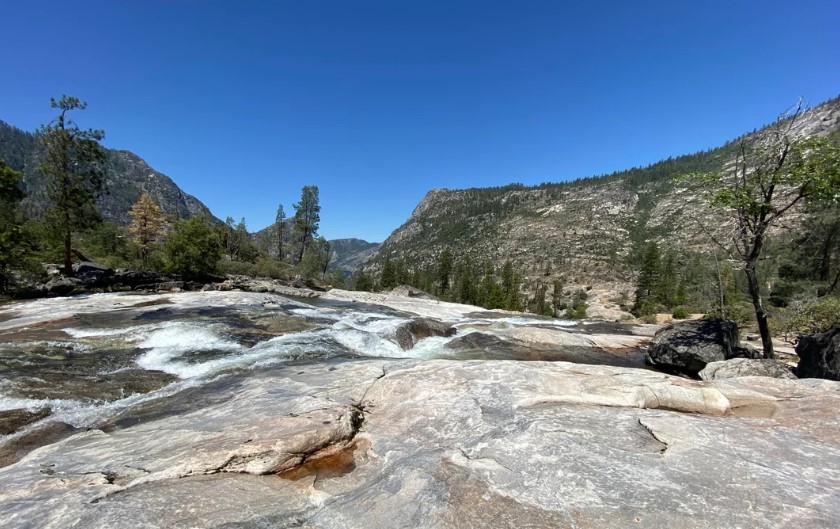
Hetch Hetchy lies in the northwest corner of Yosemite National Park, on the main stem of the Tuolumne River. NPS puts it 38 miles, or about 1 hour 15 minutes, from Yosemite Valley. It sits at 3,900 feet, a much lower elevation than Yosemite’s high country, and our hub for Tuolumne County hiking trails covers the county around it. For the whole park, see our guide to the best hiking trails in Yosemite National Park.
| Hetch Hetchy fact | Detail (NPS) |
|---|---|
| Elevation | 3,900 ft |
| Reservoir length | 8 miles, the largest body of water in the park |
| Dam | O’Shaughnessy Dam, 430 ft tall |
| Water stored | 360,360 acre-feet, about 117 billion gallons |
| Who drinks it | About 2.7 million Bay Area residents |
| Fed by | The Tuolumne River, which begins above Tuolumne Meadows |
How the valley became a reservoir
People have lived in this valley for more than 6,000 years, and NPS says the name comes from the Miwok word hatchhatchie, meaning edible grasses. Native names survive on Tueeulala Falls, Wapama Falls, Kolana Rock, and the Tuolumne River.
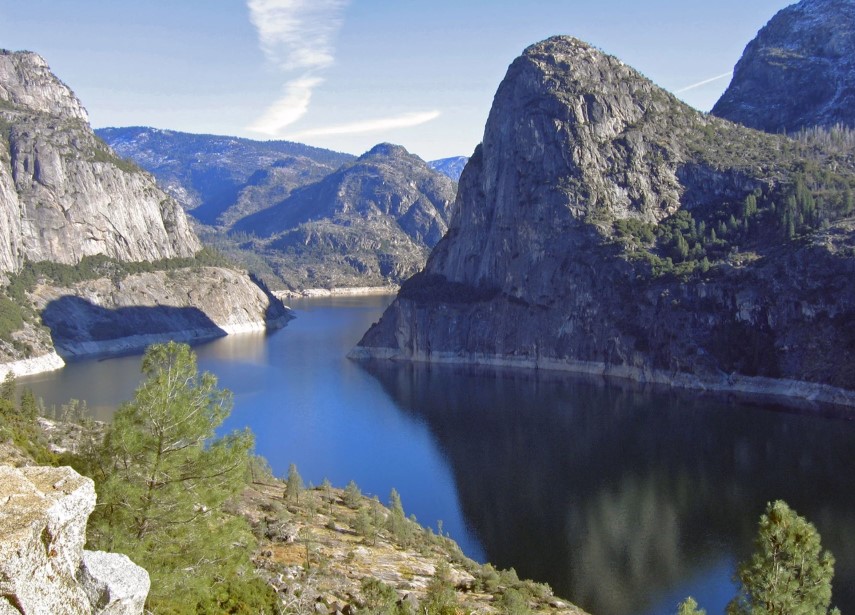
San Francisco first eyed the valley as a reservoir site as early as 1882. Preservationists led by John Muir fought to keep it untouched, but after the 1906 earthquake and fire, Congress passed the Raker Act in 1913. The first phase of O’Shaughnessy Dam was finished in 1923, and a final phase in 1938 raised it to 430 feet.
How do you get to Hetch Hetchy?
The Hetch Hetchy Road begins just outside the park on Highway 120, near the Big Oak Flat Entrance Station. It is one of Yosemite’s five entrances, so you leave Highway 120 outside the park to reach it. Here are the rules NPS lists:
- Hours: The road is open from sunrise to sunset only.
- Delays: The entrance station can back up when the parking lot fills, typically at midday on weekends.
- Winter: From November through March, the road may close or require chains because of ice and snow. NPS provides a recorded line at 209/372-0200 (press 1, then 1).
- Vehicle limits: Vehicles and trailers over 25 feet long and 8 feet wide are not permitted on the narrow, winding road.
- Transportation: Hetch Hetchy is accessible only by car, and there is no public transportation.
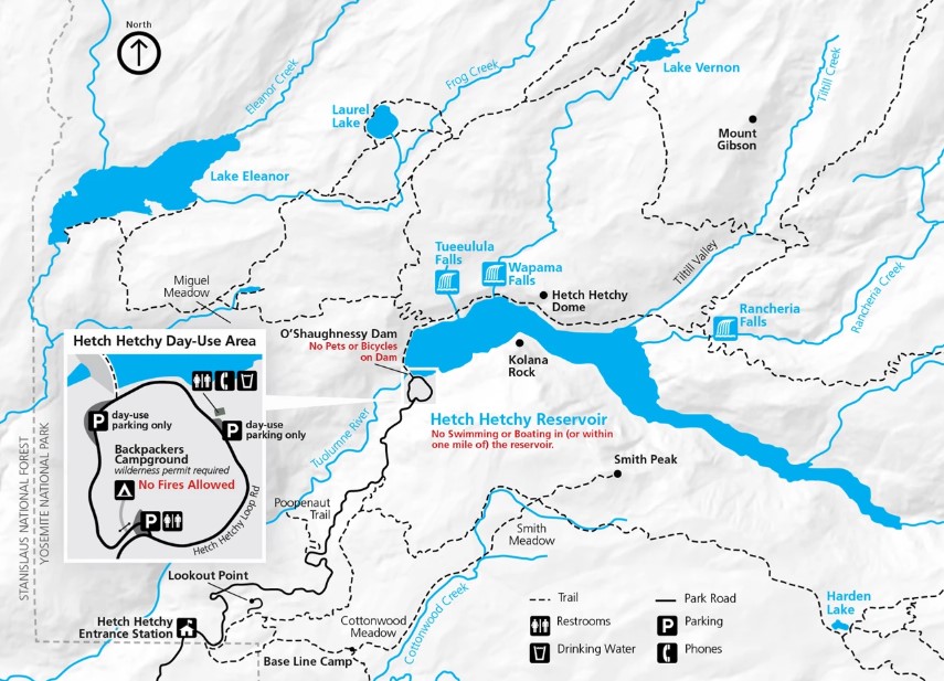
- Rules: Pets are not allowed on the dam or on hiking trails. Swimming and boating are prohibited in the reservoir, and the public may not go below its high-water mark.
The Yosemite entrance fee applies. NPS lists a private vehicle pass at $35 for seven days and $20 per person on foot or bicycle (16 and older), plus an additional $100 per person for non-US residents 16 and older without an annual or America the Beautiful pass.
The park does not accept cash. For maps and GPS cautions, see our Yosemite National Park maps and trailhead navigation guide, and if you need a bed nearby, see where to stay near Yosemite.
Hetch Hetchy hikes at a glance
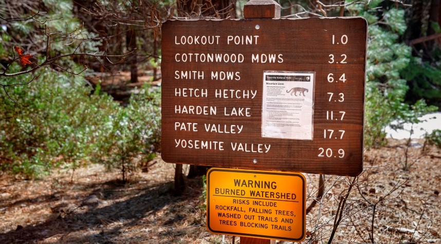
NPS lists six hikes here, with distances and elevation gain that cover everything from a short outlook to a 29-mile backpacking loop. Read the right-hand column for what each one asks of you.
| Hike | Distance | Elevation gain | What NPS says |
|---|---|---|---|
| Lookout Point | 2 mi round trip | 680 ft | Moderate climb to a rocky outcropping over the valley; starts at the entrance station |
| Wapama Falls | 5 mi round trip | 507 ft | Reservoir shoreline with moderate ups and downs; cross the dam and go through the tunnel |
| Poopenaut Valley | 2.5 mi round trip | 1,279 ft | Steep descent to the Tuolumne River, strenuous climb back; trailhead 4 mi past the entrance station |
| Rancheria Falls | 13 mi round trip | 1,909 ft | Continues past Wapama Falls; a long day hike or an overnight trip |
| Smith Peak | 13 mi round trip from a trailhead 6 mi past the entrance; 16 mi from the entrance station | 3,700 ft; 3,300 ft | Highest point in the area at 7,751 ft |
| Laurel/Vernon/Rancheria Loop | 29 mi | 5,929 ft | Multi-day loop; the first four miles can be hiked as an 8-mile day hike |
The NPS day hikes page has the Hetch Hetchy map and these trail descriptions in one place, and it is the best source for trailhead details.
Wapama Falls Hetch Hetchy: the trail, mile by mile
The Hetch Hetchy trail to Wapama Falls is the hike most people come for, and it is easy to see why. It is 5 miles round trip with 507 feet of elevation gain, and NPS says it follows the reservoir’s shoreline with moderate ups and downs.
The dam and the tunnel
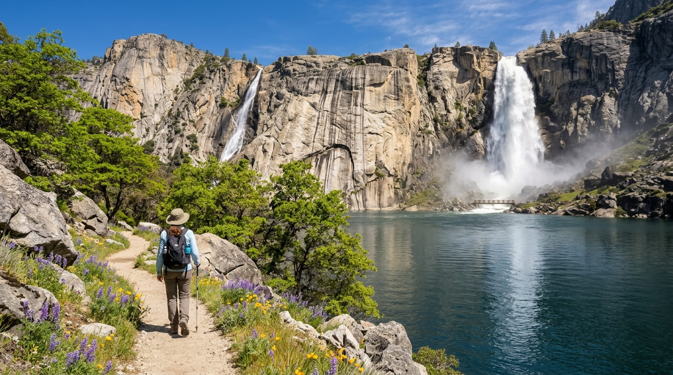
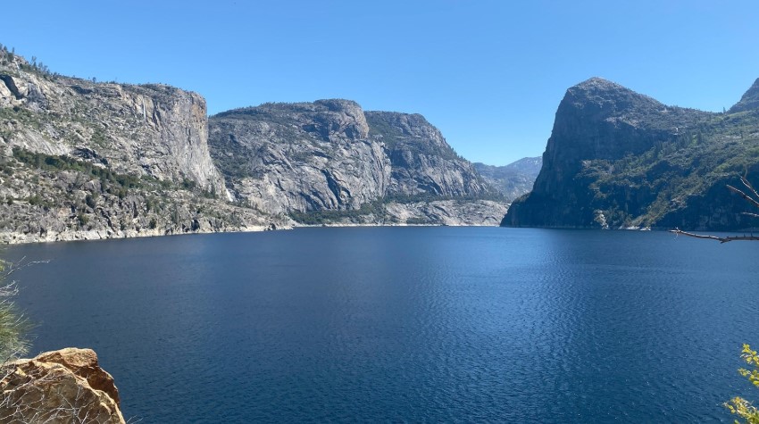
You begin at O’Shaughnessy Dam. To reach the trail, you cross the dam and pass through the tunnel, and then the path opens up along the reservoir. Spring and early summer bring wildflowers here, including lupine, wallflower, monkeyflower, and buttercup, according to NPS. The park also lists gray pine, incense-cedar, and California black oak among the trees.
Along the shoreline
The trail runs along the reservoir with views of both Tueeulala Falls and Wapama Falls, NPS notes. Hiking guides describe Tueeulala as a seasonal waterfall that can cross the trail in a wet spring. Much of this stretch is open to the sun, according to hiking guides, so carry extra water. NPS also asks hikers to watch for rattlesnakes and poison oak.
The footbridges at Wapama Falls
Roughly 2.5 miles in, the trail reaches the footbridges at the base of Wapama Falls. In a heavy spring runoff, the bridges are the part of this hike that demands judgment. Hiking guides and conservation groups note that water can flow over the footbridges during peak snowmelt or after big storms, and that they can be closed when flows are high.
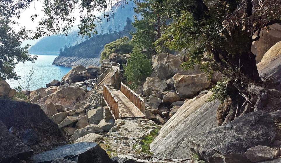
If water is moving hard over the bridge, do not cross. Guides say you can still see the falls from the trail before the bridges, so turning around costs you the crossing, not the view. Check the NPS current conditions page before you go, and read our guide to water hazards on California trails for how to judge a crossing.
Past Wapama: Rancheria Falls
Hikers who continue reach Rancheria Falls after 6.5 miles one way, which makes a 13-mile day or an overnight trip. NPS says backpackers can also use the Rancheria area to reach Tiltill or Rancheria Mountains and Yosemite’s northwestern wilderness.
When is the best time for Hetch Hetchy hiking?
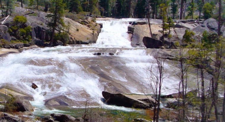
NPS says Hetch Hetchy’s relatively low elevation makes it ideal for hiking in spring and fall, and summers can be uncomfortably hot. It also lists the area as having one of the longest hiking seasons in the park. Here is how the year breaks down:
- Spring: The waterfalls peak with snowmelt, and wildflowers bloom through early summer. This is also when the Wapama footbridges are most likely to be wet.
- Summer: Expect heat on an exposed trail. Start early, and plan for the hike to feel hotter than Yosemite Valley.
- Fall: Cooler temperatures return, and NPS calls fall ideal for hiking.
- Winter: The area can be explored on skis or snowshoes on snowy days, but the road may close or require chains from November through March.
The area is a good match for hikers chasing water, and our guide to California hiking trails with waterfalls after rain shows how seasons shape flow across the state. For month-by-month weather, see our guide to Yosemite weather by month.
Can you backpack at Hetch Hetchy?
Yes. NPS says a wilderness permit is required for all overnight trips. The classic route is the 29-mile Laurel/Vernon/Rancheria Loop, which gains 5,929 feet and passes high Sierra lakes.
NPS’s permit station list says that from roughly April through October, Hetch Hetchy Entrance Station permits are picked up at the Big Oak Flat Information Station, so confirm the current process before you drive.
Our Yosemite permits and wilderness access guide explains how the system works. For another northern Sierra backpacking area next door, see our Emigrant Wilderness guide.
What should you know before you go?
- Carry a map. NPS tells hikers to carry a map and know where they are going.
- Water and sun: Bring plenty of water and sunscreen. Much of the Wapama trail is exposed.
- Wildlife: Watch for rattlesnakes and black bears, and do not approach or feed wildlife.
- Trash: Pack out everything you bring.
- Conditions: Check for road and trail status the week you go. As of NPS’s October 9, 2026 update, the Hetch Hetchy area listed no trail closures. Our guide to how to check California trail closures explains what to look for.
If this is your first look at the north side of the park, a nearby roundup is our guide to hiking trails near Yosemite’s Big Oak Flat entrance, and our list of waterfall hikes in Tuolumne County covers more falls in the same county.
The honest bottom line
Hetch Hetchy Yosemite asks you to hold two ideas at once: a dam changed this valley, and the hiking around it is still some of the best in Yosemite. Go in spring for the waterfalls, bring more water than you expect, and read the Wapama Falls footbridges before you step onto them. The sunrise-to-sunset road hours keep the day honest. Arrive early, hike while the light is good, and leave before the road closes for the night.
Hetch Hetchy Yosemite FAQs
How far is Hetch Hetchy from Yosemite Valley?
NPS says 38 miles, about 1 hour 15 minutes by car. There is no public transportation.
Can you visit Hetch Hetchy as a day trip from Yosemite Valley?
Yes. NPS lists it as 38 miles and about 1 hour 15 minutes each way. Because the road is open only from sunrise to sunset and the parking lot can fill by midday on weekends, leave the Valley early.
How long is the Wapama Falls hike?
NPS lists 5 miles round trip with 507 feet of elevation gain.
Is Hetch Hetchy open year-round?
The area is open all year, but the road is open only from sunrise to sunset, and it may close or require chains from November through March.
Can you swim in Hetch Hetchy Reservoir?
No. Swimming and boating are prohibited to keep the drinking water clean.
Are dogs allowed?
No. Pets are not allowed on the dam or on hiking trails.
Where does San Francisco’s water come from?
Hetch Hetchy is the primary water source for about 2.7 million residents of the San Francisco Bay Area, according to NPS.