The 5 Best Hiking Trails in Santa Barbara County
Santa Barbara County packs front-country summits, wine-country waterfalls, and a working seal rookery into this guide to the best hiking trails in Santa Barbara. This guide spans the range; for a deeper dive into the Santa Ynez Mountains specifically, my dedicated guide on that range goes further than this overview can. Start at the Santa Barbara County trail guide for the complete picture.
Disclosure: Please note that some of the links below are affiliate links and at no additional cost to you, I may earn a commission. Know that I only recommend hiking gear I personally stand behind; when you use my affiliate links, it helps me run this blog and keep all of this content free of charge for readers (like you).
Good news up front: all five trails here are currently open; no closures to work around. Read each section for the real difficulty and access details, since a couple run harder than their reputations suggest.
Key takeaways:
- The signature view: Inspiration Point via Tunnel Trail, Santa Barbara, the Pacific, and the Channel Islands in one overlook.
- The wine-country waterfall: Nojoqui Falls is short, shaded, and genuinely easy, near Solvang.
- Harder than it looks: Gaviota Peak, a real 6-plus-mile climb, with hot springs as a detour, not the main event.
- The short rock-formation hike: Lizard’s Mouth, wind-carved sandstone with Channel Islands views, in well under a mile.
- The wildlife destination: Carpinteria Bluffs, one of only four harbor seal rookeries on the Southern California coast.
Inspiration Point Trail (via Tunnel Trail)
Trailhead access: free roadside parking at the Tunnel Trailhead, Santa Barbara
Park at the end of Tunnel Road above the Santa Barbara Botanic Garden for free, no permit, though spots fill early on weekends and illegally parked cars are ticketed.
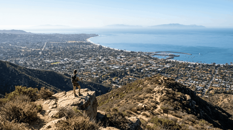
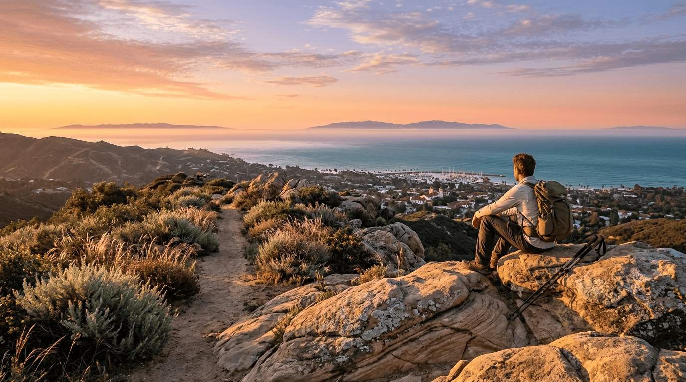
What you’ll see: a classic overlook of Santa Barbara and the Channel Islands
It’s about 3.5 to 3.75 miles round trip, with roughly 950 to 1,000 feet of elevation gain, a mix of paved access road and singletrack through chaparral, and a crossing of Mission Canyon Creek along the way. The payoff at the top takes in the city of Santa Barbara, the Pacific coastline, and the Channel Islands on clear days, widely regarded as the area’s signature front-country view. Trail etiquette matters more here than at most trails in this guide; this is genuinely popular with trail runners and mountain bikers sharing the same singletrack.
Best time to hike Inspiration Point: early morning before it gets hot
This trail is largely south-facing and exposed once you’re past the initial paved stretch. An early start makes a real difference in comfort, especially in summer.
Nojoqui Falls Trail (Near Solvang)
Trailhead access: free Santa Barbara County park lot near Solvang
Nojoqui Falls County Park has its own free lot off Alisal Road, open daily from 8 a.m. to 10 p.m, in wine-country territory rather than the coastal front country covered by the rest of this guide.
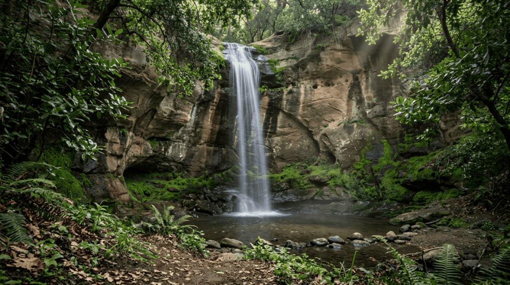
What you’ll see: a seasonal waterfall framed by a sandstone grotto
This is a short, easy walk about two-thirds of a mile round trip, with roughly 175 feet of elevation gain through a shaded oak and laurel forest to an 80-foot seasonal waterfall tucked into a mossy grotto. The name Nojoqui comes from the Chumash language, reflecting the deep, genuine history of this land. Watch for poison oak along the trail, and heed posted rockfall warnings near the falls themselves.
Best time to hike Nojoqui Falls: winter and spring for peak flow
Like most Central Coast waterfalls, this one runs strongest after winter rain and can slow to a trickle by late summer, a real water hazard consideration if timing your visit around an actual flowing waterfall matters to you.
Gaviota Peak Trail (Gaviota State Park)
Trailhead access: free parking lot along Highway 101
Park at the dirt trailhead lot just off Highway 101 at the Gaviota Pass (unlike the state park beach lot, parking here is free). Worth knowing, clearly: dogs aren’t allowed on this trail.
What you’ll see: a coastal mountain summit with ocean and ranchland views
This runs considerably harder than a casual outing. AllTrails rates it “hard” at 6.4 miles round trip with 2,178 feet of gain, climbing fire roads to a 2,458-foot summit genuinely one of the more demanding climbs covered in my guide to the physical benefits of hiking.
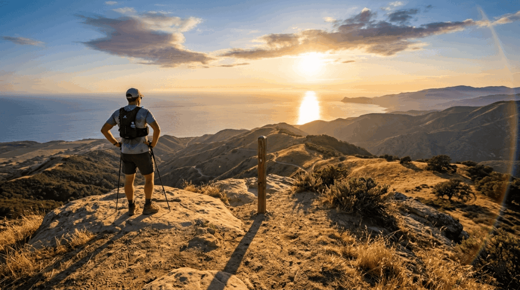
A short spur trail leads to Gaviota Hot Springs along the way, best saved for the descent. From the top, views stretch across the Santa Ynez Mountains, Lompoc Valley, the Pacific, and the Channel Islands. Rattlesnakes are common here, and guided signs also warn of mountain lions real terrain hazards worth taking seriously on a climb this exposed.
Best time to hike Gaviota Peak: late afternoon for golden-hour ocean views
This trail’s west-facing exposure rewards late-day light for photography, though the tradeoff is tackling the steepest sections in the day’s warmest hours, and an early start with a late-morning summit works for most hikers instead.
Lizard’s Mouth Trail (via Camino Cielo)
Trailhead access: free roadside pullouts along West Camino Cielo Road
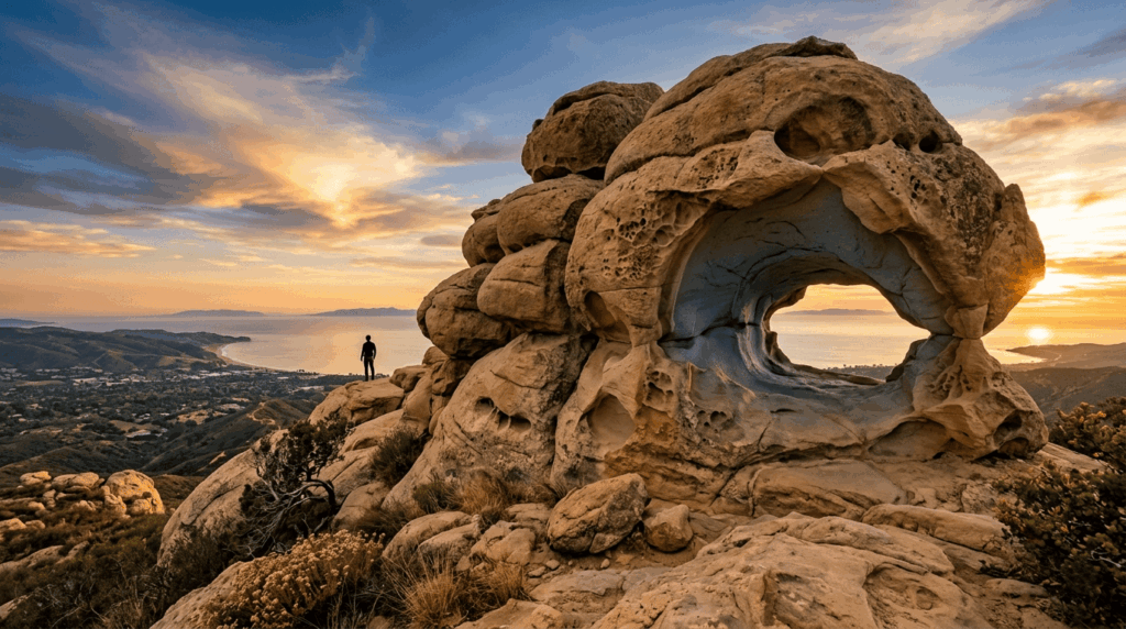
Park at the dirt pullouts along West Camino Cielo Road for free; no permit required; and the highest-elevation trailhead in this entire guide. Two separate access points exist: a lower trailhead with a longer, more scenic rock-scramble approach, and an upper trailhead offering a shorter, more direct route to the same formation.
What you’ll see: wind-sculpted sandstone boulders with panoramic views
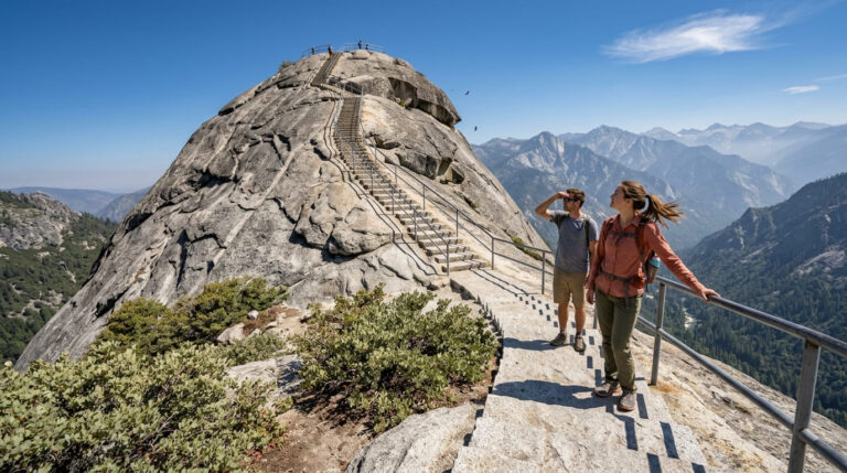
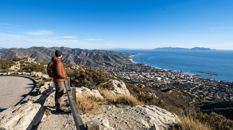
At well under a mile from either trailhead, this short walk reaches a dramatic sandstone outcropping wind-carved into cave-like pockets, popular with climbers and photographers. Views stretch across Goleta, Santa Barbara, and the Gaviota coast, with the Channel Islands visible on clear days.
Best time to hike Lizard’s Mouth: sunset for silhouetted rock photography
This ridge-top formation is a well-known local sunset spot; just budget the extra drive time on Camino Cielo’s winding road, and watch for broken glass and evidence of informal overnight camping in the area.
Carpinteria Bluffs Nature Preserve Trail
Trailhead access: free preserve lot near Carpinteria
Take Highway 101 to Bailard Avenue, about 12 miles east of Santa Barbara, and follow it to the free dirt parking area at Carpinteria Bluffs Nature Preserve, the southernmost trail in this entire guide.
What you’ll see: a seasonal harbor seal rookery below the bluffs
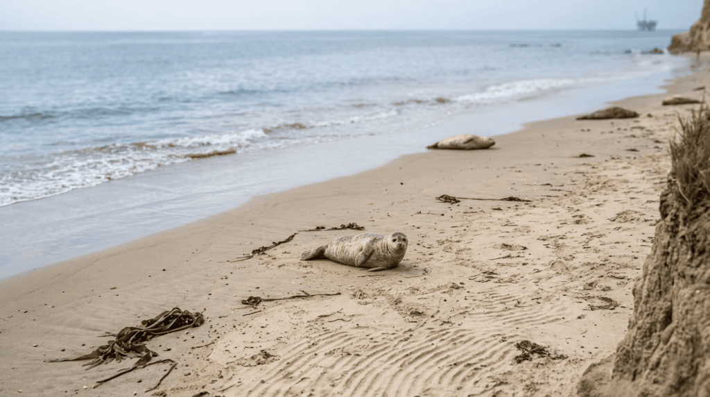
A flat, easy bluff-top walk leads to the Carpinteria Seal Sanctuary Overlook, where you can look down about 75 feet to a beach hosting one of only four harbor seal rookeries on the entire Southern California coast, home to roughly 100 seals, with pups appearing between December and May. A working Chevron pier sits just offshore, adding an unusual industrial note to an otherwise wild scene.
Best time to hike Carpinteria Bluffs: winter for harbor seal pupping season
December through May is when pups are most likely to be visible on the beach. Outside that window, you’ll still see adult seals, just fewer of them.
Which of these five to hike first
If you want the single best view in the county, Inspiration Point earns its reputation. If you’re road-tripping through wine country, Nojoqui Falls is a genuinely worthwhile five-minute detour. And if Gaviota Peak’s difficulty caught you off guard, Lizard’s Mouth delivers comparable Channel Islands views for a fraction of the effort.
Frequently asked questions
Are hiking trails open in Santa Barbara?
Yes, all five trails in this guide, spanning wine country near Solvang to the Carpinteria coast, are currently open with no closures.
Are Santa Barbara hiking trails open right now?
Yes. If you’re checking on a specific trail beyond this guide’s five, conditions can vary. Los Padres National Forest and California State Parks both post current closure alerts on their respective sites.
Is Inspiration Point Trail hard?
Moderate, not hard, about 3.5 to 3.75 miles round trip with 950 to 1,000 feet of gain via Tunnel Trail, the shorter of two common approaches.
Is Nojoqui Falls always flowing?
No, it’s seasonal, strongest in winter and spring after rain, and often reduced to a trickle by late summer.
Is Gaviota Peak a good sunset hike?
Yes, its west-facing exposure makes for excellent golden-hour ocean views, though its real difficulty (rated “hard” at over 6 miles round trip) means most hikers should start well before late afternoon to finish safely.
Is Carpinteria Bluffs good for whale watching?
It’s better known for its harbor seal rookery than whale watching specifically, though the bluff-top views make incidental whale sightings possible during migration season.