Best Slot Canyon and Desert Hiking Trails in California
These seven Slot Canyon and Desert Hiking Trails in California cover the strangest ground in this state’s deserts, squeeze-through slots, wind-bored sandstone caves, and a cinder cone volcano you can walk straight into. Every one of them shares a hazard worth taking seriously: flash floods. None of these canyons care whether the rain fell miles away; the water finds them anyway. I’ve flagged where that risk is highest and what to check before you go.
Disclosure: Please note that some of the links below are affiliate links and at no additional cost to you, I may earn a commission. Know that I only recommend hiking gear I personally stand behind; when you use my affiliate links, it helps me run this blog and keep all of this content free of charge for readers (like you).
Key Takeaways
- Best ladder-climbing adventure: Ladder Canyon in the Mecca Hills, fixed wooden ladders through a colorful slot canyon.
- Tightest squeeze on this list: the Slot Canyon Trail in Anza-Borrego, narrowing to under three feet in places.
- Most famous polished narrows: Mosaic Canyon in Death Valley, where flash floods have scoured the marble-like walls smooth.
- Best maze-like exploration: Sidewinder Canyon, with branching side-slots and natural rock windows instead of one single passage.
- Oldest feature on this list by far: Amboy Crater, a cinder cone that geologists date to roughly 79,000 years old.
- The one rule that applies to all seven: never enter a slot canyon, wash, or narrows with any rain in the forecast, even rain that looks far away.
1. Ladder Canyon (Painted Canyon), Mecca Hills Wilderness (Riverside County)
Why it made this list: fixed wooden ladders through a colorful slot canyon
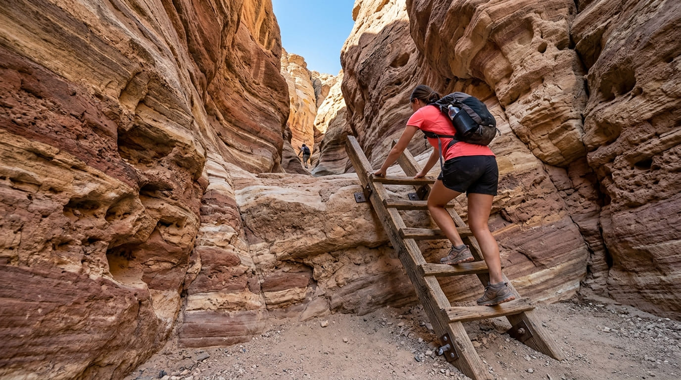
Ladder Canyon is the most purely fun entry on this list, a roughly 4.5-mile loop through the Mecca Hills Wilderness that climbs a slot canyon via a series of fixed wooden ladders bolted into the rock, with banded, colorful walls shaped by the same geologic forces as the nearby San Andreas Fault. Our Riverside County Palm Springs trail guide covers more of this same Coachella Valley desert region.
Practical tips: access and best timing
The drive in is part of the adventure: Painted Canyon Road runs about 4.5 miles of unpaved wash to the trailhead, usually passable to a careful two-wheel-drive vehicle when dry, but it closes after rain and can wash out entirely.
This is a flash-flood zone; check the forecast before you go, and skip it entirely if there’s any rain in the region, even upstream and out of sight. Best season runs September through April; summer heat in the exposed sections is brutal.
2. Slot Canyon Trail, Anza-Borrego Desert State Park (San Diego County)
Why it made this list: a narrow sandstone passage you can squeeze through
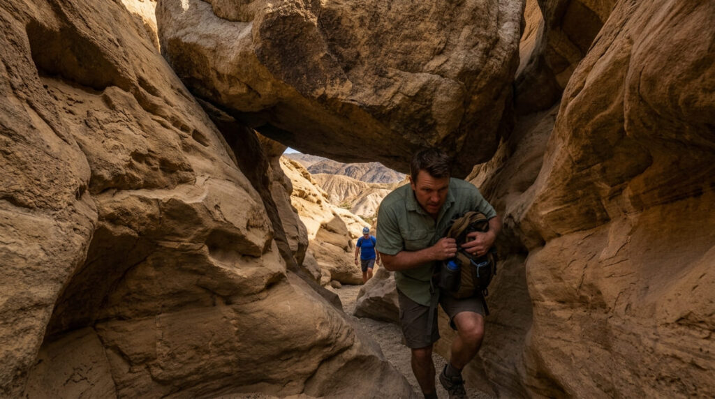
Locally known simply as “The Slot,” this is the most popular slot canyon in the park for good reason: a short, dramatic passage through eroded badlands that narrows to under three feet in spots, with a precarious rock arch wedged overhead near the far end. Our San Diego County desert trail guide covers more of Anza-Borrego’s badlands terrain in the same area.
Practical tips: access and best timing
Like Ladder Canyon, the approach road matters as much as the hike: a soft-sand dirt road (Buttes Pass Road off Highway 78) that can shift unpredictably after winter rain, and like every entry on this list, this one should be avoided entirely with any storm in the forecast.
Anza-Borrego is a winter park: summer highs here regularly reach 125°F, which turns a fun squeeze-through hike into a heat-illness risk. October through April is the actual season.
3. Mosaic Canyon Trail (Death Valley National Park, Inyo County)
Why it made this list: water-polished marble walls unlike any other slot canyon on this list
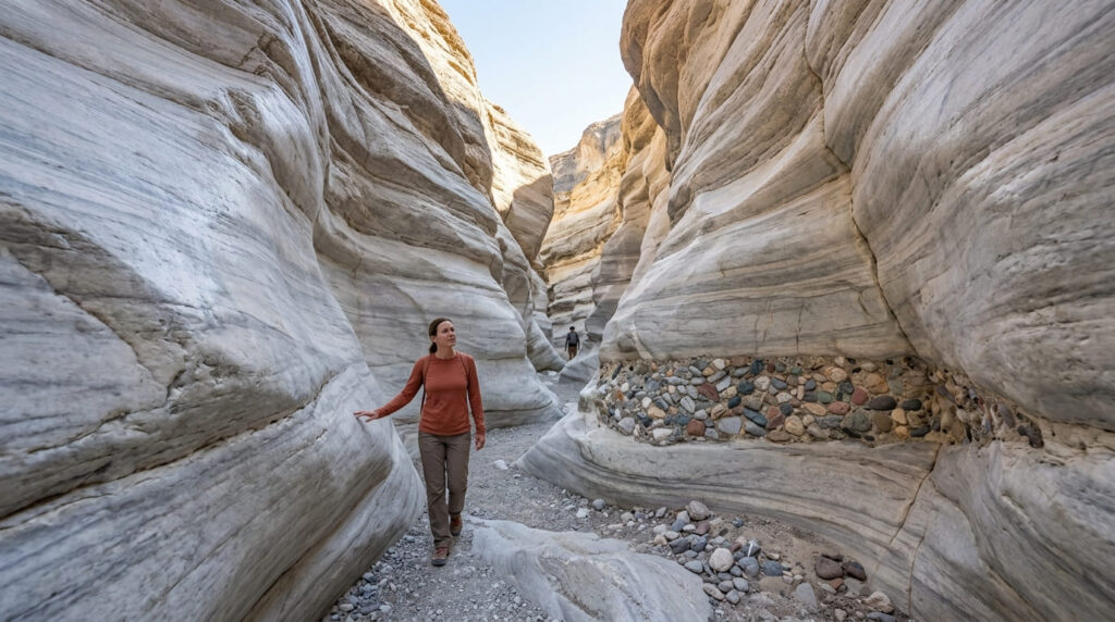
Mosaic Canyon earns its name from the colorful mosaic breccia visible near its mouth, but the draw is the first half-mile: narrows with walls polished to a marble-like sheen by centuries of flash-flood scouring. Our Inyo County Death Valley trail guide covers this and the next two entries in more depth, since all three sit within the same park. To map out your approach and trailhead logistics across these desert canyons, consult our Death Valley National Park map and route planner.
Practical tips: access and best timing
The National Park Service’s own posted guidance for this trail is blunt, and worth repeating here directly: do not enter Mosaic Canyon if there’s any chance of rain. The narrows that make this hike beautiful are the exact terrain that channels flash floods fastest.
The access road, a roughly 2.3-mile unpaved stretch off CA-190 near Stovepipe Wells, is typically passable to standard cars. Like the rest of Death Valley, October through April is the season here; summer heat at this elevation is dangerous.
4. Sidewinder Canyon Trail (Death Valley National Park, Inyo County)
Why it made this list: a network of side slots and natural rock windows
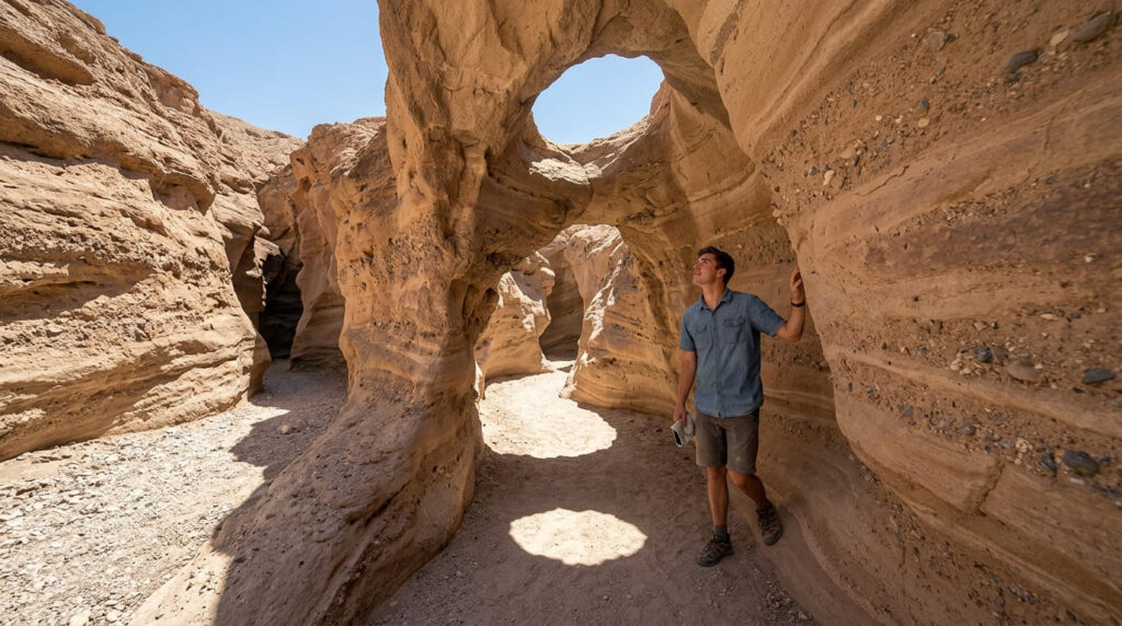
Sidewinder Canyon trades a single dramatic passage for something more exploratory: several narrow side-canyons branching off the main wash, including natural rock windows and small arches that reward wandering rather than a single out-and-back walk.
Practical tips: access and best timing
Budget more time here than the mileage suggests; the branching side-slots make this a route-finding exercise, not a straight there-and-back hike, and it’s easy to spend an extra hour exploring one more side passage than you planned.
Reached off Badwater Road near mile marker 31.5 in the park’s southern end, this area saw flood damage in past years but has been fully reopened for some time now; still, the same flash-flood caution applies here as everywhere else on this list.
5. Fall Canyon Trail (Death Valley National Park, Inyo County)
Why it made this list: a dramatic narrows section deep within the canyon
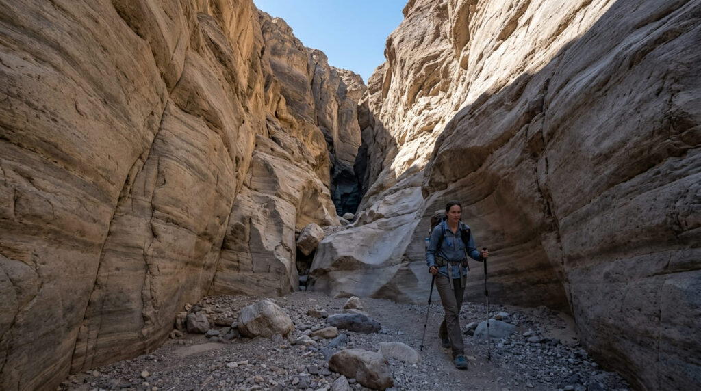
Fall Canyon closes out this park’s three-entry stretch with its longest approach; the true slot-canyon narrows sit well up-canyon, rewarding hikers willing to put in more distance than Mosaic or Sidewinder require.
Practical tips: access and best timing
This is the most physically demanding of the three Death Valley entries here, so pair the same cool-season timing (October through April) with an earlier start and more water than you think you’ll need.
One keyword note for anyone researching this trail online: search results for “Fall Canyon” sometimes surface results for an entirely different “Waterfall Canyon” trail out of state; make sure any trail app or map you’re using is actually showing Death Valley, California.
6. Amboy Crater Trail (San Bernardino County)
Why it made this list: a 79,000-year-old volcanic cinder cone along historic Route 66
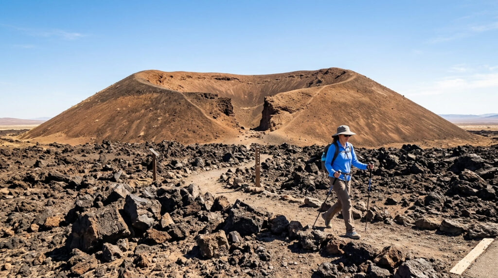
Amboy Crater is the geological outlier on this list, a nearly perfectly symmetrical cinder cone rising 250 feet above the desert floor, with a trail that leads you through a lava field, in through a breach in the crater wall, and up to the rim. Modern dating puts the cone’s formation at roughly 79,000 years ago, with its most recent eruption closer to 10,000 years back.
Practical tips: access and best timing
This is one of the better-maintained trails on this list, with a paved access road off historic Route 66, an ADA-accessible overlook, picnic tables, and vault toilets, with the roughly 3-mile round-trip trail itself well marked.
There’s no water available anywhere on site, so bring a gallon per person for this one. It’s also worth knowing this spot doubles as one of the darker night skies in Southern California; if you’re building a stargazing trip around it too, see our best stargazing and night hike trails in California guide for more on that angle.
7. Wind Caves Trail, Anza-Borrego Desert State Park (San Diego County)
Why it made this list: wind-carved sandstone caves and honeycomb rock formations
The Wind Caves close out this list with a different formation type: sandstone hollowed and pitted by wind erosion into a honeycomb texture, set above Fish Creek Wash with views across the Carrizo Badlands.
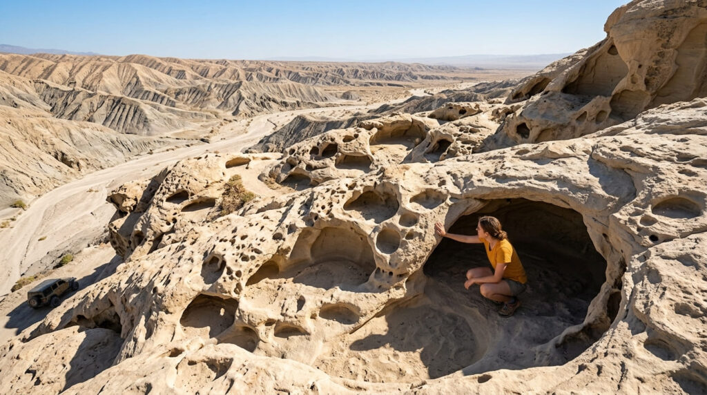
Practical tips: access and best timing
The approach here is the obstacle: Split Mountain Road down into Fish Creek Wash requires a high-clearance, all-wheel-drive vehicle at minimum.
Some two-wheel-drive vehicles have made it through, but it’s a gamble, and winter rain can shift the sand and rock enough to make the route unpredictable from one visit to the next. Once you’re at the trailhead, the hike itself is short, under a mile round trip with modest elevation gain.
Quick comparison: all 7 slot canyon and desert trails at a glance
| Trail | Distance | Access Difficulty | Flash Flood Risk |
|---|---|---|---|
| Ladder Canyon | ~4.5 mi loop | Moderate, sandy unpaved road | High |
| Slot Canyon Trail (Anza-Borrego) | ~1–2.8 mi | Moderate, soft-sand road | High |
| Mosaic Canyon | ~3.5 mi | Easy, sedan-friendly dirt road | High (NPS explicitly warns) |
| Sidewinder Canyon | Varies, exploratory | Easy | Moderate–High |
| Fall Canyon | Longer approach | Easy | Moderate–High |
| Amboy Crater | ~3 mi | Easy, paved access road | Low |
| Wind Caves | Under 1 mi | Hard, high-clearance/AWD needed | Moderate |
Before you go, a few honest notes
Every one of the six true canyon and cave entries on this list carries flash-flood risk, and I’d treat that as non-negotiable rather than a minor caveat. Check the forecast for the entire drainage area, not just the trailhead, and postpone if there’s any doubt.
Amboy Crater is the outlier here, with essentially no flood risk given its open, exposed setting, which makes it a solid choice if the weather elsewhere on this list looks uncertain.
Frequently Asked Questions About Best Slot Canyon and Desert Hiking Trails in California
Is it safe to hike slot canyons in California?
Generally yes, with the right precautions, but flash floods are a sometimes fatal risk; canyons can flood from rain falling miles upstream even when the sky above you is clear. Check the forecast for the whole drainage, not just your location, before entering any of these.
What is a flash flood risk in a slot canyon?
Slot canyons funnel and concentrate runoff from a much larger area into a narrow channel, so a storm many miles away can send a wall of water through a canyon with little to no warning at your location. Narrow canyons like Mosaic and the Anza-Borrego Slot are especially dangerous because there’s often nowhere to climb out quickly.
Which California slot canyon is easiest for beginners?
Mosaic Canyon: the first half-mile is a gentle, well-defined walk through polished narrows with a sedan-friendly access road, making it the most approachable entry on this list for a first slot canyon hike.
Do you need special gear to hike a slot canyon?
Sturdy shoes with good grip, more water than you’d expect for the mileage, and a headlamp as backup are the essentials. Ladder Canyon specifically requires comfort with exposure while climbing fixed ladders, which isn’t true of the others on this list.
Are California’s desert slot canyons open year-round?
Technically yes, but I wouldn’t recommend it. October through April is the season for all seven of these; summer heat across this list’s desert locations regularly exceeds 110–125°F, which turns an enjoyable hike into a real medical risk.
How do you check weather before hiking a slot canyon?
Check the National Weather Service forecast for the entire watershed above the canyon, not just the trailhead location, since the water causing a flash flood can originate many miles upstream. If there’s any thunderstorm or flash flood watch for the broader region, postpone the hike rather than hoping it holds off.