Best Hiking Trails in California for Beginners: Start Here
If this is your first hike, skip anything with “summit,” “wilderness,” or “backcountry” in the name. Start with a flat, short, well-marked trail you can finish in under an hour, one where getting lost isn’t really possible and turning around isn’t a big deal. I’ve picked seven beginner hiking trails in California, spread across the state, and every one meets that bar: no scrambling, no route-finding, nothing you need a permit or topo map to survive.
Disclosure: Please note that some of the links below are affiliate links and at no additional cost to you, I may earn a commission. Know that I only recommend hiking gear I personally stand behind; when you use my affiliate links, it helps me run this blog and keep all of this content free of charge for readers (like you).
Key takeaways
- Best true first hike: Fern Dell Nature Trail, Griffith Park (shaded, half-mile loop, 15 minutes, free parking).
- Best for solo confidence: Lake Lagunitas Loop, Marin (under 2 miles, flat, hard to get lost).
- Best amenities: Woodward Park Loop, Fresno (2.8 paved miles, restrooms and water fountains).
- Best built-in payoff: Natural Bridges State Beach, Santa Cruz (a sea arch, plus monarchs October–February).
- Best gear test: Florida Canyon Trail, Balboa Park (2 easy miles of native habitat downtown).
- One to watch: Pinecrest Lake’s full loop is “easy to moderate” for a reason; stick to the southern shoreline first.
How the 7 compare
| Trail | County | Distance | Gain | Parking | Beginner Edge |
|---|---|---|---|---|---|
| Fern Dell Nature Trail | Los Angeles | ~0.5 mi loop | Negligible | Free (street) | Shaded, paved, 15–20 min |
| Woodward Park Loop | Fresno | 2.8 mi loop | ~95 ft | $5/vehicle | Paved, restrooms, water |
| Lake Lagunitas Loop | Marin | ~1.8 mi loop | ~150 ft | $8/vehicle | Flat, hard to get lost |
| Natural Bridges State Beach | Santa Cruz | Under 1 mi | Negligible | $10 or free street | Sea arch, monarch grove |
| Florida Canyon Trail | San Diego | ~2.0 mi loop | Minimal | Free (most lots) | Native habitat, downtown |
| Shell Beach Bluff Trail | San Luis Obispo | ~0.9 mi | Minor | Free (street) | Paved, ocean view throughout |
| Pinecrest Lake NRT (south shore) | Tuolumne | Out-and-back | Flat south side | Varies (USFS) | Flattest trail in the county |
Fern Dell Nature Trail, Griffith Park (Los Angeles County)
Why it’s great for beginners: a shaded, paved path with no elevation to worry about
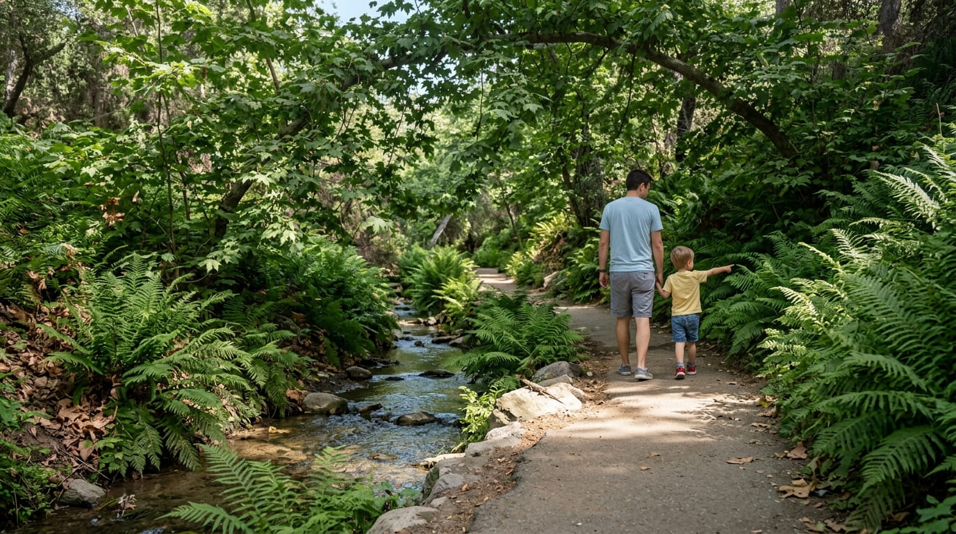
Fern Dell is the trail I send every first-timer in Los Angeles to before anywhere else. It’s a quiet, densely shaded corner of Griffith Park, a paved and packed-dirt path along a small stream, bordered by ferns and sycamores that stay green even when the rest of the park browns out. Most people finish the loop in 15 to 20 minutes.
This isn’t the Hollywood Sign hike or the steep push to the Observatory, both of which start nearby and trip up first-timers who wander onto the wrong trailhead. Fern Dell stays flat and contained the whole way. Once you’ve got this one down, our guide to the best Los Angeles hikes in Runyon Canyon and Griffith Park covers where to go next.
Practical tips: what to know before you go
Parking is free along Fern Dell Drive, though the roughly 30 spots fill up on weekends, so get there before 10 a.m. Restrooms are portable, not flush. The path is stroller-friendly and shaded enough for a midday summer visit, which isn’t true of much else in Griffith Park.
Woodward Park (Fresno County)
Why it’s great for beginners: flat, wide paths with restrooms and water fountains nearby
Woodward Park’s main loop, a paved 2.8-mile path along the San Joaquin River, is about as low-pressure as a first hike gets.
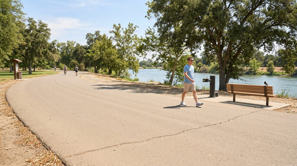
The surface is flat and even (95 ft of gain across nearly 3 miles is functionally nothing), and you’re never far from a bench, restroom, or drinking fountain, making it a good place to break in new hiking shoes without risk. Pair this with our Fresno County guide to family-friendly hiking trails for backup options nearby.
Practical tips: what to know before you go
Woodward Park isn’t free. As of August 2026, it’s a $5 per-vehicle day-use fee ($3 for seniors, $7 on holidays), collected at the kiosk. Shade is inconsistent, so a morning visit beats a Central Valley summer afternoon.
Lake Lagunitas Loop Trail (Marin County)
Why it’s great for beginners: a short, well-marked loop with a clear turnaround point
Lake Lagunitas is the smallest of five lakes in the Mount Tamalpais Watershed, and its shoreline loop, about 1.8 miles and mostly flat aside from one short climb near the trailhead, gives you a Sierra-adjacent feel with almost no risk of getting turned around.
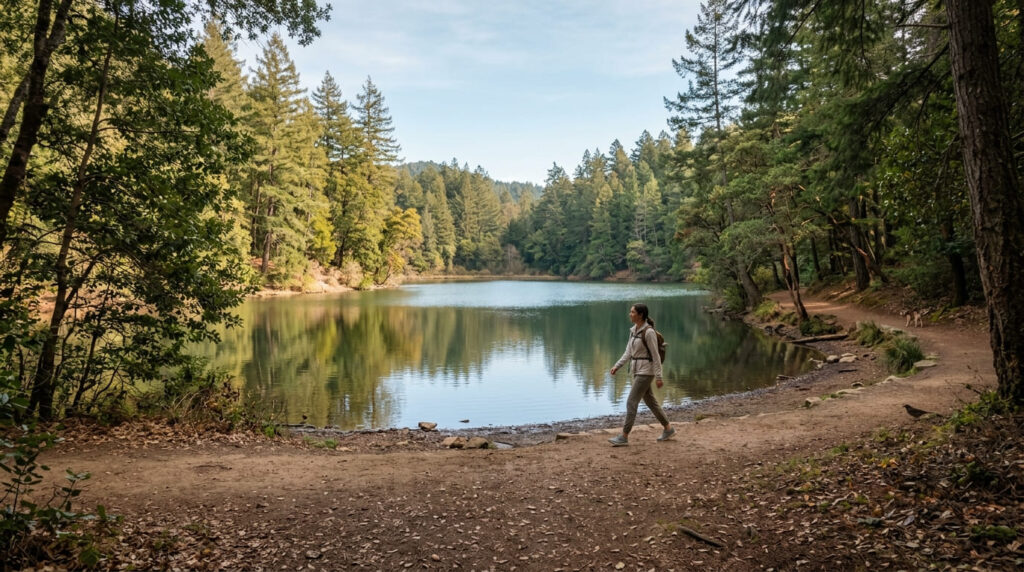
You’re never more than a few hundred feet from the trailhead, a confidence-builder for a first solo hike. For more options in the same watershed, check our Marin County family-friendly trail guide.
Practical tips: what to know before you go
Bring cash or a card for the pay kiosk on Sky Oaks Road; it’s an $8 day-use fee, and rangers do check. Dogs must stay leashed. Restrooms at the trailhead are portable only, so use them before you start.
Natural Bridges State Beach Trail (Santa Cruz County)
Why it’s great for beginners: a short trail built around reaching a specific, rewarding landmark
Natural Bridges gives new hikers something a lot of “easy” trails don’t: a destination worth the walk. Its short boardwalk, barely an eighth of a mile, leads through the Monarch Butterfly Natural Preserve to an observation deck, and from October through February you might catch part of the tens of thousands of monarchs that overwinter here. Even off-season, the wave-carved sea arch off the main beach is a landmark. For more coastal options nearby, see our Santa Cruz County coastal trails guide.
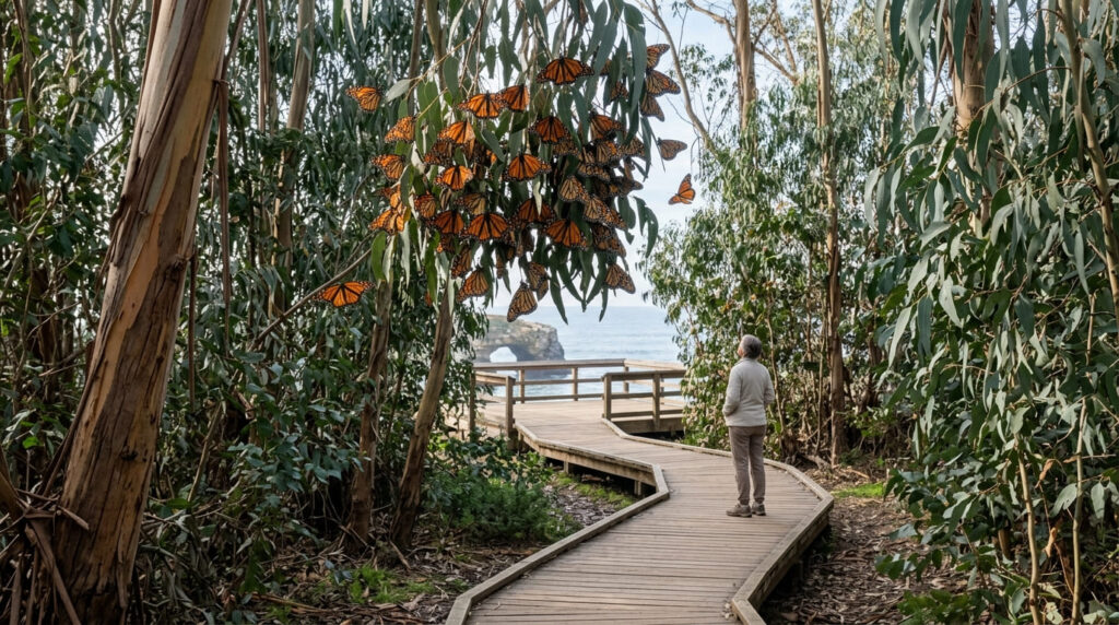
Practical tips: what to know before you go
There’s a $10 per-vehicle day-use fee for the state beach lots, but free street parking exists nearby (the overlook lot caps you at 20 minutes, so it’s a quick-look option only). The visitor center runs 11 a.m.–4 p.m., daily October through January and Friday–Monday the rest of the year. For current hours and conditions, California State Parks’ official Natural Bridges page is the one to bookmark.
Florida Canyon Trail, Balboa Park (San Diego County)
Why it’s great for beginners: an easy loop steps from a major city, no wilderness skills required
Florida Canyon sits inside Balboa Park’s Native Plant Preserve, and its loop, about 2 miles, easy grade, roughly 50 minutes at a relaxed pace, gets you coastal sage scrub habitat without leaving the city.
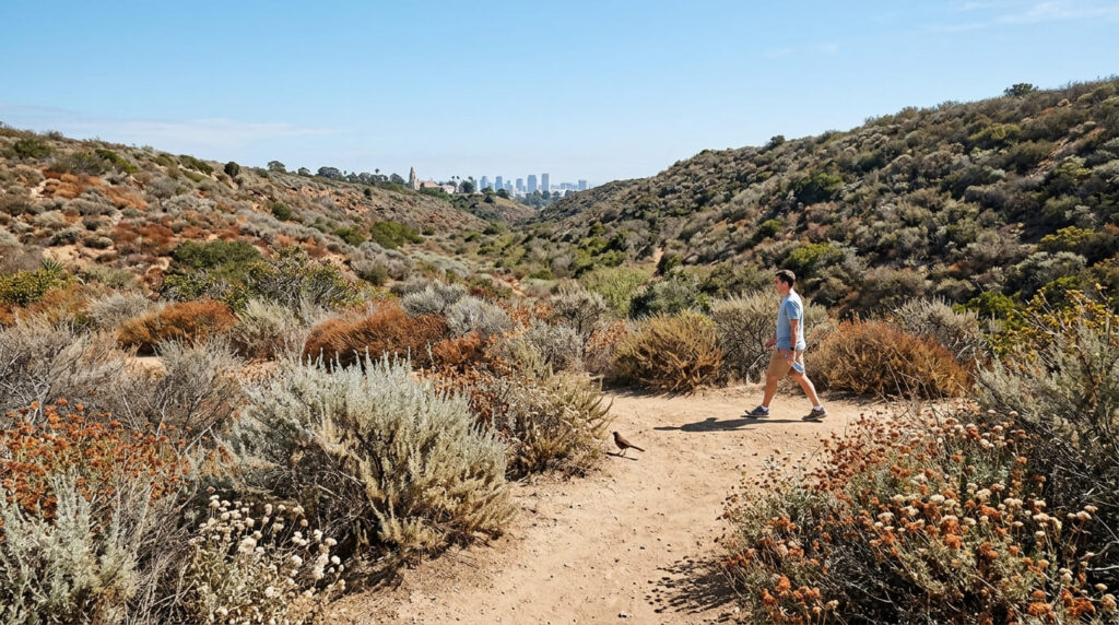
It’s a good litmus test: finish it wanting more, and you’re probably ready for mountain trails. For more of what Balboa Park’s canyons offer, our San Diego County canyon trails guide rounds up a few neighbors to Florida Canyon.
Practical tips: what to know before you go
Most Balboa Park lots are free, though they fill fast near the zoo on weekends; park by Morley Field instead. There’s minimal shade, dogs need to be leashed, and the surface can get eroded and muddy for a day or two after rain.
Shell Beach Bluff Trail (San Luis Obispo County)
Why it’s great for beginners: flat and paved with constant ocean views to keep motivation high
Shell Beach Bluff Trail is a paved, wooden-railed path along the Pismo-area cliffs, and it’s a strong beginner pick in its own right.
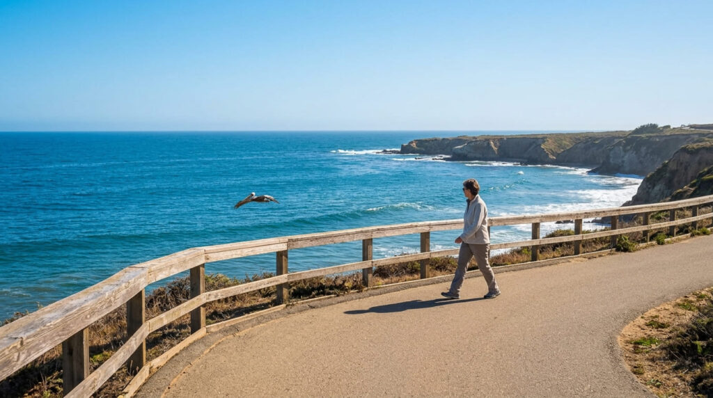
At under a mile out-and-back with ocean views nearly the entire way, the payoff here never lets up: you’re not waiting for one big view at the end. It runs along the bluffs above Pirate’s Cove, with the ocean audible the whole way.
Practical tips: what to know before you go
Park on the residential streets near Indio Drive and Bluff Drive rather than fighting for the small lot, which can get tight on weekends. The path is mostly paved but hits roughly a 10% grade at its steepest, and there are no restrooms directly on the trail.
Pinecrest Lake National Recreation Trail (Tuolumne County)
Why it’s great for beginners: the flattest, easiest stretch in an otherwise mountainous county
Pinecrest Lake National Recreation Trail offers flat walking in a county where most other trails climb straight into Sierra terrain.
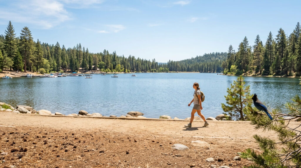
The full lake loop runs close to 4 miles, rated easy-to-moderate, with rockier, stepped sections on the north shore. My take: skip the full loop your first time. Start from the day-use area near the marina and walk the flatter southern shoreline as an out-and-back, turning around whenever you’ve had enough.
Practical tips: what to know before you go
This works well as a gentle warm-up before Tuolumne County’s more demanding Sierra trails on the same trip. Parking near the day-use area fills fast on summer weekends. Check the U.S. Forest Service’s Pinecrest Lake trail page for current conditions before you go.
Where to go once you’ve done a few of these
After two or three of these, the next question is usually “what’s easy, versus just labeled that way?” Our guide to reading California trail difficulty ratings across AllTrails and NPS systems breaks down exactly how those labels get assigned. When you’re ready to build toward something bigger, our guide to training for a harder California hike like Half Dome or Mount Whitney lays out a path there. And if you haven’t already, our beginner’s guide to what hiking trails are covers the basics none of these seven trails assume you already know.
My recommendation
If you only try one trail off this list, make it Fern Dell. It’s short enough that a bad first experience is basically impossible, and it sits close enough to Griffith Park’s bigger trails that you can decide, on the spot, whether to keep going. Everything else here shares that same trait: a payoff, without asking you to earn it the hard way first.
Frequently asked questions about the best beginner hiking trails in California
What should a beginner bring on their first hike?
Water (about half a liter per hour), sun protection, a charged phone, closed-toe shoes with decent grip, and a small snack. That’s it; don’t overthink your first outing.
How long should a beginner’s first hike be?
Somewhere between 1 and 3 miles, or 30 to 90 minutes, is the sweet spot. Every trail above fits that range, and you can always turn around early.
What is considered an easy hiking trail?
Most rating systems call a trail “easy” when it’s under about 3 miles round-trip, under 500 ft of elevation gain, and clearly marked. Our hiking trail difficulty levels guide breaks down exactly how California trails get rated.
Do beginners need hiking boots?
Not for any of these seven: they’re paved or hard-packed, so supportive sneakers or trail runners are plenty. Boots matter once you’re on loose rock, mud, or elevation.
How do you build up to harder hikes?
Add distance or elevation gradually, repeating a trail at a slightly longer version rather than jumping from 2 miles to 10. See the training guide linked above for a progression.
Is it okay to turn back partway through a hike?
Yes, every time, no exceptions. Turning around isn’t a failure; it’s the skill that keeps easy hikes easy and hard hikes survivable. I’d rather see someone finish half of Fern Dell than push through a trail that’s stopped being fun.