5 Best Coastal Hiking Trails in Humboldt County, From a Working 1871 Lighthouse to California’s Only Roadless Coastline
Coastal Hiking Trails in Humboldt run from a working Coast Guard lighthouse in a small fishing village to a stretch so rugged that Highway 1 was never built through it. This guide covers the coast; for the county’s old-growth redwood trails, see our Humboldt redwood trails guide, part of our full Humboldt County hiking guide.
Disclosure: Please note that some of the links below are affiliate links and at no additional cost to you, I may earn a commission. Know that I only recommend hiking gear I personally stand behind; when you use my affiliate links, it helps me run this blog and keep all of this content free of charge for readers (like you).
Key takeaways:
- Best short loop with a working lighthouse: Trinidad Head Trail, offering 360-degree views and a real 1871 lighthouse still guiding ships today.
- Most culturally significant: Rim Trail at Sue-meg State Park, featuring sea stacks, tide pools, and a reconstructed Yurok village on land recently restored to its traditional name.
- Most singular: the Lost Coast Trail, California’s only major stretch of coastline too rugged for a highway.
- Best family beach: Moonstone Beach, a wide sandy shore at the mouth of the Little River.
- Quietest wildlife stop: Table Bluff County Park, offering panoramic coastal bluff views and regular Roosevelt elk sightings (with its historic lighthouse history tied to the lens now displayed at the nearby Humboldt Bay Maritime Museum).
- Two of these trails (Rim Trail, Lost Coast Trail) depend heavily on tide timing; check a tide table before you go.
How these five Humboldt coastal trails compare
| Trail | Distance | Difficulty | Fee/Permit | Best for |
|---|---|---|---|---|
| Trinidad Head Trail | ~1.2-1.4 mi loop | Easy-moderate | Free | Short loop, working lighthouse |
| Rim Trail (Sue-meg State Park) | ~2-4 mi | Easy-moderate | Day-use fee | Tide pools, Yurok history |
| Lost Coast Trail (from Black Sands Beach) | Adjustable out-and-back | Easy (short) to strenuous (multi-day) | Free day hike; permit for overnight | Roadless coastline |
| Moonstone Beach | Flexible beach walk | Easy | Free | Family beach, tide pools |
| Table Bluff County Park | Short bluff walk | Easy | Free | Elk sightings, lighthouse lens |
Trinidad Head Trail
Trailhead access and parking in the village of Trinidad
Free parking is available near Trinidad Bay, right in the small coastal village, making it the most walkable, town-adjacent trailhead in this entire guide.
What you’ll see: a historic lighthouse and whale-watching bluffs
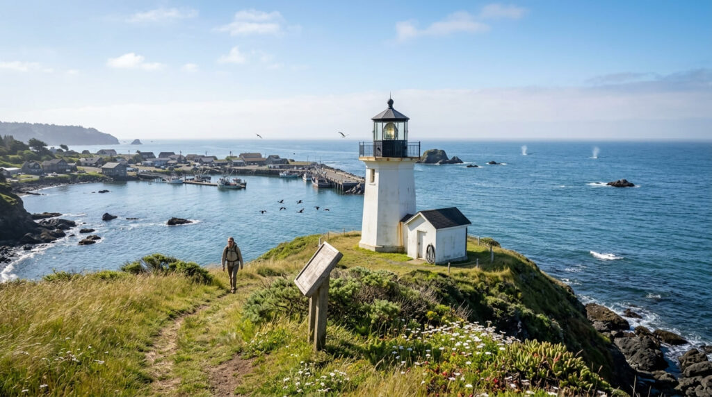
The loop runs about 1.2 to 1.4 miles around Trinidad Head with genuine 360-degree coastal views. The real Trinidad Head Lighthouse, built in 1871, still operates today as an active Coast Guard aid to navigation; it is open to public tours only on the first Saturday of the month, 10 a.m. to noon. (Don’t confuse it with the separate Trinidad Memorial Lighthouse, a 1949 replica down in the harbor itself, which are two different structures in the same small town.)
Best time to hike Trinidad Head: winter for gray whale migration
Elevated bluff views make this a genuine land-based whale-watching spot during the winter gray whale migration, so bring binoculars and patience.
Winter Travel Note: While winter offers ideal land-based whale watching off Trinidad Head, coastal storms can cause sudden wind and rain. Additionally, the monthly Trinidad Head Lighthouse open house tours (first Saturday, 10 a.m.–noon) are weather-dependent and typically take place seasonally from May through September.
Rim Trail (Sue-meg State Park)
Trailhead access and parking at Sue-meg State Park
A day-use fee applies at this state park north of Trinidad. Worth knowing before you go: the park was renamed from Patrick’s Point to Sue-meg in 2021, restoring the Yurok Tribe’s traditional name for land that’s been a seasonal fishing site for the Yurok people for thousands of years, as part of a statewide initiative to address place names tied to historical violence against Indigenous communities.
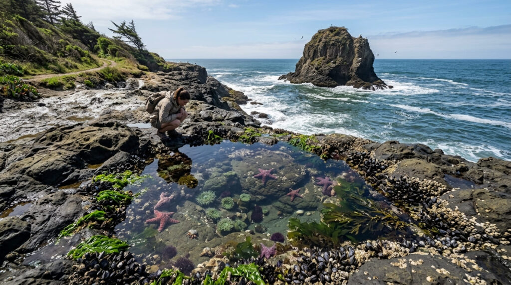
What you’ll see: sea stacks, tide pools, and a reconstructed Yurok village
The Rim Trail runs roughly 2 to 4 miles along the bluff edge, connecting dramatic viewpoints like Wedding Rock with accessible tide pools below. The park also includes Sumeg Village, a reconstructed traditional Yurok village open to visitors. One detail worth flagging: dogs are allowed on leash in campgrounds and paved roads here, but not on the beaches or park trails, including this one.
Best time to hike the Rim Trail: low tide for tide pool access
The richest tide pools (containing sea anemones, starfish, urchins, and crabs) are only fully visible at low tide, so check a tide chart before you plan your visit around them specifically.
Lost Coast Trail: Black Sands Beach
Trailhead access and parking at Black Sands Beach, Shelter Cove
Free parking is available at Black Sands Beach in Shelter Cove, the standard southern access point into the King Range National Conservation Area’s famous Lost Coast Trail.
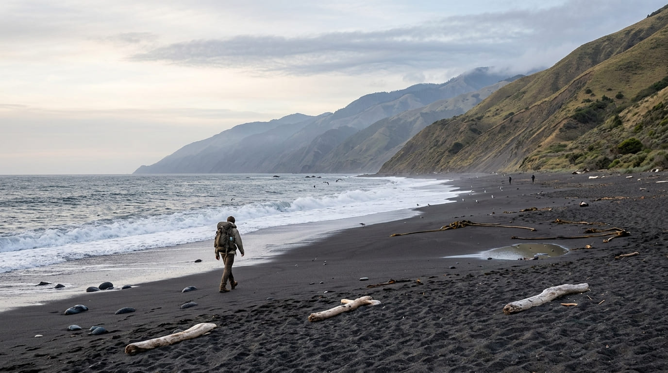
What you’ll see: California’s only major roadless stretch of coastline
Sea Lion Gulch, a well-known landmark on this trail, sits near the trail’s northern end near Mattole Beach and Punta Gorda, roughly 19 to 20 miles north of Black Sands Beach, well beyond a standard day-hike distance.
For hikers looking to explore further north in the county, local guide Wild Trail Tours recommends the stunning Gold Bluffs Beach Coastal Trail loop, starting from Fern Canyon to Friendship Ridge, heading down West Ridge to the north section of the coastal trail, and hiking back south, and they also offer overnight camping tours in the area.
If you’re starting from Black Sands Beach specifically, plan a shorter out-and-back along the black volcanic sand beach itself, which still delivers the core experience (California’s only significant stretch of coastline too rugged for Highway 1 to ever be built) without requiring a multi-day backpacking trip. The full Mattole-to-Black-Sands trail runs about 25 miles one-way.
Best time to hike Black Sands Beach: check tide tables before you go
This is worth taking seriously: several sections of the full Lost Coast Trail are genuinely impassable at high tide, and the managing agency (BLM) has documented real accidents and close calls tied to poor tide planning.
A short out-and-back from Black Sands Beach itself is far more forgiving, but always check current tide predictions before setting out, even for a shorter walk. No permit is required for day hikes; overnight backpacking in the King Range Wilderness requires a separate advance permit.
Moonstone Beach Trail
Trailhead access and parking at Moonstone Beach, Trinidad
Free beach parking is available south of Trinidad, at the mouth of the Little River.
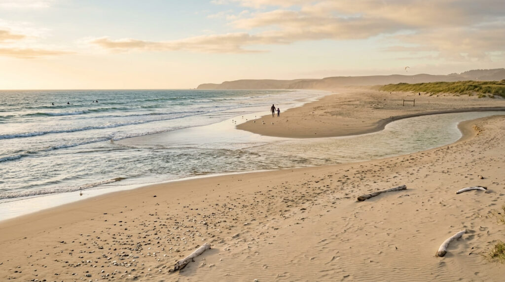
What you’ll see: a wide sandy beach at the mouth of the Little River
Moonstone is a genuinely wide, sandy beach where the Little River meets the Pacific, offering a real contrast to the rockier coves elsewhere in this guide, and popular for family visits, surfing, and wading in the calmer river mouth. At low tide, especially in summer, you can often ford the Little River to reach neighboring Clam Beach as well.
Best time to hike Moonstone Beach: low tide for the widest beach access
The sandy area narrows considerably as the tide comes in; low tide gives you the most room to walk and the easiest river crossing if you’re heading toward Clam Beach.
Table Bluff County Park Trail
Trailhead access and parking at Table Bluff County Park, near Eureka
Free parking is available at this Humboldt County park south of Eureka, which is the southernmost stop in this guide and genuinely one of the least-visited.
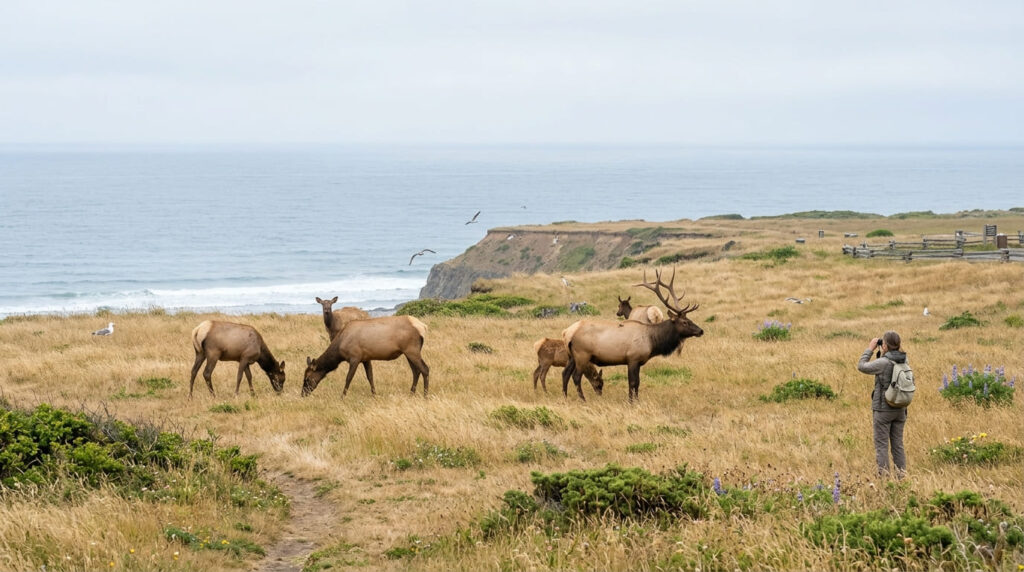
What you’ll see: a historic lighthouse lens and elk sightings
Known for its sweeping blufftop views, Table Bluff offers genuinely regular Roosevelt elk sightings in the surrounding grassland, creating a wildlife-and-history combination unmatched by any other trail in this guide.
Best time to hike Table Bluff: any season, providing a reliable short coastal walk
This trail’s short length and low-key profile make it a dependable stop nearly any time of year, without the tide-timing considerations that govern several other trails in this guide.
Frequently asked questions about coastal hiking trails in Humboldt County
Is the Lost Coast Trail hard?
It depends entirely on how much of it you hike: a short out-and-back from Black Sands Beach is genuinely easy, while the full 25-mile Mattole-to-Black-Sands traverse is a strenuous, multi-day backpacking trip requiring real tide-table planning.
Do you need a permit for the Lost Coast Trail?
Only for overnight stays in the King Range Wilderness. Day hikes, including a shorter walk from Black Sands Beach, don’t require a permit.
Is Sue-meg State Park the same as Patrick’s Point?
Yes. It’s the same park, renamed in 2021 to restore the Yurok Tribe’s traditional name for the area, as part of a statewide effort to address place names tied to historical violence against Indigenous people.
Can you see whales from Trinidad Head?
Yes. The elevated bluff views make it a genuine land-based whale-watching spot, especially during the winter gray whale migration.
Are there elk at Table Bluff County Park?
Yes, Roosevelt elk sightings in the surrounding grassland are a regular, reliable feature of this park.
Is Moonstone Beach good for swimming?
The Little River’s calmer mouth is genuinely good for wading and family visits; the open ocean itself carries the same cold-water and current cautions as anywhere else on this exposed coastline.