Joshua Tree National Park Maps & Trail Map Guide
Sooner or later in Joshua Tree, the bars on your phone disappear. The blue dot freezes, the road ahead forks, and every boulder pile starts to look like the last one. That is the moment a Joshua Tree National Park map stops being trip-planning homework and starts deciding how your day goes.
Disclosure: Please note that some of the links below are affiliate links and at no additional cost to you, I may earn a commission. Know that I only recommend hiking gear I personally stand behind; when you use my affiliate links, it helps me run this blog and keep all of this content free of charge for readers (like you).
The park makes this easy to prepare for, though. One free brochure map covers the roads, the entrances, and the popular stops. A trail map handles the hikes. A topographic sheet takes over when the path ends. Let’s walk through each one in the order the questions usually come up, starting with the first: which map do you need?
Which Joshua Tree National Park map should you carry?
Carry two. Pick up the official park map for roads, entrances, visitor centers, and campgrounds, then add a trail or topographic map for anything longer than a nature walk. The National Park Service maps page is the best place to start, because it gathers the downloadable park map, campground maps, backcountry road maps, and USGS topographic sheets in one spot.
| Map | Best for | Where to find it | Keep in mind |
|---|---|---|---|
| NPS park brochure map | Roads, entrances, visitor centers, campgrounds, popular trailheads | Entrance stations, visitor centers, or a free download to print | An overview, so no contour lines |
| NPS app offline map | Finding your way with no signal | Download before you arrive | Depends on a charged phone |
| USGS topographic quadrangles | Terrain, washes, elevation | Free download or paid print, linked from the NPS maps page | Leave off day-use areas and wilderness boundaries |
| National Geographic Trails Illustrated Map 226 | Hiking, driving, backcountry planning | Map shops and outdoor retailers | Check the edition date |
| Campground maps | Site layout at each of the park’s nine campgrounds | NPS maps page | One campground per map |
That topographic note matters. NPS points out that USGS sheets leave off day-use areas and wilderness boundaries, so it recommends the printed regulatory maps sold at visitor centers for hikers, backcountry campers, and climbers.
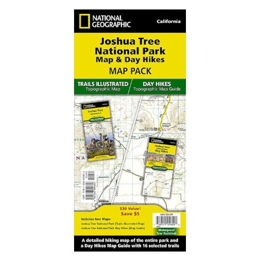
Most hikers end up with National Geographic’s Trails Illustrated Map 226. It is waterproof and tear-resistant, drawn at 1:80,000 with contour lines, a UTM grid, and mileages between trail intersections. For shorter outings, the Trails Illustrated Day Hikes map (Map 1717) lays out 16 day hikes with elevation profiles.
How is Joshua Tree National Park laid out on the map?
Open the park map, and the first thing you notice is the space. The park covers 792,510 acres, an area larger than Rhode Island, and the map splits it between two deserts. The higher Mojave Desert, above 3,000 feet, fills the western half and holds the Joshua trees. The lower Colorado Desert, below 3,000 feet, covers the eastern half and belongs to the larger Sonoran Desert. Elevation runs from 536 feet in the southeast corner to 5,814 feet on Quail Mountain.
The park also straddles two counties. If you want to see what surrounds it, our guides for Riverside County hiking trails and San Bernardino County hiking trails cover both sides of the boundary.
Where are the entrances on the Joshua Tree map?
Three entrance stations feed the park:
- West Entrance: roughly five miles south of Highway 62 in the village of Joshua Tree, where Park Boulevard begins.
- North Entrance: in Twentynine Palms, about three miles south of Highway 62 where Utah Trail meets it.
- South Entrance: near Cottonwood Spring, off Interstate 10, about 25 miles east of Indio.
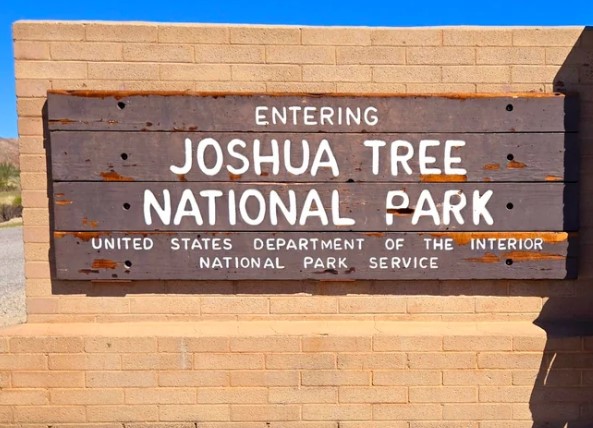
If you are holding an older map, one detail has changed. NPS finished a new West Entrance station in February 2026, built less than half a mile south of the old one and farther inside the park, so older maps and screenshots may draw it in the wrong spot. The North Entrance station sits about 25 miles east of the West Entrance along Highway 62.
Which roads hold the map together?
Park Boulevard is the spine. It links the West Entrance to the North Entrance. Pinto Basin Road runs north from the South Entrance and meets Park Boulevard at the junction known as the Pinto Wye.
Three areas break the pattern. Black Rock Canyon Road, Indian Cove Road, and the Fortynine Palms trailhead are each reached from Highway 62 and do not connect to Park Boulevard. Park at Black Rock and you cannot drive across to Hidden Valley; you exit and re-enter instead.
Where are the visitor centers?
The park has four, and each is a good place to pick up a printed map:
- Joshua Tree Visitor Center: 6554 Park Boulevard, Joshua Tree. Bookstore, café, flush toilets.
- Joshua Tree National Park Visitor Center: 6533 Freedom Way, Twentynine Palms. Flush toilets, bottle filling, bookstore, EV charging.
- Cottonwood Visitor Center: on Pinto Basin Road, about 7 miles north of Interstate 10 exit 168. Water, flush toilets, bookstore, picnic tables.
- Black Rock Nature Center: 9800 Black Rock Canyon Road, Yucca Valley. Water, flush toilets, bookstore, picnic area, with shorter summer hours.
Still deciding where to sleep? Our guide to where to stay near Joshua Tree covers lodging for hikers.
What does the official park map show?
The brochure map uses a legend you can learn in a minute. Red lines are paved roads and gray lines are unpaved. Dashed outlines mark four-wheel-drive roads for high-clearance vehicles only, and black dashes mark hiking trails. Mile markers run along Park Boulevard and Pinto Basin Road, which gives you a way to tell a ranger exactly where you are. A blue circle with a white B marks a backcountry trailhead, where a permit is required.
Icons mark picnic areas, drinking water, campgrounds, ranger stations, self-guided trails, and the medical facility. Emergency telephones sit at Indian Cove Ranger Station, Intersection Rock, and Cottonwood Visitor Center. A small inset shades the wilderness areas, and the brochure reminds you that most of the park away from the road corridors is wilderness with its own rules.
Joshua Tree National Park trail map: where do the hikes sit?
NPS sorts the park’s trails into three bands, and the map is easier to use once you know them. Short walks and nature trails suit year-round visits, though summer starts should be before 9 a.m. Moderate hikes may not be recommended in summer. Strenuous hikes should not be attempted in the heat, and NPS says visitors are rescued from them every year. Think of the table below as a Joshua Tree trail map in text form, using NPS distances.
| Trail | Trailhead on the map | Distance | Elevation | Time | NPS band |
|---|---|---|---|---|---|
| Cholla Cactus Garden | Pinto Basin Road, about 20 miles north of Cottonwood Visitor Center | 0.25 mi loop | 10 ft | 15–30 min | Short walk |
| Keys View | End of Keys View Road | 0.25 mi paved loop (steep) | 25 ft | 30 min | Short walk |
| Cap Rock | Junction of Park Boulevard and Keys View Road | 0.4 mi loop | 20 ft | 30–45 min | Short walk |
| Hidden Valley | Hidden Valley picnic area | 1 mi loop | 100 ft | 1 hr | Short walk |
| Barker Dam | Barker Dam parking area | About 1.3 mi loop | About 50 ft | 1 hr | Short walk |
| Arch Rock | Twin Tanks parking lot | 1.4 mi (0.6 mi to a 0.2 mi loop) | 100 ft | 1 hr | Short walk |
| Skull Rock | Just east of Jumbo Rocks Campground | 1.7 mi loop | 160 ft | 1–2 hrs | Short walk |
| Lost Horse Mine | Lost Horse Mine trailhead, Keys View Road | 4 mi out and back | 550 ft | 2–3 hrs | Moderate |
| Mastodon Peak | Cottonwood Spring parking area | 3 mi loop | 375 ft | 1.5–2.5 hrs | Moderate |
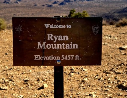
| Ryan Mountain | Between Sheep Pass and Ryan Campground | 3 mi out and back | 1,050 ft | 1.5–2.5 hrs | Strenuous |
| Fortynine Palms Oasis | Fortynine Palms parking area, off Highway 62 | 3 mi out and back | 300 ft each way | 2–3 hrs | Strenuous |
| Lost Palms Oasis | Cottonwood Spring parking area | 7.5 mi out and back | 500 ft | 5–6 hrs | Strenuous |
| Willow Hole | Boy Scout Trailhead, inside the West Entrance | 7.2 mi out and back | Mostly flat | 4 hrs | Strenuous |
A few deserve a second look. NPS lists Ryan Mountain as strenuous, even though plenty of blogs call it moderate. Fortynine Palms Oasis is only 3 miles round trip, but the trail climbs about 300 feet over a ridge in both directions, and NPS says to avoid it when it is hot.
Pin the Park Boulevard cluster first. Most short walks sit along it. Hidden Valley starts at its picnic area, Barker Dam has its own lot off Barker Dam Road, and Skull Rock’s lot is just east of Jumbo Rocks Campground. Follow Keys View Road to Lost Horse Mine and the Keys View overlook, where a clear day shows the San Andreas Fault, Mount San Jacinto, Mount San Gorgonio, and the Salton Sea. For a longer list of what to hike once the map is open, see our Joshua Tree National Park hiking trails guide.
Then the south. Pinto Basin Road leads to the Cholla Cactus Garden and on to the Cottonwood Spring trailheads for Mastodon Peak and Lost Palms Oasis.
Then the northern fringe. Black Rock has its own network: Hi-View at 1.4 miles, West Side Loop at 4.7, Warren Peak at 6.3, and Panorama Loop at 6.6. Indian Cove has a 0.6-mile nature trail from the west end of its campground. The paved half-mile Oasis of Mara loop at the Twentynine Palms visitor center is the one trail where pets are allowed. If this corner appeals, our roundups of desert hiking trails in San Bernardino County and hikes near Joshua Tree pair well with it.
The longest routes live on the topographic sheet. The Boy Scout Trail runs 8 miles one way between the Boy Scout trailhead and the Indian Cove backcountry board, and NPS strongly recommends a vehicle shuttle. The California Riding and Hiking Trail stretches 36.6 miles from Black Rock Canyon to the North Entrance.
Can your phone replace a Joshua Tree hiking map?
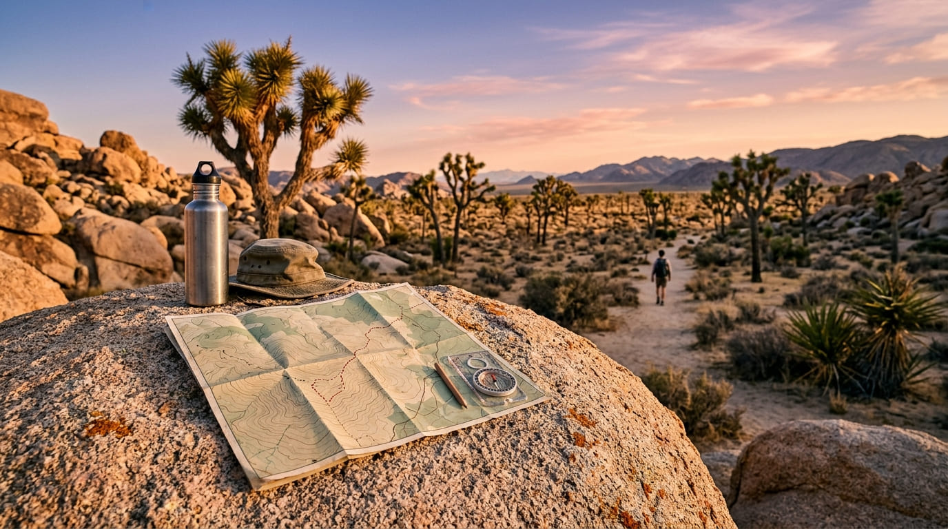
Not on its own. NPS says cell service is extremely limited and, in many areas, nonexistent, which can make it impossible to call for help or reach your group. Its advice: make plans before you enter, download the NPS app’s offline maps, carry a printed map and compass as backup, and bring a second GPS or satellite communication device. Skip rideshare for leaving the park, since a ride request needs a signal. The brochure map is also free in the Avenza Maps app.
Two more cautions. First, do not rely on GPS driving directions, which sometimes route vehicles onto backcountry roads with ruts or soft sand. Second, treat crowd-sourced hiking apps with care. NPS warns that apps and blogs can mislabel difficulty, present user-made routes as trails, and lead people into off-trail scrambling, which has led to search and rescue calls. The agency’s own trail information is the reference to trust.
New to topo sheets? Our guide on how to read a California hiking trail map covers scale and contour lines. If you are weighing options, compare free vs paid trail maps and the best hiking apps for California trails.
What can’t a Joshua Tree map tell you?
A printed map is fixed. Conditions are not.
Closures. NPS publishes a live map of closures for roads, trails, campgrounds, and backcountry zones on its alerts and conditions page, along with a forecast and a webcam from Belle Mountain. Check it before you drive in, and see our tips on how to check California trail closures.
Heat. Spring and fall bring highs near 85°F and lows near 50°F. Winter days sit around 60°F with freezing nights. Summer days pass 100°F, and NPS says to avoid hiking between 10 a.m. and 5 p.m. in that season.
Water. NPS recommends at least one gallon per person per day, and trails have no water sources. Drinking water is limited to a few spots: the Twentynine Palms visitor center, park headquarters, the West Entrance station, Black Rock Campground, Cottonwood Campground, and Indian Cove Ranger Station. Most campgrounds have none.
Storms. The monsoon season runs from mid-July to early September. Flash floods can strike on a sunny day, so stay out of washes during and after severe weather.
Do backcountry trips need a different map?
Yes. The blue B on the park map marks a backcountry trailhead, and overnight trips follow their own rules. A permit is required for every night in the backcountry. It costs $6, covers 1 to 12 people for up to 14 nights, and allows up to three consecutive nights in one zone. Book on Recreation.gov up to six months ahead, or at the permit office at park headquarters.
You camp inside one of 15 zones. The Boy Scout zone is limited to 14 designated sites. Elsewhere, camp at least one mile from any backcountry trailhead, half a mile from any road, and 200 feet from any trail. Campfires are not allowed. Park only at backcountry trailheads, and know that yellow self-registration permits are prohibited. NPS recommends a map, compass, and satellite communicator, and warns that a rescue can take hours or days.
The honest bottom line
A Joshua Tree map will not make the desert gentler, but it will make your choices clearer. Carry the free park map for roads and entrances. Add Trails Illustrated Map 226 or the NPS app’s offline maps for trails. Check the closures page before you leave town, and pack a gallon of water per person. The blue dot on your phone is a hint, never a promise. A folded sheet of paper, read at the right moment, can turn a bad afternoon into a good story.
Joshua Tree map FAQs
Is there a free map of Joshua Tree National Park?
Yes. NPS offers the park brochure map as a free download to print, and the NPS app includes offline maps. Printed copies are available at entrance stations and visitor centers.
How many entrances does Joshua Tree have?
Three entrance stations: West (Joshua Tree), North (Twentynine Palms), and South (Cottonwood, off Interstate 10). Black Rock, Indian Cove, and Fortynine Palms are reached separately from Highway 62.
What is the best map for hiking in Joshua Tree National Park?
For most hikers, the NPS park map plus Trails Illustrated Map 226, with trail details checked against the NPS hiking page. For a single-day route, the Day Hikes map (Map 1717) is easier to handle.
How much does it cost to enter?
On the NPS fees page, updated September 29, 2026, a private vehicle pass is $30 for seven days, a motorcycle is $25, and walkers or cyclists 16 and older pay $15 each. The Joshua Tree annual pass is $55, and America the Beautiful passes are accepted. Passes bought online must be printed or saved to your phone. For how passes work statewide, see our California hiking trail permits and passes guide.
Can dogs go on the trails?
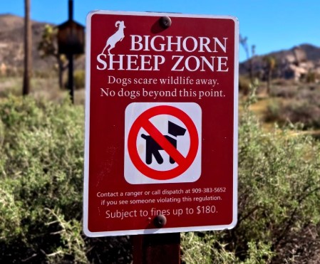
No. Pets are not permitted on trails except the paved Oasis of Mara loop, and elsewhere they must stay leashed in campgrounds, in picnic areas, and within 100 feet of roads.
Where can I find rock climbing maps?
The NPS maps page links to the park’s climbing pages, which cover the legendary climbing and bouldering areas.