How to Read a California Hiking Trail Map: Complete Guide
Reading a hiking trail map comes down to four skills: understanding the legend, calculating real distance from the scale, reading elevation from contour lines, and orienting the map with a compass. To further expand your wilderness knowledge, you can explore our curated list of essential navigation and map-reading guidebooks. None of these are complicated on their own, but most hikers never learn them because apps have made it optional, right up until a dead zone in the Sierra or the Mojave makes it not optional anymore. I’ve spent four-plus years cataloging California trails, and map literacy is one of those skills that costs nothing to learn and occasionally matters more than any piece of gear in your pack.
Disclosure: Please note that some of the links below are affiliate links and at no additional cost to you, I may earn a commission. Know that I only recommend hiking gear I personally stand behind; when you use my affiliate links, it helps me run this blog and keep all of this content free of charge for readers (like you).
Key takeaways:
- A paper map works with no battery and no signal, which is exactly when you’re most likely to need one in California’s backcountry.
- The legend, scale, contour lines, and a compass are the four building blocks of reading any trail map.
- USGS topographic maps use a standard 1:24,000 scale, meaning 1 inch on the map equals 24,000 inches (about 2,000 feet) on the ground.
- California’s magnetic declination runs roughly 11–14°E, and ignoring it introduces real navigation error over distance.
- Google Maps and AllTrails are useful complements to a paper map, not replacements for one.
Why every California hiker should know how to read a trail map
A trail map doesn’t need battery, signal, or a software update, which is exactly why the skill of reading one is worth having even if you navigate by phone most of the time.
When digital navigation fails: why paper maps still matter in California
Cell service drops out reliably in the Sierra Nevada’s granite canyons, across much of the Mojave, and in dense NorCal forest, not as a rare edge case, but as a near-guarantee on certain trails. A phone that can’t get signal also can’t download a map it doesn’t already have stored, and a dead battery makes even an offline map useless. A paper map sidesteps all of that, which is why it’s still listed on the Ten Essentials decades after GPS became common.
Understanding the key elements of a California trail map
Every trail map, whether it’s an NPS handout or a USGS topographic quad, is built from the same core elements: a legend, a scale, a north arrow, and trail markings.
How to read the legend and map symbols on California trail maps
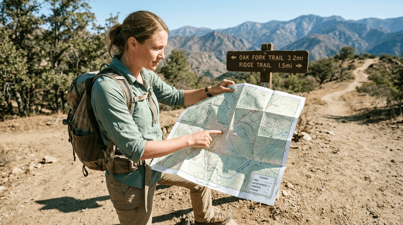
The legend translates the map’s symbols into plain meaning, a dashed line might mean an unpaved trail, a solid blue line means a year-round stream, and specific icons mark ranger stations, water sources, and campsites. Many CA park maps also color-code trails by difficulty, similar to ski-run coloring, so check the legend before assuming a color means the same thing it did on a different park’s map.
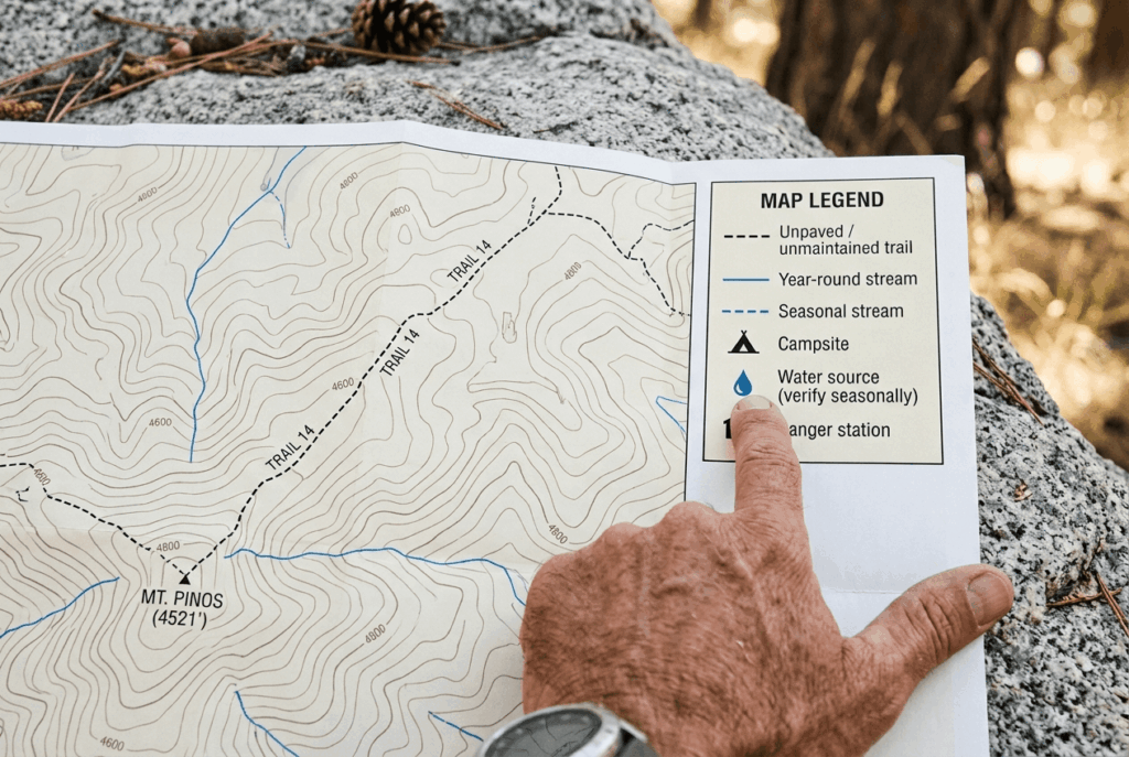
| Common symbol | Typical meaning |
|---|---|
| Dashed line | Unpaved or unmaintained trail |
| Solid blue line | Year-round stream or river |
| Blue dashed line | Seasonal or intermittent stream |
| Tent icon | Designated campsite |
| Water droplet icon | Water source (verify seasonally) |
| Small building icon | Ranger station or visitor center |
Map scale explained: how to calculate real distance on a California trail map
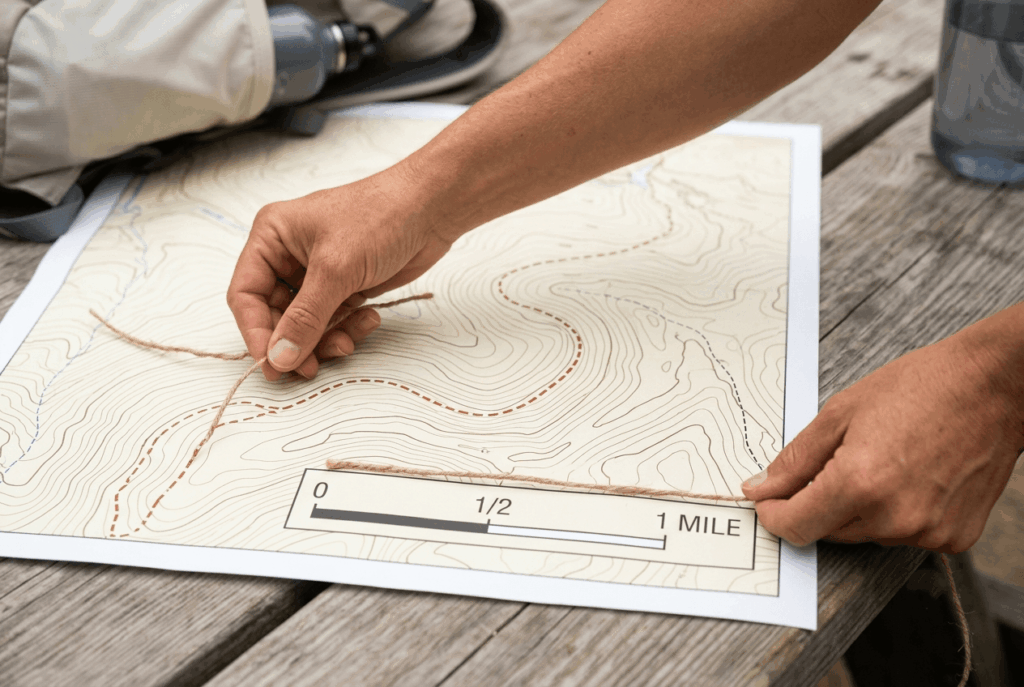
USGS topographic quads use a standard 1:24,000 scale, meaning 1 inch on the map equals 24,000 inches, roughly 2,000 feet, or a little over a third of a mile, on the ground. Most trail maps also include a graphic scale bar, which is more reliable to use directly than doing the ratio math yourself, especially on a photocopied or resized map where the printed scale may no longer be accurate.
Reading topographic maps: understanding elevation and terrain
Contour lines are what separate a real topographic map from a simple trail sketch, they’re the only element that tells you what the elevation actually does between two points, not just how far apart they are.
How to read contour lines to predict trail difficulty in California
Closely spaced contour lines mean steep terrain; widely spaced lines mean a gentler grade. Index contours (typically every fifth line, printed bolder and labeled with elevation) let you quickly count elevation gain without tracing every single line. Before committing to a trail, scan the contour spacing across its full length, a trail that looks short on the page can still be brutal if the lines are packed tight for most of it.
Identifying key terrain features on California topo maps: ridges, valleys, and summits
Each major terrain feature has a distinct, recognizable contour pattern once you know what to look for:
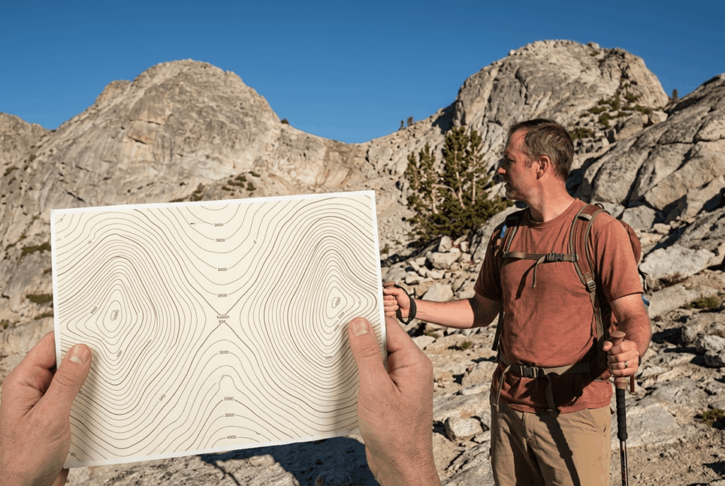
| Terrain feature | Contour pattern |
|---|---|
| Ridge | Contours form a line of U or V shapes pointing away from higher ground |
| Valley/drainage | Contours form V shapes pointing toward higher ground (upstream) |
| Peak/summit | Concentric closed loops, smallest loop at the center |
| Saddle | An hourglass shape between two higher points |
| Depression | Closed loops with small tick marks pointing inward |
| Cliff | Contour lines packed so tightly they appear to merge |
Sierra Nevada maps make good practice ground for this, since granite terrain tends to produce especially clean, textbook examples of ridges and saddles.
Using a compass with a California trail map
A baseplate compass is only useful once the map is oriented to actual north; otherwise, you’re just guessing which direction the symbols on the page correspond to in real life.
California’s magnetic declination: why you must adjust your compass
A compass needle points to magnetic north, not true north, and in California that gap, magnetic declination, runs roughly 11°E in the south to about 14°E in the north. Skip the adjustment and a bearing that looks correct on paper can walk you meaningfully off course over a few miles, which matters far more on a multi-hour route than it sounds like it should over a short distance.

How to take and follow a bearing on a California trail
Line up your compass baseplate between your current position and your destination on the map, rotate the bezel until its lines match the map’s north-south grid, then adjust for declination before you start walking. In the field, follow the bearing by picking a landmark directly ahead of you on that line and walking to it, then re-sighting a new landmark; this keeps you on course through terrain where you can’t see your final destination the whole way. If an obstacle forces a detour, “boxing” it, turning 90 degrees, counting paces around the obstacle, then turning back and reversing the process, gets you back on your original line.

Does Google Maps show hiking trails in California? Digital vs. paper maps
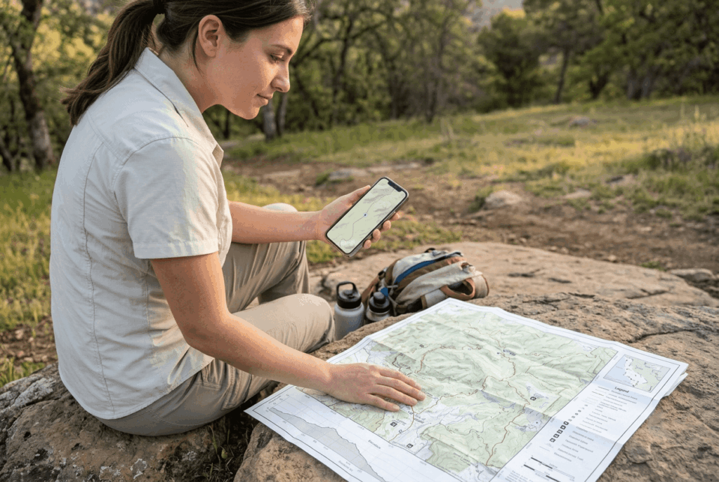
Google Maps shows some popular trails, but its trail-specific data is inconsistent, and it wasn’t built with the legend, contour detail, or difficulty coding that a real trail or topo map provides. It’s genuinely useful for getting to a trailhead and confirming parking, but treat it as a road map with some trails visible, not a hiking map.
How to add hiking trails to Google Maps in California
In the Google Maps app, switch the map type to “Terrain” from the layers menu, which adds elevation shading and shows more trail lines than the default view. This still isn’t a substitute for AllTrails, Gaia GPS, or a real topo map once you’re off pavement; for a fuller comparison of navigation apps and devices, see our navigation hazards guide.
If you’re building broader trail-planning skills, our beginner’s guide to hiking trails is a good starting point, and understanding trail difficulty ratings pairs naturally with reading contour lines, since both are ultimately describing the same terrain. Examining real-world destination examples, such as our Yosemite National Park maps, Redwood National Park map and trail guide, our Joshua Tree map guide, and our Death Valley National Park map and trail guide, lets you see how contour lines and brochure legends translate directly to different terrains.
Frequently asked questions: reading hiking trail maps in California
How do I read a hiking trail map?
Start with the legend to understand its symbols, use the scale to judge real distance, read contour lines for elevation and steepness, and orient the map with a compass if you’re navigating by bearing.
Does Google Maps show hiking trails in California?
Partially, it displays some popular trails and works well for driving to a trailhead, but its trail data is inconsistent and it lacks the contour and difficulty detail a dedicated trail map provides.
How do I find hiking trails on Google Maps?
Switch the map type to “Terrain” from the layers menu for better elevation and trail visibility, though AllTrails or Gaia GPS will show more complete and reliable trail data.
What is the best topographic map for hiking in California?
A USGS 7.5-minute quad (1:24,000 scale) is the standard for detailed terrain reading; many hikers pair it with a Gaia GPS or AllTrails digital layer for convenience.
What is magnetic declination and why does it matter for hiking in California?
It’s the gap between magnetic north (where your compass points) and true north (where the map’s grid points); in California that gap runs roughly 11–14°E, and ignoring it causes real course error over distance.
Can I use AllTrails as a replacement for a paper map in the Sierra Nevada?
Not entirely, AllTrails is a great planning and on-trail tool, but Sierra cell dead zones and battery limits mean a paper map and compass are still worth carrying as backup on remote routes.