Redwood National Park Map & Hiking Guide
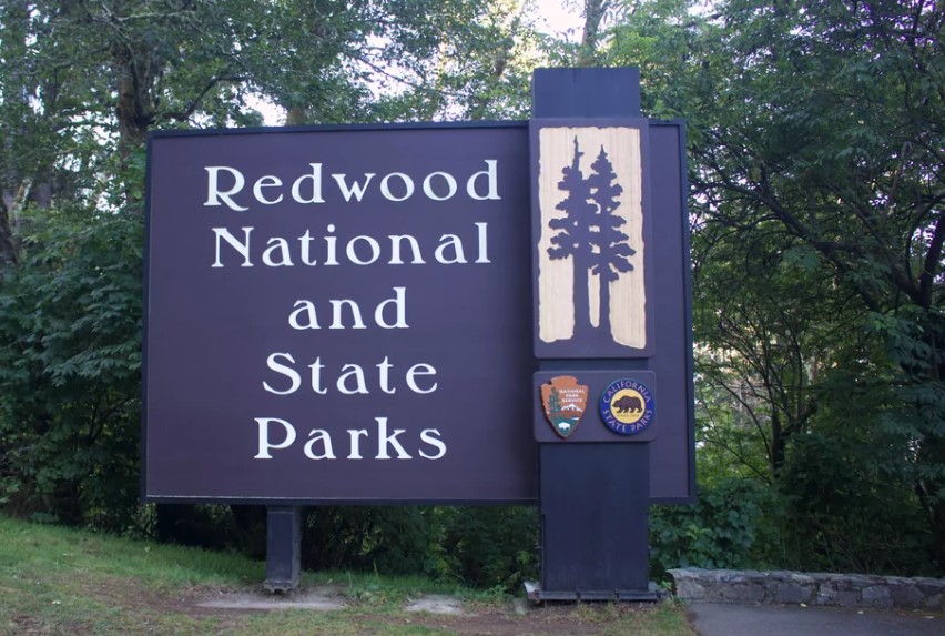
Look at a Redwood National Park California map for the first time, and it will not look like a park. There is no front gate, no loop road, and no single boundary line. A long ribbon of forest, prairie, and coastline runs beside Highway 101, shared by one national park and three California state parks that all appear on the same sheet.
Disclosure: Please note that some of the links below are affiliate links and at no additional cost to you, I may earn a commission. Know that I only recommend hiking gear I personally stand behind; when you use my affiliate links, it helps me run this blog and keep all of this content free of charge for readers (like you).
That is the first surprise. The second is that the digital map you trust may not understand any of it. The National Park Service warns that popular GPS apps can send visitors to remote logging roads and private property. So let’s walk this map the way you will drive it: which parks it covers, which roads are safe bets, where to pick up a printed copy, which trails to pin first, and when to go.
What does a Redwood National Park California map cover?
Redwood National and State Parks is a partnership. California set aside Prairie Creek, Del Norte Coast, and Jedediah Smith as state parks in the 1920s. Congress created Redwood National Park in 1968, and in 1994 the National Park Service and California State Parks agreed to manage all four together. The United Nations named the area a World Heritage Site in 1980. Today the combined parks cover roughly 130,000 acres, including about 45% of the world’s remaining old-growth redwoods, along nearly 40 miles of coast.
The Klamath River cuts across the middle of the map, and NPS publishes a full park map plus separate northern and southern halves. Treat the river as your first mental divide. Our hubs for Del Norte County hiking trails and Humboldt County hiking trails cover the two counties the parks sit in.
| Park unit | Side of the Klamath | Where to find it on the map | Known for |
|---|---|---|---|
| Jedediah Smith Redwoods State Park | North | Along US 199 near Hiouchi | Howland Hill Road, Stout Grove, Smith River |
| Del Norte Coast Redwoods State Park | North | Along US 101 south of Crescent City | Mill Creek Campground |
| Redwood National Park | Patches on both sides | Coast and inland, around the state parks | Klamath River Overlook, Lady Bird Johnson Grove, Tall Trees Grove |
| Prairie Creek Redwoods State Park | South | Newton B. Drury Scenic Parkway, north of Orick | Elk Prairie, Fern Canyon, Prairie Creek Visitor Center |
Which roads hold the map of Redwood National Park together?
Highway 101 runs north and south through the center of the parks, and NPS calls it the most reliable route. US 199 provides access from the northeast, and Highway 299 is the best approach from the southeast. NPS says not to use Bald Hills Road as a way into the park.
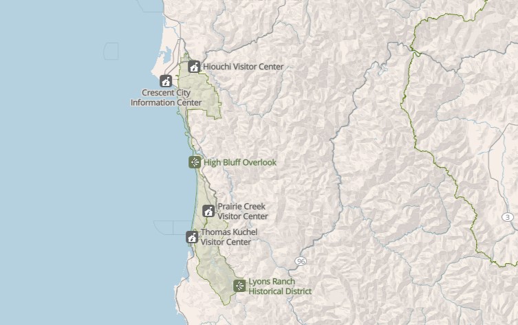
There is no main gate and no entrance fee, and the parks are always open. For scale, NPS puts the parks about seven hours north of San Francisco, four hours west of Redding, and eight hours south of Portland.
Once you are inside, four drives do most of the work:
| Road | Surface | Length and time | Vehicle notes |
|---|---|---|---|
| Newton B. Drury Scenic Parkway | Paved, two-way | 10 mi one way, about 30 min | No commercial vehicles |
| Howland Hill Road | Mostly unpaved, narrow | 10 mi one way, about 45 min | Motor homes and trailers not advised |
| Coastal Drive Loop | Mostly paved, one-way northbound section | 9 mi loop, about 45 min | Motor homes and trailers prohibited |
| Bald Hills Road | Mostly paved, steep, narrow | 17 mi one way to the park boundary, about 45 min | Motor homes and trailers not advised |
Davison Road leads to Gold Bluffs Beach and Fern Canyon. NPS says its two stream crossings can be challenging after storms and recommends high clearance. Trailers are not allowed, and other vehicles are limited to 24 feet.
The Newton B. Drury Parkway is the one to circle first. It passes through the old-growth forest of Prairie Creek Redwoods State Park, and NPS recommends it as an alternative to Highway 101.
Which Redwood National Park map should you carry?
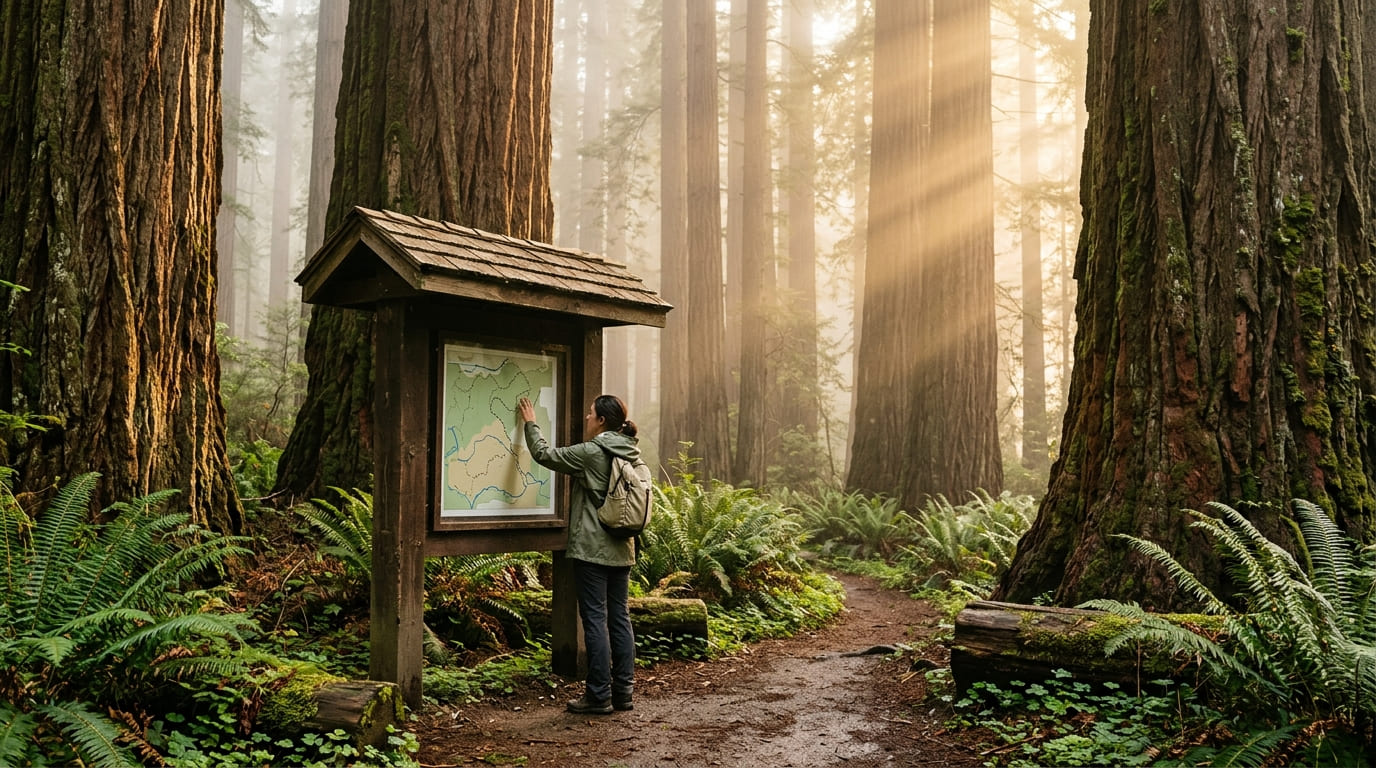
Start with the official park map. The NPS maps page offers the full park map (prints on legal paper), the northern half and southern half (each prints on letter paper), campground maps, and a horse trail brochure. Then add a trail map if you plan to leave the road.
| Map | Best for | Where to find it | Keep in mind |
|---|---|---|---|
| NPS park map (full, north, south) | Roads, parks, visitor centers | NPS website, free brochures at visitor centers | Overview only, no contour lines |
| NPS Visitor Guide map | Scenic drives and short walks | NPS website | Check for the current edition |
| NPS app | Accurate GPS data, offline use | Download before you arrive | Needs a charged phone |
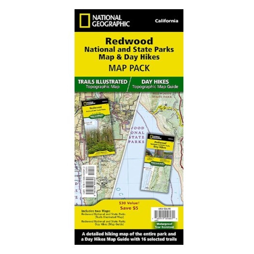
| National Geographic Trails Illustrated Map 218 | Hiking and backcountry planning | Park stores, outdoor retailers | Waterproof, tear-resistant, topographic, with a UTM grid |
| Trails Illustrated Day Hikes Map 1719 | Sampling 16 day hikes | Park stores, outdoor retailers | Covers over 75 miles of trail |
| Campground maps (4) | Site layout | Linked from the NPS maps page | Hosted by California State Parks |
Trails Illustrated Map 218 is the one most hikers end up buying. It was created with NPS, California State Parks, and the U.S. Forest Service, and it names Crescent City, Orick, Klamath, the Smith River, and Trinidad Head among its features. NPS recommends printed maps because digital ones are unreliable here, and the park stores run by the Redwood Parks Conservancy sell maps and guidebooks.
Where can you pick up a printed map?
NPS lists five visitor centers, and official park brochures are free at all of them:
- Crescent City Information Center: 1111 Second Street, Crescent City, which is also park headquarters.
- Hiouchi Visitor Center: about 9 miles northeast of Crescent City on US 199.
- Jedediah Smith Visitor Center: in Jedediah Smith Campground, also on US 199. The campground store there is open in summer only.
- Prairie Creek Visitor Center: about 6 miles north of Orick on Newton B. Drury Scenic Parkway.
- Thomas H. Kuchel Visitor Center: on US 101, about 2 miles south of Orick.
NPS lists summer hours of 9 a.m. to 5 p.m. and 9 a.m. to 4 p.m. the rest of the year, with closures on Thanksgiving, December 25, and January 1, so confirm before you drive. Park wifi is available at the Crescent City bookstore, the visitor centers, and the Elk Prairie Campground kiosk.
Can your phone replace a Redwood National Park map?
Not here. NPS rangers list unreliable GPS as the second of their top ten planning tips. The park’s own maps page says many popular online maps and GPS apps do not cover Redwood accurately, and visitors are often misdirected to isolated towns, remote logging roads, or private property. Rangers also suggest not typing “Bald Hills Road” or “Tall Trees Grove” into a navigation app as a destination.
The fix is simple. Download the NPS app before you arrive, since its content can be saved for offline use and cell service is limited across much of the park. Carry a printed map as backup. If you are new to reading one, our guide on how to read a California hiking trail map covers scale and contour lines, and our comparison of free vs paid trail maps helps you decide what to buy.
Redwood is also a national and state park at once, which changes some rules on the ground. Our explainer on state parks vs. national parks covers the differences for hikers.
Redwood National Park hiking trails: where to pin them on the map
NPS counts more than 100 miles of trails, so you will not pin them all. This table lists the ones most visitors build a day around. Distances come from the park’s 2026 Visitor Guide and trail pages.
| Trail | Where it starts on the map | Distance | Elevation | Time |
|---|---|---|---|---|
| Simpson-Reed | Walker Road, off US 199 | 0.8 mi loop | 50 ft | 30 min–1 hr |
| Stout Grove | East end of Howland Hill Road | 0.5 mi loop | 32 ft | 30 min–1 hr |
| Grove of Titans | East end of Howland Hill Road | 1.7 mi out and back | 137 ft | 1–1.5 hrs |
| Boy Scout Tree | West end of Howland Hill Road | 5.5 mi out and back | 900 ft | 3–4 hrs |
| Yurok Loop | Lagoon Creek Picnic Area, US 101 | 1.25 mi loop | 100 ft | 45 min–1.25 hrs |
| Revelation | Near Prairie Creek Visitor Center | 0.3 mi loop | 9 ft | 15–45 min |
| James Irvine | Prairie Creek Visitor Center | 10.4 mi out and back | 1,400 ft | 5–7 hrs |
| Fern Canyon Loop | Fern Canyon parking area, Davison Road | 0.7 mi loop | Not steep | Short loop |
| Trillium Falls | Elk Meadow Day-Use Area, Davison Road | 2.75 mi loop | 450 ft | 1.25–2 hrs |
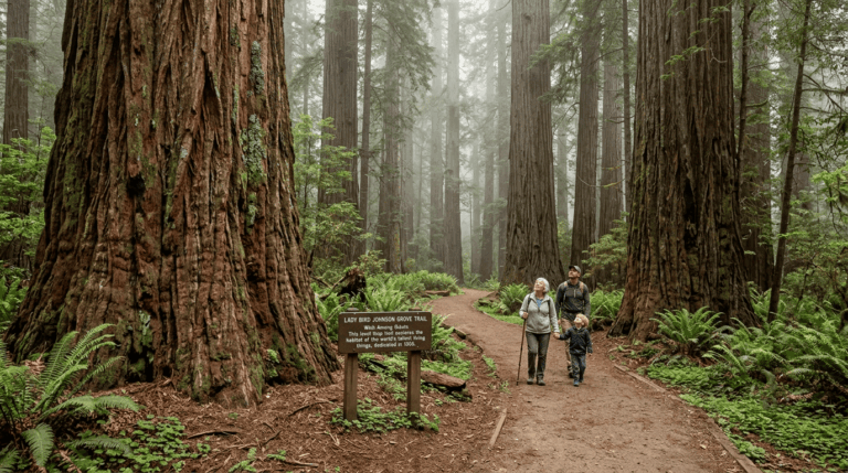
| Lady Bird Johnson Grove | Bald Hills Road | 1.5 mi loop | 100 ft | 45 min–1.25 hrs |
| Tall Trees | Tall Trees Trailhead (reservation required) | 4.5 mi round trip | Drops 800 ft in the first 1.5 mi | About 2 hrs hiking, 4 hrs total |
Start in the north. Jedediah Smith Redwoods State Park holds the Stout Grove, Grove of Titans, and Boy Scout Tree trailheads along Howland Hill Road, plus Simpson-Reed off Walker Road. The road is mostly unpaved, and NPS advises against motorhomes and trailers on it. Stout Grove is reachable from Jedediah Smith Campground in summer by a seasonal footbridge.
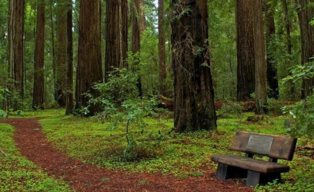
Then work south. Prairie Creek Visitor Center is the hub for Revelation, James Irvine, and the Newton B. Drury Parkway trails. Revelation was built for visitors who are blind or have low vision. Davison Road leads to Elk Meadow, Gold Bluffs Beach, and Fern Canyon. Roosevelt elk are seen most often south of the Klamath, around Prairie Creek, Gold Bluffs Beach, Bald Hills Road, and Orick. NPS asks you to stay at least 75 feet back.
Then go inland and to the coast. Lady Bird Johnson Grove sits off Bald Hills Road, and Tall Trees descends to Redwood Creek. On the coast, the Coastal Trail’s Last Chance section runs 0.6 miles one way to Enderts Beach tide pools. For longer lists of what to hike, see our guide to Redwood National and State Parks hiking trails, then our roundups of redwood hikes in Humboldt County and coastal hikes in Humboldt County.
Pets are not allowed on trails. They can go on leashes at campgrounds, picnic areas, roads, parking areas, and Crescent, Gold Bluffs, and Freshwater beaches. NPS singles out Walker Road and Cal Barrel Road as places to walk through old-growth with a dog.
Do you need a reservation to follow the map?
Three places on the map require one. All are free and online-only.
- Fern Canyon and Gold Bluffs Beach Day-Use Area: a reservation is required for each vehicle from May 15 to September 15. A cash day-use fee applies on site. Expect to hike through ankle-to-knee-deep water in the canyon.
- Tall Trees Trailhead: a reservation is required year-round. You can book up to 180 days ahead, or on the morning or afternoon before for a half day. Allow about four hours in total, including 6 miles of dirt road. The small lot cannot take RVs over 21 feet or trailers, and a locked gate code arrives by email.
- Backcountry camping: a free permit is required, issued online only. NPS lists seven backcountry campsites.
The four developed campgrounds charge $35 a night. Reservations run spring through fall through ReserveCalifornia, from 48 hours to six months ahead. Our guide to California hiking trail permits and passes explains how these systems compare statewide.
When is the best time to visit Redwood National Park?
The parks are open year-round, so the answer depends on what you want from the map. NPS describes steady coastal temperatures from the mid-40s to low 60s°F. From October through April, storms drop most of the 60 to 80 inches of annual rain. In summer, fog slips up the river canyons and keeps the forest damp, while inland areas are warmer and sunnier.
- Spring: Native rhododendrons bloom from mid-May to early June, and elk calves arrive in May and June. Gray whales pass in March and April.
- Summer: Fog is frequent. Fern Canyon is popular and busy, and its reservation window runs through September 15. Seasonal footbridges are in place.
- Fall: Elk are in rut, and NPS warns that males can be aggressive. Vine and big-leaf maples turn crimson and gold from October through December, as along Mill Creek Trail. Gray whales pass again in November and December.
- Winter: Expect rain, quiet trails, and no seasonal footbridges. Redwood Creek runs high and fast from December through May.
A resident group of gray whales can be seen year-round from the Klamath River Overlook. For other parks, see our guide to the best time to hike each California national park.
What can’t a Redwood map tell you?
A map shows where a trail goes, not whether you can walk it today. NPS keeps a live list of trail, road, and campground status on its current conditions page, including fallen trees, failed bridges, and Caltrans work. Check it the week you go, and see our guide on how to check California trail closures.
The map also leaves out hazards. Check tide tables before walking beaches, because rising water can trap you against a cliff. Never turn your back on the ocean, since sneaker waves can pull people in. The coast is a tsunami hazard zone, and falling limbs are a risk in old-growth forest during high winds. Protect against poison oak and ticks. NPS also warns of many vehicle break-ins at some trailheads, including Boy Scout Tree, so leave no valuables in the car.
The bottom line
A Redwood National Park California map rewards a little homework. Carry the free NPS park map, add Trails Illustrated Map 218 for trails, and download the NPS app before you lose signal. Book Fern Canyon or Tall Trees early, check conditions the week you go, and treat your phone’s blue dot as a suggestion. Some of these trees are more than 2,000 years old, and none of them will move for your GPS. A folded sheet of paper will get you there.
Redwood map FAQs
Is there an entrance fee for Redwood National Park?
No. Redwood National Park charges no entrance fee. Cash day-use fees apply at three state park areas: Jedediah Smith Day-Use Area, Gold Bluffs Beach and Fern Canyon, and Elk Prairie Picnic Area. Federal and California State Park pass holders do not pay them.
Is Redwood one park or four?
Four, managed as one. Redwood National Park shares the map with Jedediah Smith, Del Norte Coast, and Prairie Creek Redwoods State Parks.
Where is Redwood National Park in California?
On the far north coast, just below the Oregon border. Park headquarters is in Crescent City, and the southern parts of the parks cluster around Orick.
Can you drive through a redwood tree there?
No. There are no drive-through trees in the parks. NPS notes three privately owned ones elsewhere, including one at Klamath, a few minutes from the park, and they charge a fee.
Where can you camp?
Four developed campgrounds: Jedediah Smith, Elk Prairie, and Gold Bluffs Beach year-round, and Mill Creek seasonally. There are no lodges inside the parks.