Best Hiking Trails for Advanced Hikers in California
Truly challenging hiking in California means more than long mileage; it means real technical terrain, serious elevation gain, remote access with limited rescue coverage, and often a competitive permit lottery before you even get to the trailhead. I’ve spent four-plus years cataloging trails across this state, and the hiking trails for advanced hikers in this guide are the ones I recommend once someone has genuinely outgrown “strenuous” and is looking for a real test. This covers the trails, the permits, and how to actually train for them.
Disclosure: Please note that some of the links below are affiliate links and at no additional cost to you, I may earn a commission. Know that I only recommend hiking gear I personally stand behind; when you use my affiliate links, it helps me run this blog and keep all of this content free of charge for readers (like you).
Key takeaways:
- Advanced California trails generally mean 10+ miles round-trip, 2,500+ ft of elevation gain, and often technical terrain or remote, limited-rescue access.
- Half Dome and Mount Whitney both require competitive permit lotteries. Half Dome’s preseason lottery runs all of March; Whitney’s runs February 1 through March 1.
- Cloud’s Rest offers a comparable (some say better) Yosemite summit experience to Half Dome without any lottery at all.
- Backpackers with a Yosemite wilderness permit can add Half Dome access at pickup for $10/person, skipping the day-hike lottery entirely.
- Training for hikes like Half Dome or Whitney takes real weeks of preparation; loaded hikes, stair training, and altitude exposure all matter more than raw mileage alone.
What qualifies as an advanced hiking trail in California?
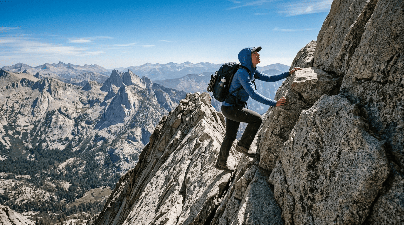
An advanced trail typically means 10+ miles round-trip, 2,500+ ft of elevation gain, and some combination of technical terrain scrambling, real route-finding, exposed ridgelines, plus remote access where rescue response time is measured in hours, not minutes. Permits are common at this tier, not incidental.
California’s trail rating tiers: where advanced hiking begins
Most trail databases use “strenuous” as their top difficulty label, but strenuous covers a wide range; advanced hiking generally starts where NPS or AllTrails’ strenuous rating meets real technical demand. The Yosemite Decimal System provides a more precise technical threshold: Class 3 (real scrambling, hands required) marks the point where a hike shifts from strenuous walking to genuinely technical terrain.
Multi-day backcountry commitment carrying everything you need, days from the nearest road, is its own separate advanced tier, independent of any single day’s difficulty.
Best advanced day hikes in Yosemite National Park
Half Dome: California’s most famous and most regulated advanced hike
At 14–16 miles round-trip with about 4,800 ft of elevation gain, Half Dome’s defining feature is its final 400 ft: two steel cables bolted into the granite at roughly a 45-degree angle, the only way up without technical climbing gear.
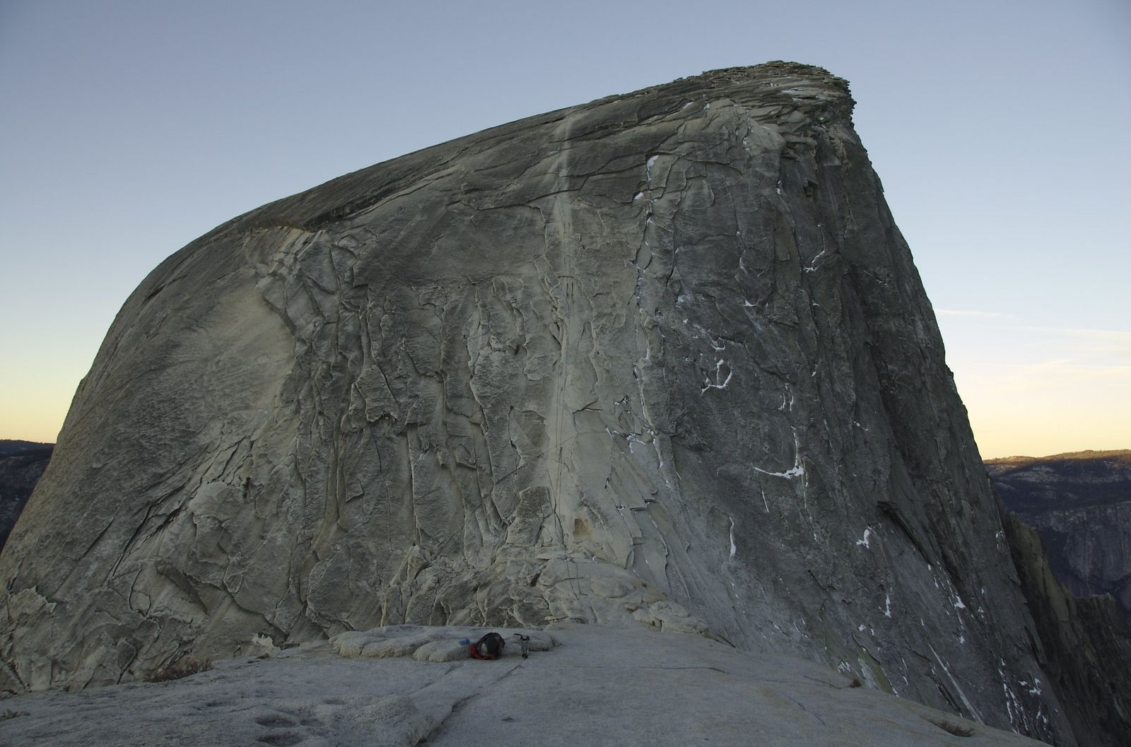
A permit is required whenever the cables are up (typically late May through mid-October, though exact dates shift with conditions). The preseason lottery runs all of March on Recreation.gov with results in mid-April, or a daily lottery opens applications two days before your hike date. Both lotteries charge a $10 non-refundable application fee, plus $10 per person if awarded, and the park caps day-hike permits at 300 per day.
One option many people miss: backpackers with a Yosemite wilderness permit can add Half Dome access at permit pickup for $10 per person, skipping the day-hike lottery entirely. For more information on Yosemite’s other routes, see our Yosemite hiking trails guide.
Cloud’s Rest: Yosemite’s best advanced hike without a lottery
At 14 miles round-trip from Tenaya Lake with about 2,700 ft of gain, Cloud’s Rest climbs to 9,926 ft, higher than Half Dome itself, along a narrow, genuinely exposed ridgeline with roughly 1,000 ft drops on both sides near the summit.
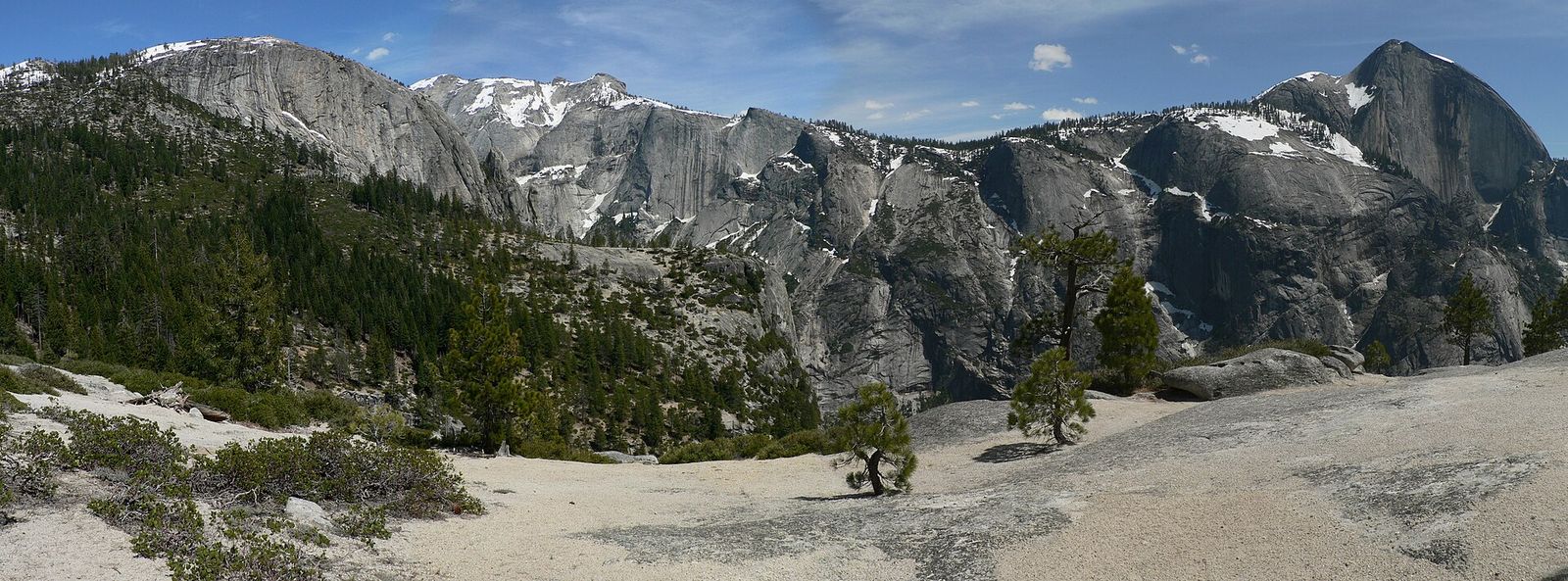
No permit is required for this one as a day hike, which makes it the trail I point people to when they can’t get a Half Dome permit or don’t want to deal with the lottery at all; several experienced Yosemite hikers consider the views from the top comparable to or better than Half Dome’s.
Best advanced hiking trails in the Sierra Nevada
Mount Whitney: hiking the highest peak in the continental United States
At 22 miles round-trip with about 6,100 ft of elevation gain to a 14,505 ft summit, Whitney is the tallest peak in the Lower 48 and a genuine test even for fit, experienced hikers; altitude sickness is a real risk, not a footnote, at this elevation. A permit is required for both day hikers and backpackers in the Whitney Zone from May 1 through November 1; the lottery runs February 1 through March 1 on Recreation.gov, with results posted around mid-March.
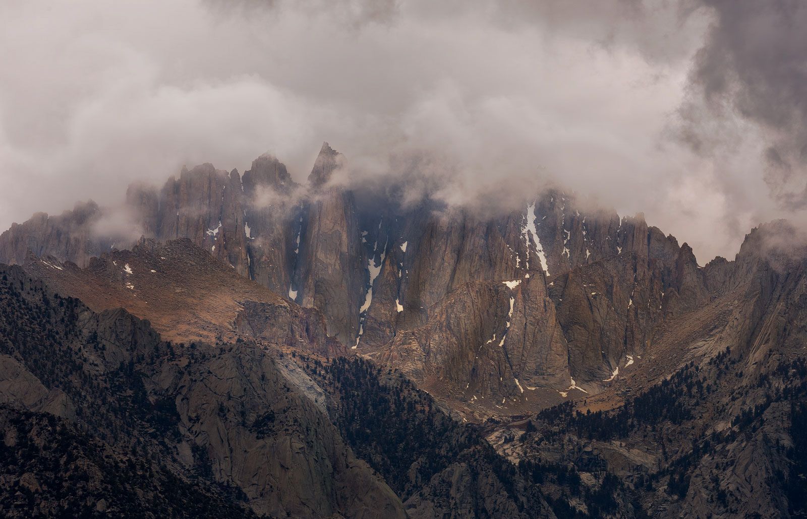
Outside that quota season, permits are available without a lottery. Attempting it as a single-day push demands real fitness and an early start; most parties who struggle underestimate the altitude, not the distance.
The High Sierra Trail: California’s most scenic long-distance advanced hike
Running 72 miles from Crescent Meadow in Sequoia National Park to the summit of Mount Whitney itself, the High Sierra Trail takes most backpackers 5 to 8 days and totals around 11,760 ft of cumulative elevation gain. It’s widely considered one of the most scenic long-distance routes in North America, crossing from giant sequoia groves through increasingly alpine terrain before joining the Whitney corridor for its final push.
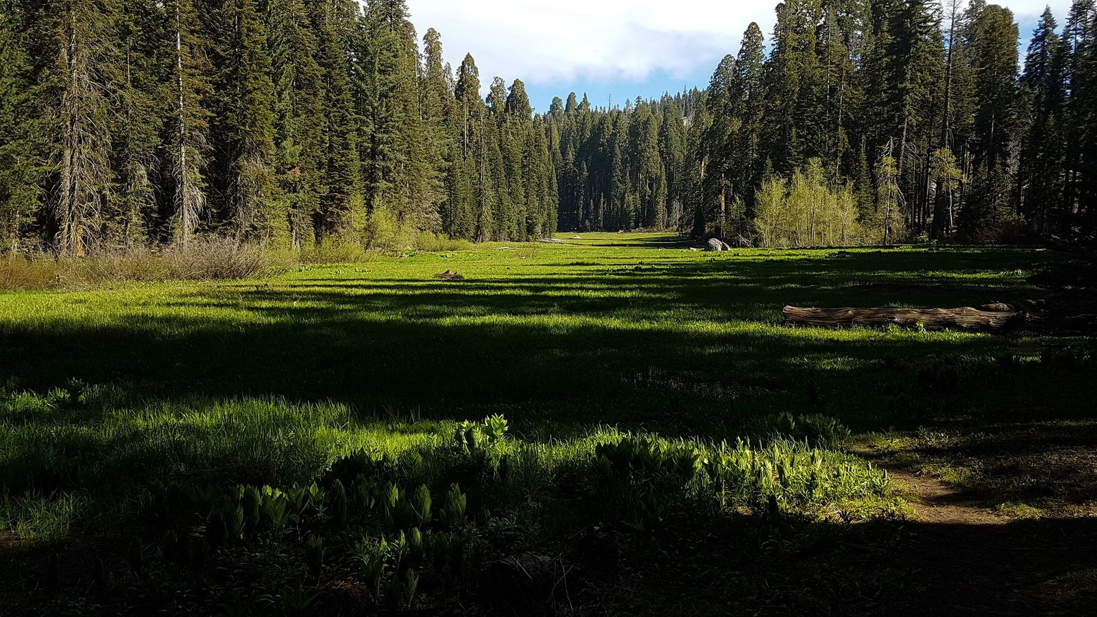
A wilderness permit is required, and given the route ends at Whitney’s summit, quota logistics on both ends need real advance planning. Read our Sequoia & Kings Canyon guide to coordinate trailheads.
Best advanced coastal and mountain hikes in California
Not every advanced California hike is in the Sierra. Cone Peak in Big Sur delivers one of the steepest coastal elevation gains in the state, climbing from near sea level to over a mile high in a short horizontal distance. Check out our Big Sur hiking trails guide for other steep coastal trails.
A full Mount Tamalpais summit circuit in Marin makes for a legitimate full advanced day even without Sierra-scale elevation. Cucamonga Peak, in the San Bernardino Mountains, rounds out a solid Southern California advanced trio alongside the two below.
San Gorgonio Mountain: Southern California’s hardest and highest summit
At 16 miles round-trip with about 5,400 ft of gain, San Gorgonio climbs to 11,503 ft, the highest point in Southern California, with the final approach spent well above timberline over 10,000 ft.
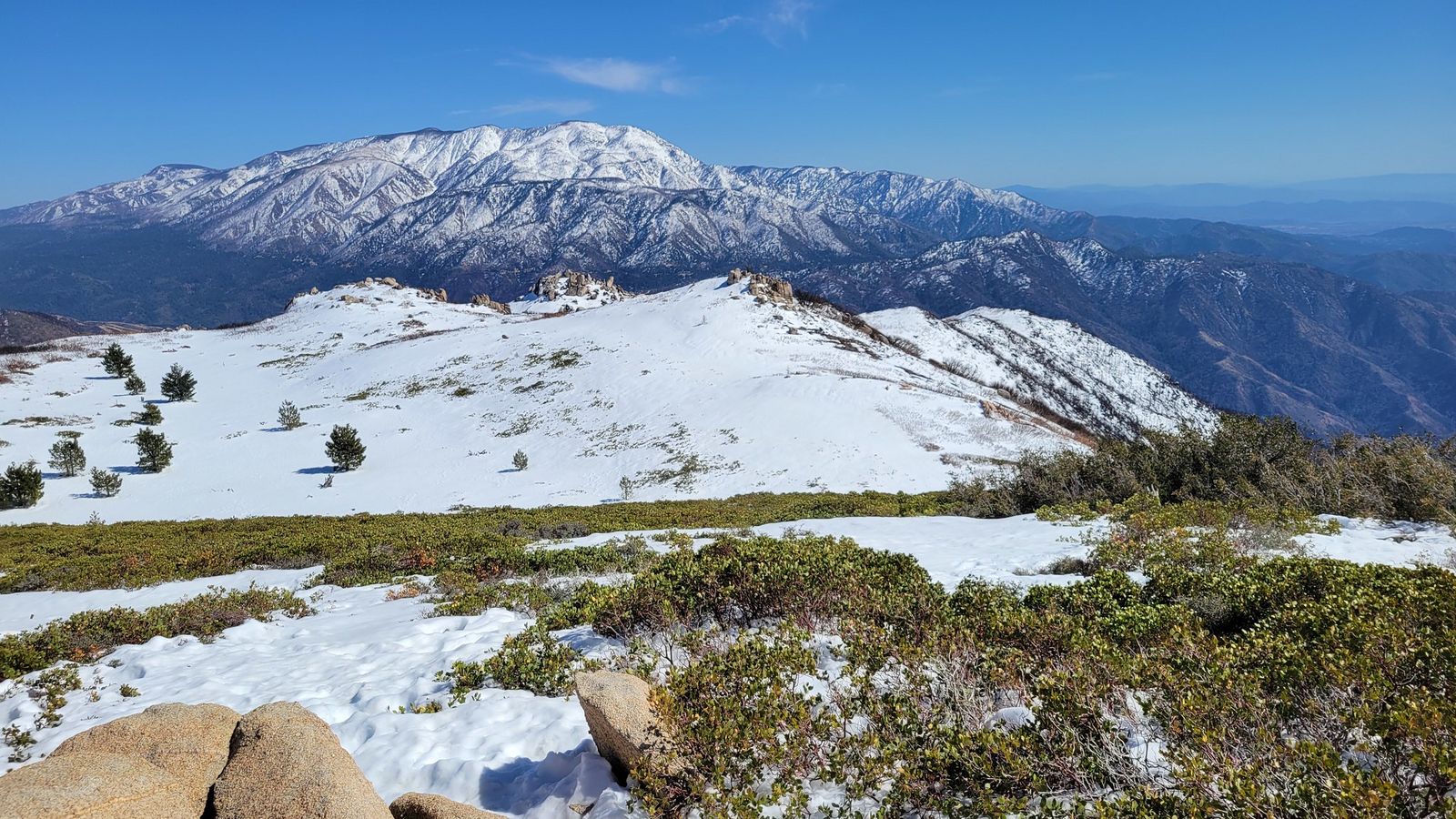
A wilderness permit is required, and the best window is roughly July through October, once snow clears from the upper mountain; conditions above treeline change fast even in summer, so check current weather before committing to a summit push.
Telescope Peak: Death Valley’s most demanding advanced summit
At 14 miles round-trip with about 3,000 ft of gain to an 11,049 ft summit, Telescope Peak offers a view found almost nowhere else: both the highest point in the contiguous U.S. (Mount Whitney) and the lowest (Badwater Basin) are visible from the top on a clear day. The Mahogany Flat trailhead typically requires a high-clearance or 4WD vehicle to reach, and the best season is October through November, after summer heat breaks but before serious winter snow moves in. See our Death Valley trails guide for access details.
Advanced backcountry hiking in California: multi-day wilderness routes
For hikers ready to commit multiple days, California’s advanced backcountry options scale from serious to genuinely epic: the Lost Coast Trail (25 miles, Humboldt County) and Skyline-to-Sea (30 miles, Santa Cruz Mountains) are shorter, weekend-scale commitments, while the Rae Lakes Loop (41 miles) and Evolution Loop (54 miles), both in Kings Canyon, push into full week-plus territory. For a broader overview of the state parks hosting routes like Skyline-to-Sea, see our state parks hiking guide. The John Muir Trail (211 miles) sits at the top of this tier for most California hikers, a genuine multi-week undertaking rather than a long weekend.
How to train for California’s most challenging hikes
Build from roughly 10-mile training hikes to 14+ mile days over about 8 weeks, adding real elevation gain and eventually your actual pack weight. Loaded hiking (rucking), specifically, not just distance, is what prepares your body for a Whitney or High Sierra Trail push. Stair training builds the same muscles you’ll use on sustained climbs without needing mountain access every weekend.
If your target hike sits above 10,000 ft, some altitude pre-exposure in the weeks before even day trips to elevation meaningfully reduces your risk of acute mountain sickness derailing a summit attempt. For desert advanced hikes like Telescope Peak, heat acclimatization in the weeks before matters just as much as the elevation training does. If you are putting together a kit or shopping for gear gifts for male hikers, You can purchase a rugged hydration reservoir or a GPS watch to keep your pace.
If you’re building toward one of these, our hiking safety guide and high-elevation hiking guide both cover preparation that applies directly here, and being honest about a route’s difficulty rating against your current fitness matters more at this tier than at any other.
| Trail | Distance | Elevation gain | Permit | Best season |
|---|---|---|---|---|
| Half Dome | 14–16 mi RT | ~4,800 ft | Yes (lottery) | Late May–mid-Oct |
| Cloud’s Rest | 14 mi RT | ~2,700 ft | No | Summer–fall |
| Mount Whitney | 22 mi RT | ~6,100 ft | Yes (lottery) | July–September |
| High Sierra Trail | 72 mi | ~11,760 ft | Yes | Summer |
| San Gorgonio | 16 mi RT | ~5,400 ft | Yes | July–October |
| Telescope Peak | 14 mi RT | ~3,000 ft | No | October–November |
Frequently asked questions: advanced hiking in California
What is the hardest hiking trail in California?
Mount Whitney and Half Dome are the most commonly cited answers given their combined distance, elevation, and altitude or exposure risk, though the John Muir Trail arguably tops both for hikers measuring difficulty by total commitment rather than a single day.
How do I get a permit to hike Mount Whitney?
Apply during the lottery window, February 1 through March 1, on Recreation.gov; results post around mid-March, and any unclaimed dates release later in the season on a first-come basis.
How hard is the Half Dome hike in Yosemite really?
Genuinely hard 14 to 16 miles round-trip with about 4,800 ft of gain, capped off by a steep, exposed cable ascent that isn’t technical climbing but does demand real upper-body strength and comfort with exposure.
What is the difference between strenuous and advanced hiking in California?
Strenuous typically describes a hike’s physical demand alone (distance and elevation gain), while advanced usually adds technical terrain, permit requirements, or remote access with limited rescue support on top of that physical difficulty.
How do I train for hiking Half Dome or Mount Whitney?
Build from 10-mile to 14+ mile training hikes over about 8 weeks, add loaded pack training and stair or hill work, and get some altitude exposure beforehand if your training location is near sea level.
Are there advanced hikes near Los Angeles for experienced hikers?
Yes, San Gorgonio Mountain and Cucamonga Peak both offer genuinely advanced elevation and distance within a reasonable drive of LA, without requiring a Sierra Nevada road trip.