Best Hiking Trails in California for Photographers
These seven Hiking Trails in California for Photographers have less to do with mileage and more to do with light. Some are a five-minute walk from the car; one demands an off-road expedition. What unites them is that each has become a template, the kind of shot that shows up on gallery walls, calendars, and a thousand Instagram grids because the composition simply works. If you are looking to trade rugged Sierra peaks for trails leading up to the Hollywood Sign, Southern California also offers unmatched urban landmark vistas. I’ve noted the timing that actually matters for each, plus what’s changed recently that you’d want to know before you drive out.
Disclosure: Please note that some of the links below are affiliate links and at no additional cost to you, I may earn a commission. Know that I only recommend hiking gear I personally stand behind; when you use my affiliate links, it helps me run this blog and keep all of this content free of charge for readers (like you).
Key Takeaways
- The single most reproduced shot on this list: Tunnel View, El Capitan, Half Dome, and Bridalveil Fall framed in one composition, no hike required.
- Best rock-arch composition: Mobius Arch in the Alabama Hills, which frames Mount Whitney and the Sierra crest through a natural granite window.
- Most demanding access, by far: Racetrack Playa, worth checking current road status before committing to the long drive.
- Oldest living subject you’ll ever photograph: the bristlecone pines at Schulman Grove, some over 4,800 years old.
- Best “frozen in time” subject: Bodie, a 1880s ghost town preserved in deliberate “arrested decay” rather than restoration.
- Good news for a Big Sur trip: Highway 1 fully reopened through Big Sur in March 2026 after years of partial closure, so Pfeiffer Beach is fully reachable from either direction again.
1. Tunnel View Overlook Trail (Yosemite National Park)
Why it made this list: the single most reproduced landscape photograph in California
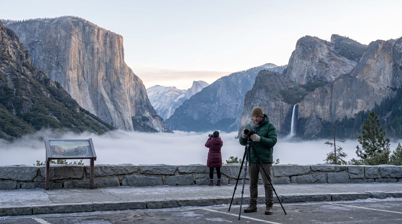
Tunnel View is the shot most people picture when they picture Yosemite before they’ve ever been: El Capitan on the left, Half Dome centered in the distance, Bridalveil Fall dropping on the right, all in one frame from a single roadside overlook on Wawona Road. It requires essentially no hiking at all, which is part of why it’s become the most-repeated composition to come out of the park.
Practical tips: access and best timing
Golden hour here is spectacular, and winter mornings occasionally bring a low fog that pools in the valley below while the peaks stay lit, a completely different, quieter version of the classic shot. The overlook has a proper parking area and is accessible year-round via Wawona Road, though tire chains can be required during winter storms.
2. Mobius Arch Trail, Alabama Hills (Inyo County)
Why it made this list: a natural rock arch perfectly framing Mount Whitney
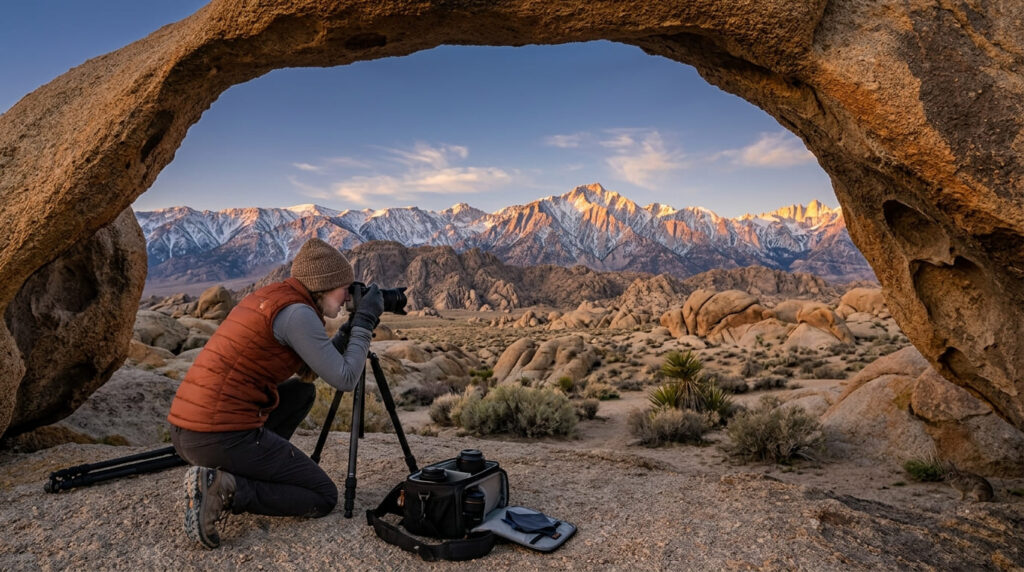
Mobius Arch is the Eastern Sierra’s answer to Tunnel View, a naturally formed granite arch that frames Mount Whitney and the Sierra crest through its opening, on a short loop trail through the same rounded rock formations that have stood in for countless Western film backdrops. Our Inyo County Mount Whitney trail guide covers the peak itself if this composition inspires an actual summit attempt; see also our best mountain-view hiking trails in California guide.
Practical tips: access and best timing
Sunrise is the classic timing here, when first light catches the Sierra crest through the arch’s opening. Access is free with no permit needed for hiking or photography, though the BLM does require a separate permit for any drone flight in the Alabama Hills.
Seasonal campfire restrictions were in effect as of this writing; check current fire restrictions before any camping trip built around this shot.
3. Racetrack Playa Trail (Death Valley National Park, Inyo County)
Why it made this list: the mysterious “sailing stones” phenomenon
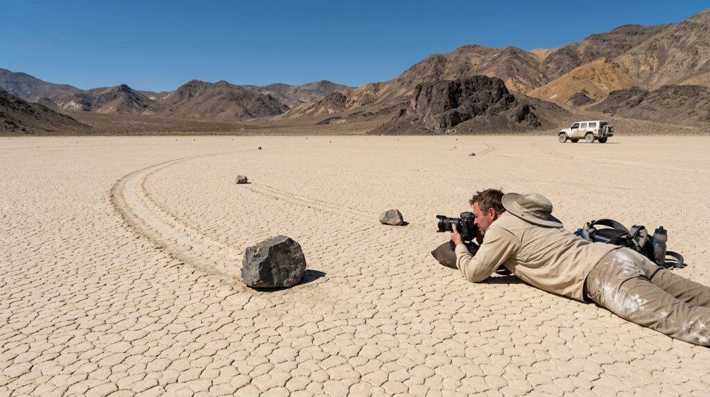
Racetrack Playa is home to one of the strangest photographic subjects in the state: rocks that leave long trails across a dry lakebed, evidence of movement no one has directly observed. It’s a unique composition, precisely because nowhere else in California offers it.
Practical tips: access and best timing
I want to be upfront about access here rather than make this sound simpler than it is. The road in from Ubehebe Crater runs nearly 30 miles of rough, high-clearance, 4WD-recommended gravel, and Death Valley’s backcountry roads, including this one, have a recent history of flash-flood damage and extended closures, most recently from storms in late 2025.
Call the visitor center or check the official Death Valley current-conditions page before committing to this drive; it’s too remote and too long an approach to gamble on. If dark skies are also on your list, this same park anchors our best stargazing and night hike trails in California guide.
4. Ancient Bristlecone Pine Forest, Schulman Grove (Inyo County, White Mountains)
Why it made this list: the oldest living trees on Earth
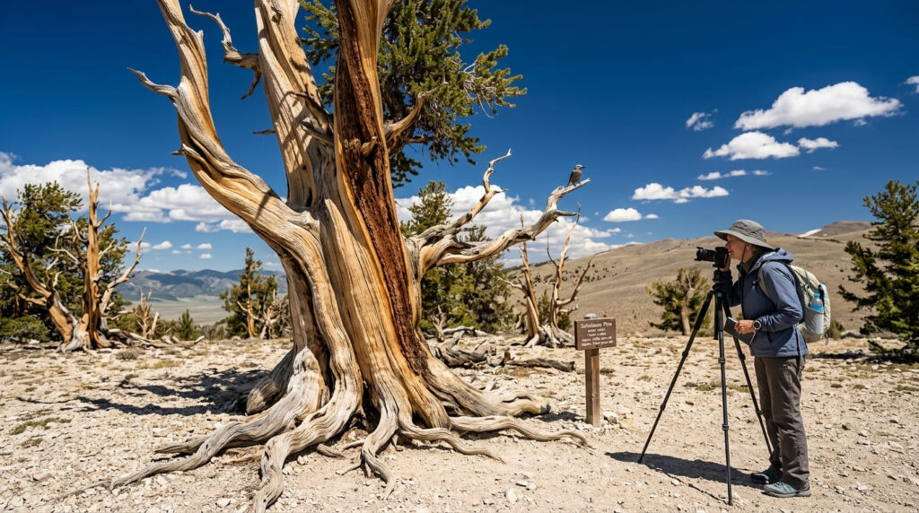
Schulman Grove is home to bristlecone pines exceeding 4,800 years old, their wood twisted and weathered into shapes that look sculpted rather than grown, unlike any other photographic subject on this list, living or otherwise.
Practical tips: access and best timing
This grove sits above 10,000 feet, so budget time to acclimatize even on the easy, well-marked trails here; altitude affects people at this elevation regardless of fitness level. The U.S. Forest Service’s Ancient Bristlecone Pine Forest site confirms the visitor center and access road are open seasonally, roughly mid-May through fall, and closed by snow in winter; a small day-use fee applies.
One important research note: if you’re searching online for “White Mountains hiking trails” to plan this trip, most results will point you to New Hampshire’s White Mountains, not this one. Search “Inyo National Forest White Mountains” or “Schulman Grove” specifically instead.
5. Bodie Ghost Town Trail, Bodie State Historic Park (Mono County)
Why it made this list: a preserved 1880s Gold Rush ghost town frozen in arrested decay
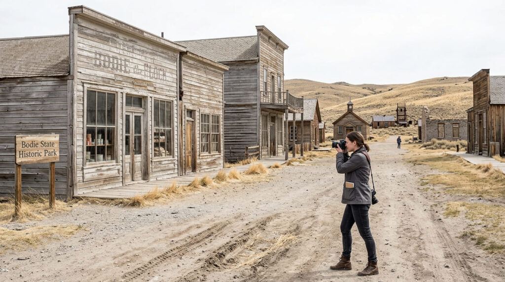
Bodie is the real thing, a gold-mining boomtown left exactly as it was abandoned, maintained in a state California State Parks calls “arrested decay” rather than restored to look new. Storefronts, a schoolhouse, and a saloon still sit stocked with goods behind dusty glass, offering a photographic subject with a level of authenticity you can’t recreate on a set.
Practical tips: access and best timing
As of this writing, Bodie is open on its standard summer schedule, 9 a.m. to 6 p.m. through Labor Day. The last three miles of Bodie Road are unpaved and can be rough, and the park’s elevation of 8,375 feet means winter access is limited to skis, snowshoes, or a snowmobile once the road closes with snow; plan a late-spring-through-fall trip if you want a normal vehicle approach.
6. South Tufa Trail, Mono Lake (Mono County)
Why it made this list: otherworldly limestone formations at sunrise and sunset
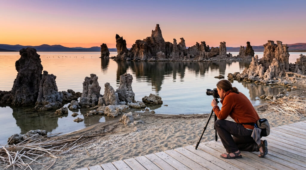
Mono Lake’s tufa towers are limestone spires formed underwater and exposed as the lake’s level dropped, and the South Tufa Trail puts you walking directly among them on an easy boardwalk-and-sand loop. Our Mono County Mono Lake trail guide covers more of this same shoreline in greater depth.
Practical tips: access and best timing
Both sunrise and sunset genuinely give you two different photographs here, warm sidelight raking across the tufa in the morning, and the towers silhouetted against color in the evening. A small day-use fee applies at the reserve, and the loop itself is short enough to shoot both sessions in a single overnight stay nearby.
7. Pfeiffer Beach Keyhole Rock Trail (Monterey County, Big Sur)
Why it made this list: purple sand and a natural rock arch that frames the setting sun
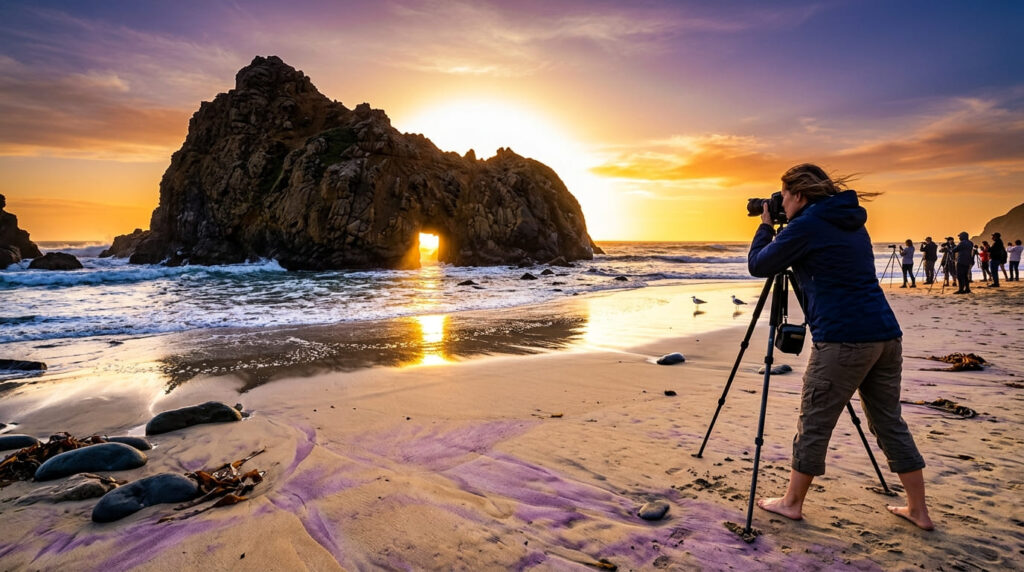
Pfeiffer Beach pairs two distinct photographic draws in one stop: a natural rock arch, Keyhole Rock, that aligns with the setting sun on clear evenings around the winter solstice, and sand with a genuine purple tint from manganese garnet deposits, most vivid where fresh water crosses it. Our Monterey County Big Sur trail guide covers more of this coastline nearby.
Practical tips: access and best timing
Good news if you’ve been putting off a Big Sur trip: Highway 1 fully reopened through the corridor in March 2026 after being closed at Regent’s Slide since early 2023, so Pfeiffer Beach is reachable from both the north and south again.
The turnoff onto Sycamore Canyon Road is easy to miss; watch for a small “Narrow Road” sign, and the lot is small and fills fast on clear evenings near the solstice, so arrive with real time to spare. There’s no swimming here regardless of how calm it looks; the rip currents are dangerous.
Quick comparison: all 7 photography trails at a glance
| Trail | Effort | Best Light | Current Access Note |
|---|---|---|---|
| Tunnel View | None, roadside | Golden hour, winter fog | Open year-round; chains may be required in storms |
| Mobius Arch | Short loop, under 1 mi | Sunrise | Open; drone permit required |
| Racetrack Playa | Long drive + short walk | Any time, once there | Verify road status before the drive |
| Schulman Grove | Easy trails, high altitude | Midday works; any time | Open seasonally, mid-May,fall |
| Bodie | Walking tour | Overcast/midday fine | Open on summer hours through Labor Day |
| South Tufa | Easy boardwalk loop | Sunrise and sunset | Open |
| Pfeiffer Beach | Short beach walk | Sunset near solstice | Highway 1 fully reopened as of March 2026 |
Before you go, a few honest notes
Two of these seven, Tunnel View and Bodie, need essentially no planning beyond checking hours. The other five reward timing decisions: Mobius Arch and South Tufa for specific light, Pfeiffer Beach for a specific season, and Racetrack Playa and Schulman Grove for access logistics that are worth confirming a day or two out rather than assuming.
Frequently Asked Questions About Best Hiking Trails in California for Photographers
What is the best time of day for landscape photography?
Golden hour, the hour after sunrise and before sunset, gives the warmest, most directional light, which is why it’s called out specifically for Tunnel View, Mobius Arch, and Pfeiffer Beach on this list. Midday works fine for subjects like Bodie’s buildings or Schulman Grove’s trees, where texture matters more than dramatic sidelight.
Do you need a permit to photograph in national parks?
Not for personal or hobbyist photography at any of the national park sites on this list, including Tunnel View and Racetrack Playa. Commercial shoots, drone flights, and any filming involving models, props, or crews typically do require a separate permit; check with the specific park or BLM field office first.
What is the most photographed trail in California?
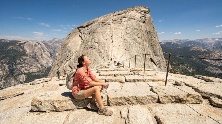
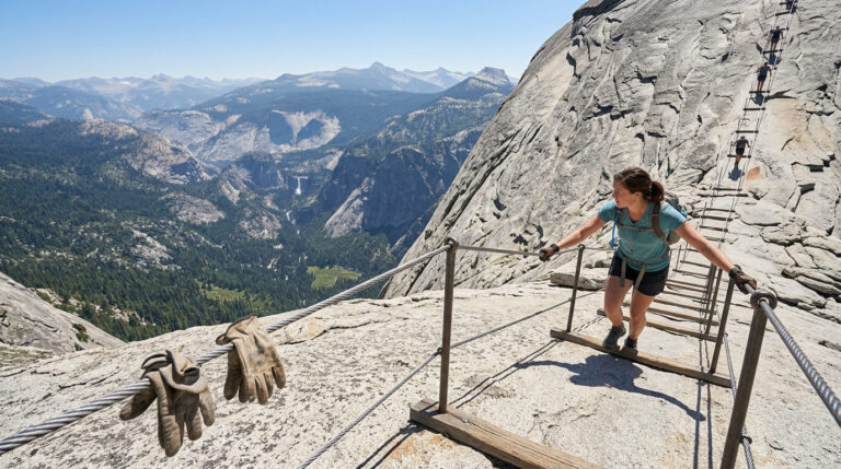
Tunnel View is a strong contender for the single most photographed viewpoint in the state, given its role as the classic first-glimpse of Yosemite Valley. Half Dome’s summit cables would be the top contender for most-photographed actual hike.
Is a tripod allowed on California hiking trails?
Yes, generally, for personal use at every location on this list. Tripods can trigger commercial-use questions at some sites if paired with lighting equipment or an obvious commercial setup, so a simple tripod for personal photography is not an issue anywhere here.
What gear should photographers bring on a hike?
Beyond the obvious camera and lenses, bring a headlamp for any sunrise or sunset shoot, extra batteries (cold mornings drain them fast at places like Schulman Grove or Mobius Arch), and a lens cloth; dust at desert locations like Racetrack Playa gets on everything.
Are these photography trails crowded with other photographers?
It varies a lot by location and time. Tunnel View and Pfeiffer Beach near the winter solstice can be crowded with other photographers at peak light; Racetrack Playa and Schulman Grove, given their remoteness, are far more likely to have you working alone.