10 California Hiking Trails Every Serious Hiker Should Do Before They Die
If I had to send you home with one list, this would be it. These are the 10 California hiking trails to do before you die, not the 10 easiest, not the 10 closest to a parking lot, but the 10 that actually earn a spot on a lifetime list alongside our favorite top hiking books and guidebooks to read before you go: a granite cable route, the tallest peak in the Lower 48, a coastline too rugged for a highway, and a waterfall that makes its own rainbow. Some take a morning. A couple take a week. All ten are worth building a trip around.
Disclosure: Please note that some of the links below are affiliate links and at no additional cost to you, I may earn a commission. Know that I only recommend hiking gear I personally stand behind; when you use my affiliate links, it helps me run this blog and keep all of this content free of charge for readers (like you).
Key Takeaways
- Hardest single push: Cactus to Clouds, 10,300+ ft of gain in 21 miles, more vertical than almost any day hike in the country.
- Best “first big permit hike”: the Mist Trail to Vernal and Nevada Falls, no lottery required, and it’s the warm-up act for Half Dome.
- Most competitive permit: Half Dome’s cables, capped at 300 hikers a day and awarded mostly through a March lottery.
- Best multi-day payoff: the Rae Lakes Loop, a roughly 40-mile Sierra circuit most backpackers stretch over 4 to 5 days.
- Most singular geography: the Lost Coast Trail, the one stretch of California shoreline too rugged for Highway 1 to ever reach.
- Best “loop the lake” objective: the Tahoe Rim Trail, hikeable as a multi-week thru-hike or in single-day bites from either shore.
1. Half Dome via the Cables (Yosemite National Park)
Why it made this list: the single most recognizable day hike in America
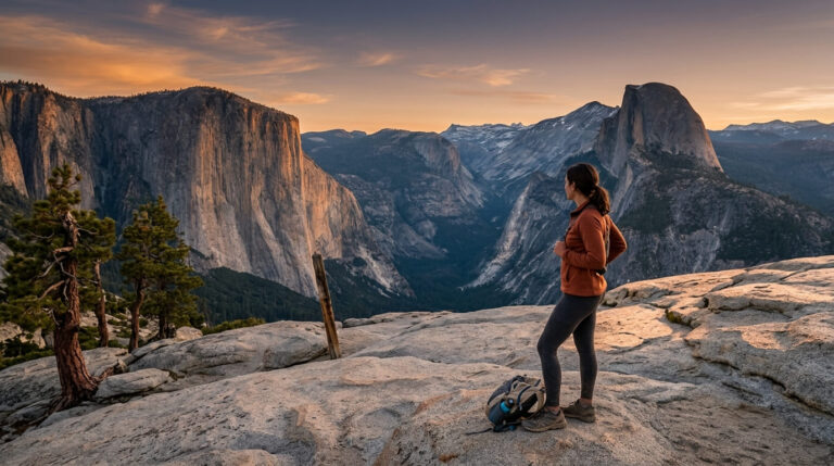
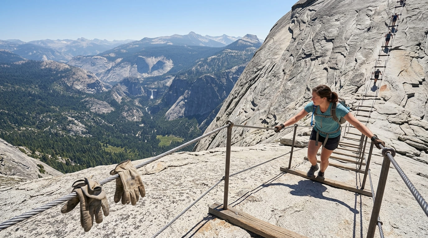
Half Dome is the trail everyone’s cousin has a photo from, and it earns that reputation. The National Park Service lists the round trip at just over 17 miles with 4,800 ft of elevation gain, finishing on a pair of steel cables bolted into the last 400 vertical feet of bare granite.
I’d never call it technical; you’re pulling yourself up with your arms, not climbing, but it’s exposed, it’s crowded, and it’s a 10- to 14-hour day for most people who attempt it.
Practical tips: access and best timing
The cables only go up when a separate permit system says so; this trips up more people than the mileage does. As of August 2026, the cables are up for the season (typically installed in late May, pulled around mid-October).
Yosemite caps cable access at 300 hikers a day, about 225 day-hike permits, awarded mostly through a March 1–31 preseason lottery on Recreation.gov with results in mid-April, plus a two-days-out daily lottery for the rest.
My honest take: apply for every date you’d accept, not just your dream Saturday; weekday odds run noticeably better. Our guide to training for a hike like Half Dome or Mount Whitney is worth reading first, and our permits guide covers the lottery mechanics for every trail here that needs one.
2. Mist Trail to Vernal and Nevada Falls (Yosemite National Park)
Why it made this list: two waterfalls and a granite staircase through the spray
This is the trail I point first-timers to before I ever mention Half Dome. The stone steps beside Vernal Fall climb about 1,000 ft over roughly 3 miles round trip and put you close enough to the water to get soaked in spring runoff.
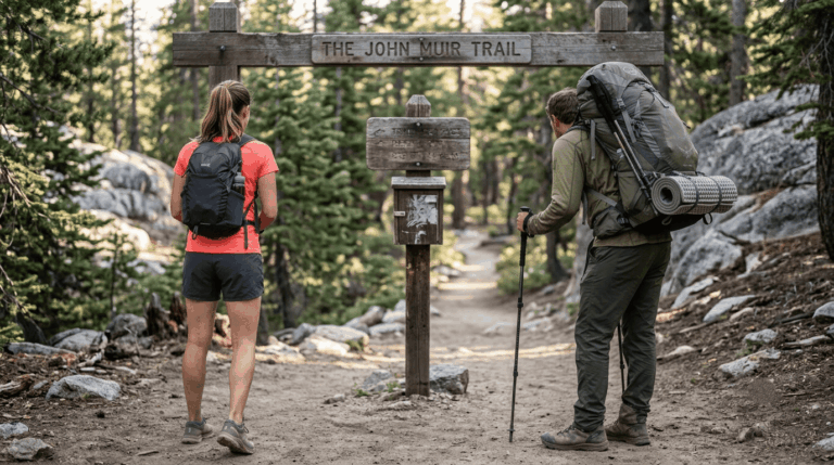
Push on past the footbridge and up the John Muir Trail junction to Nevada Fall, and you’re looking at closer to 5.4–6.4 miles round trip with around 1,900 ft of gain, a real hike, not a stroll, but one that needs no permit at all.
Practical tips: access and best timing
Footwear matters more here than almost anywhere else on this list. The granite steps get slick when the falls are running high, typically April through June, so I’d skip anything with a smooth sole. A poncho isn’t a bad idea either, the trail earns its name.
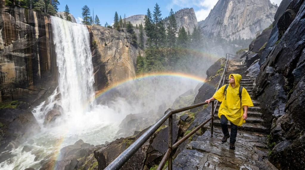
Climbing the wet granite steps beside Vernal Fall along Yosemite's Mist Trail.3. Mount Whitney Trail (Inyo County)
Why it made this list: the highest point in the contiguous United States
At 14,505 ft, Whitney is the tallest peak in the Lower 48, and the trail up from Whitney Portal reflects it: 22 miles round trip with roughly 6,100 ft of elevation gain, most of it above tree line. My rule for this one: don’t treat the altitude as an afterthought. People who train hard for the mileage and ignore acclimatization are the ones who turn around at 13,000 ft.
Practical tips: access and best timing
The Whitney lottery runs Feb. 1 through March 1 on Recreation.gov, with results posted March 15 and a hard claim-and-pay deadline of April 21; miss that window and your permit reverts to the unclaimed pool released April 22.
Quota season runs May 1 through Nov. 1, capped at 100 day-use and 60 overnight permits daily out of the roughly 65,000 applications the lottery draws each year. Our Inyo County Mount Whitney trail guide covers nearby shorter options if the lottery doesn’t go your way.
4. Rae Lakes Loop (Kings Canyon National Park, Fresno County)
Why it made this list: one of the finest multi-day backpacking loops in the Sierra
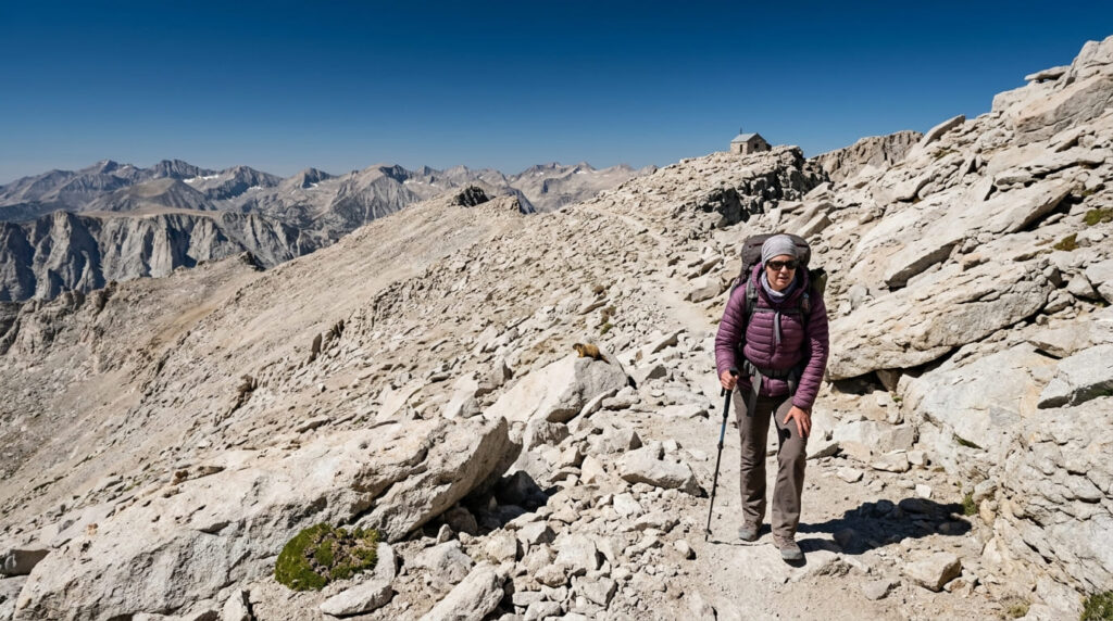
This is the one trail on this list I’d call a trip rather than a hike, a roughly 40-mile loop through Kings Canyon that most backpackers spread over 4 to 5 days, cresting Glen Pass above 11,900 ft along the way. I go into more depth on the surrounding high country in our Fresno County high-elevation trails guide.
Practical tips: access and best timing
Like Half Dome and Whitney, this one runs on a reservation system, not a lottery; permits release on a rolling basis exactly six months ahead at 7 a.m. Pacific on Recreation.gov, and popular entry dates during the May-to-late-September quota season go within minutes. Remaining walk-up permits are released online via Recreation.gov 2 weeks in advance on a rolling basis, as in-person walk-up permits at ranger stations are no longer offered.
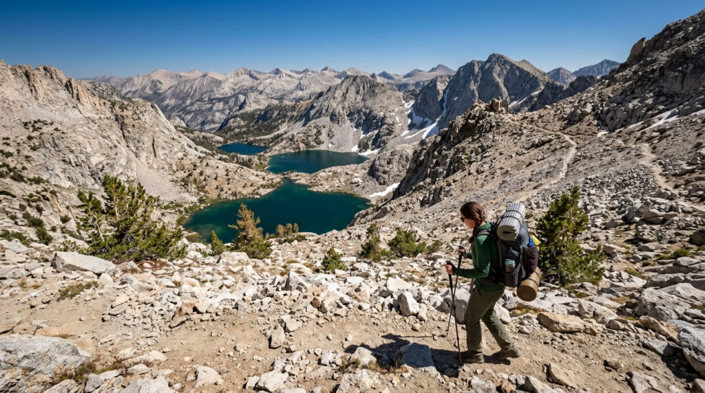
Descending Glen Pass toward the alpine basin of the Rae Lakes Loop in Kings Canyon.5. Thousand Island Lake (Ansel Adams Wilderness, Mono County)
Why it made this list: one of the most photographed alpine lakes in California
Banner Peak reflected in Thousand Island Lake is one of those Sierra images you’ve probably seen before you ever set foot in California, and I’d argue the real thing beats the photo. The day hike in from Agnew Meadows runs roughly 16 to 18 miles round trip on the River Trail, making for a strenuous, full-day effort.
Practical tips: access and best timing
Sunrise is the whole game here. The water is calmest before the wind picks up, which is also when you’ll have the shoreline mostly to yourself; arrive mid-afternoon on a summer weekend and you’ll be sharing the view with a crowd.
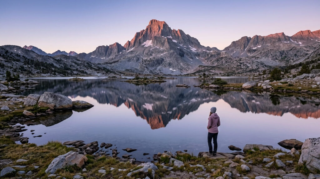
6. Lost Coast Trail (King Range National Conservation Area, Humboldt/Mendocino Counties)
Why it made this list: California’s only major roadless stretch of coastline
Highway 1 detours inland here because the King Range simply refused to let a road through, which is exactly what makes the Lost Coast Trail’s 25-mile northern section, from Mattole Beach to Black Sands Beach, feel unlike anywhere else on this list. It’s a multi-day backpack, not a day hike, and I mean that as a selling point.
Our Humboldt County coastal trails guide has shorter tastes of this same coastline if a multi-day trip isn’t in the cards.
Practical tips: access and best timing
A tide table isn’t optional gear here; it’s the single most important thing you’ll pack. Several stretches of beach are fully impassable at high tide, and the BLM publishes a list of specific impassable dates each year; check it before you lock in your permit.
The King Range Wilderness Permit is required year-round and, as of this writing, releases on a rolling basis via Recreation.gov well ahead of peak season, so I wouldn’t wait until the month before to book a summer date.
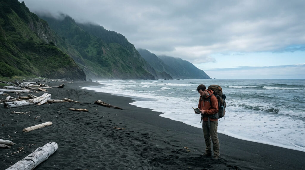
7. Skyline-to-the-Sea Trail (Big Basin Redwoods to Waddell Beach, Santa Cruz County)
Why it made this list: a complete mountains-to-ocean trek in one trail
On paper, this trail takes you from Castle Rock’s ridgelines through old-growth redwoods all the way to the Pacific, a rare mountains-to-ocean transect.
As of August 2026, that’s not the whole story, and I’d rather say so up front than let you show up expecting a through-hike. Our Santa Cruz County Big Basin Redwoods guide covers what’s currently accessible inside the park.
Practical tips: access and best timing
The 2020 CZU Lightning Complex Fire tore through 97% of Big Basin, and full recovery of the backcountry sections is a multi-year project.
As of now, the open segment runs from Castle Rock State Park to the Big Basin main day-use area, the continuation on to Waddell Beach remains closed while State Parks rebuilds bridges and trail structures.
It’s still one of the best short redwood-to-chaparral hikes in the Santa Cruz Mountains; just don’t plan a beach-to-mountains itinerary around it yet. Check current status before you go.
8. Cactus to Clouds Trail (Palm Springs, Riverside County)
Why it made this list: widely cited as one of the hardest day hikes in the country
Nothing else on this list comes close to Cactus to Clouds for sheer vertical punishment: roughly 21 miles round trip with about 10,300 ft of elevation gain, climbing from the desert floor near Palm Springs straight to the summit of San Jacinto Peak.
My honest take: this is the one trail here I wouldn’t recommend as anyone’s first big hike. Our Riverside County Palm Springs trail guide has friendlier options nearby if you want to scout the area first.
Practical tips: access and best timing
Start before dawn, no exceptions; most hikers begin between 2 and 4 a.m. to clear the shadeless lower miles before the desert heat arrives.
This isn’t dramatics: the trail sees roughly one fatality a year, almost always dehydration or heat exhaustion, and California State Parks has repeatedly closed it outright during extreme heat waves in recent summers. Confirm it’s open before you drive out, and treat any triple-digit forecast as a hard no.
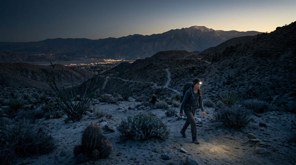
A pre-dawn start on Cactus to Clouds, climbing high above the Palm Springs lights.9. Rainbow Falls Trail (Devils Postpile, Near Mammoth Lakes)
Why it made this list: the single highest-search-demand trail name in this entire project
A 101-ft cascade on the San Joaquin River that throws a midday rainbow in its mist; it’s a short walk, roughly 2 miles round trip from the Reds Meadow shuttle stop, and it’s one of the most reliably crowd-pleasing stops in the Eastern Sierra.
Practical tips: access and best timing
As of summer 2026, Reds Meadow Road is mid-reconstruction, which means access runs Thursday through Sunday only, with the road and mandatory Eastern Sierra Transit shuttle closed Monday through Wednesday; the season is expected to run into early November.
That’s a real change from a normal year, so check current status before you drive up, this is one detail I’d hate for you to learn at a closed gate.
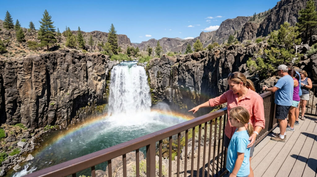
A midday rainbow appearing in the mist of 101-foot Rainbow Falls near Mammoth Lakes.10. Tahoe Rim Trail (Lake Tahoe Basin)
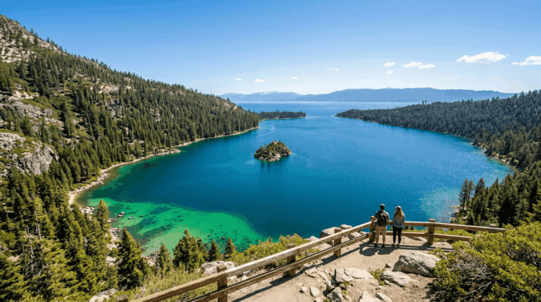
Why it made this list: a long loop circling one of the most beautiful lakes in America
The Tahoe Rim Trail Association, which maintains the route, measures its own trail at 165 miles (you’ll see some older guides cite 170, 175 miles, since rerouting shifts the total slightly year to year). Hike it end to end as a multi-week thru-hike, or treat it the way most locals do, as a menu of dozens of single-day segments launched from either the California or Nevada shore.
Practical tips: access and best timing
The real planning question here isn’t a permit for the whole trail, it’s which trailhead to pick for a given day. One exception: new for 2026, thru-hikers and section-hikers camping inside Desolation Wilderness now need a reserved permit under a 10-person daily quota that runs from the Friday before Memorial Day through Sept. 30, a change from the largely open-access system of past years.
Quick comparison: all 10 trails at a glance
| Trail | Round-Trip Distance | Elevation Gain | Permit Required? | Best Season |
|---|---|---|---|---|
| Half Dome (cables) | ~17 mi | ~4,800 ft | Yes, lottery | Late May, mid-Oct |
| Mist Trail (to Nevada Fall) | ~5.4, 6.4 mi | ~1,900 ft | No | Apr, Jun (peak flow) |
| Mount Whitney Trail | 22 mi | ~6,100 ft | Yes, lottery | May, Oct |
| Rae Lakes Loop | ~40 mi (loop) | High, multi-day | Yes, reservation | Late May, late Sep |
| Thousand Island Lake | ~16–18 mi | Moderate | No (day hike) | Jul, Sep |
| Lost Coast Trail (north) | 25 mi (one-way) | Coastal, tide-gated | Yes, reservation | Apr, May, Sep, Oct |
| Skyline-to-the-Sea (open segment) | Varies by segment | Moderate | No | Year-round; check status |
| Cactus to Clouds | ~21 mi | ~10,300 ft | No (seasonal closures apply) | Nov, Mar |
| Rainbow Falls Trail | ~2 mi | Minimal | No (shuttle required) | Jul, Sep |
| Tahoe Rim Trail (full loop) | 165 mi (loop) | ~26,000 ft cumulative | Only in Desolation Wilderness | Jul, Sep |
Before you go, a few honest notes
Nine of these are day hikes; two, Rae Lakes and the Lost Coast, are multi-day trips that deserve their own planning window. I wouldn’t string more than two or three together in one vacation; California’s geography doesn’t cooperate with a tidy road-trip loop between the Sierra, the North Coast, and the desert.
My honest recommendation: start with the Mist Trail and Rainbow Falls, no lottery, low risk, then build toward Half Dome or Whitney once you know your pace on a long day.
Frequently Asked Questions About 10 California Hiking Trails to Do Before You Die
Do you need hiking boots for the Mist Trail?
You don’t strictly need boots, but I’d skip smooth-soled shoes. The granite steps beside Vernal Fall get slick with spray, especially during spring runoff, so grippy tread matters more than ankle support here.
What is the hardest hike on this bucket list?
Cactus to Clouds, by a wide margin, roughly 21 miles with about 10,300 ft of elevation gain, more vertical than almost any other day hike in the country. Half Dome and Mount Whitney are harder to get permits for, but Cactus to Clouds is physically the toughest single push.
Do all of these trails require a permit?
No. Half Dome, Mount Whitney, Rae Lakes, and the Lost Coast Trail all require a permit or reservation. The Mist Trail, Thousand Island Lake (as a day hike), Rainbow Falls, and Cactus to Clouds don’t, though Cactus to Clouds does see seasonal closures during extreme heat.
Can a beginner do any of these bucket-list trails?
Yes, start with Rainbow Falls or the Mist Trail’s lower stretch to the Vernal Fall footbridge. Both are short, well-marked, and require no permit, which makes them the natural entry point before you take on something like Half Dome.
What is the best time of year to attempt this bucket list?
It depends heavily on which trail. High Sierra entries like Half Dome, Whitney, and Rae Lakes are best from July through September once snow clears; desert trails like Cactus to Clouds flip that entirely and are best November through March, cooler months only.
How many of these trails can you do in one trip?
Realistically, two or three per trip if you’re not trying to live in the car. The Sierra entries (Half Dome, the Mist Trail, Whitney, Rae Lakes, Thousand Island Lake, Rainbow Falls, and Tahoe) pair well together on one Eastern Sierra swing; the Lost Coast, Skyline-to-the-Sea, and Cactus to Clouds are each better as their own dedicated trip.