Reinhardt Redwood Regional Park Hiking Guide
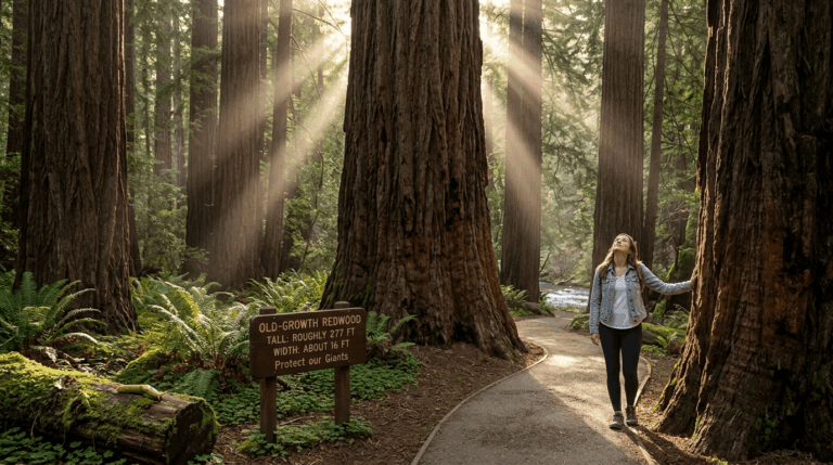
Redwood Road climbs out of Highway 13, crosses Skyline Boulevard, and slides past horse stables, and then the light changes. The road drops into shade and a creek appears beside the pavement. A few miles over the ridge from downtown Oakland, you’ve reached a coast redwood forest.
Disclosure: Please note that some of the links below are affiliate links and at no additional cost to you, I may earn a commission. Know that I only recommend hiking gear I personally stand behind; when you use my affiliate links, it helps me run this blog and keep all of this content free of charge for readers (like you).
That’s the way into Reinhardt Redwood Regional Park, a 1,833-acre East Bay Regional Park District (EBRPD) park in the Oakland Hills with nearly 40 miles of trails. Until 2019 it was simply Redwood Regional Park, and the older name is still in wide use.
The park holds the largest natural stand of coast redwoods in the East Bay, a creek where a native trout strain still swims upstream, and, in fall and winter, thousands of ladybugs. This guide follows your questions in order: how to get in, what’s open, which trail fits your day, and what to do with the dog. It’s one of the anchor parks in our Alameda County hiking trails guide.
Key Takeaways
- Where: Reinhardt Redwood Regional Park, Oakland, CA 94619. The main entrance, Redwood Gate, is at 7867 Redwood Road. Other staging areas include Canyon Meadow, Skyline Gate and Moon Gate.
- Hours and cost: Park curfew is 10 p.m. to 5 a.m. Parking is $5 per vehicle, collected in cash at Redwood Gate on weekends and major holidays from April through October. Skyline Gate parking is free.
- Closures: As of EBRPD’s October 7, 2026 update, sections of the Stream Trail are closed for repairs from Trail’s End through Fern Trail.
- Easiest walk: Stream Trail from Canyon Meadow to Trail’s End, about 1.7 miles round trip.
- Longest classic loop: Canyon Meadow loop on the Stream, Tres Sendas, French, Orchard and Bridle trails, about 6.2 to 6.6 miles.
- Cell service: Little or none inside the park.
- Dogs: Allowed with leash rules, but leashes are required on the Stream and Bridle trails.
What Makes Reinhardt Redwood Regional Park Special?
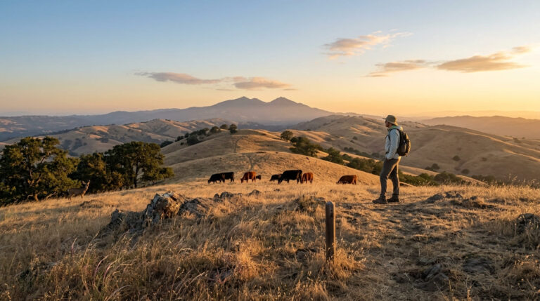
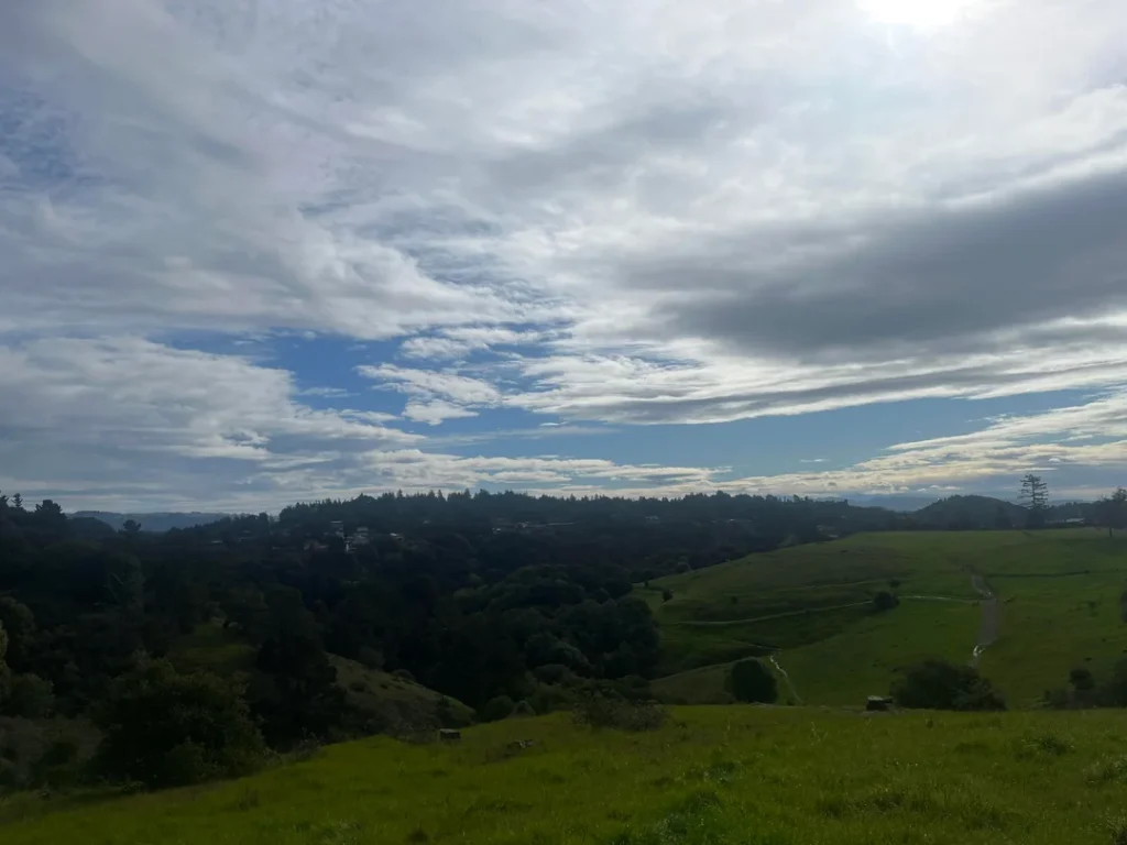
Reinhardt Redwood Regional Park sits in the hills east of Oakland, with part of it across the line in Contra Costa County. Coast redwoods dominate the creek canyon, and the ridges above carry other evergreens, chaparral and grassland.
Deer, squirrels, rabbits and raccoons are common, and with luck you might spot a golden eagle or an Alameda striped racer. Search for Redwood Regional Park Oakland CA, Redwood Regional Park Oakland or Oakland Redwood Regional Park and you’ll land in the same place.
The big trees you see today are third-generation. In the mid-1800s, loggers leveled an enormous old-growth forest here to supply building materials for the Bay Area. EBRPD’s brochure suggests you can picture what was lost from a heritage viewing deck in the neighboring Roberts Regional Recreation Area.
The park dates to 1939, and in 2019 EBRPD renamed it for Dr. Aurelia Henry Reinhardt, president of Mills College and one of the five founding directors elected to the Park District’s first board in 1934. The Save the Redwoods League tells the story of why her name was restored.
Redwood Creek adds the park’s other claim to fame. A unique strain of rainbow trout migrates seasonally up the creek from Upper San Leandro Reservoir, helped by a constructed fish ladder. The fishway interpretive site, a short walk past Redwood Gate, is California Historical Landmark No. 970. Fishing in Redwood Creek is prohibited, both inside the park and along Redwood Road.
What’s Closed at Reinhardt Redwood Regional Park Right Now
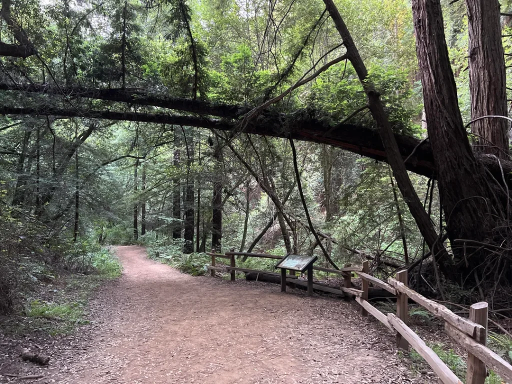
Check this before you pick a trail. EBRPD’s October 7, 2026 update lists a Stream Trail closure for repairs, beginning August 24, from Trail’s End through Fern Trail.
It also planned to shut down a section of Stream Trail at the Old Church picnic site in late September and early October. A small piece of the Golden Spike Trail, reached from the Monteiro Trail, is closed October 5 through 16 for FEMA-funded projects.
In practice, the Stream Trail up to Trail’s End is open, but loops that continue up the canyon on Stream Trail need a detour. EBRPD’s page lists no other closures. Our guide to California hiking trail closures explains how to check before you drive.
Getting to Reinhardt Redwood Regional Park in Oakland, CA: Entrances, Parking and Fees
The park has several entrances, and your choice shapes your hike.
Redwood Gate (main entrance): From Highway 13 in Oakland, take the Redwood Road exit and head east, uphill. After about two miles, you cross Skyline Boulevard, pass Skyline Ranch Equestrian Center and Piedmont Stables, then reach the Big Bear and MacDonald staging areas before Redwood Gate. Canyon Meadow Staging Area, where the Stream Trail begins, sits past the gate.
Skyline Gate: Reached from Skyline Boulevard, this staging area offers free parking, access to the ridge trails, and a wheelchair-accessible staging area. Moon Gate and Redwood Bowl are other Skyline Boulevard options.
Parking at Redwood Gate costs $5 per vehicle, but only on weekends and major holidays from April through October, when the kiosk is staffed. Redwood Gate accepts cash only. The main entrance gate hours run 8 a.m. to 6 p.m. in November through February, to 7 p.m. in March and October, and to 8 p.m. from April through September.
The park curfew is 10 p.m. to 5 a.m. There’s little or no cell service, so download your map beforehand. For alerts, hours and fees, check EBRPD’s Reinhardt Redwood page. EBRPD’s map also shows AC Transit lines 39 and 339 serving stops by the park; call 511 to confirm service.
Best Hiking Trails at Reinhardt Redwood Regional Park
The park has nearly 40 miles of trails. These routes are the most popular, with distances from EBRPD and published trail descriptions. Trail apps may show slightly different numbers.
| Route | Distance | Level | Starts at |
|---|---|---|---|
| Stream Trail to Trail’s End | About 1.7 mi round trip | Easy | Canyon Meadow |
| East & West Ridge Loop | About 3.5 mi | Moderate | Skyline Gate |
| Canyon Meadow loop (Stream, Tres Sendas, French, Orchard, Bridle) | About 6.2–6.6 mi | Moderate to challenging | Canyon Meadow |
Stream Trail to Trail’s End: The Easy Redwood Walk
If you only have an hour, or you’re pushing a stroller, start here. From Canyon Meadow, the Stream Trail runs beside Redwood Creek under redwoods. It’s paved for the first stretch, close to a mile, and the steepest grade stays under 8 percent.
A children’s play structure sits about a quarter mile in, and the Old Church picnic area, with an interpretive panel on the site’s history, sits along the paved stretch. The pavement ends near Trail’s End, the turnaround while the upper trail is closed. Our guide to wheelchair-accessible hiking trails in California lists more paved redwood walks.
Come in fall or winter and watch the trailside: EBRPD says thousands of convergent ladybugs are often seen along the Stream Trail then. Leashed dogs only here, since the Stream Trail is on EBRPD’s leash list.
East and West Ridge Loop from Skyline Gate
For a moderate half day, park free at Skyline Gate and walk about 3.5 miles. One published route heads out on the East Ridge Trail, picks up the Phillips Loop and Eucalyptus Trail, drops to the Stream Trail around 1.1 miles, and climbs back past the Starflower and French trails to Tres Sendas and the West Ridge Trail.
The trade is classic East Bay Hills: chaparral on the ridge, then redwood canyon, then steep climbs on the French Trail. Water is available at Skyline Gate. Because part of this loop touches the Stream Trail, confirm the closure map first.
French and Tres Sendas: Into the Big Trees
These two trails reward effort. The French Trail climbs steeply through dense forest, and Tres Sendas, whose name is Spanish for “three paths,” runs through redwoods along Redwood Creek.
Together with the Orchard and Bridle trails, they make up the classic Canyon Meadow loop that EBRPD features in its Trails Challenge: Stream Trail 1.97 miles to Tres Sendas, then French, Orchard and Bridle, and back to Canyon Meadow by way of Fern Dell Meadow and the Stream Trail.
EBRPD describes most of it as narrow-gauge trail for hikers and equestrians only, with several hundred feet of elevation change, and lists it at about 6.2 to 6.6 miles with roughly 970 feet of gain. That loop uses the closed stretch of Stream Trail, so wait until EBRPD reopens it.
Beyond the Park: Roberts, Huckleberry and Sibley
The park connects to a larger trail network. Roberts Regional Recreation Area, next door on Skyline Boulevard, has a lifeguarded pool, an archery range and picnic sites, plus the heritage viewing deck.
Skyline Boulevard continues to Huckleberry Botanic Regional Preserve and Sibley Volcanic Regional Preserve, and the East Bay Skyline National Trail and Bay Area Ridge Trail both pass through Reinhardt Redwood.
Dogs, Bikes, Horses and Other Park Rules
Dogs must be leashed in parking lots, within 200 feet of any trail or park entrance, in picnic areas and developed areas, and where grazing animals are present.
EBRPD’s map also requires leashes on the Stream and Bridle trails, and people and dogs must stay out of the creek and off its banks. Elsewhere, dogs must be under voice control at all times. Our guide to hiking with dogs in California covers leash rules in other parks.
Bicycles are permitted on designated trails only, and riders under 18 must wear a helmet. EBRPD maps an 8.22-mile multi-use “Redwood Bike Route” that loops from Canyon Meadow along the East Ridge, West Ridge, Baccharis and Bridle trails. Horses have the right of way on trails.
Drones, smoking and wading in undesignated areas are prohibited. Several reservable group camps, including Girls’ Camp, which closes in winter, operate in the park, and EBRPD requires reservations at least three business days ahead.
Family Hikes and Seasonal Highlights
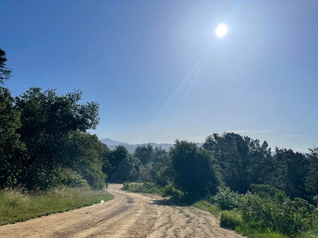
For families, the Canyon Meadow stretch is the easiest introduction, with its play structure and picnic areas. EBRPD also runs drop-in naturalist programs such as Hikes for Tykes at the park, and our guide to hiking trails in California for kids and toddlers has more ideas. Ladybugs gather in fall and winter, and the creek’s native trout migrate up Redwood Creek seasonally.
When Is the Best Time to Visit Reinhardt Redwood Regional Park?
The park is open year-round, with the longest gate hours from April through September and the shortest from November through February. Fall and winter bring the ladybugs. EBRPD cautions that trails can be slippery, rocky and steep and that weather can change suddenly.
Weekends from April through October are the busiest, and Redwood Gate’s parking fee applies then, so weekday or Skyline Gate visits avoid both the fee and the crowds. Before you go, see our guide to reading a California trail map, since the park’s many junctions are easy to mix up.
Where to Go Next After Reinhardt Redwood
For more East Bay ridges and redwoods, see our guide of the best hiking trails in the East Bay Hills explore open grassland ridges with our Briones Regional Park hiking guide, and check out the best hiking trails in Berkeley. Since part of Reinhardt Redwood lies in Contra Costa County, our guide to regional park hiking trails in Contra Costa County is a natural next stop.
If you want a summit instead of shade, try our Mission Peak hiking guide, or head south for the Henry Cowell Redwoods State Park hiking guide. For the whole county, return to the Alameda County trail guide.
Final Recommendation
Here’s the honest version: with an hour, walk the Stream Trail to Trail’s End and look up. With half a day, park free at Skyline Gate and hike the East and West Ridge Loop. When the Stream Trail reopens, save a full morning for the Canyon Meadow loop through the French and Tres Sendas trails. Check the closure update before you leave, and go in the fall if you want to see the ladybugs.
Frequently Asked Questions About Reinhardt Redwood Regional Park
How much does it cost to park at Reinhardt Redwood Regional Park?
Parking at Redwood Gate is $5 per vehicle, collected in cash on weekends and major holidays from April through October. EBRPD doesn’t collect fees at other times. Skyline Gate parking is free.
Are dogs allowed at Reinhardt Redwood Regional Park?
Yes, with leash rules. Dogs must be leashed in parking lots, within 200 feet of trails and entrances, in picnic areas, and on the Stream and Bridle trails. They must stay out of Redwood Creek.
What’s the easiest hike at Reinhardt Redwood Regional Park?
The Stream Trail from Canyon Meadow to Trail’s End, about 1.7 miles round trip, is the gentlest. The first stretch is paved and has a playground and picnic areas, and the grade stays below 8 percent.
Is Reinhardt Redwood Regional Park the same as Redwood Regional Park?
Yes. EBRPD renamed Redwood Regional Park in 2019 for Dr. Aurelia Henry Reinhardt. It’s the same park at 7867 Redwood Road in Oakland.
Is there cell service in the park?
Very little. EBRPD says there’s little or no cellular service, though limited public Wi-Fi is available at the park office for emergencies. Download your trail map before you go.
Can you fish in Redwood Creek?
No. Fishing is prohibited in the park and along Redwood Road, because the creek holds a rare strain of native rainbow trout.