Death Valley National Park Map & Hiking Planning Guide
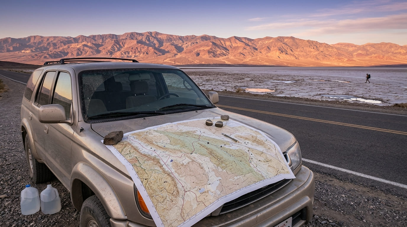
A Death Valley National Park map is the first thing you should trust and the last thing you can afford to lose. This park runs about 140 miles from end to end, covers roughly 3.4 million acres, and drops to 282 feet below sea level at Badwater Basin before climbing past 11,000 feet at Telescope Peak. There is no front gate, no public transportation, and no cell service along most roads. The National Park Service goes further: do not depend only on your vehicle’s GPS, because it has sent travelers to dead-end and closed roads.
Disclosure: Please note that some of the links below are affiliate links and at no additional cost to you, I may earn a commission. Know that I only recommend hiking gear I personally stand behind; when you use my affiliate links, it helps me run this blog and keep all of this content free of charge for readers (like you).
So the map is not a souvenir here. It is the plan. Let’s read it together: how the park is laid out, which maps to carry, where the entrances are, which hikes to pin, and how to turn all of it into one, two, or three days.
What does a Death Valley National Park map show?
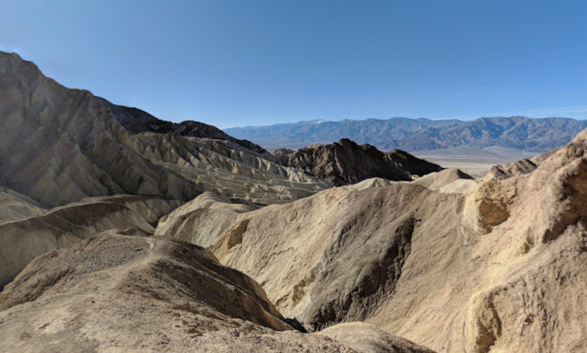
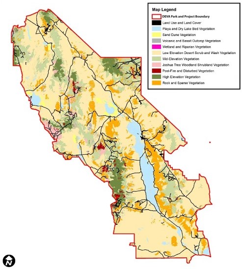
Death Valley is the largest national park in the lower 48 states, and the map reads like a spine with ribs. Furnace Creek is the hub, home to the main visitor center. CA-190 is the major east-west road, and Badwater Road runs south from the Furnace Creek area to Badwater Basin and beyond. NPS counts more than 300 miles of paved roads, 300 miles of improved dirt roads, and several hundred miles of unmaintained four-wheel-drive roads.
| Map fact | Detail |
|---|---|
| Length | About 140 miles |
| Lowest point | Badwater Basin, 282 ft below sea level |
| Highest point | Telescope Peak, more than 11,000 ft |
| Main hub | Furnace Creek Visitor Center |
| Gas stations | Three: Furnace Creek, Stovepipe Wells, Panamint Springs |
| Public transportation | None |
Most of the park lies in Inyo County, and our hub for hiking trails in Inyo County shows what surrounds it. For park-specific trail lists, see our guide to the best hiking trails in Death Valley National Park.
Which Death Valley park map should you carry?
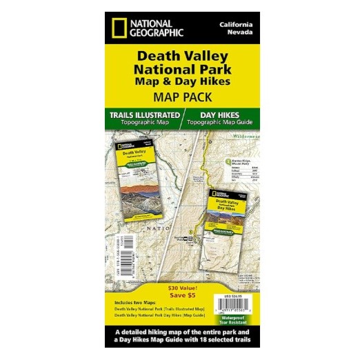
Start with the official one. The NPS maps page offers an interactive map you can switch between park tiles and the printed brochure map, plus separate downloads for backcountry and wilderness access, hiking routes, and driving routes from Las Vegas.
| Map | Best for | Where to find it | Keep in mind |
|---|---|---|---|
| NPS brochure map | Roads, sites, and visitor services | NPS website, Furnace Creek Visitor Center | An overview only |
| Backcountry and Wilderness Access Map | Dirt roads and general road conditions | NPS maps page | Conditions change quickly after storms |
| NPS hiking maps and route pages | Maps and GPS data for popular hikes | NPS hiking page | Many routes are unmarked |
| Routes from Las Vegas | Getting to the park | NPS maps page | A driving guide, not a trail map |
| USGS topographic maps | Terrain and cross-country routes | Order online from USGS | Single sheets cover small areas |
| Tom Harrison Recreation Map | Backcountry trip planning | Death Valley Natural History Association | Recommended by NPS |
| National Geographic Trails Illustrated | Backcountry trip planning | Death Valley Natural History Association, retailers | Recommended by NPS |
| Day Hikes Map (Trails Illustrated 1709) | 18 day hikes | Retailers | Waterproof and topographic |
NPS recommends either the Tom Harrison or National Geographic map for backcountry planning. If you are deciding between a free map and a paid one, our comparison of free vs paid trail maps lays out the trade-offs.
Where are the Death Valley National Park entrances?
Here is the surprise on the map: there is no entrance gate. Death Valley has paved entrance roads, and you pay your fee at a visitor center, a ranger station, or a self-pay machine inside the park. NPS lists these paved entrances:
| Side | Road | Comes from |
|---|---|---|
| East | CA-190 | Death Valley Junction, CA |
| East | SR 374 (Daylight Pass Road) | Beatty, NV |
| East | CA-178 | Shoshone, CA |
| East | SR 267 | US 95, NV |
| West | CA-190 | Olanche, CA (SR 136 from Lone Pine) |
| West | SR 178 (Panamint Valley Road) | Trona, CA |
Several dirt roads also cross the boundary, including Wildrose Canyon Road, Harry Wade Road, Titus Canyon Road, Death Valley/Big Pine Road, and Saline Valley Road. There are no services along these for many miles. If you enter on a dirt road, you can pay in advance on Recreation.gov and display a printed pass on your dashboard.
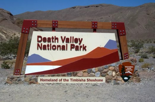
How the fee works. A private vehicle pass is $30 and covers seven days with unlimited re-entry. A motorcycle is $25, a person on foot or bicycle (16 and older) pays $15, and an annual pass is $55. NPS says no reservation is required, and the park accepts only cards and digital payments, not cash. Pay at Furnace Creek Visitor Center, Stovepipe Wells Ranger Station, or machines at spots such as Zabriskie Point, Badwater Basin, and Hell’s Gate.
Which entrance suits you? From Las Vegas, NPS calls the route through Pahrump the fastest, at about 120 miles and two hours. From the Eastern Sierra, CA-190 from Olancha brings you in from the west. Pick the road that points toward your first stop, and keep the whole loop in mind, because distances inside the park are long.
Can you trust GPS in Death Valley?
Not by itself. NPS says GPS navigation to remote places like this is notoriously unreliable and urges travelers to carry up-to-date road maps to check it. There is no street address for the park or the Furnace Creek Visitor Center, and NPS gives its coordinates as N 36°27.70, W 116°52.00. Download the free NPS app before you go and save Death Valley for offline use.
Build the rest of your safety plan around the facts NPS states plainly:
- No cell service along most park roads, and help may be many hours away, so travel prepared to self-rescue.
- Fuel is limited. The three gas stations are at Furnace Creek, Stovepipe Wells, and Panamint Springs. There are no rapid EV chargers inside the park.
- Roads are narrow and winding. Many were built in the 1930s, and NPS says the most dangerous thing in Death Valley is not the heat but the single-car rollover.
- Stay on roads. Driving off designated roads is prohibited.
If you are new to reading terrain, our guide on how to read a California hiking trail map covers scale and contour lines.
Death Valley hiking map: where to pin the hikes
Death Valley has few constructed trails. NPS says most hiking routes are cross-country, up canyons, or along ridges, so a Death Valley hiking map is as much about trailheads as about trails. Distances below come from NPS, with locations measured from Furnace Creek where NPS gives them.
| Hike | Where it starts | Distance | Elevation gain | Time |
|---|---|---|---|---|
| Harmony Borax Works | 1 mi west of Furnace Creek on CA-190 | 0.4 mi paved loop | 50 ft | 30 min |
| Badwater Salt Flat | Badwater Road, 17–18 mi south of Furnace Creek | 1 mi round trip to the flat’s edge | Flat | Self-paced |
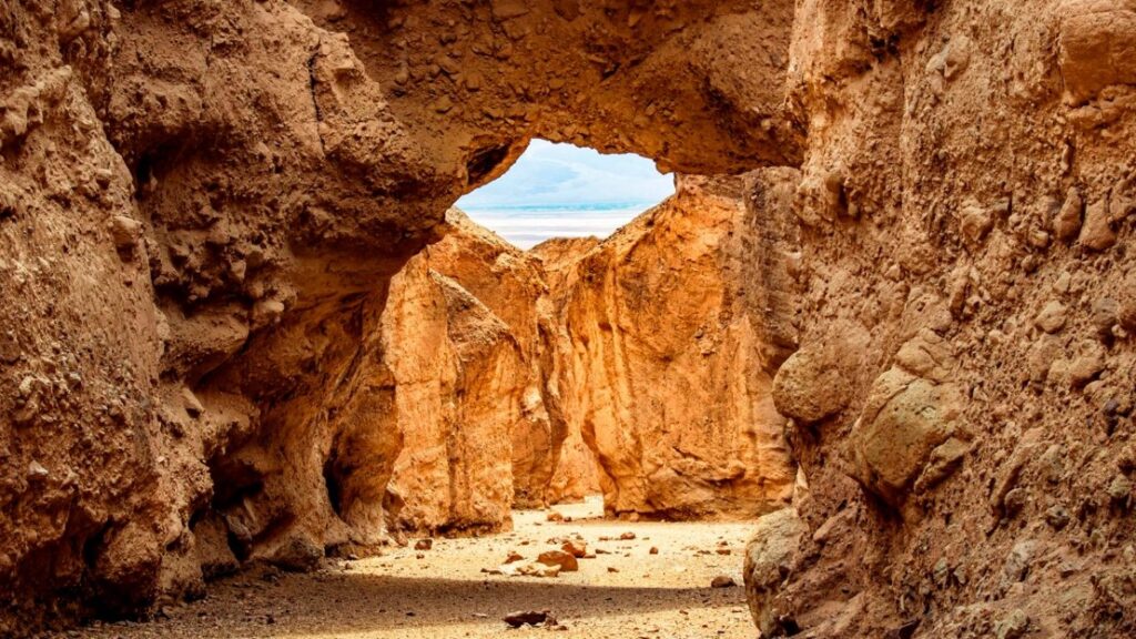
| Natural Bridge | Natural Bridge Road, 13.5 mi south of CA-190 | 1 mi round trip | 86 ft | 45 min |
| Golden Canyon, Gower Gulch, Badlands Loop | Golden Canyon trailhead or Zabriskie Point | 3–8 mi routes | 535–834 ft | 1.5–4.5 hrs |
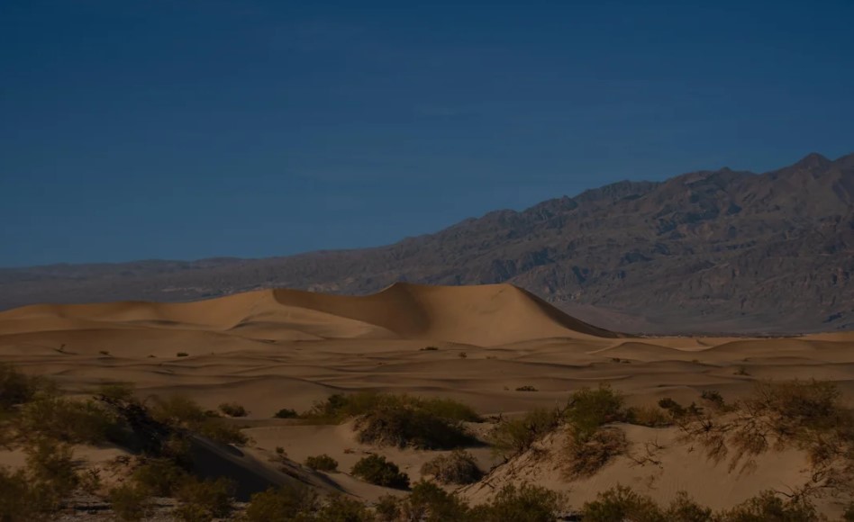
| Mesquite Flat Sand Dunes | Stovepipe Wells Village, about 24 mi west of Furnace Creek | 2 mi round trip | 185 ft | 1.5 hrs |
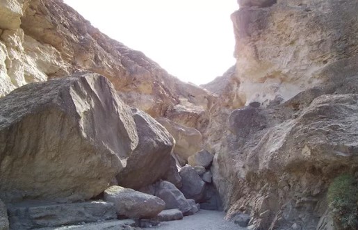
| Mosaic Canyon | Mosaic Canyon Road at Stovepipe Wells | 4 mi round trip | 1,200 ft | 2.5–3 hrs |
| Ubehebe Crater Loop | 8 mi west of Scotty’s Castle | 1.5 mi loop | 500 ft | 1 hr |
| Wildrose Peak | Charcoal Kilns, via Emigrant Canyon Road | 7.9 mi round trip | 2,572 ft | 6 hrs |
| Telescope Peak | Charcoal Kilns, via Emigrant Canyon Road | 12.2 mi round trip | 3,375 ft | 7 hrs |
Two cautions come with the table. The Badwater Salt Flat is flat, but NPS says not to attempt it when it is hot. And the two high peaks sit in a different season from the valley floor: NPS says the high peaks are a pleasant escape from summer heat but are usually covered in snow in winter and spring, when an ice axe and crampons are needed. The road to the Charcoal Kilns trailhead has a 25-foot vehicle limit.
Timing sorts the rest. NPS says the best time to hike in Death Valley is November through March, and that low-elevation hikes should be saved for the cooler winter days. Carry at least 2 liters for a short winter day hike, and a gallon or more for longer warm-season hikes. Springs are rare and unreliable. Dogs must stay on roads and in developed areas, so they cannot go on trails.
For more routes, see our roundup of the 5 best hiking trails in Death Valley, Inyo County, and our guide to slot canyon and desert hiking trails in California. For how much water to carry in dry heat, see our guide to water and electrolytes for California hikers.
Death Valley National Park itinerary: one, two, or three days
Distances here are deceiving, so plan the park in clusters. NPS offers a useful shortcut: Devils Golf Course, Badwater, and Artists Drive on the way back to CA-190 take about 1.5 hours round trip, and adding Zabriskie Point or the dunes rounds out a two-hour visit. NPS lists Dante’s View, Zabriskie Point, and the dunes as popular sunrise spots, and Zabriskie Point, the dunes, Artist’s Palette, and Aguereberry Point as good sunset spots.
| Day | Morning | Midday | Late afternoon |
|---|---|---|---|
| Day 1: Furnace Creek and Badwater Road | Sunrise at Zabriskie Point, then Furnace Creek Visitor Center for maps, fees, and road status | Badwater Road: Natural Bridge and Badwater Basin; in summer, take a heat break indoors | Artists Drive, a 9-mile one-way loop, with sunset at Artists Palette |
| Day 2: Stovepipe Wells side | Mosaic Canyon from Stovepipe Wells, before it warms | Lunch and a rest at Stovepipe Wells or Furnace Creek | Mesquite Flat Sand Dunes at sunset, then Harmony Borax Works for stars |
| Day 3: Viewpoints and badlands | Sunrise at Dante’s View, about 25 miles south of Furnace Creek; allow two hours or more round trip | Salt Creek boardwalk, 13 miles west of Furnace Creek (0.5 mile, best February to April for pupfish) | Golden Canyon and Gower Gulch loop from Zabriskie Point, in cooler months |
For a peak day, swap Day 3 for Wildrose Peak (7.9 miles) or Telescope Peak (12.2 miles) from the Charcoal Kilns, and start at first light.
A few notes make this work. Artists Drive and Dante’s View both restrict vehicles 25 feet and longer. Harmony Borax Works is also a good place to see the night sky, according to NPS. In summer, NPS says you can tour many main sites in an air-conditioned vehicle, but stay on paved roads, carry plenty of water, and treat hiking as an early-morning or mountain-only activity. If you are tying this into a bigger trip, our guide to California road trip and hiking combos shows how Death Valley fits alongside other stops.
What can a Death Valley map not show?
A map cannot tell you what a flood did last week. Death Valley’s roads have taken repeated flood damage, and NPS keeps a live road status map on its alerts and conditions page. As of NPS’s early October 2026 update, Bonnie Clare Road and Scotty’s Castle are closed for flood recovery with no reopening date. The one-way section of Titus Canyon Road is closed for repairs, with reopening anticipated in May 2027. The Darwin Falls road is closed too, and Southern Badwater Road, south of Badwater Basin toward Shoshone, has flood damage and loose gravel. Check the page before you drive, and see our guide on how to check California trail closures.
Weather is the other blind spot. NPS records the world’s highest air temperature here: 134°F on July 10, 1913, at Furnace Creek Ranch. For a sense of the park by season, our guide to the best time to hike each California national park puts Death Valley beside the others. If wildflowers are your goal, NPS says that after several winter and spring storms, blooms can arrive in late March and early April in the low elevations, April and May at mid elevations, and into June in the mountains.
The bottom line
A Death Valley National Park map will not make the desert smaller, but it will keep you honest about its size. Carry the NPS map and a paid topographic map, download the NPS app, and plan by cluster rather than by dot. Fill the tank at Furnace Creek or Stovepipe Wells, carry more water than feels sensible, and check road status before you leave pavement. The valley rewards people who respect it, and that respect starts with a folded piece of paper.
Death Valley map FAQs
Is there a Death Valley National Park entrance fee?
Yes. A private vehicle pass is $30 for seven days, and an annual pass is $55. America the Beautiful passes are accepted. The park takes cards and digital payments only.
Do you need a reservation to enter?
No. NPS says no reservation is required to enter the park. Only Furnace Creek Campground takes campground reservations, from mid-October through mid-April.
How many entrances does Death Valley have?
NPS lists four paved entrances on the east side and two on the west, plus many dirt roads. None has a gate.
Where is the Furnace Creek Visitor Center?
Off CA-190 in Furnace Creek, at N 36°27.70, W 116°52.00. It has no street address. Stovepipe Wells Ranger Station is the other staffed station, on CA-190 at Stovepipe Wells.
Where can you stay?
NPS lists lodging at Furnace Creek and Stovepipe Wells Village. Outside the park, Beatty, Nevada, is about a 45-minute drive from Furnace Creek, and Shoshone is about an hour. Las Vegas is roughly two to two and a half hours.
Can you bring a dog?
Yes, but NPS does not recommend it. Dogs must stay on a leash and on roads or in developed areas, so there is no hiking with them on trails.