Easy & Short Hikes in Yosemite National Park
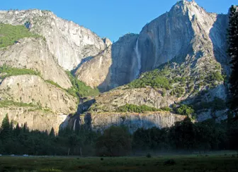
Some days in Yosemite you do not have six hours and 2,700 feet of climbing in you, and that is fine. The park is generous with short hikes: a half-mile paved path to the base of a 620-foot waterfall, a flat loop through a meadow where Yosemite Falls and Half Dome share the horizon, a rocky dome with a 360-degree view. NPS lists them all, and short hikes in Yosemite National Park are scattered across it, from the Valley floor to the sequoia groves to the high country.
Disclosure: Please note that some of the links below are affiliate links and at no additional cost to you, I may earn a commission. Know that I only recommend hiking gear I personally stand behind; when you use my affiliate links, it helps me run this blog and keep all of this content free of charge for readers (like you).
The catch is that short does not always mean easy. Some of these trails are flat; some are brief but steep; a few go downhill first and make you pay on the way back. So let’s sort them by what they ask of you, area by area.
What counts as a short or easy hike in Yosemite?
NPS gives us the vocabulary for easy hikes in Yosemite. In Yosemite Valley, it labels Bridalveil Fall, Lower Yosemite Fall, and Cook’s Meadow Loop as easy, and Mirror Lake as easy to moderate. In Tuolumne Meadows, it defines “Short Walks and Hikes” as trips of about an hour or less. For this guide, a short hike is a trail NPS lists at roughly 3.5 miles or less, and easy means little elevation gain, with notes wherever the return trip is harder than the way out.
| Hike | Area | Distance | Elevation gain | Starting point |
|---|---|---|---|---|
| Bridalveil Fall Trail | Valley | 0.5 mi round trip | 80 ft | Bridalveil Fall parking |
| Lower Yosemite Fall Trail | Valley | 1 mi loop | 50 ft | Shuttle stop #6 |
| Cook’s Meadow Loop | Valley | 1 mi loop | Flat | Shuttle stop #5 or #6 |
| Mirror Lake | Valley | 2 mi round trip (5 mi loop) | 100 ft (200 ft loop) | Shuttle stop #17 |
| Glacier Point overlook | Glacier Point Road | 300 yds one way | Paved, gentle | Glacier Point parking |
| Sentinel Dome | Glacier Point Road | 2 mi round trip | 400 ft | Sentinel Dome/Taft Point Trailhead |
| Taft Point | Glacier Point Road | 2.2 mi round trip | 200 ft | Sentinel Dome/Taft Point Trailhead |
| Swinging Bridge | Wawona | 0.6 mi round trip | Mostly flat | End of Forest Drive |
| Big Trees Loop | Mariposa Grove | 0.3 mi round trip | Flat | Mariposa Grove Arrival Area |
| Grizzly Giant Loop | Mariposa Grove | 2 mi round trip | 300 ft | Mariposa Grove Arrival Area |
| Wawona Meadow Loop | Wawona | 3.5 mi loop | Mostly flat | Wawona Hotel |
| Pothole Dome | Tuolumne Meadows | 1 mi round trip | 200 ft | Pothole Dome parking |
| Parsons Lodge and Soda Springs | Tuolumne Meadows | 1.4 mi round trip | Mostly flat | Lembert Dome parking or Visitor Center |
| Twin Bridges | Tuolumne Meadows | 3 mi round trip | Mostly flat | Dog Lake parking |
| Lukens Lake | Tioga Road | 1.6 mi round trip | 200 ft | Lukens Trailhead |
| Tuolumne Grove | Crane Flat | 2.5 mi round trip | 500 ft on the return | Tuolumne Grove Trailhead |
Short hikes in Yosemite Valley
The Valley is where most first-time visitors start, and NPS says the free shuttle serves trailheads year-round. Our hub for Mariposa County hiking trails covers the county the Valley sits in. For the park-wide picture, see our guide to the best hiking trails in Yosemite National Park.
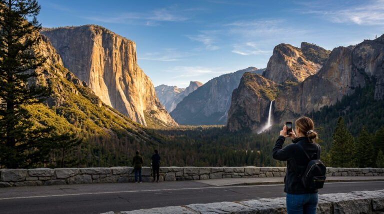
Bridalveil Fall. This is often the first waterfall you see when entering the Valley. A paved trail climbs about 80 feet over 0.5 miles round trip to the base of a fall that plunges 620 feet. NPS says it flows year-round and the trail is open year-round, though it can be icy in winter.
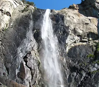
About halfway up, there is a wheelchair-accessible viewing platform. Beyond it, the grade steepens, and the trail is not wheelchair accessible. There is no shuttle service to this trailhead, so you drive and park. Stay on the pavement, because NPS warns that the rocks above the platform are slippery even when dry.
Lower Yosemite Fall. A 1-mile paved loop with 50 feet of gain, starting at shuttle stop #6. NPS says leashed pets and strollers are allowed. The catch is timing: the falls are often dry from late July or August through October, so spring is the season for this one.
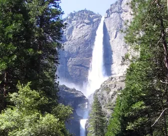
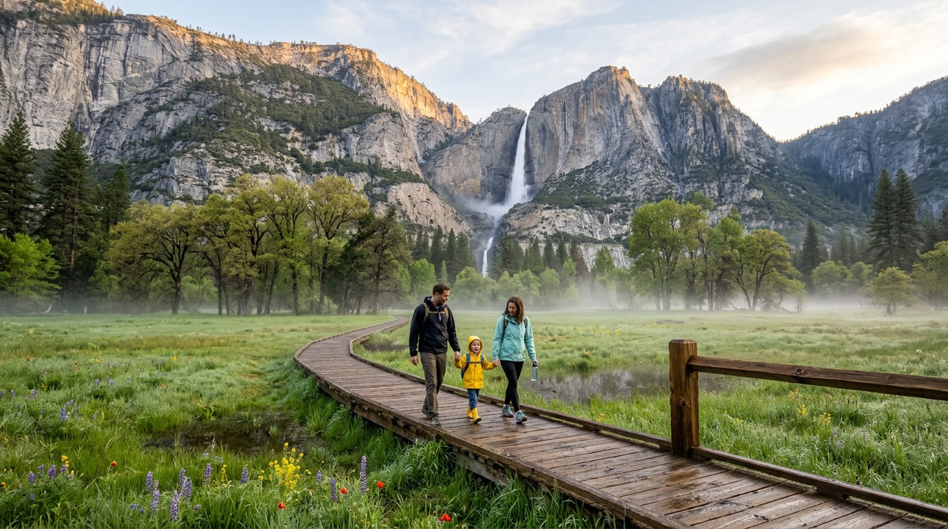
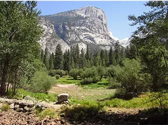
Cook’s Meadow Loop. A flat, 1-mile loop with views of Yosemite Falls, Half Dome, Glacier Point, and Sentinel Rock. NPS says you can start at the visitor center (shuttle stop #5) or at stop #6 and cross the street into the meadow, which makes it an easy pairing with Lower Yosemite Fall. A water fountain stands near the Lower Yosemite Fall restrooms.
Mirror Lake. The trail begins at shuttle stop #17, and the first mile is a paved service road that leads straight to the lake. NPS puts the walk to the lake and back at 2 miles and about an hour. The full loop is 5 miles and takes 2 to 3 hours. There is no parking at the trailhead, so ride the shuttle. NPS says leashed pets, bicycles, and strollers are allowed on that first paved mile. In late summer, the lake shrinks, and NPS notes it is often called Mirror Meadow then, so spring and early summer are best.
One short hike that is not easy. NPS lists the Vernal Fall and Nevada Fall trails as moderate to strenuous, from 1.6 to 8 miles round trip with 400 to 2,000 feet of gain. Search for Yosemite easy hikes, and you will find lists that call the walk to Vernal Fall easy. Treat it as a moderate climb, and plan accordingly.
Short hikes along Glacier Point Road
NPS groups three outings here under “Short Walks and Hikes,” and all of them work only when the road is open, which NPS says is usually from May to November.
- Glacier Point overlook: 300 yards one way on a paved path with a gentle incline, ending at an overlook 3,200 feet above the Valley.
- Sentinel Dome: 2 miles round trip with 400 feet of gain, 1 to 2 hours. NPS says you scramble up the side of a granite dome for 360-degree views.
- Taft Point: 2.2 miles round trip with 200 feet of gain, also 1 to 2 hours. The trail runs through forest and meadow to the rim of the Valley.
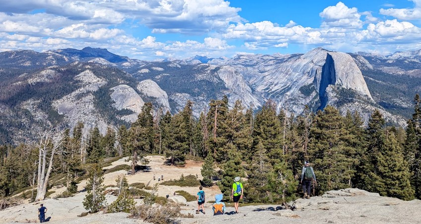
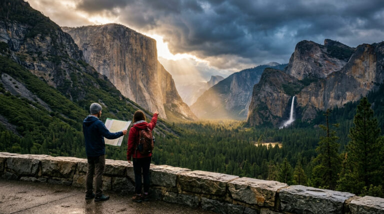
Sentinel Dome and Taft Point share the same trailhead, so they pair well in one half-day. Stay well back from the rim at Taft Point. For maps and trailhead navigation, see our Yosemite National Park maps and trailhead guide.
Short hikes in Wawona and Mariposa Grove
The southern entrance side of the park offers giant sequoias on trails that are short by any measure. Our guide to hiking trails near Yosemite’s southern entrance covers more of this area.
- Big Trees Loop: 0.3 miles round trip, 30 to 45 minutes, flat pavement, packed dirt, and boardwalk. NPS calls it easy and wheelchair accessible. It passes the Fallen Monarch and interpretive panels on sequoia ecology.
- Grizzly Giant Loop: 2 miles round trip with 300 feet of gain, 1.5 to 2 hours. NPS rates it moderate. It passes the Bachelor and Three Graces, the 3,000-year-old Grizzly Giant, and the California Tunnel Tree.
- Swinging Bridge: 0.6-mile round trip in about 30 minutes, mostly flat, from the end of Forest Drive to a suspended footbridge on the South Fork Merced River.
- Wawona Meadow Loop: 3.5 miles, mostly flat on uneven terrain, 2 to 3 hours, starting at the Wawona Hotel.
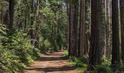
Mariposa Grove has its own access rules. NPS says the grove road is open only to vehicles with a disability placard, and everyone else uses a free shuttle from the Mariposa Grove Welcome Plaza, which runs from about late April through November. When the road and shuttle are closed, NPS says access is a two-mile hike each way on the Washburn Trail, with about 500 feet of gain.
Short hikes on Tioga Road, Tuolumne Meadows, and Crane Flat
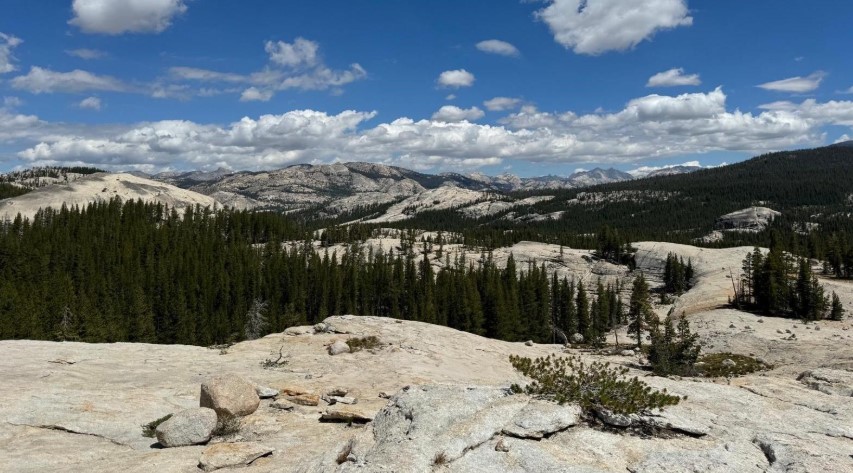
Tioga Road crosses the high country, and NPS says Tuolumne Meadows sits at an elevation of 8,600 feet, so even short walks feel different here. These are only reachable by car when the road is open, typically May or June to November. Our hub for Tuolumne County hiking trails and our guide to Tuolumne Meadows hiking trails go deeper.
- Pothole Dome: 1 mile round trip with 200 feet of gain. A short walk from the parking area along Tioga Road, then a scramble up the dome for meadow views.
- Parsons Lodge and Soda Springs: 1.4 miles round trip, mostly flat and unpaved, to cold, bubbling Soda Springs and a historic lodge.
- Twin Bridges: 3 miles round trip on the John Muir Trail to the Lyell Fork of the Tuolumne River, mostly flat on uneven terrain.
- Lukes Lake: 1.6 miles round trip with 200 feet of gain, down to a small lake surrounded by a meadow.
Two groves that are short but climb on the way back. The Tuolumne Grove, a 2.5-mile round trip, and the Merced Grove, a 3-mile round trip, are both near Crane Flat, about 30 minutes from the Valley. NPS says you hike down an old road to reach each grove, then climb about 500 feet on the return, and calls the return strenuous. Plan your energy for the walk back.
Which short hikes work for families, wheelchairs, and dogs?
- Wheelchairs and strollers: NPS describes a wheelchair-accessible viewing platform partway up the Bridalveil Fall trail and lists the Big Trees Loop as wheelchair accessible, and strollers are allowed on Lower Yosemite Fall and the first paved mile of Mirror Lake. Our guides to wheelchair-accessible hiking trails in California and hiking trails for kids and toddlers cover more of the state.
- Dogs: NPS allows leashed pets on the Bridalveil Fall trail, the Lower Yosemite Fall loop, and the first paved mile of the Mirror Lake trail. Pets are not allowed on the shuttle.
- First-timers: If you are new to hiking, our guide to the best hiking trails for beginners in California covers the basics.
When are the best short hikes in Yosemite?
Water drives the answer. Bridalveil Fall flows year-round, according to NPS, so it is a safe choice in any season. Lower Yosemite Fall is often dry from late July or August through October, and Mirror Lake shrinks to a meadow late in the year. Glacier Point Road and Tioga Road close for winter, and the Mariposa Grove road and shuttle close around November 30 and reopen no earlier than April 15. In winter, stick to the Valley floor and expect ice. For month-by-month weather, see our guide to Yosemite weather by month.
What should you know before you go?
NPS keeps a live list of road, trail, and fire conditions on its current conditions page. As of NPS’s October 9, 2026 update, Glacier Point Road was temporarily closed for smoke and firefighting, and trails in the area around Wawona and Glacier Point were closed, so check before you plan a Glacier Point day. Our guide on how to check California trail closures explains what to look for.
Beyond that, NPS asks you to stay on paved trails where it says so, stay at least 50 yards from bears in forests and meadows, and carry out all trash and food waste. For the full set of Valley trail profiles, the NPS Yosemite Valley day hikes page is the best reference. If you need a bed nearby, see where to stay near Yosemite.
The bottom line
Short hikes in Yosemite are not a consolation prize. A half-mile walk to Bridalveil Fall, a meadow loop under Yosemite Falls, and an hour or two among the Mariposa Grove sequoias give you the park at its scale without the climb. Match the trail to the season, check conditions the week you go, and remember that a short trail can still have a hard return. The big hikes will still be there when you want them.
Short hikes in Yosemite FAQs
What is the easiest hike in Yosemite?
NPS lists Bridalveil Fall (0.5 mile round trip, 80 feet of gain), Lower Yosemite Fall (1-mile loop, 50 feet), and Cook’s Meadow Loop (1-mile loop, flat) as easy. Cook’s Meadow has no elevation gain.
Can you hike in Yosemite without a car?
In the Valley, yes. The free shuttle runs year-round and serves trailheads such as stop #6 for Lower Yosemite Fall and stop #17 for Mirror Lake. Bridalveil Fall has no shuttle service, so you drive to it.
Which short hikes have waterfalls?
Bridalveil Fall and Lower Yosemite Fall, with Bridalveil the more reliable late in the year.
Do you need a permit to day hike?
Not for these trails. You do need to enter the park. NPS lists a private vehicle pass at $35 for seven days, $20 per person on foot or bicycle (16 and older), and an additional $100 per person for non-US residents 16 and older without an annual or America the Beautiful pass. The park does not accept cash, and NPS says no entry reservation is needed in 2026.
Are there short hikes that are not crowded?
NPS describes the Tuolumne and Merced Groves as two small, quiet groves of giant sequoias near Crane Flat.