Emerald Bay State Park Hiking Guide
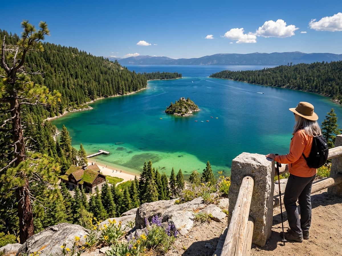
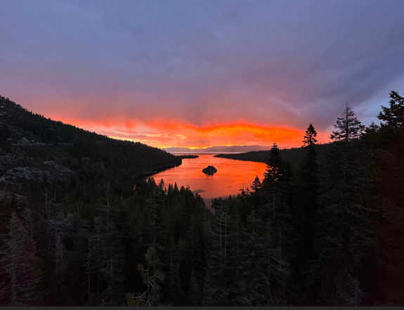
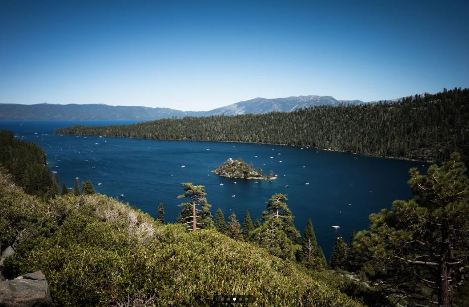
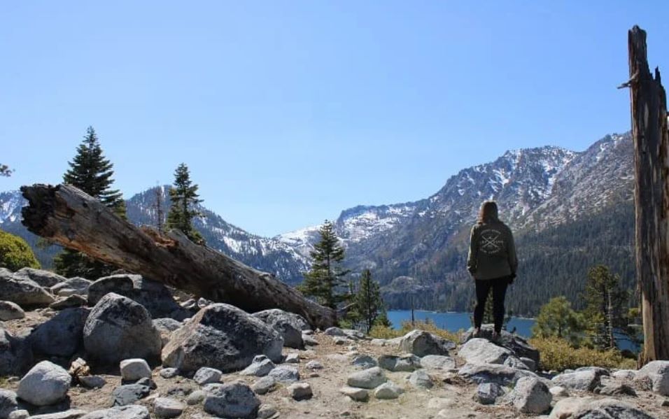
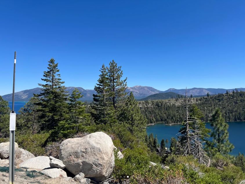
Tahoe Emerald Bay State Park starts at a railing beside Highway 89. You pull into a small lot 12 miles north of South Lake Tahoe, walk to the overlook, and the whole bay is laid out below you: a deep green-blue inlet cut into granite, one small island at its center, and a Scandinavian-style mansion half hidden in the pines at the water’s edge. What the overlook does not tell you is that no road goes down. To reach the shore, you walk a steep mile and drop roughly 500 feet, then earn every one of those feet on the way back up.
Disclosure: Please note that some of the links below are affiliate links and at no additional cost to you, I may earn a commission. Know that I only recommend hiking gear I personally stand behind; when you use my affiliate links, it helps me run this blog and keep all of this content free of charge for readers (like you).
That trade defines Emerald Bay Lake Tahoe. The view is free and instant. The water, the castle, and the beach belong to people willing to hike.
This guide covers the Vikingsholm Trail, the Rubicon Trail, the Eagle Falls trailhead across the highway, the paddle to Fannette Island, and the parking, fee, and seasonal details that decide whether your day runs smoothly.
I tie the practical facts to California State Parks and the Sierra State Parks Foundation, and I flag anything that changes with the season.
Key Takeaways
- Emerald Bay State Park sits on Lake Tahoe’s southwest shore along Highway 89, 12 miles north of South Lake Tahoe and 22 miles south of Tahoe City. It is open from sunrise to sunset.
- The Vikingsholm Trail is a steep one-mile descent of roughly 500 feet to the water. State Parks lists the round trip at 2 miles with about 400 feet of climbing, and there are no rides out.
- Parking in the Vikingsholm lot costs $10 per vehicle for the day or $3 per hour. Arrive before 9 a.m. or after 3 p.m., and avoid weekends if you can.
- Vikingsholm tours run from late May through September 30. The 2026 season has ended, so plan on the next one opening around Memorial Day weekend.
- Dogs are not allowed on any trail, beach, or road into the bay. Eagle Falls Trail, managed by the Forest Service, does allow them.
- Fannette Island can only be reached by watercraft, and it is closed in April and May for wildlife breeding.
Emerald Bay State Park at a Glance
| Detail | What to know |
|---|---|
| Location | Highway 89, southwest shore of Lake Tahoe, El Dorado County |
| Distance | 12 miles north of South Lake Tahoe; 22 miles south of Tahoe City |
| Hours | Sunrise to sunset |
| Parking | $10 per vehicle per day or $3 per hour in the Vikingsholm lot |
| Vikingsholm Trail | 1 mile each way, about 500 feet of descent, steep return |
| Rubicon Trail | 7.4 miles between Emerald Bay and D.L. Bliss State Park, moderate to strenuous |
| Dogs | Not allowed on trails, beaches, the Rubicon Trail or Fannette Island |
| Designations | National Natural Landmark (1969); underwater state park (1994) |
| Size | 1,533 acres; state park since 1953 |
Where Emerald Bay Sits on Lake Tahoe
Emerald Bay State Park sits on the southwest shore of Lake Tahoe, California, in El Dorado County, covering 1,533 acres of granite shoreline that became a state park in 1953.
The federal government recognized the bay as a National Natural Landmark in 1969 for its glacier-carved landscape, and in 1994 California State Parks added the water itself, which protects the old boats, launches, and barges resting on the bottom.
Glaciers gouged this bay out thousands of years ago. Fannette Island survived because it is a resistant rib of granite that the ice rode over instead of removing.
When you stand at the overlook, you are looking at a landscape the glaciers edited rather than erased. For the wider picture of the lake’s trail network, our guide to hiking trails around Lake Tahoe shows where Emerald Bay fits among the other shoreline and alpine routes.
Getting to Emerald Bay From South Lake Tahoe
Highway 89 is the only road in. From South Lake Tahoe, drive northwest for about 12 miles, and the overlook and Vikingsholm parking lot appear beside the highway. Coming from the north, Tahoe City is 22 miles away on the same highway. Vehicles cannot drive down to the lake, so every route to the water starts on foot.
If you are basing yourself on the south shore, our guide of South Lake Tahoe hiking trails pairs well with an Emerald Bay morning. If you are driving down from Tahoe City, the Placer County side of the lake has its own set of trails you can stack onto the same trip.
Winter changes the drive. State Parks notes that chains or four-wheel drive are frequently required, and it points drivers to Caltrans for current Highway 89 conditions. Check road status before you leave, because the highway is the only way in.
Parking, Fees and the Emerald Bay Shuttle
Parking is the pressure point at Emerald Bay. State Parks says the area has limited parking and recommends arriving before 9 a.m., coming after 3 p.m., or skipping weekends. During peak season, the Vikingsholm lot can close and gate when it fills, which keeps highway traffic moving.
| Option | Cost | What to know |
|---|---|---|
| Vikingsholm lot (State Parks) | $10 per vehicle per day, or $3 per hour | Self-pay by card or exact-change cash; display the receipt on the dash; sunrise to sunset only; no overnight parking; 18-foot vehicle limit, no trailers |
| Eagle Falls Trailhead (Forest Service) | Paid; about $5 per vehicle at last check | Across the highway; serves Eagle Falls and Desolation Wilderness |
| Highway 89 shoulder | Not allowed | State Parks says illegally parked vehicles are towed |
| Emerald Bay Shuttle | $10 per adult round trip in 2026 reporting | Ran daily June 26 to September 7 in 2026; pickups at Sugar Pine Point Campground, the South Tahoe Y Transit Center and Camp Richardson |
Your parking receipt is good at any California State Park on the day you buy it, and California State Park day-use passes are accepted. Federal passes are not. If you are weighing which passes to carry on a longer trip, our guide to California hiking trail permits and passes lays out the options.
The shuttle is a summer program run by the Tahoe Transportation District with the transit provider Via, and its 2026 season ran from late June through Labor Day weekend.
Dates and fares can change each year, so confirm them before you plan around it. Enforcement is serious: California Highway Patrol wrote 248 parking citations during the 2025 shuttle season. Check the California State Parks Emerald Bay page the morning you go, since it carries the current restrictions banner.
The Vikingsholm Trail: One Mile Down, One Mile Back
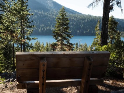
The Vikingsholm Trail begins at the overlook at about 6,800 feet. The first minutes are easy because every step points downhill, and the bay keeps appearing through the trees: the island, the kayaks, the pale curve of beach. Your legs only learn what they agreed to on the return.
State Parks describes the route as a steep one-mile trail that drops about 500 feet to the house, with a 2-mile round trip and roughly 400 feet of climbing on the way out. The agency is blunt about the risk: visitors with medical conditions, recent surgeries, or mobility issues should not attempt it, and there are no rides out.
At this elevation, hikers arriving from sea level can feel lightheaded, so carry water and snacks. Our guide to high-elevation hiking in the Sierra Nevada explains how altitude affects pace and hydration.
There is a gentler option. The Sierra State Parks Foundation notes a less steep 1.5-mile trail that leaves from the Eagle Point Campground campfire center.
At the bottom, you will find the beach, the pier, restrooms about 50 yards in from the pier, and the Visitor Center just past the house. State Parks reports no services or drinking water from October through May, though restrooms stay open year-round at the bottom.
Touring Vikingsholm
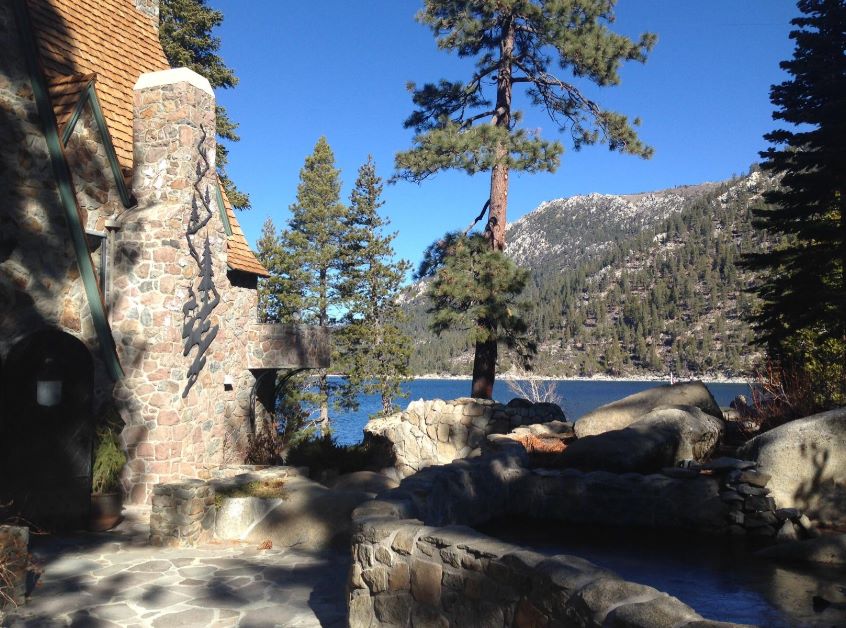
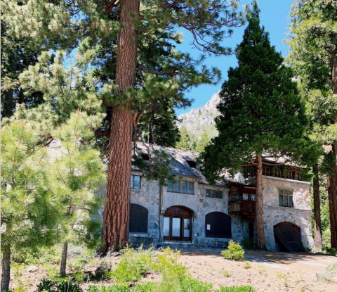
Lora Josephine Knight bought the land at the head of Emerald Bay and Fannette Island in 1928 for $250,000. Before construction began, she and her architect traveled to Scandinavia for ideas. Two hundred workers hand-hewed timbers, carved ornament, and forged hinges and latches, and the granite for the foundation and walls came from a quarry behind the house.
The design draws on buildings as old as the 11th century, and some sections contain no nails, pegs or spikes. The sod roof, two carved dragon beams and six fireplaces are the features visitors remember.
State Parks announced restoration work in 2025 on the turret and chimneys and on the Morning Room, which was damaged in a 2021 earthquake. Tours stayed open during that work.
The Sierra State Parks Foundation runs the public tours. They last 30 minutes, depart every half hour from 10:30 a.m. to 4 p.m. (there is no 12:30 tour), and are first come, first served. Tickets are $18 for adults and $15 for students ages 7 to 17, college ID holders, active-duty military, and seniors, and children 6 and under are free.
You buy them at the Visitor Center, which is open daily during tour season. The 2026 season ran May 23 through September 30, and the next one should open around Memorial Day weekend.
Lower Eagle Falls
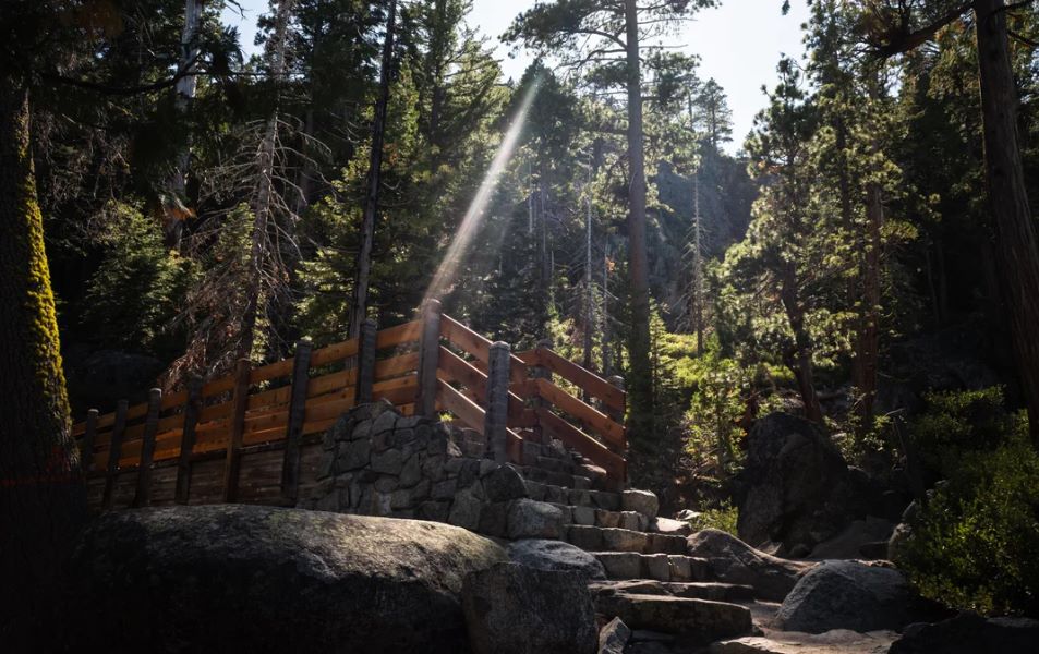
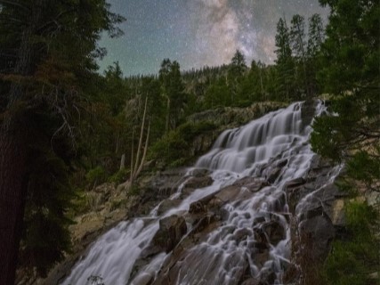
For a deeper look at the route, our Eagle Falls trail overview notes that Lower Eagle Falls sits a quarter mile behind the Visitor Center. State Parks notes it does not make a loop, so you walk up and back the same way. It is the easiest add-on at the bottom of the hill.
The Rubicon Trail: Emerald Bay to D.L. Bliss State Park
The Rubicon Trail wraps the shoreline for 7.4 miles between Emerald Bay State Park and D.L. Bliss State Park, ranging from moderate to strenuous with lake views for most of it. It is a pedestrian trail, and State Parks lists no dogs, fires, bicycles, camping, jumping, or diving.
| Access point | Location | Notes |
|---|---|---|
| North trailhead | Calawee Cove, D.L. Bliss State Park | Start of the full 7.4 miles |
| Lighthouse Trailhead | 1.3 miles south of the north end, D.L. Bliss | Lighthouse Trailhead parking area |
| Vikingsholm access | About 5.7 miles south of the north end | Steep 1-mile hike from the Vikingsholm lot to reach the trail; closest shuttle access |
| South trailhead | Eagle Point Campground, Emerald Bay | Southern end, 7.4 miles from Calawee Cove |
D.L. Bliss State Park reopened in 2026 after a three-year closure for a waterline replacement, and the Rubicon Trail technically stayed open during that period.
Cell reception can drop out along the route, so bring layers, food, and water, and check the weather, because High Sierra conditions change fast. Restrooms operate from Memorial Day to Labor Day at D.L. Bliss and at the Emerald Bay boat camp.
Eagle Falls and Eagle Lake: The Trail Across the Highway
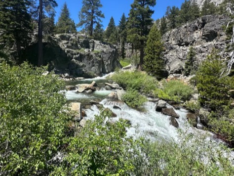
The Eagle Falls trailhead sits directly across Highway 89 from the bay, but it is Forest Service land, not state park land. The shaded trailhead is at about 7,100 feet and is typically open from mid-May through mid-October, depending on weather. Parking is paid, and the lot fills early on weekends.
The falls come in two parts. Lower Eagle Falls is inside the state park, and Upper Eagle Falls lies in Desolation Wilderness, so anyone going past the Upper Eagle Falls bridge needs a free day-use permit that you fill out at the trailhead self-service station (you can review the full Desolation Wilderness permit rules before you head out).
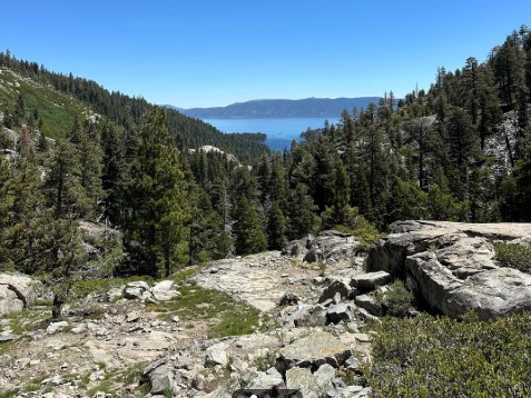
From there, the trail climbs to Eagle Lake, roughly a mile each way with 400 to 500 feet of elevation gain, depending on the source you consult. Longer routes continue to the Velma Lakes and beyond.
Our guide to Desolation Wilderness hiking trails covers those, and our guide to the best waterfall hikes in California places Eagle Falls beside the state’s other cascades.
Fannette Island, Kayaking and the Underwater Trail
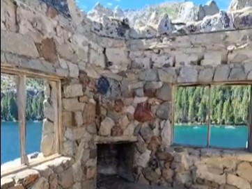
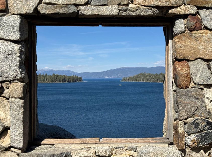
Fannette Island is the only island in Lake Tahoe, a brush-covered granite upthrust that rises 150 feet above the water. On top sits a stone shell that looks like a miniature castle. It was the Tea House, built in 1928 and 1929 with a 16-by-16-foot room, a fireplace, and an oak table.
Popular stories say Knight hosted tea parties there, but the Sierra State Parks Foundation says she rarely used it. Vandalism over the years left only the stone walls.
You can reach the island only by watercraft, and State Parks closes it in April and May because it is a wildlife breeding site. Swimming out is prohibited because of boat traffic, and camping and dogs are not allowed on the island.
Kayak Tahoe rents kayaks and paddleboards near the beach on a first-come, first-served basis, and the season runs through the summer. Winds in the bay often pick up in the afternoon, so State Parks recommends paddling in the morning. Clean, drain, and dry any small craft you bring, and keep speeds to 5 mph within 600 feet of shore.
Below the surface, California’s first Maritime Heritage Underwater Trail opened in October 2018, giving divers and snorkelers access to historic recreational watercraft and barges. Ospreys, bald eagles, bobcats, and black bears are all reported around the bay, so give wildlife room.
Camping at Emerald Bay
The park has two campgrounds: Eagle Point Campground and a boat-in camp on the north side of the bay. The boat-in camp has no vehicle access, offers buoys, and sits in the old Emerald Bay Resort area. Reservations open six months ahead through ReserveCalifornia.
Both campgrounds closed for the 2026 season. Bears are active in the area, and state law requires all food, drinks, and toiletries to be kept in the provided metal lockers day and night, with ice chests stored inside them too.
If a campsite is not available, our guide on where to stay near Lake Tahoe covers lodging with easy trail access.
When to Visit Emerald Bay
| Season | What to expect |
|---|---|
| Summer | Peak crowds, Vikingsholm tours, the shuttle, boat rentals and full services. Daytime highs near 75°F and nights in the low 40s. |
| Fall | Tours end September 30. Drinking water and services at the bottom shut off in October. |
| Winter | Daytime temperatures of about 20 to 40°F, snow and ice on the trail, frequent chain controls on Highway 89, and no services. In extremely cold winters the bay can freeze over. |
| Spring | Fannette Island is closed in April and May. The Eagle Falls trailhead typically opens around mid-May. |
State Parks welcomes winter hikers down to Vikingsholm any time of year, but it asks you to weigh footwear, clothing, food, water, and stamina before heading into snow. Our guide to winter hiking in California covers traction and cold-weather gear.
Dogs, Drones and Park Rules
Dogs are not allowed anywhere on land in Emerald Bay State Park, including beaches, dirt trails, service roads, the boat camp, the Rubicon Trail, the Vikingsholm grounds, and Fannette Island. Rangers enforce this year-round.
Dogs may stay on boats and at the overlook beside the Vikingsholm lot. The Forest Service’s Eagle Falls Trail and the Bayview and Cascade trails do allow dogs, and our list of dog-friendly hiking trails in California gives more leashed options.
Other rules: no drones, no fires or smoking, no bicycles or motors on the trails, and no camping outside designated campgrounds.
FAQ
Is there an entrance fee for Emerald Bay State Park?
Parking is the fee. The Vikingsholm lot charges $10 per vehicle for the day or $3 per hour, and your receipt works at other California State Parks on the same date.
How hard is the hike to Vikingsholm?
It is a steep one-mile descent with about 400 feet of climbing on the way back, starting at roughly 6,800 feet. Most of the effort comes on the return.
Can I visit Vikingsholm if I cannot manage the trail?
The Sierra State Parks Foundation offers ADA assistance from June through September. Email EmeraldBayADA@yahoo.com ahead of your visit to coordinate. The foundation also partners with boat operators on tour packages that reach Vikingsholm by water.
Can I take my dog to Emerald Bay?
Not onto the trails, beaches, or Vikingsholm grounds. Dogs can use the overlook at the parking lot, and the Forest Service’s Eagle Falls Trail allows them.
Can I visit Emerald Bay in winter?
Yes. You can hike down any time of year, but snow and ice create hazards, and there is no drinking water from October through May. Chains or four-wheel drive are frequently required on Highway 89.
Can I swim or paddle to Fannette Island?
You can paddle there in a kayak or on a board, except in April and May when the island is closed. Swimming to it is prohibited because of boat traffic.