Best Road Trip Routes for California Hiking: From the Coast to the Sierra Crest
This route strings together five of California’s best hiking regions into one multi-week trip: Highway 1 down the coast to Big Sur, a Central Valley crossing to Yosemite, Tioga Road over the Sierra crest, Highway 395 down the Eastern Sierra, and Highway 49 back through Gold Country. Do the whole thing over 10 to 14 days, and you’ll touch redwood coastline, granite high country, and Gold Rush foothills without repeating a single landscape.
Disclosure: Please note that some of the links below are affiliate links and at no additional cost to you, I may earn a commission. Know that I only recommend hiking gear I personally stand behind; when you use my affiliate links, it helps me run this blog and keep all of this content free of charge for readers (like you).
One piece of timing that makes 2026 a good year to drive it: Highway 1 through Big Sur reopened in full on January 14, 2026, after three years of landslide repairs, marking the first complete peak season for this drive since 2023. Treat this as a template rather than a script; most people drive a portion of it, not the whole thing in one go, and each segment below stands on its own as one of the best road trip routes for California hiking if a shorter trip is what your schedule allows.
Key takeaways:
- Biggest 2026 change: Highway 1 is fully open between Carmel Highlands and San Simeon for the first time in three years, with no detour required for the coastal leg of this route.
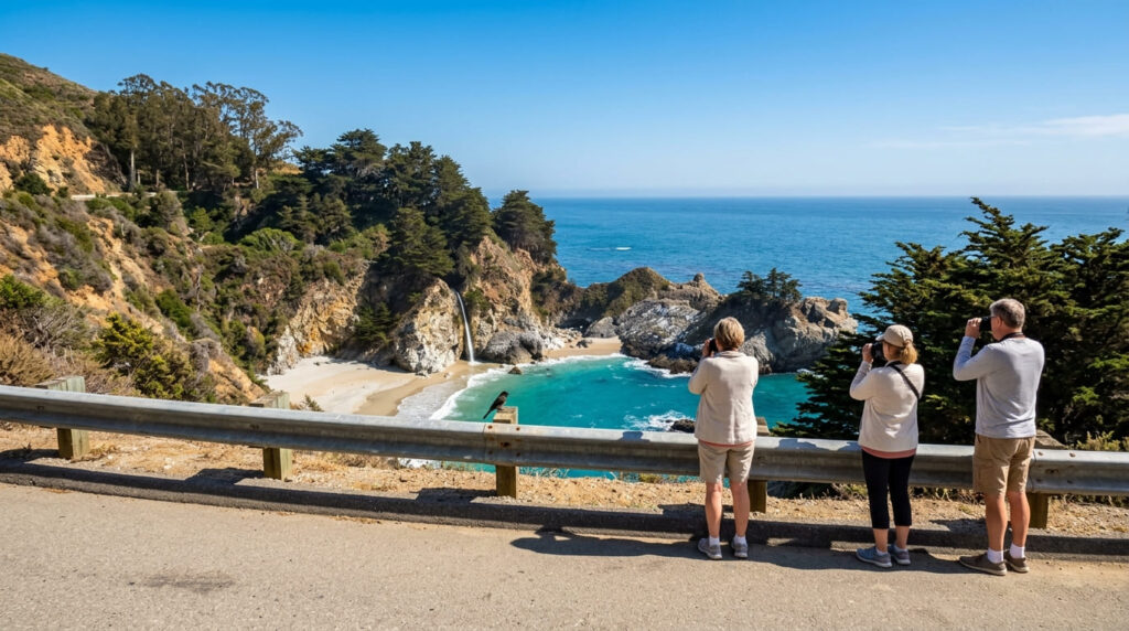
- One trail to skip, not the park: McWay Falls’ Waterfall Overlook Trail at Julia Pfeiffer Burns State Park is closed for a retaining wall project into 2026; you can still see the falls from a Highway 1 pullout, and the nearby Ewoldsen Trail remains open.
- The one hard seasonal constraint: Tioga Road, the only way to drive this route’s Sierra-crossing segment, is closed roughly November through May and opened May 15, 2026, marking its earliest opening in 16 years.
- Budget more time than Google Maps suggests: Highway 1’s curves and Highway 49’s two-lane hairpins both run meaningfully slower than their mileage implies.
- A geography note worth knowing before you plan: the Alabama Hills near Lone Pine, often lumped in with Mono County’s Eastern Sierra trails, sit in Inyo County.
Highway 1: San Francisco to Big Sur
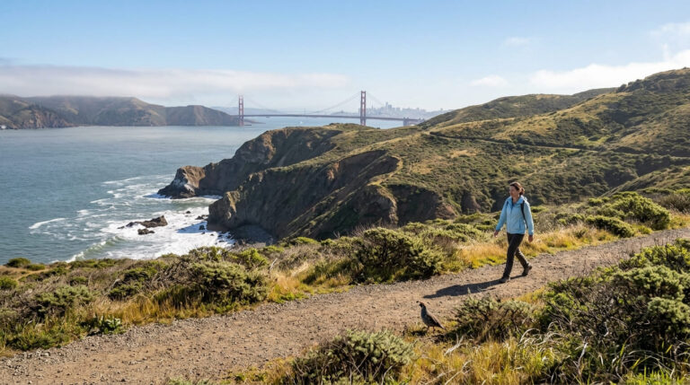
What you’ll pass: coastal trails from Marin to Monterey. Leaving San Francisco, this stretch runs directly by the Marin Headlands and, a bit farther out, Point Reyes, both covered in our Marin County guides, including our dedicated Marin Headlands trail guide.
Continuing south, Highway 1 threads through the Santa Cruz Mountains and along the Santa Cruz coastline before reaching Monterey and Carmel, the gateway to Big Sur itself, covered in our Big Sur trail guide.
McWay Falls, one of the most photographed stops in Julia Pfeiffer Burns State Park, still has its famous overlook trail closed for a long-term retaining wall repair project extending into 2026; you can view the falls from a marked pullout on Highway 1 instead, and the park’s Ewoldsen Trail remains open if you want a hike in this area.
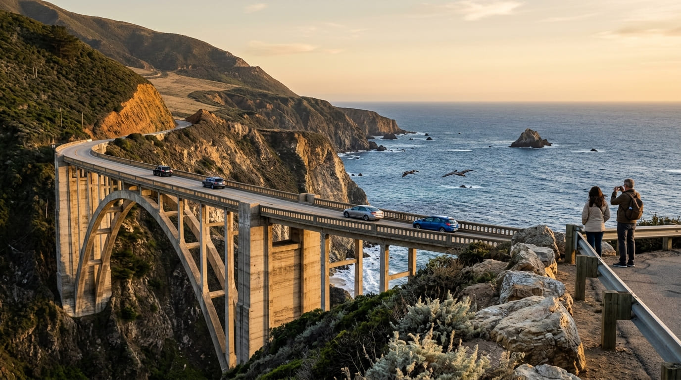
Driving time and where to break the trip. Highway 1’s curves make this segment run much slower than its mileage suggests: figure roughly 3 hours of pure driving time from San Francisco to Big Sur if you don’t stop, and a full day once you factor in Bixby Bridge, coastal pullouts, and lunch in Santa Cruz or Monterey.
Break the trip overnight in Santa Cruz or Monterey rather than attempting San Francisco to Big Sur in one push; both make sensible stops before continuing into Big Sur proper the next morning. For road-trippers extending their coastal journey further south down toward San Luis Obispo County, adding a stop at a Morro Bay State Park campsite or Pismo Beach camping provides an exceptional oceanfront overnighter before heading inland toward the Central Valley.
Big Sur to Yosemite: crossing the Central Valley
What you’ll pass: a necessary interior crossing. This is the least scenic stretch of the entire route and deliberately so: it’s the most direct way to connect the coastal Highway 1 segment to the Sierra Nevada foothills. The typical path runs inland via Highway 101 and Pacheco Pass (Highway 152) to Highway 99, then east on Highway 140 toward Merced and into Yosemite Valley.
There’s no hiking-specific reason to detour off this stretch; think of it as the connective tissue between two trip highlights rather than a destination in its own right, and use it to restock groceries and fuel before prices climb once you’re inside the park.
Driving time and where to break the trip. Budget 4.5 to 6 hours depending on exactly where in Big Sur you’re starting from and traffic through the Central Valley. Big Sur itself spans roughly 90 miles, so “Big Sur to Yosemite” can mean meaningfully different distances depending on your starting point.
This segment’s straightforward highway driving is a welcome pace change after Highway 1’s curves, and it’s realistic to cover in a single afternoon if you get an early start. If you’re coming from farther south in Big Sur, an overnight stop in Fresno or Merced is a sensible way to split the drive rather than arriving at Yosemite exhausted and starting your first hike underslept.
Tioga Road: crossing the Sierra crest
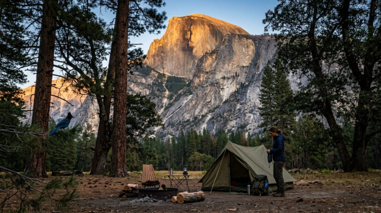
What you’ll pass: Tuolumne Meadows and the high Sierra. Tioga Road climbs dramatically through Yosemite’s high country, passing directly by Tuolumne Meadows and over Tioga Pass into Mono County on the park’s eastern boundary; this is the same stretch covered from the lodging side in our Yosemite lodging guide and from the trail side in our full Yosemite trail guide.
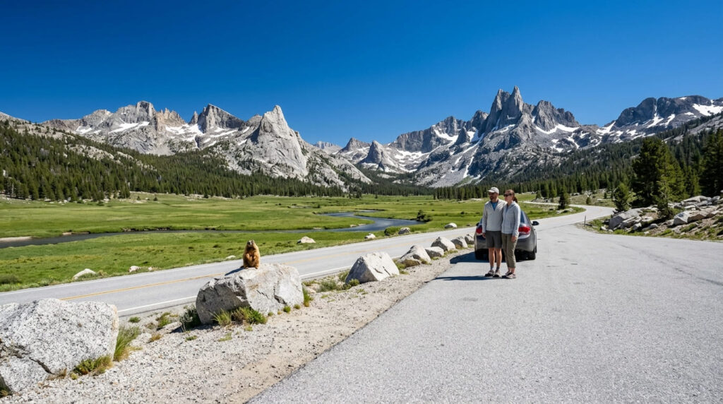
Driving time and seasonal access. This is the one hard constraint on the entire route: Tioga Road is seasonal and typically closed from November through May depending on snowpack, and there’s no detour, as it’s the only way to drive this segment of the trip.
The 2026 season opened May 15, its earliest date in 16 years, but that’s a snowpack-dependent variable, not a fixed calendar date, so check current conditions before you build a specific week around it. Once open, the drive itself is short relative to the rest of the route (the pass and its immediate surroundings can be covered in an hour or two), but almost everyone stops repeatedly for viewpoints and short trails, so budget half a day if you want to get out of the car.
Highway 395: the Eastern Sierra corridor
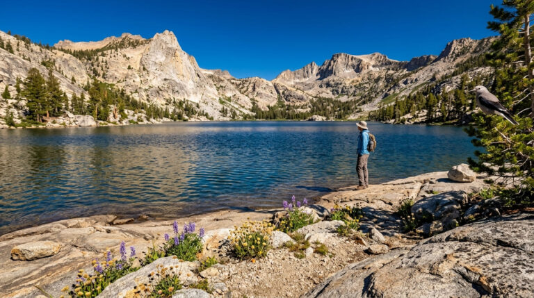
What you’ll pass: Mono Lake, Mammoth Lakes, and the Alabama Hills. Highway 395 runs north-south along the Sierra’s dramatic eastern face, passing directly by nearly every destination in our Mono County guides: Mono Lake and its tufa formations right where Tioga Road meets 395, then south to Mammoth Lakes and the Eastern Sierra’s high-altitude trails.
This corridor also delivers one of the sharpest scenery contrasts on the entire route: the Sierra Nevada rises abruptly on your right while the high desert stretches out on your left, a landscape shift you don’t get anywhere else on this trip. The Alabama Hills near Lone Pine, often mentally filed alongside Mono County’s Eastern Sierra trails because they share the same highway corridor, sit in Inyo County, closer to our Mount Whitney trail guide than to anything in Mono County proper.
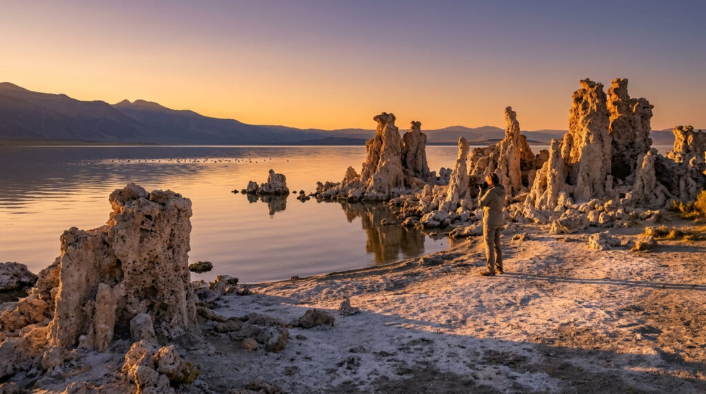
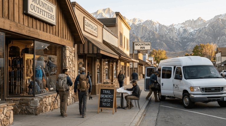
Driving time and where to break the trip. This corridor’s towns are spread out, which works in your favor for pacing: Lee Vining, Mammoth Lakes, and Bishop are all natural overnight stops roughly an hour or so apart, letting you break the drive around whichever trails from our Mono and Inyo County guides are on your itinerary rather than forcing a single long driving day.
If Mount Whitney or the Alabama Hills are on your list, plan on continuing south to Lone Pine as a separate overnight rather than a day trip from Mammoth, as it’s farther than it looks on a map of a corridor this long.
Highway 49: returning through Gold Country
What you’ll pass: El Dorado County’s Gold Rush towns. Highway 49, the historic Golden Chain Highway, runs the length of the Sierra foothills through Mariposa, Tuolumne, Calaveras, Amador, and El Dorado counties, passing directly near Coloma’s Marshall Gold Discovery State Historic Park (where James Marshall’s 1848 gold discovery started the whole Gold Rush), covered in our El Dorado County family-friendly trail guide.
Along the way, it also runs through Calaveras County’s Gold Country trails and Amador County’s Gold Country trails, both worth a stop if the Eastern Sierra hasn’t already filled your week. This is also the segment where the trip’s character changes most: after days of granite peaks and high desert, the rolling oak-studded foothills and preserved 19th-century storefronts feel like a different California.
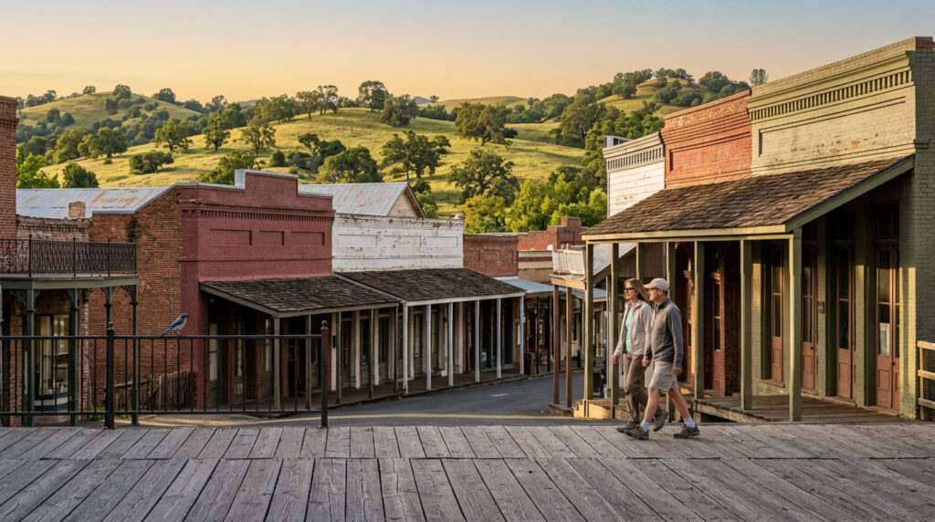
Driving time and where to break the trip. To close the loop from the Eastern Sierra, the honest routing is back north on Highway 395 to a Sierra crossing (Sonora Pass or Ebbetts Pass, both seasonal on roughly the same closure schedule as Tioga Road), landing you on Highway 49 near Sonora or Angels Camp. From there, Highway 49 is a slow, two-lane, hairpin-heavy road by design, and rushing it defeats the point.
Give yourself at least a full day to wander from the Sierra crossing down through Calaveras, Amador, and El Dorado counties, with Placerville or Sutter Creek as sensible overnight stops before closing the loop back toward Sacramento or the Bay Area.
Plan this whole route with slack built in rather than a tight day-by-day script: Highway 1’s construction schedule, Tioga Road’s snowpack-dependent opening, and Big Sur’s occasional overnight closures are all genuinely outside your control, so it’s worth checking current conditions before you commit to exact dates, and 2026’s fully reopened coastal segment is exactly the kind of window worth taking advantage of while conditions hold.
For the logistics layer this route guide doesn’t cover in depth (permits, daily pacing, and packing for the desert-to-alpine temperature swing this trip involves), see our guide to planning a multi-day national park trip.
FREQUENTLY ASKED QUESTIONS ABOUT BEST ROAD TRIP ROUTES FOR CALIFORNIA HIKING: HIGHWAY 1 TO THE SIERRA
How long does a Highway 1 to Sierra road trip take?
10 to 14 days if you want hiking time in each region rather than just driving through. It’s possible to compress it, but you’ll trade trail time for windshield time.
Is this route doable in one week?
It’s tight but doable if you pick 3 of the 5 regions rather than attempting all of them: Highway 1 to Yosemite via Tioga Road is a natural one-week core, with the Eastern Sierra and Gold Country segments as a second trip.
What season is best for this road trip route?
Late June through September is the only window when every segment is guaranteed open; Tioga Road’s seasonal closure is the hard constraint, since it typically doesn’t open until mid-May at the earliest and can close again by November.
Do you need a specific type of vehicle for this route?
No. Every segment covered here runs on paved, regularly maintained highways suitable for any standard car. A 4WD or high-clearance vehicle isn’t required unless you’re detouring onto unpaved side roads.
Is cell service reliable along this route?
No, and it’s worth planning around rather than assuming. Big Sur has long stretches with no signal at all; Tioga Road and much of Yosemite’s high country are similarly dead, and even Highway 395’s towns (Bishop, Mammoth Lakes) have gaps between them. Highway 49’s Gold Country stretch is the most reliable of the five.
Can you do this route in reverse?
Yes, starting in Gold Country and finishing on the coast works just as well logistically. The main reason to keep the order as written is pacing: it’s a nice psychological arc to end a long trip on Highway 1’s coastline rather than starting there and closing out in the Central Valley crossing.